February 15-16, 2010
Relentless Winter Weather
|
Another Winter Storm Across Hard-Hit Area
 |
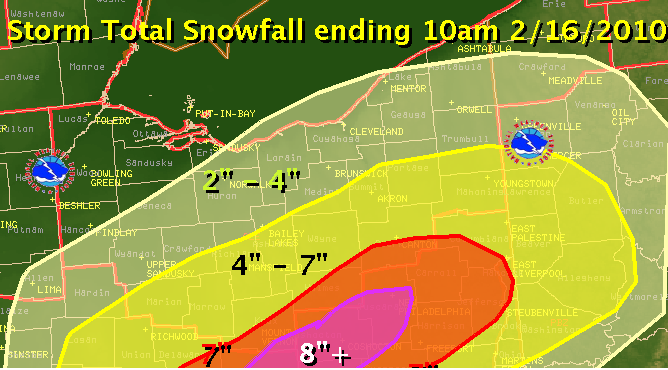
Only ten days after 12 to 18 inches of snow walloped portions of east-central Ohio, an additional 6 to 8 inches fell with a storm that tracked through the Ohio Valley.
This time the low tracked from western Kentucky into southeast Ohio. While the snowfall amounts were still significant, this storm lacked the moisture of the February 5-6th Storm.
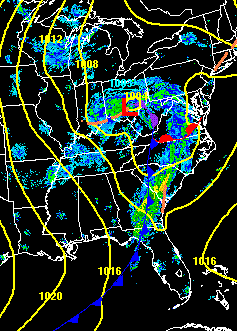
To the left is a radar composite and surface frontal analysis from the afternoon of the 15th. The swath of heaviest snow reached into Knox, Holmes, and Stark counties.
Below is the preliminary snowfall totals tallied from snow spotter reports and local officials. This takes into account the snow that fell associated with the low pressure, ending at 10 am on the 16th. Snow showers associated with a trough of low pressure moving into the area during the day on the 16th provided some additional light accumulation.
|
 |
|

