Overview
|
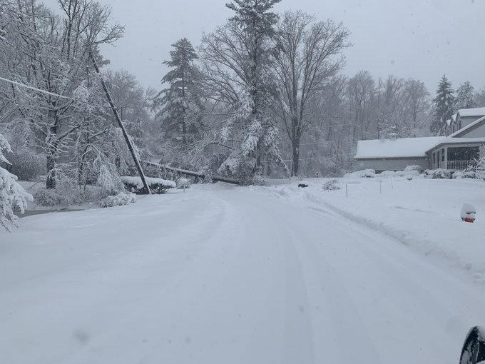
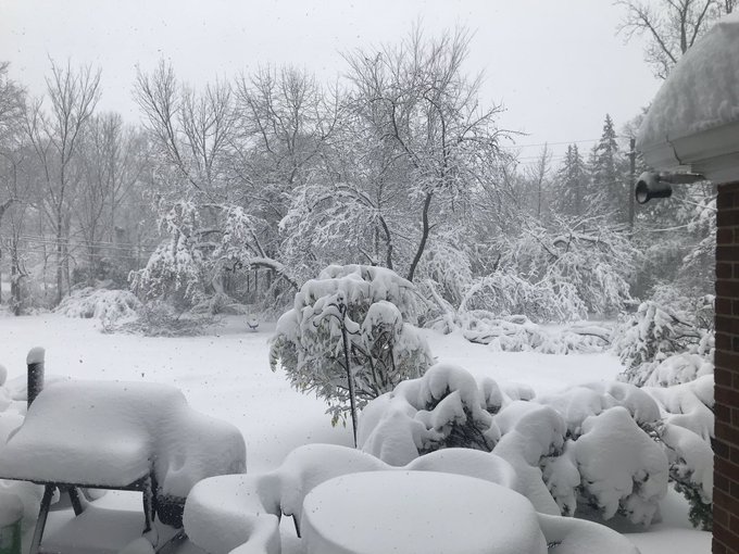
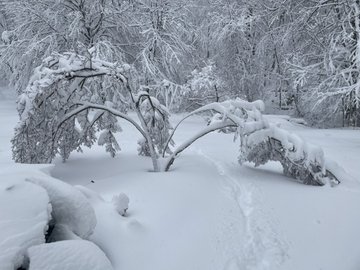
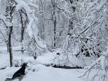
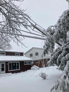
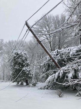
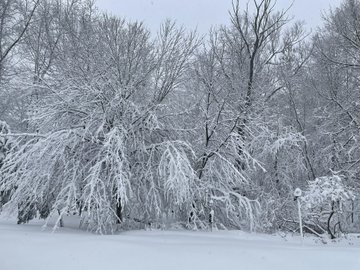
On Saturday, November 28th, an upper level closed low moved out of the Four Corners Region across the southern Plains. This upper low began to open on Sunday, November 29th as it moved northeast towards the Ohio Valley, phasing with a stronger upper level trough that was digging across the Midwest. Upper level jet energy would extend all the way to the southeastern states as this upper level closed low developed over Indiana, which deepened as it pivoted towards the eastern Great Lakes on Tuesday. Meanwhile, the associated surface low pressure system originated near the Gulf Coast, tracking northeast towards Pennsylvania by 18Z Monday then continued north to Upstate New York by 06Z Tuesday. This is where the low remained for the next 12 hours, slightly retrograding westward to Lake Ontario, before finally drifting north into Quebec Tuesday afternoon. As the surface low tracked northeast towards Pennsylvania on Monday, widespread rain overspread the area, transitioning to snow from west to east on Monday and Monday night as cold air advected in from the west. The TRough of Warm Air ALoft (TROWAL) wrapped all the way around the low, providing lift and deep moisture to our region, with that moisture being advected all the way over from the Atlantic Ocean. Lower snow-to-liquid (SLR) ratios observed during this event were around 8-9:1, which is quite a bit lower than climatological values for the Cleveland forecast area, which is closer to 13-15:1. There are a few reasons this occurred. A considerable amount of the lift was located between 750mb and 900mb, which was located just below the dendritic growth zone (which was between 600 and 700 mb). Surface winds were also fairly strong, with gusts persistently around 25-30 mph (which can reduce SLR). Additionally, surface temperatures hovered in the low 30s and occasionally in the upper 20s through the duration of the event. It is likely that these factors contributed to the lower snow ratios that were observed during the event. Minimal snow accumulations occurred through the day on Monday as the rain snow line shifted east to the Central Highlands. A very gradual transition to snow occurred through the evening hours on Monday with Cleveland changing over around 10 PM EST and Erie at 3 AM EST. The end result was widespread snowfall of 12 to 18 inches along the primary and secondary snowbelts, extending all the way west from Lorain, OH, east across the Cleveland metro area and into extreme Northeast Ohio and Northwest Pennsylvania. Locally higher snow amounts of 18 to 24+ inches fell in eastern Cuyahoga, southern Lake, northern Geauga, western Ashtabula and inland Erie, PA counties. An underrated impact from this event was snow load damage to wires and trees, causing widespread power outages. At its peak, there were over 90,000 power outages on Tuesday across the NWS Cleveland forecast area, the vast majority of which was in Cuyahoga, Lake, Geauga, and Ashtabula counties. The rain that occurred on Monday froze on trees and wires after temperatures decreased Monday night and significant low SLR snow efficiently accumulated on trees and wires, causing the weight of snow to overload trees and wires across the region. |
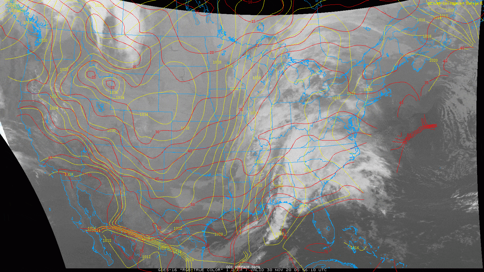
True color satellite loop with mean sea level pressure (yellow contours) and temperature (red contours) overlaid. |
Photos & Video
|
|
 |
 |
|
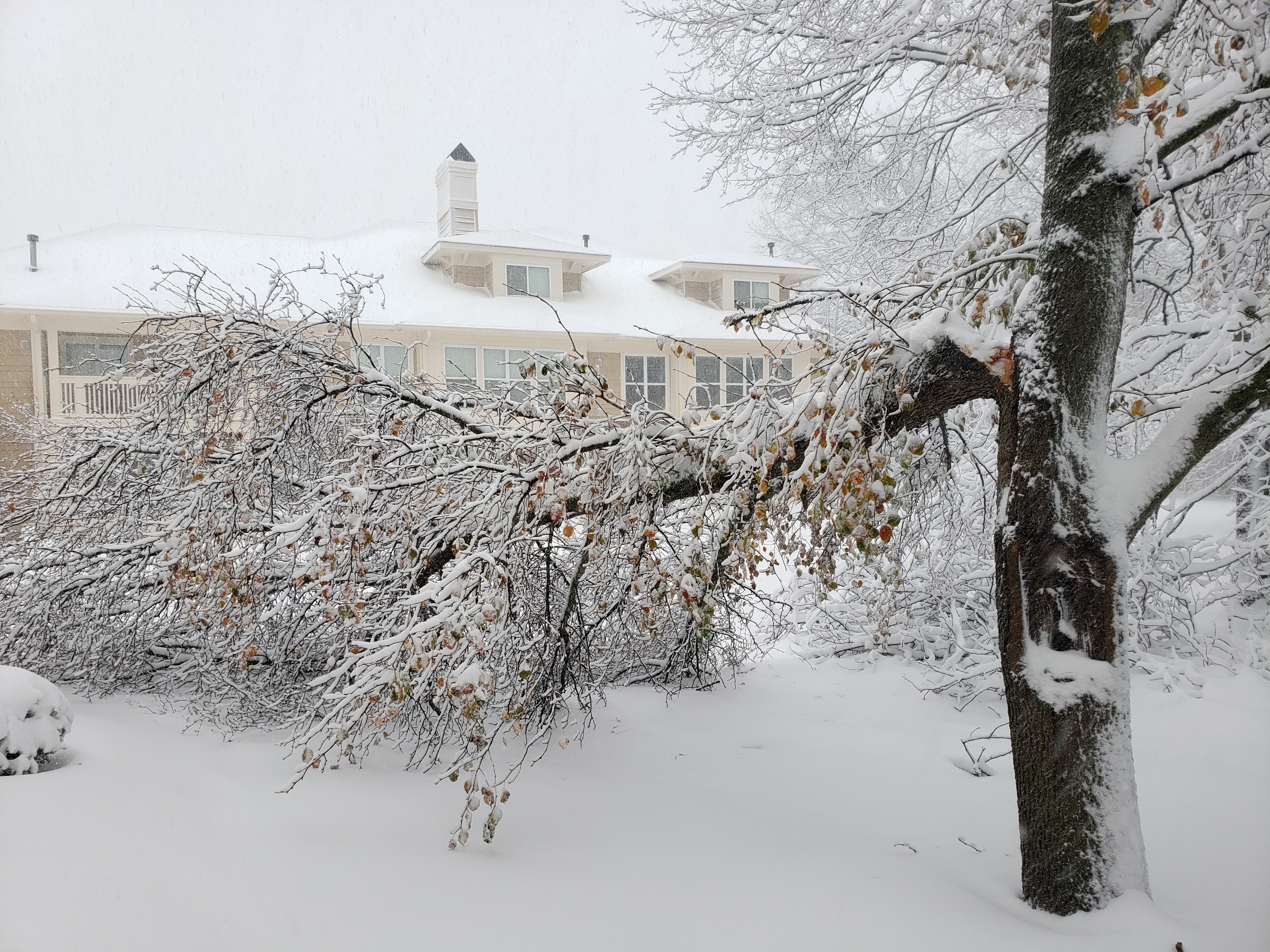
| Storm damage to a large tree branch in North Olmsted, OH. Photo credit: Patrick Saunders | Tree damage in Cuyahoga/Geauga County. Photo credit: Illuminating Company | Tree damage in Cuyahoga/Geauga County. Photo credit: Illuminating Company | Tree damage in Cuyahoga/Geauga County. Photo credit: Illuminating Company |
|
|
|
|
|
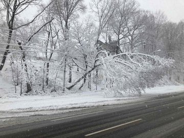
| Tree damage in Cuyahoga/Geauga County. Photo credit: Illuminating Company | Tree damage in Pepper Pike, OH Photo credit: Pepper Pike Police Department | Tree damage in Shaker Heights, OH. Photo credit: Nick Greenfield | Tree damage in Strongsville, OH. Photo credit: Alex Tomoff |
|
|
 |
|
|
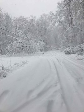
| Tree damage in Strongsville, OH. Photo credit: Alex Tomoff | Tree damage in Strongsville, OH. Photo credit: Alex Tomoff |
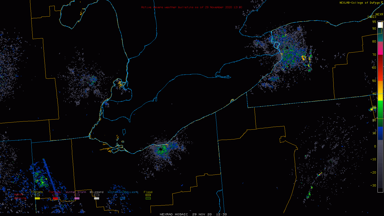
Radar
 |
 |
 |
| Radar loop of the entire event showing the progression of winter headlines including Winter Weather Advisories (shaded in blue) and Winter Storm Warnings (shaded in pink). | Fast radar loop of the entire event showing wind gusts and wind vectors and streamlines. | Slower radar loop showing the entirety of the event. |
Storm Reports
PUBLIC INFORMATION STATEMENT
SPOTTER REPORTS
NATIONAL WEATHER SERVICE CLEVELAND OH
1250 PM EST WED DEC 02 2020

...STORM TOTAL SNOWFALL SINCE MONDAY NIGHT...

THE FOLLOWING ARE UNOFFICIAL OBSERVATIONS TAKEN DURING THE PAST TWO DAYS
FOR THE STORM THAT HAS BEEN AFFECTING OUR REGION. APPRECIATION
IS EXTENDED TO HIGHWAY DEPARTMENTS, COOPERATIVE OBSERVERS, SKYWARN
SPOTTERS AND MEDIA FOR THESE REPORTS. THIS SUMMARY ALSO IS AVAILABLE
ON OUR HOME PAGE AT WEATHER.GOV/CLEVELAND

********************STORM TOTAL SNOWFALL********************

LOCATION          STORM TOTAL     TIME/DATE   COMMENTS
                     SNOWFALL           OF
                     /INCHES/   MEASUREMENT

OHIO

...ASHLAND COUNTY...
   3 WSW HAYESVILLE       6.3   924 PM 12/01  TRAINED SPOTTER
   1 NNE SULLIVAN         5.5   700 AM 12/01  COCORAHS
   PERRYSVILLE            3.6   505 AM 12/01  TRAINED SPOTTER

...ASHTABULA COUNTY...
   3 ENE TRUMBULL        22.0   800 AM 12/02  TRAINED SPOTTER
   2 N CHERRY VALLEY     21.4   600 AM 12/02  TRAINED SPOTTER
   3 E SOUTH MADISON     20.7   950 PM 12/01  TRAINED SPOTTER
   1 E ORWELL            20.4   805 AM 12/02  TRAINED SPOTTER
   2 ESE PIERPONT        17.5   804 AM 12/02  TRAINED SPOTTER
   1 ENE JEFFERSON       14.0   652 PM 12/01  TRAINED SPOTTER
   2 ESE MONROE CENTER   13.5   841 AM 12/02  TRAINED SPOTTER
   1 SSE KELLOGGSVILLE   13.0   724 AM 12/02  TRAINED SPOTTER
   1 ENE GENEVA           6.0   445 PM 12/01  TRAINED SPOTTER
   1 WSW CONNEAUT         4.5   700 AM 12/02  TRAINED SPOTTER
   EDGEWOOD               4.4   943 PM 12/01  TRAINED SPOTTER
   2 SW EDGEWOOD          3.6   451 PM 12/01  TRAINED SPOTTER
   2 S ASHTABULA          2.8   535 PM 12/01  TRAINED SPOTTER

...CRAWFORD COUNTY...
   1 W GALION             7.2   751 AM 12/02  TRAINED SPOTTER
   3 WSW TIRO             5.9   721 AM 12/01  TRAINED SPOTTER
   1 NE BUCYRUS           5.0   700 AM 12/02  CO-OP OBSERVER
   1 NW BUCYRUS           4.9   700 AM 12/02  COCORAHS

...CUYAHOGA COUNTY...
   1 ENE LYNDHURST       22.0   843 PM 12/01  TRAINED SPOTTER
   1 W CHAGRIN FALLS     19.9   909 PM 12/01  TRAINED SPOTTER
   1 SSW SOLON           18.1  1100 AM 12/02  TRAINED SPOTTER
   1 W SHAKER HEIGHTS    18.0   754 PM 12/01  TRAINED SPOTTER
   1 NNE SEVEN HILLS     17.3   700 AM 12/02  TRAINED SPOTTER
   SEVEN HILLS           15.6   514 PM 12/01  TRAINED SPOTTER
   2 SW CLEVELAND HEIGH  15.5   615 AM 12/02  TRAINED SPOTTER
   2 SSE PARMA           15.4   900 PM 12/01  TRAINED SPOTTER
   SOUTH EUCLID          15.1   750 PM 12/01  TRAINED SPOTTER
   3 SW NORTH ROYALTON   14.6   930 PM 12/01  TRAINED SPOTTER
   1 SSW WESTLAKE        14.3   800 AM 12/02  COCORAHS
   1 WSW CLEVELAND HEIG  14.0   715 AM 12/02  TRAINED SPOTTER
   1 SE STRONGSVILLE     13.5   800 AM 12/02  COCORAHS
   7 SW CLEVELAND        13.2  1000 PM 12/01  COCORAHS
   2 NNW PARMA           12.7   800 AM 12/02  COCORAHS
   1 SSW LAKEWOOD        12.7   700 AM 12/02  COCORAHS
   CLEVELAND-OLD BROOKL  12.0   600 AM 12/02  TRAINED SPOTTER
   CLEVELAND HOPKINS AI  10.1   700 AM 12/02  ASOS
   CLEVELAND-KAMMS CORN  10.1  1130 PM 12/01  TRAINED SPOTTER
   2 SE BRECKSVILLE       9.8   700 AM 12/02  COCORAHS
   2 SW WILLOWICK         7.0   621 PM 12/01  TRAINED SPOTTER

...ERIE COUNTY...
   5 NNE WAKEMAN          8.7   800 AM 12/01  COCORAHS
   HURON                  7.0   523 PM 12/01  TRAINED SPOTTER
   2 NNE CASTALIA         6.3   630 AM 12/02  COCORAHS

...GEAUGA COUNTY...
   2 WNW HAMBDEN         26.3   700 AM 12/02  TRAINED SPOTTER
   2 ESE SOUTH THOMPSON  24.4   934 AM 12/02  TRAINED SPOTTER
   2 W BURTON            22.2   827 AM 12/02  TRAINED SPOTTER
   2 W CHARDON           22.0   546 PM 12/01  TRAINED SPOTTER
   1 S MONTVILLE         18.0   621 PM 12/01  TRAINED SPOTTER
   SOUTH RUSSELL         15.7   648 PM 12/01  TRAINED SPOTTER
   5 SSE CHARDON         15.5   454 AM 12/02  COCORAHS
   2 SE SOUTH MADISON    13.0   517 PM 12/01  TRAINED SPOTTER

...HANCOCK COUNTY...
   1 SSW FINDLAY          5.7   800 AM 12/01  TRAINED SPOTTER
   FINDLAY                3.0   953 AM 12/01  TRAINED SPOTTER

...HURON COUNTY...
   3 NW NEW LONDON        7.6   637 AM 12/02  TRAINED SPOTTER
   1 N BELLEVUE           6.6   500 AM 12/02  COCORAHS

...KNOX COUNTY...
   4 NNW FREDERICKTOWN    4.0   700 AM 12/01  COCORAHS

...LAKE COUNTY...
   1 SE CONCORD          16.9   740 AM 12/02  TRAINED SPOTTER
   2 WNW CONCORD         16.5   902 PM 12/01  TRAINED SPOTTER
   1 NW CONCORD          15.8   700 AM 12/02  TRAINED SPOTTER
   1 S WAITE HILL        14.3   900 PM 12/01  TRAINED SPOTTER
   3 ESE PAINESVILLE     12.0   624 PM 12/01  TRAINED SPOTTER
   1 NNE KIRTLAND HILLS  12.0   831 AM 12/02  TRAINED SPOTTER
   3 SW WILLOUGHBY       11.6   605 AM 12/02  COCORAHS
   1 E MENTOR             9.5   733 PM 12/01  TRAINED SPOTTER
   1 SSE MENTOR           7.9   848 PM 12/01  TRAINED SPOTTER
   1 ENE WICKLIFFE        4.6   100 PM 12/01  COCORAHS

...LORAIN COUNTY...
   3 NE NORTH RIDGEVILL  15.2   700 AM 12/02  COCORAHS
   ELYRIA                14.4   450 AM 12/02  TRAINED SPOTTER
   1 S OBERLIN           12.9   800 AM 12/01  CO-OP OBSERVER
   2 NE NORTH RIDGEVILL  12.6  1009 AM 12/02  TRAINED SPOTTER
   3 SE ELYRIA           12.5   746 AM 12/02  TRAINED SPOTTER
   4 N LAGRANGE           9.0   700 AM 12/01  CO-OP OBSERVER
   6 SW WELLINGTON        6.1   800 AM 12/01  COCORAHS
   1 E SHEFFIELD LAKE     4.7   819 AM 12/01  TRAINED SPOTTER

...LUCAS COUNTY...
   3 SSW OREGON           3.0   800 AM 12/02  COCORAHS
   2 ENE TOLEDO           2.6   700 AM 12/01  COCORAHS
   2 ENE MAUMEE           2.0   700 AM 12/01  COCORAHS
   TOLEDO EXPRESS AIRPOR  1.7   652 AM 12/02  ASOS
   7 NNE SWANTON          1.5   700 AM 12/01  COCORAHS

...MAHONING COUNTY...
   1 NW AUSTINTOWN        4.0   731 PM 12/01  TRAINED SPOTTER
   1 N CANFIELD           3.4   645 AM 12/02  COCORAHS

...MARION COUNTY...
   MARION                 4.2   845 AM 12/01  TRAINED SPOTTER
   4 SSE MARION           2.9   720 AM 12/01  TRAINED SPOTTER

...MEDINA COUNTY...
   1 ENE BRUNSWICK       13.6   700 AM 12/02  TRAINED SPOTTER
   2 ESE HINCKLEY        12.8   830 AM 12/02  TRAINED SPOTTER
   1 ENE MEDINA           8.5   730 AM 12/02  COCORAHS
   2 N LODI               8.0   909 PM 12/01  TRAINED SPOTTER
   2 E HOMERVILLE         4.3   925 AM 12/02  TRAINED SPOTTER
   5 WNW WADSWORTH        3.5   500 AM 12/01  COCORAHS

...MORROW COUNTY...
   5 ESE MOUNT GILEAD     5.5   600 AM 12/02  COCORAHS

...OTTAWA COUNTY...
   7 W PORT CLINTON       4.2   800 AM 12/02  COCORAHS
   3 W PORT CLINTON       4.0   900 AM 12/01  COCORAHS

...PORTAGE COUNTY...
   1 NNW MANTUA          13.8   600 AM 12/02  COCORAHS
   HIRAM                 12.5   929 AM 12/02  TRAINED SPOTTER
   2 WNW AURORA          12.5   700 AM 12/02  COCORAHS
   2 W AURORA            11.7   800 AM 12/02  COCORAHS
   2 SSW STREETSBORO      9.8   700 AM 12/02  COCORAHS
   1 ENE STREETSBORO      8.7   803 AM 12/02  TRAINED SPOTTER
   4 NE KENT              7.4   800 AM 12/02  COCORAHS
   1 SSW BRADY LAKE       7.2   645 PM 12/01  TRAINED SPOTTER
   1 ENE MOGADORE         4.8   814 AM 12/02  TRAINED SPOTTER
   5 SE MOGADORE          2.1   700 AM 12/02  COCORAHS
   1 W CRAIG BEACH        2.0   700 AM 12/02  CO-OP OBSERVER

...RICHLAND COUNTY...
   1 NW LEXINGTON         7.7   800 AM 12/02  COCORAHS
   5 NW MIFFLIN           6.8   817 PM 12/01  TRAINED SPOTTER
   1 W MANSFIELD          6.3   725 PM 12/01  TRAINED SPOTTER
   5 WSW MANSFIELD        5.7   800 AM 12/02  COCORAHS
   MANSFIELD LAHM AIRPO   5.6   700 AM 12/02  ASOS

...SANDUSKY COUNTY...
   2 ENE FREMONT          4.8   813 AM 12/02  COCORAHS

...SENECA COUNTY...
   2 NNW MEXICO           4.8   918 AM 12/01  TRAINED SPOTTER

...STARK COUNTY...
   4 ESE CANAL FULTON     5.5   830 PM 12/01  TRAINED SPOTTER
   3 NW WAYNESBURG        5.1   755 AM 12/02  TRAINED SPOTTER
   1 W CANTON             4.0   709 PM 12/01  TRAINED SPOTTER
   4 S ALLIANCE           4.0   700 PM 12/01  TRAINED SPOTTER
   1 ESE ALLIANCE         3.8   701 PM 12/01  TRAINED SPOTTER
   2 SW CANAL FULTON      3.5   800 AM 12/01  COCORAHS

...SUMMIT COUNTY...
   1 SE SAGAMORE HILLS   15.2   933 AM 12/02  TRAINED SPOTTER
   1 NW BOSTON HEIGHTS   14.0   700 AM 12/02  TRAINED SPOTTER
   1 N BATH              10.9   717 AM 12/02  TRAINED SPOTTER
   1 NNE BATH             9.3   700 AM 12/02  TRAINED SPOTTER
   2 SE CUYAHOGA FALLS    8.2   818 AM 12/02  TRAINED SPOTTER
   1 SW MUNROE FALLS      7.5   700 AM 12/02  CO-OP OBSERVER
   BATH                   7.2   825 PM 12/01  TRAINED SPOTTER
   1 ESE CUYAHOGA FALLS   6.8   700 AM 12/02  COCORAHS
   FAIRLAWN               6.7   819 PM 12/01  TRAINED SPOTTER
   1 NW TALLMADGE         5.8   820 AM 12/02  TRAINED SPOTTER
   1 NNE TALLMADGE        5.8   740 AM 12/02  COCORAHS
   2 W AKRON              5.2   700 AM 12/02  COCORAHS
   2 ESE FAIRLAWN         4.8   829 PM 12/01  TRAINED SPOTTER
   AKRON-CANTON AIRPORT   3.5   700 AM 12/02  ASOS
   3 SSW BARBERTON        3.0   558 PM 12/01  TRAINED SPOTTER

...TRUMBULL COUNTY...
   2 NNW SOUTHINGTON     11.5   518 PM 12/01  TRAINED SPOTTER
   2 S WILLIAMSFIELD     11.5   721 PM 12/01  TRAINED SPOTTER
   CORTLAND              10.2   521 AM 12/02  TRAINED SPOTTER
   YOUNGSTOWN-WARREN REG  8.0   651 AM 12/02  ASOS
   MOSQUITO CREEK LAKE    8.0   700 AM 12/02  CO-OP OBSERVER
   LEAVITTSBURG           7.0  1000 PM 12/01  TRAINED SPOTTER
   1 N NEWTON FALLS       6.7   700 AM 12/02  COCORAHS
   2 WSW WARREN           6.0   628 AM 12/02  TRAINED SPOTTER

...WAYNE COUNTY...
   3 ENE DOYLESTOWN       5.0   827 PM 12/01  TRAINED SPOTTER

...WOOD COUNTY...
   1 W BOWLING GREEN      4.0   700 AM 12/01  COCORAHS
   3 NW BOWLING GREEN     3.0   800 AM 12/01  COCORAHS
   1 S BOWLING GREEN      3.0  1037 AM 12/01  TRAINED SPOTTER
   2 WSW PERRYSBURG       3.0   500 AM 12/01  COCORAHS

...WYANDOT COUNTY...
   4 NW HARPSTER          3.0   856 AM 12/01  TRAINED SPOTTER

PENNSYLVANIA

...CRAWFORD COUNTY...
   1 WNW CONNEAUT LAKE   17.2   700 AM 12/02  COCORAHS
   1 WSW DRAKES MILLS    16.5   830 AM 12/02  TRAINED SPOTTER
   1 NNE MEADVILLE       16.3   815 AM 12/02  TRAINED SPOTTER
   6 E ATLANTIC          15.6   901 AM 12/02  TRAINED SPOTTER
   4 WNW CROSSINGVILLE   15.3   747 AM 12/02  TRAINED SPOTTER
   1 NE MEADVILLE        15.0   734 AM 12/02  TRAINED SPOTTER
   1 S MEADVILLE         11.0   732 AM 12/02  TRAINED SPOTTER
   3 WNW SPRINGBORO       9.0   700 AM 12/02  CO-OP OBSERVER
   2 W TITUSVILLE         8.4   700 AM 12/02  CO-OP OBSERVER

...ERIE COUNTY...
   2 SSW CORRY           22.5   900 AM 12/02  TRAINED SPOTTER
   4 SE HARBORCREEK      18.0   600 AM 12/02  TRAINED SPOTTER
   2 E EDINBORO          17.8   627 AM 12/02  TRAINED SPOTTER
   3 SE NORTH EAST       17.5   746 AM 12/02  TRAINED SPOTTER
   2 NW EDINBORO         17.0   501 AM 12/02  TRAINED SPOTTER
   3 ENE MCKEAN          17.0   738 AM 12/02  TRAINED SPOTTER
   1 W MCKEAN            16.7   812 AM 12/02  TRAINED SPOTTER
   4 W COLT STATION      16.6   827 AM 12/02  TRAINED SPOTTER
   3 NE MCKEAN           12.5   815 AM 12/02  TRAINED SPOTTER
   2 ESE NORTH EAST      11.9   716 AM 12/02  TRAINED SPOTTER
   2 S NORTH EAST         9.6   821 AM 12/02  COCORAHS
   6 SW ERIE              8.5   600 AM 12/02  COCORAHS
   GIRARD                 8.0   913 AM 12/02  TRAINED SPOTTER
   1 WNW NORTH EAST       7.0   825 AM 12/02  TRAINED SPOTTER
   2 WSW ERIE             6.0   700 AM 12/02  TRAINED SPOTTER
   ERIE INTL AIRPORT      5.3   700 AM 12/02  ASOS
   1 NNW GIRARD           4.0   616 PM 12/01  TRAINED SPOTTER
Environment
 |
.gif) |
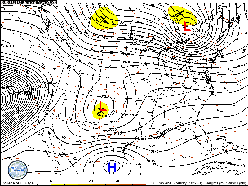 |
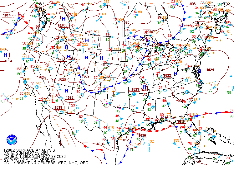
| Figure 1: WPC surface analysis from 7 AM EST November 29 to 7 AM EST December 2, 2020. | Figure 2: Loop of relative humidity (color fill), pressure (solid contour), mixing ratio (dashed line), and annotated TROWAL (white solid lines) on a 290 K isentropic surface from 7 PM EST Nov 30 to 7 AM EST Dec 2 from the NAM model. | Figure 3: Loop of 500 mb analysis height, wind, and vorticity across from 7 PM EST Nov 28 through 7 AM EST Dec 2. |
 |
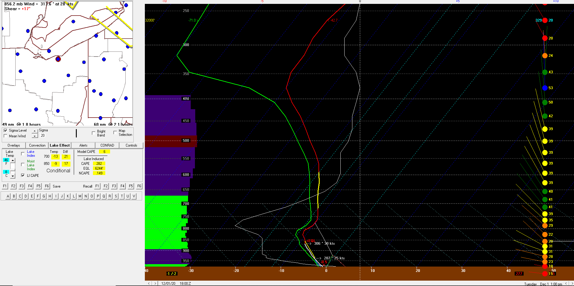 |
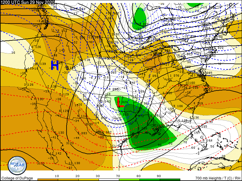
| Figure 4: Loop of 700 mb height, temperature (C), and relative humidity from 7 AM EST Nov 29 through 7 AM EST Dec 2. | Figure 5: NAM BUFKIT profile at 1 PM EST Dec 1 initialized at 1 PM EST Dec 1. |
 |
Media use of NWS Web News Stories is encouraged! Please acknowledge the NWS as the source of any news information accessed from this site. |
|


.png)