|
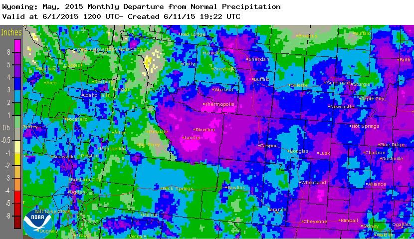
Torrential rain from slow-moving thunderstorms produced major flash flooding across Niobrara County, Wyoming on June 3-4, 2015. An active and unusually moist spring weather pattern, typical during an El Nino climate pattern, was the contributing factor in producing the wet antecedent conditions. In May, precipitation over Niobrara County ranged from 4.69 to 7.11 inches. The approach of an upper level weather disturbance combined with the plentiful moisture set the stage for training, slow-moving thunderstorms between Manville and Lusk during the late evening of June 3. Rainfall rates from these storms were 2 to 3 inches per hour. These extreme rainfall amounts caused significant flash flooding during the early morning hours of June 4. |
Credit: Niobrara County Library |
Timeline
20:30 - Rain began in the Flash Flood impacted areas.
20:43 - Severe Thunderstorm Warning issued for areas SW of Lusk until 21:30
21:34 - Severe Thunderstorm Warning issued for much of SW Niobrara County including Lusk & Manville until 22:12
22:15 - Flash Flood Warning issued for areas west of Lusk including Manville until (6/4) 02:15
22:16 - Severe Thunderstorm Warning issued for much of southern Niobrara County until 23:00
22:59 - Severe Thunderstorm Warning issued for southern Niobrara County until 23:45
00:05 - Flash Flood Warning issued for Niobrara River Basin including Lusk until 03:00
00:15 - Rain intensity significantly diminished in and around Lusk
02:16 - Flash Flood Warning issued for SW Niobrara county until 05:15
03:00 - Flash Flood Warning issued for Niobrara River Basin including Lusk until 06:00
05:21 - Areal Flood Warning issued for SW Niobrara County until 11:15
05:55 - Flash Flood Warning/Emergency issued for the Niobrara River Basin including Lusk until 09:00
08:59 - Flash Flood Warning/Emergency issued for the Niobrara River Basin including Lusk until 12:00
Photos & Video:
 |
 |
 |
 |
| Flooding west of Lusk Credit: Unknown |
Highway 18 near Manville Credit: WYDOT |
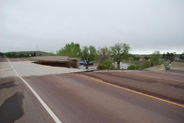
Highway 85 partial road collapse Credit: David Mayberry |
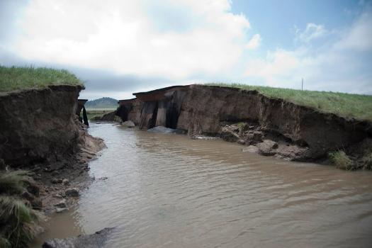
Bridge collapse on highway 85 Credit: WY Highway Patrol |
 |
 |
 |
 |
| Flooding in Lusk during the early morning hours June 4 Credit: Niobrara County Library |
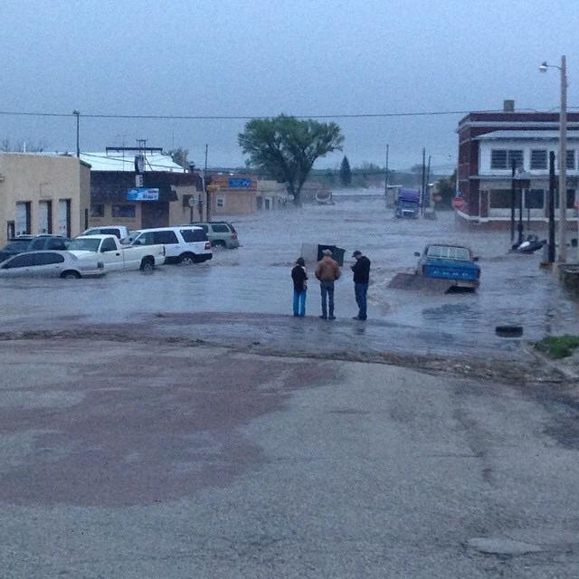
Flooding of roadways in Lusk Credit: Niobrara County Library |
Damage to a business in Lusk Credit: Niobrara County Library |
Lusk depot underwater Source: Niobrara County Library |
Radar:
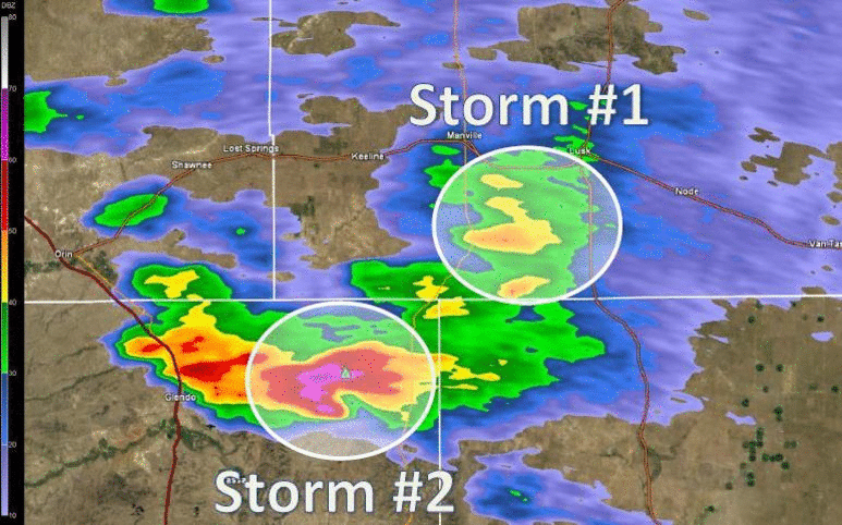 |
| Radar image loop outlining the three thunderstorm cells that impacted southern Niobrara County. The first radar image is from 8:39 PM showing the 1st cell just SW of Lusk, and the 2nd stronger cell to the south. The 1st cell moves off the the northeast and at 9:39 PM the 3rd storm is beginning to develop. At 10:19 PM the 3rd cell merges with the 2nd and remains almost stationary at 11:32 PM the storms are now exiting the area. |
Storm Reports
 |
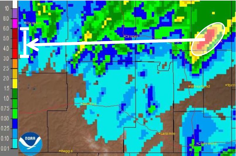 |
| May 2015 departure from normal precipitation | Storm Total Precipitation |
 |
Media use of NWS Web News Stories is encouraged! Please acknowledge the NWS as the source of any news information accessed from this site. |
|


.jpg)
 Weather Story
 Weather Map
 Local Radar