Overview
|
A weak tornado and very large hail developed near Chugwater, WY on June 20, 2010. Convection formed along a dry line that extended from just west of the Laramie Range northeast to Casper, Wyoming. Shortly after 4 PM, a supercell thunderstorm developed producing an EF0 tornado and hail up to 4 inches in diameter. The storm moved east-southeast for only a few miles before it dissipated. Several other supercell thunderstorms developed throughout the late afternoon producing large hail and significant flooding. |
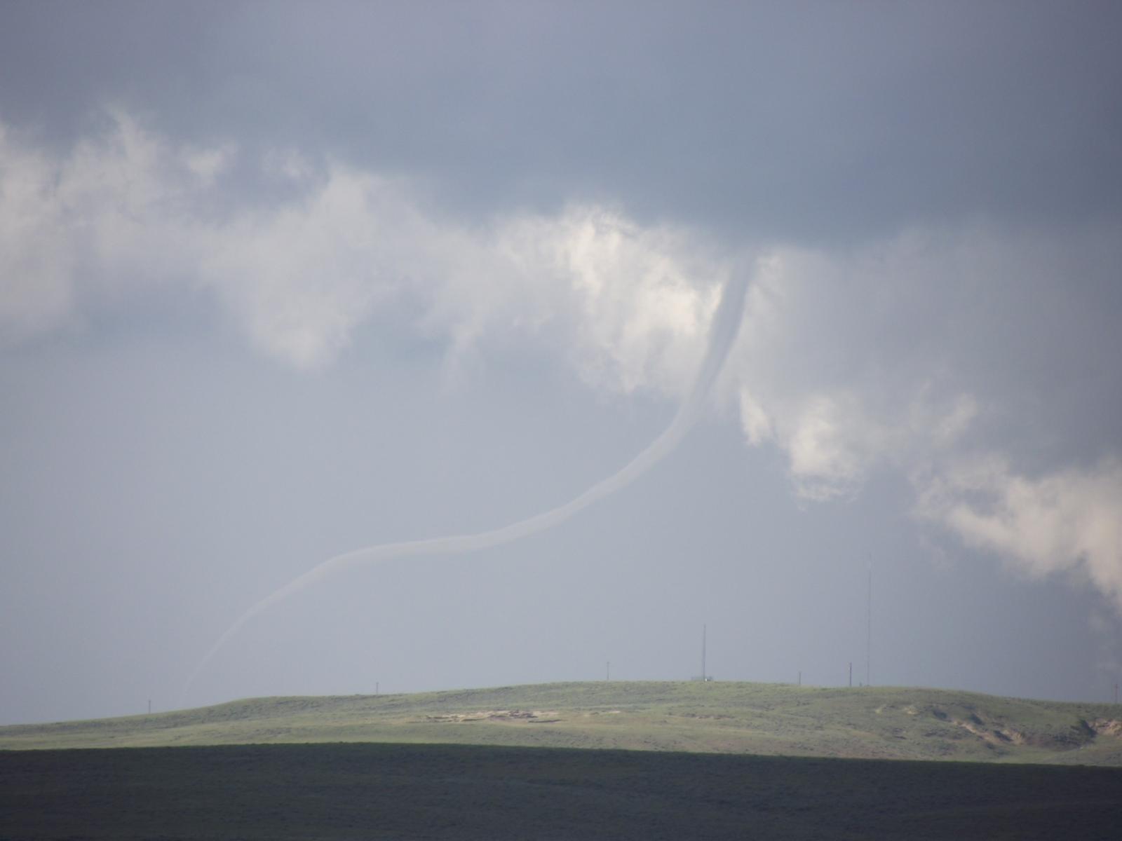
Rope tornado near Chugwater Credit: Patti Fulton |
 |
 |
 |
|
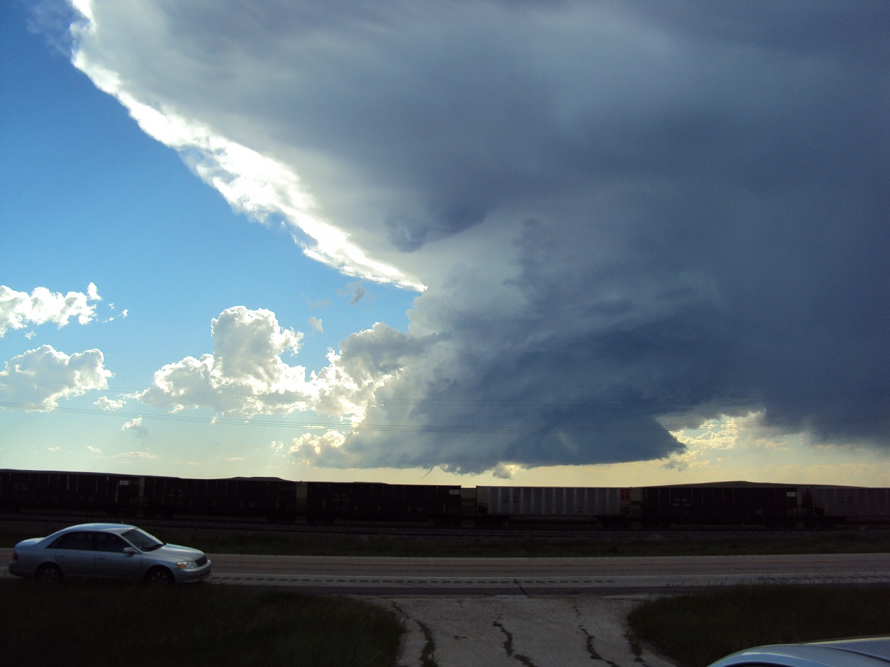
Funnel descending from a wall cloud. Credit Unknown |
Video from Tony Laubach, StormChasingVideo.com
|
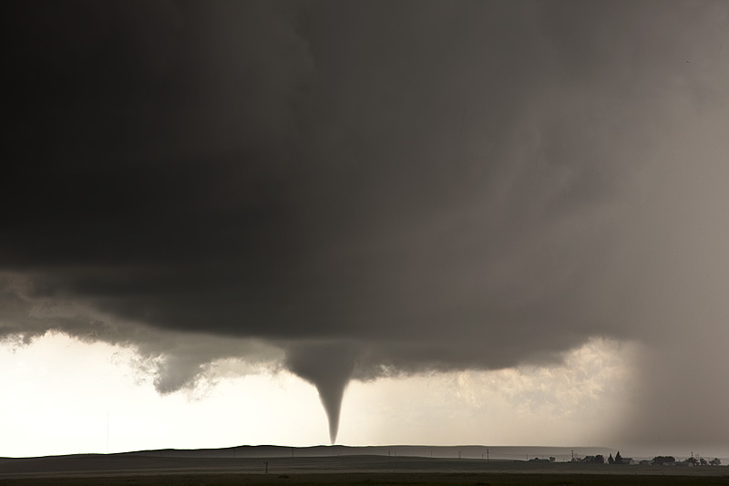
Tornado touched down east of Chugwater. Credit: Micheal Carlson |
Tornadoes:
|
Tornado - Chugwater
Track Map
 |
The Enhanced Fujita (EF) Scale classifies tornadoes into the following categories:
| EF0 Weak 65-85 mph |
EF1 Moderate 86-110 mph |
EF2 Significant 111-135 mph |
EF3 Severe 136-165 mph |
EF4 Extreme 166-200 mph |
EF5 Catastrophic 200+ mph |
 |
|||||
Photos & Video:
Nebraska and Wyoming Storm Damage
 |
 |
 |
|
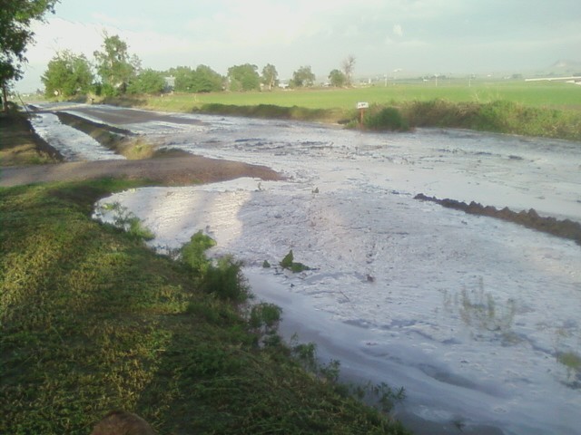
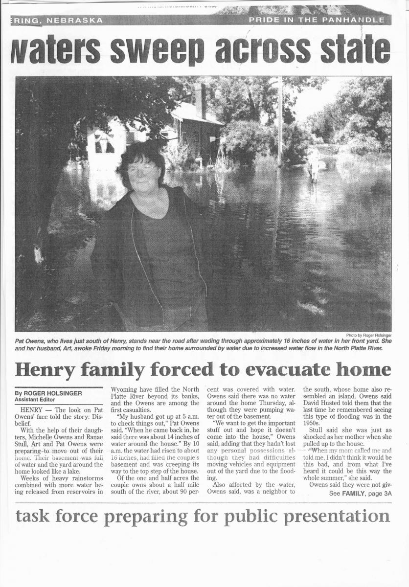
Flooding in Gering, NE Credit: Unknown |
Four inch hail east of Chugwater Credit: Tony Laubach |
Henry, NE flooding Credit: Pride of the Panhandle |
Radar:
Header
 |
 |
|
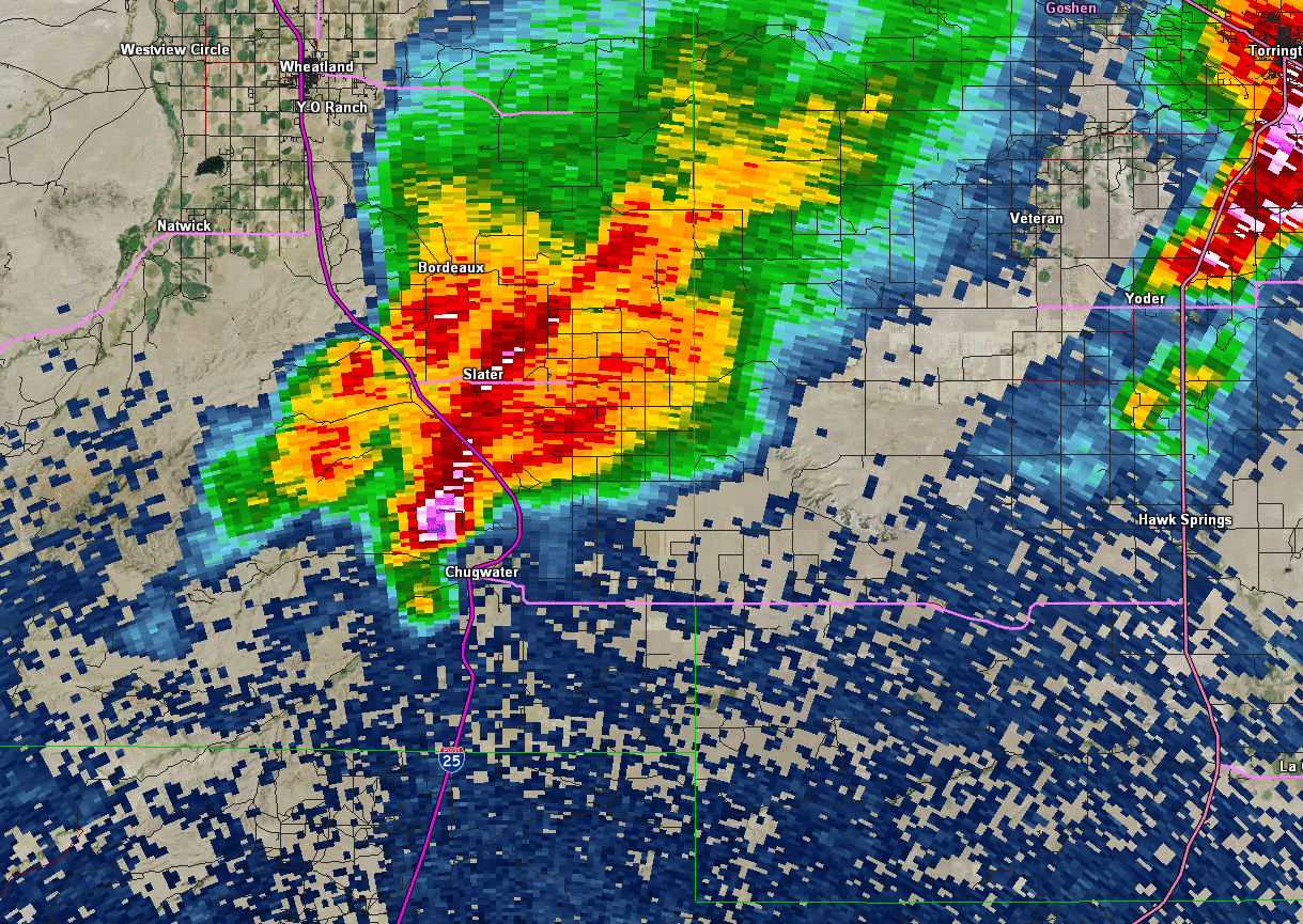
Reflectivity image loop from 401 PM to 447 PM as the supercell thunderstorm and associated tornado moved to the southeast. |
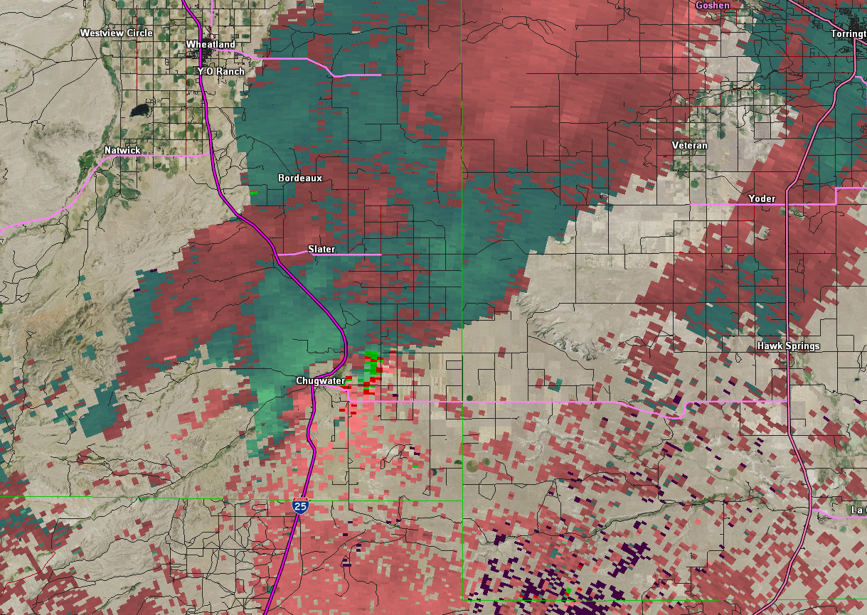
Storm relative velocity image loop from 401 PM to 447 PM. The green-red couplet depicts the tornadic rotation. |
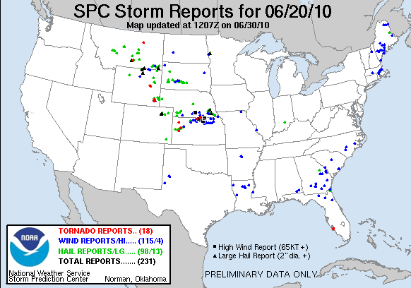
Storm Reports
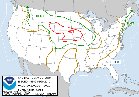
Storm Prediction Center Outlooks
 |
 |
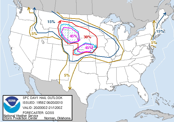 |
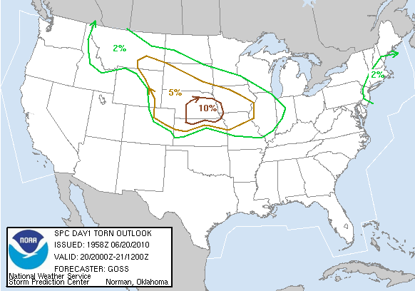
| SPC Day 1 Categorical Outlook | SPC Day 1 Tornado Outlook | SPC Day 1 Hail Outlook |
Storm Reports
 |
|
||||||||||
| June 20, 2010 Storm Reports |
 |
Media use of NWS Web News Stories is encouraged! Please acknowledge the NWS as the source of any news information accessed from this site. |
|


 Weather Story
 Weather Map
 Local Radar