Overview
|
A strong, moisture-laden late spring storm produced heavy snow and rain across southeast Wyoming and the Nebraska Panhandle from May 17th through 19th. Snow totals across southeast Wyoming ranged from 4 inches lower elevations to 36 inches over the mountains. Across the Nebraska Panhandle, rain changed to snow early Thursday morning, with heavy snow falling Thursday and Thursday night. Numerous tree damage and power outages were reported. |
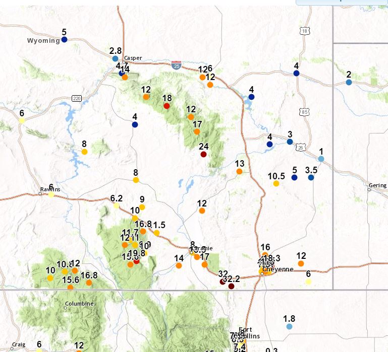
Snow reports received on May 19th. |
 |
 |
|
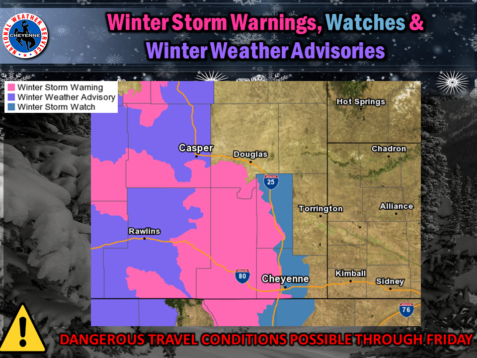
Winter storm watches, warnings, and advisories issued May 17
|
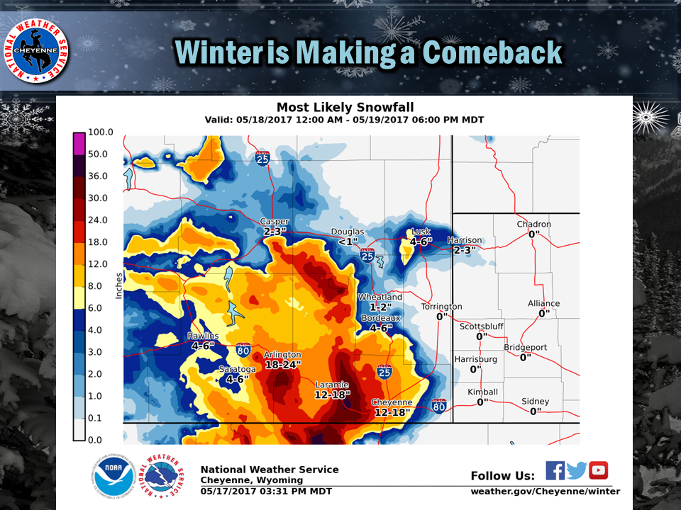
May 17, National Weather Service Weather Story Graphic |
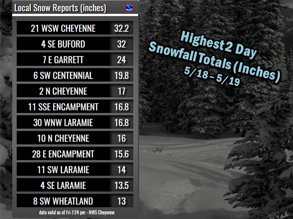
Snow Reports:
|
 |
Photos & Video:
 |
 |
 |
|
Snowfall north Cheyenne, WY Credit: Amber Reese |
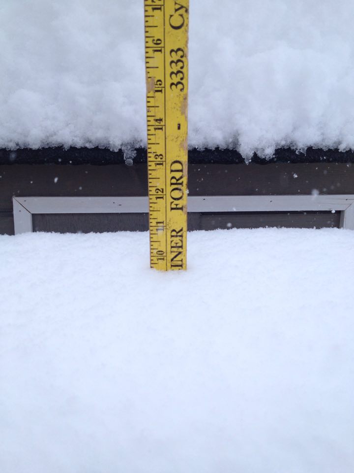
Snowfall measurement at Cheyenne, WY Credit: Oliver Smith |
Snowfall at Horse Creek, WY Credit: Chad Bunch |
 |
 |
 |
|
Snowfall near Happy Jack Rd. MM 10 Credit: Shannon Fischer |
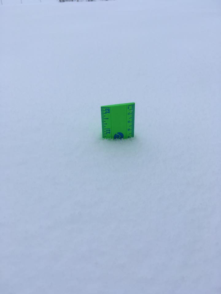
Snowfall measurement at Chugwater, WY Credit: Jana Strahan |
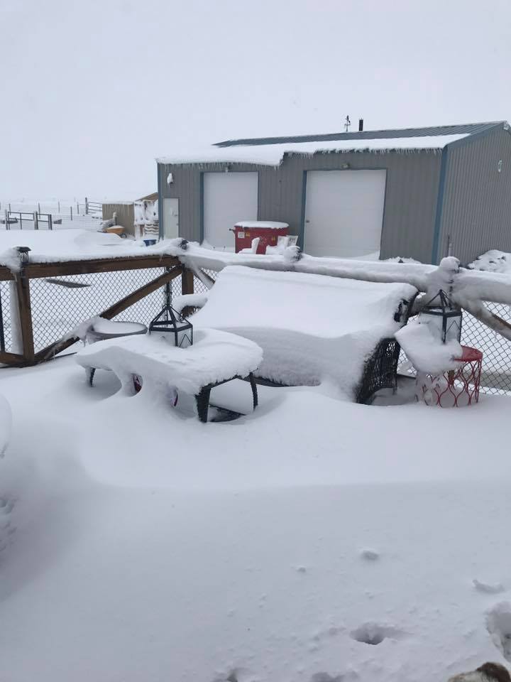
Tree clean-up after the snow storm at Cheyenne. Credit: Wyoming Tribune Eagle |


 Weather Story
 Weather Map
 Local Radar