Overview
|
Multiple rounds of thunderstorms with large hail impacted portions of eastern Wyoming and the Nebraska Panhandle on 15 August 2019, especially in Scottsbluff, NE. A severe thunderstorm developed early in the afternoon near Lusk, WY around 1 PM MDT and continued to move across the region until it finally weakened south of Sidney, NE. Along the way, the storm had a history of producing large hail including golf ball to baseball size hail for much of Scottsbluff around 3:30 PM MDT. The National Weather Service received reports of broken house windows, cracked vehicle windshields, and damaged crops with the hail after providing a 25 minute lead time for the Scottsbluff area. A second round of thunderstorms began developing near Casper, WY around 8:30 PM MDT and continued through the Nebraska Panhandle well into the early morning hours on the 16th of August. One of the thunderstorms dropped baseball size hail 5 miles south of Guernsey, WY around 12:05 AM MDT and was headed towards the Scottsbluff area. For a second time in 10 hours, Scottsbluff was hit with significant hail with sizes ranging from 1.5 to 2.0 inch diameter stones around 1:45 AM MDT with a 44 minute lead time provided by the National Weather Service.
|
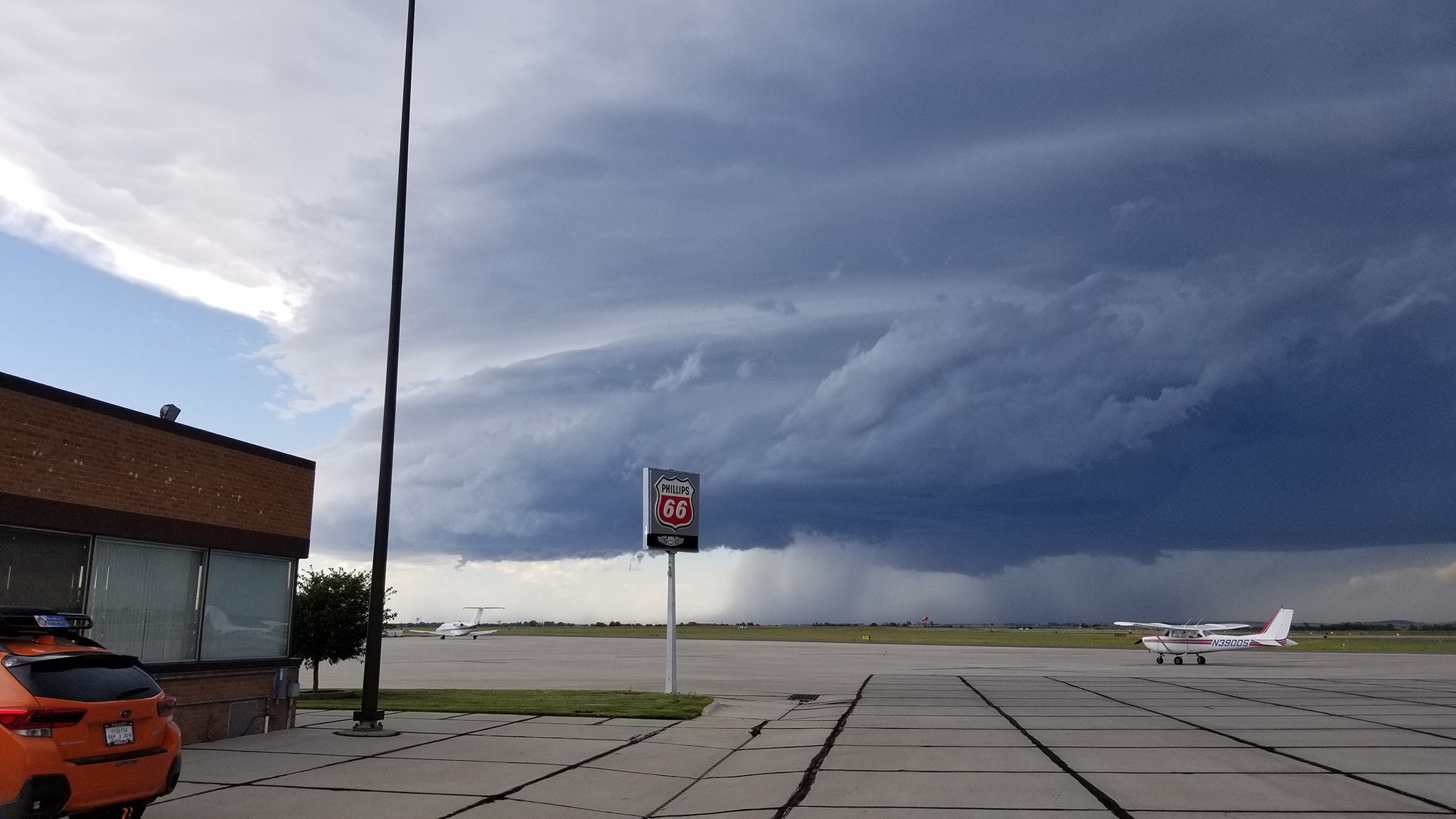
Supercell thunderstorm moving towards Western Nebraska Regional Airport shortly after 3 PM MDT. Credit: Michael Frady |
 |
 |
 |
|
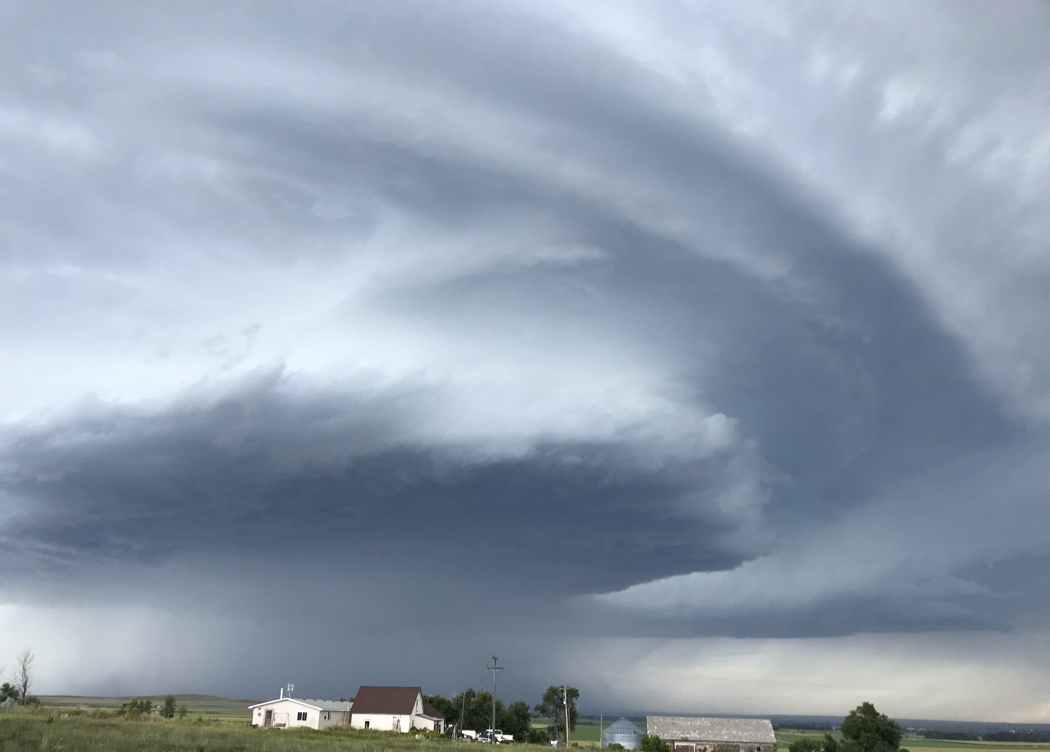
Supercell Thunderstorm north of Torrington around 2:45 PM MDT moving southeast. Credit: Dan Fitts |
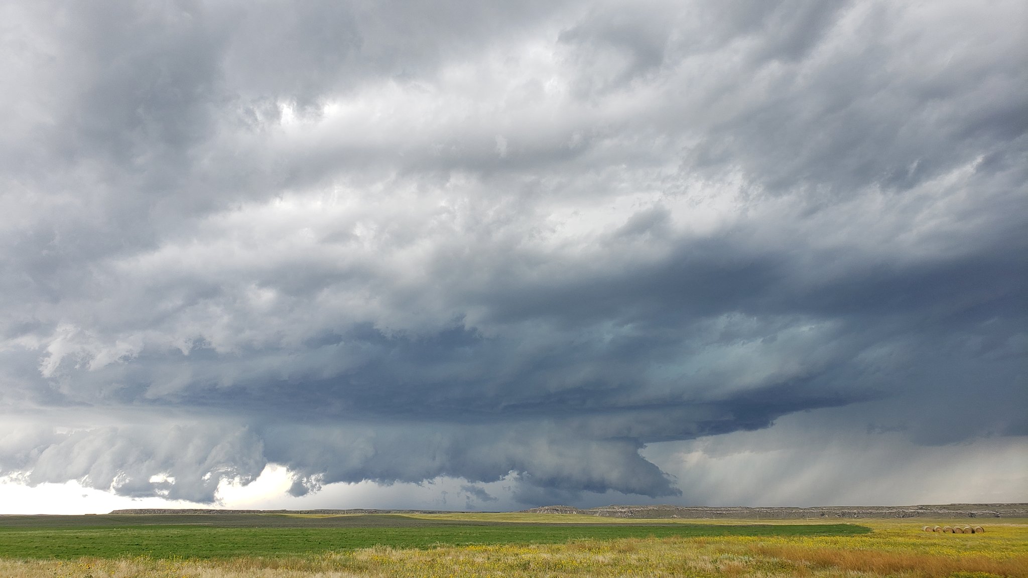
Supercell south of Melbeta around 3:47 PM MDT. Credit: Michael Charnick |
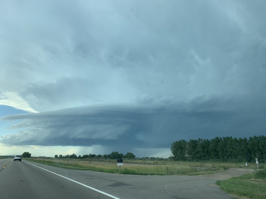
View of thunderstorm near Melbeta after passing through Scottsbluff. Credit: Taylor Stephens |
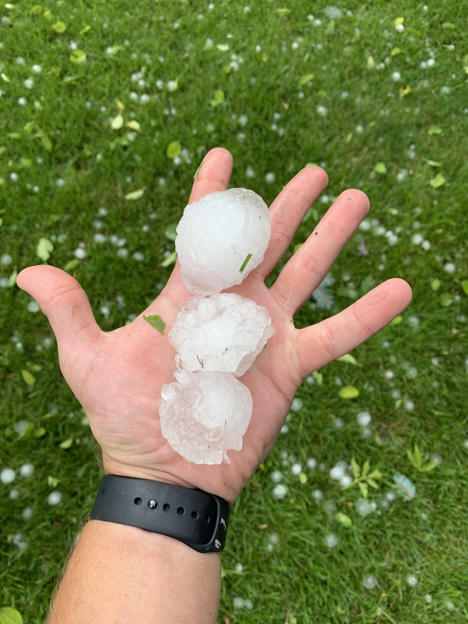
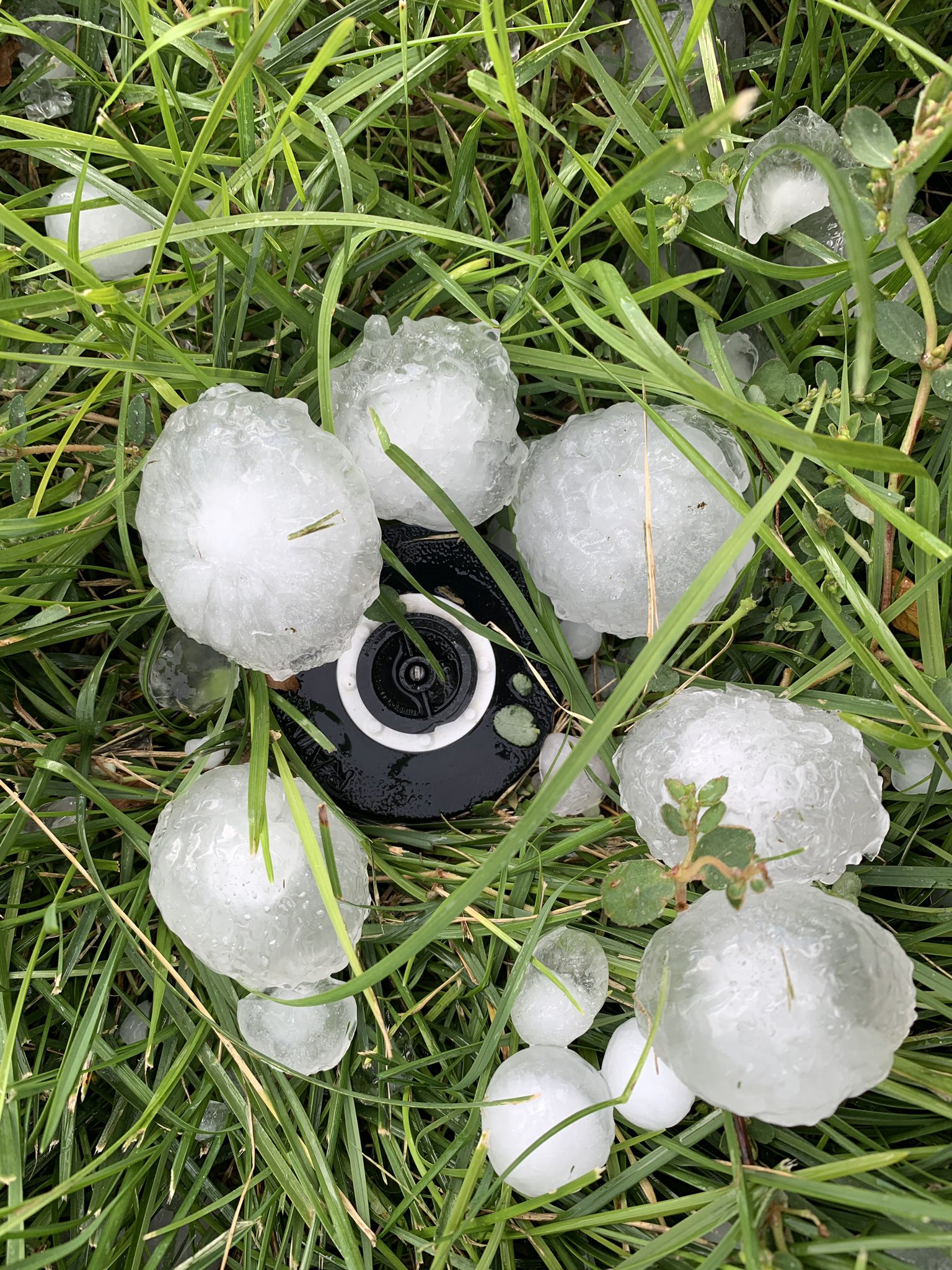
Scottsbluff Hail Pictures
Round 1 - 3:15 PM MDT to 4:00 PM MDT
 |
 |
 |
|
Hailstones in northeast Scottsbluff Credit: Tyler Thompson |
Ping pong to golf ball size hail near Western Nebraska Regional Airport Credit: Susan Hunzeker |
Hailstones in Scottsbluff around 3:50 PM MDT. Credit: Nick Marez |
 |
|
|
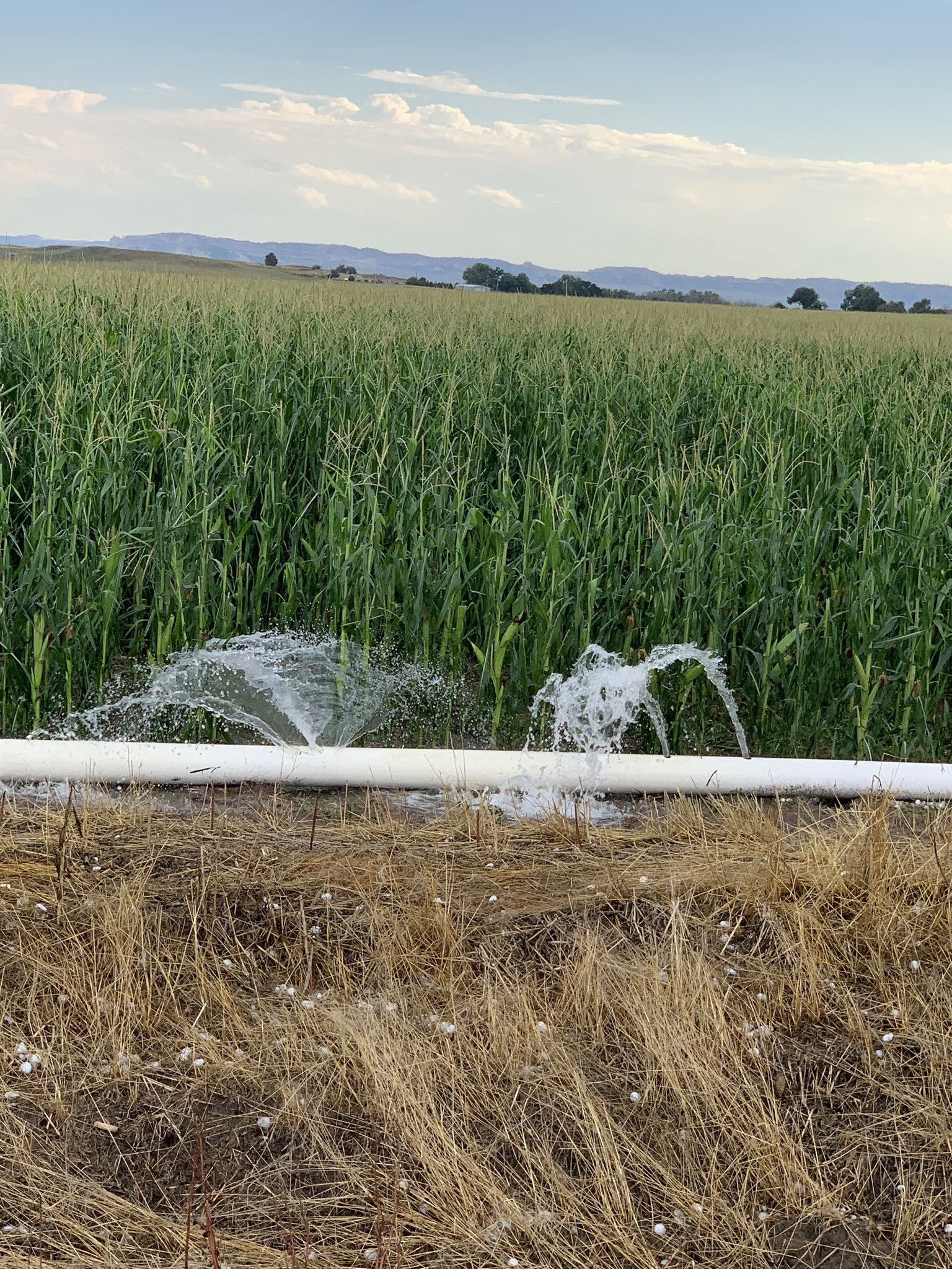
Hail punched holes in gated pipe in Scotts Bluff County. Credit: Dan Fitts |
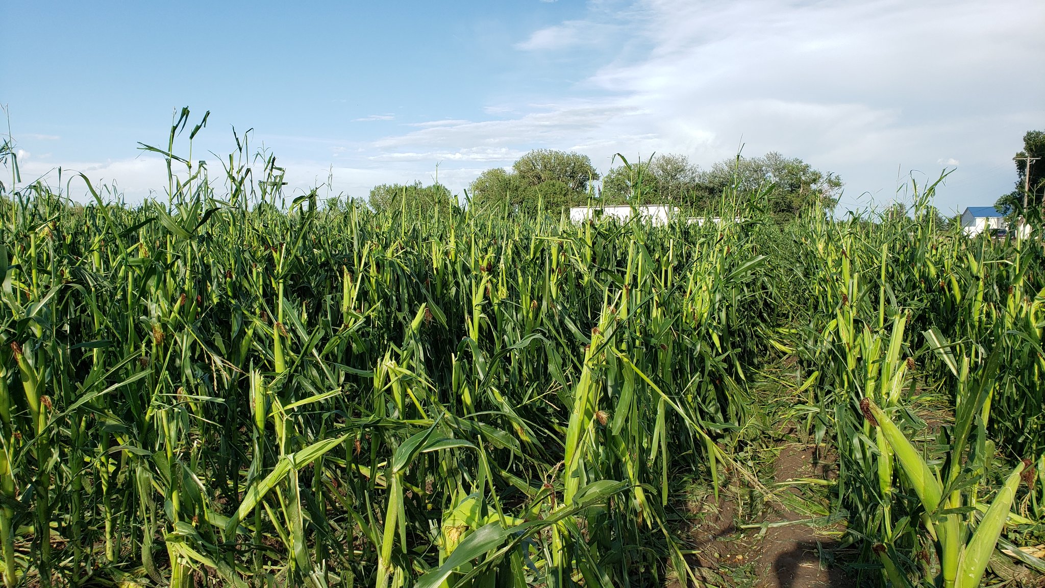
Damaged windows and crops in Scotts Bluff County. Credit: Dan Fitts |
|
|
|
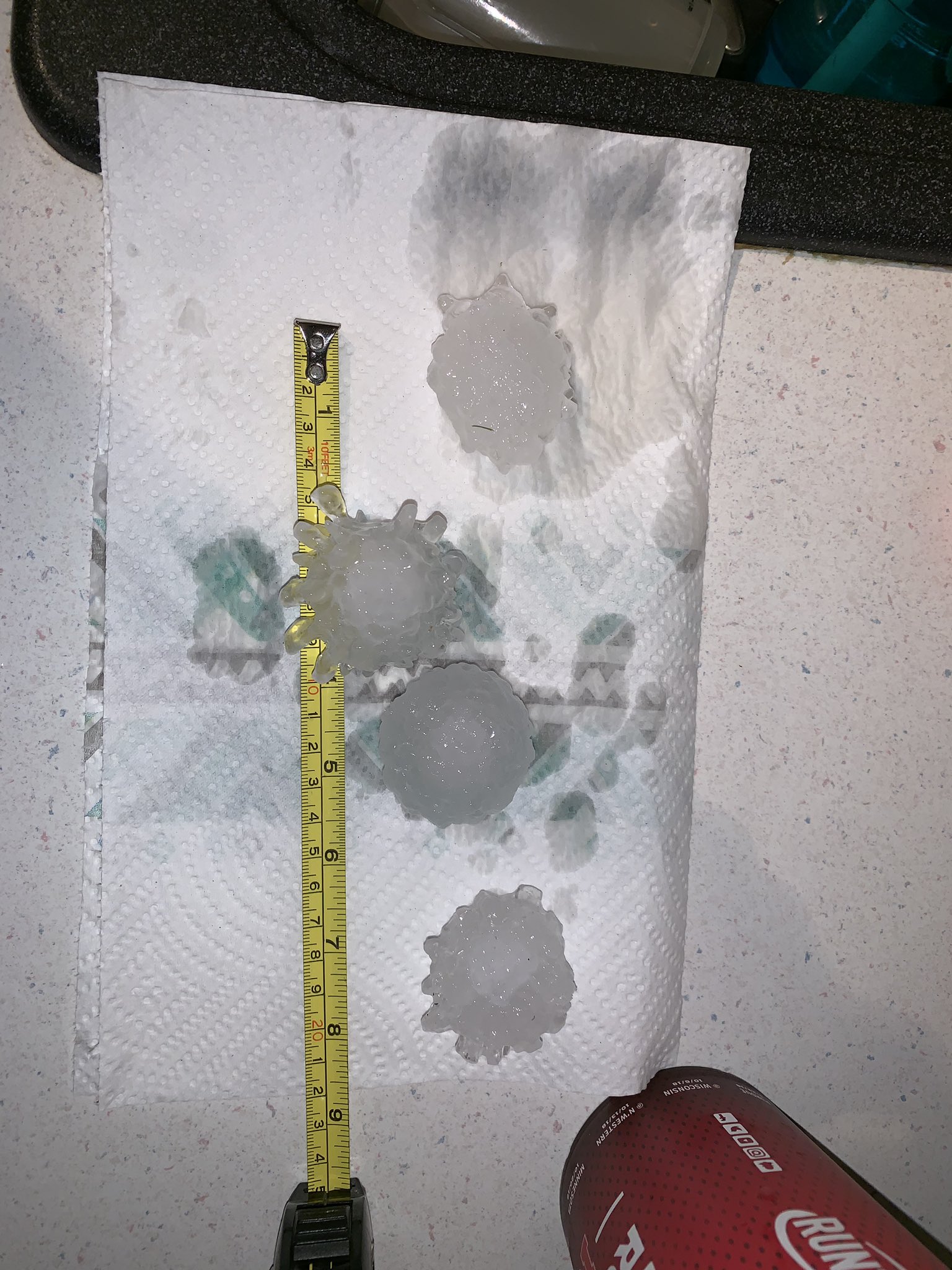
Round 2 - 1:15 AM MDT to 2:15 AM MDT
 |
 |
 |
|
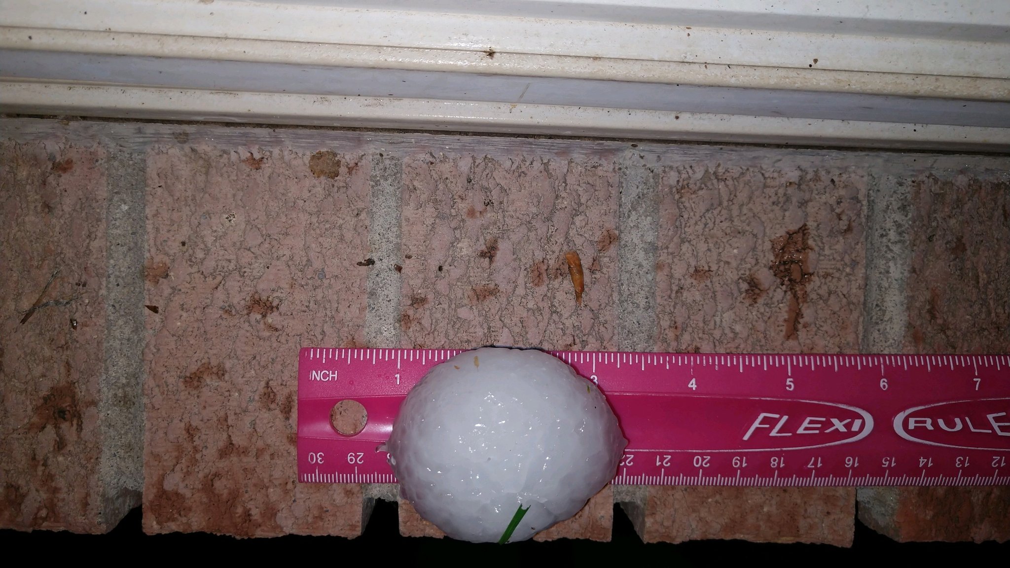
2.5 inch diameter hailstones in Gering around 1:45 AM MDT. Credit: Taylor Stephens |
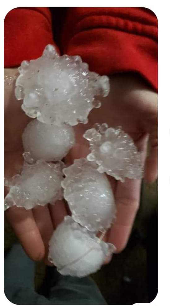
2.25 inch Hailstone in Melbeta. Credit: Dan Fitts |
Hailstones in Gering around 1:35 AM MDT. Credit: Dennis Ernest |
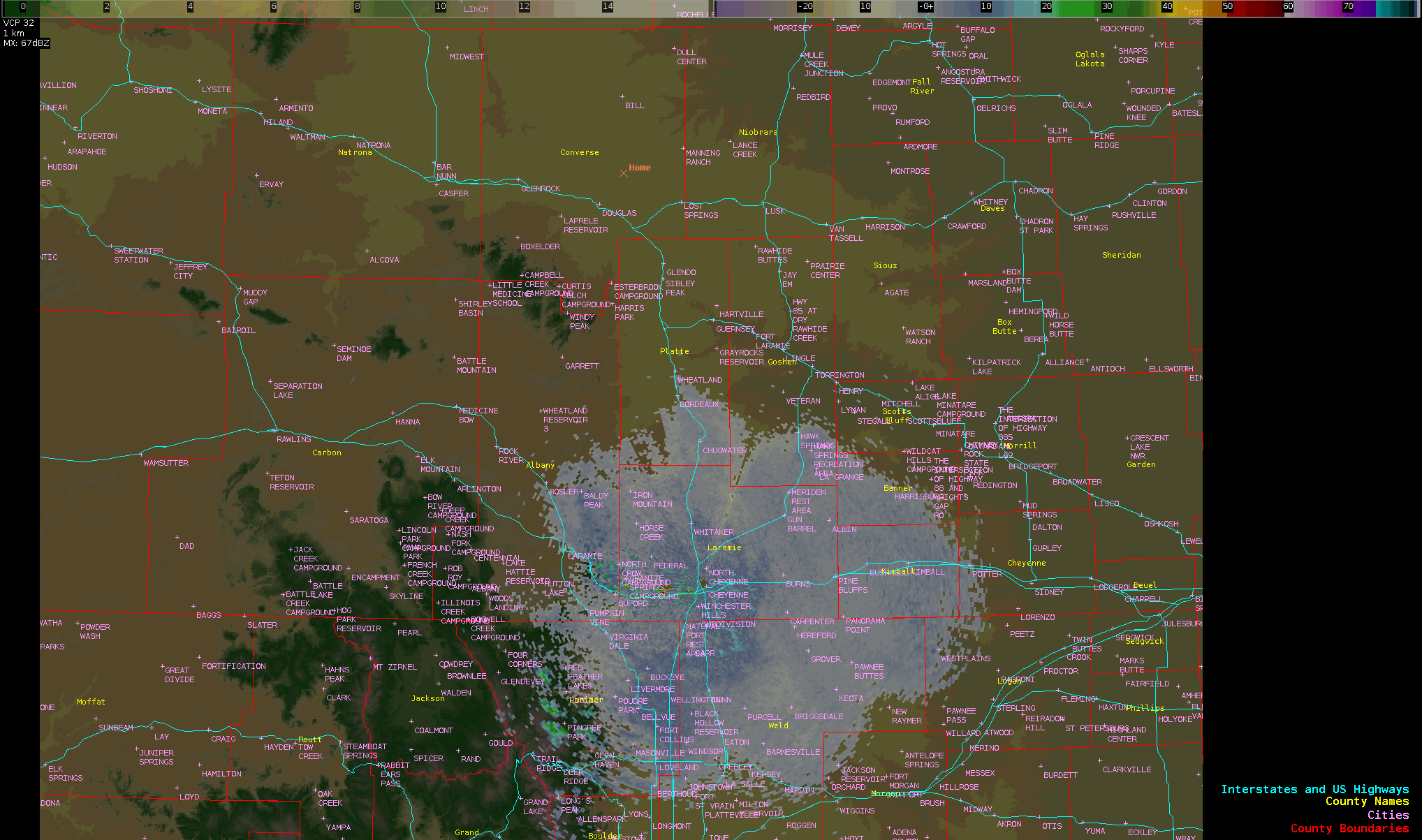
Radar
 |
 |
|
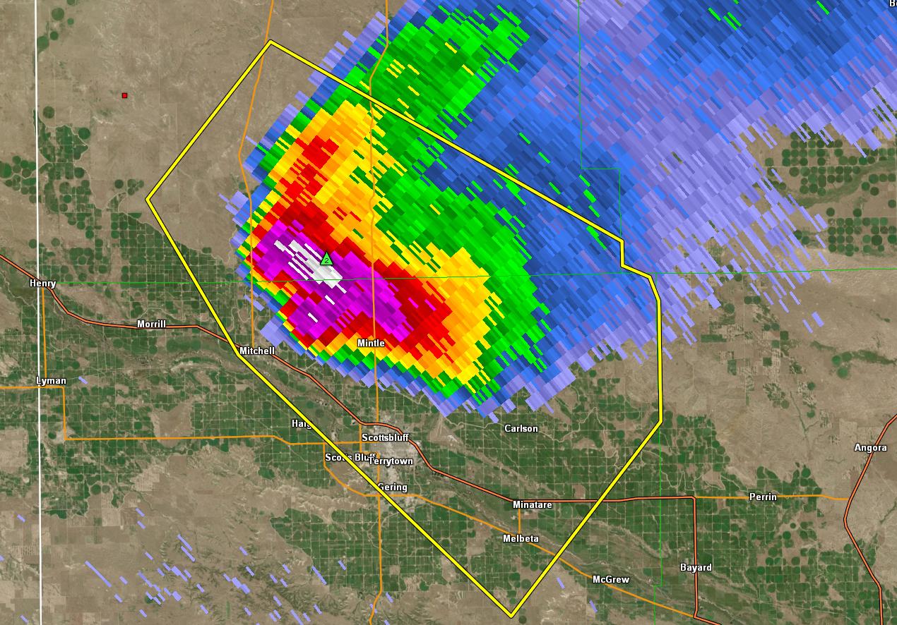
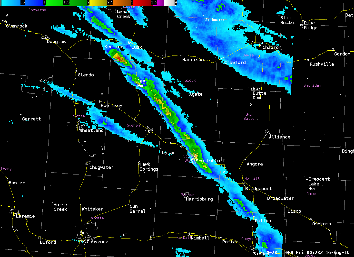
Reflectivity image around 3:20 PM MDT as the supercell thunderstorm approached Scottsbluff, NE. |
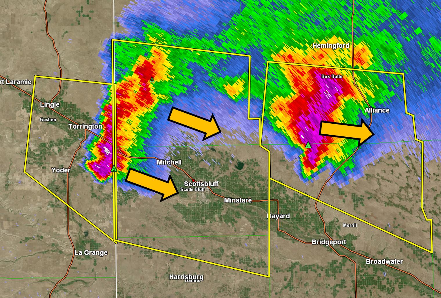
Reflectivity image around 1:00 AM MDT as the second round of severe thunderstorm approached Scottsbluff, NE. |
 |
 |
|
Radar estimated hail size (MRMS MESH) for storm as it traveled from near Lusk, WY toward Sidney, NE between 1 PM MDT and 6 PM MDT. |
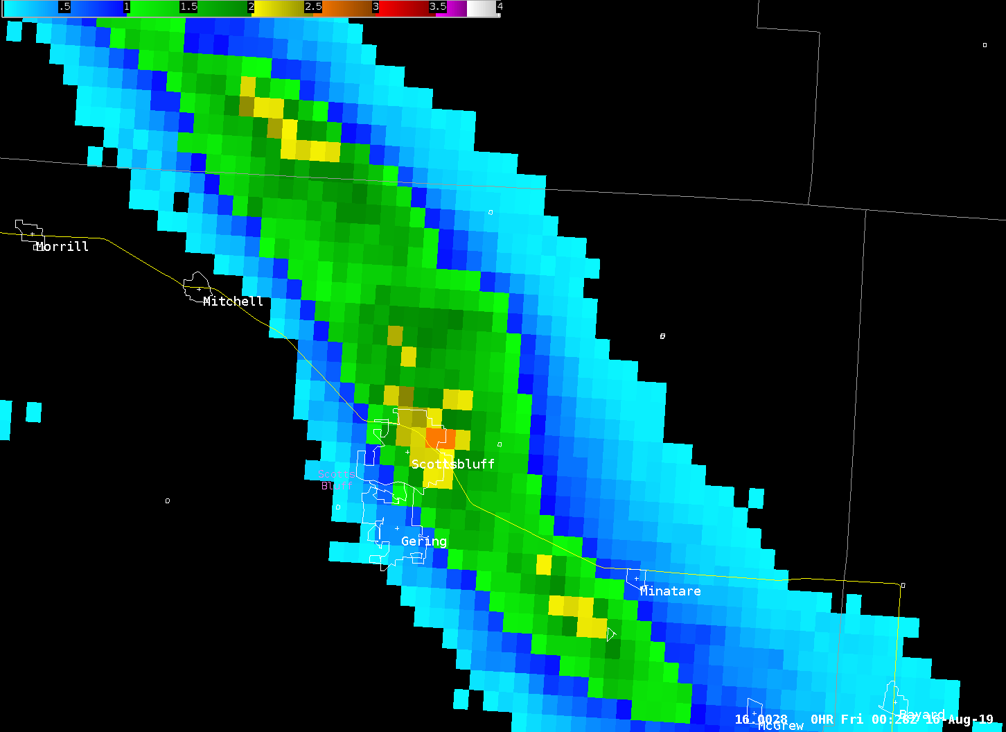
Zoomed in view of radar estimated hail size (MRMS MESH) near Scottsbluff, NE where estimates were greater than 2.5 inches in diameter. |
 |
|
Radar loop from the first round of storms that moved through the area on the afternoon of August 15, 2019. |
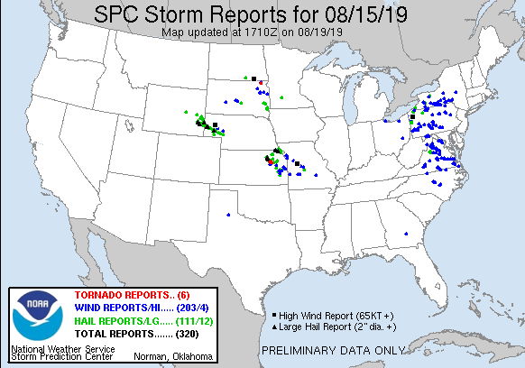
Storm Reports
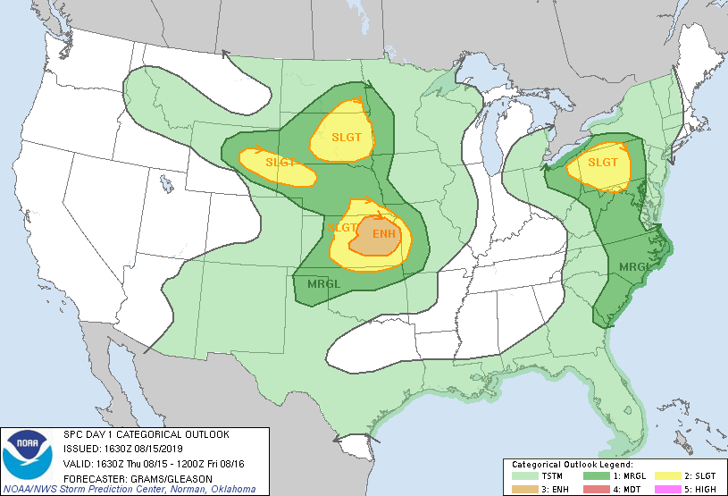
Storm Prediction Center Outlooks
 |
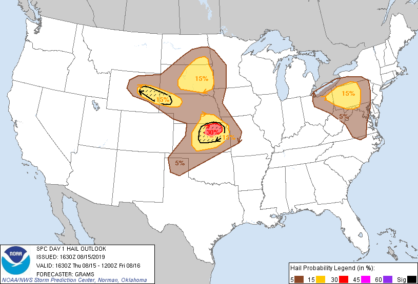 |
| SPC Day 1 Categorical Outlook | SPC Day 1 Hail Outlook |
Storm Reports
 |
|
||||||||||||
PRELIMINARY LOCAL STORM REPORT...SUMMARY
NATIONAL WEATHER SERVICE CHEYENNE WY
306 AM MDT FRI AUG 16 2019

..TIME...   ...EVENT...      ...CITY LOCATION...     ...LAT.LON...
..DATE...   ....MAG....      ..COUNTY LOCATION..ST.. ...SOURCE....
            ..REMARKS..

0234 PM     HAIL             23 N TORRINGTON         42.40N 104.18W
08/15/2019  M1.00 INCH       GOSHEN             WY   PUBLIC


0306 PM     HAIL             14 NNE TORRINGTON       42.25N 104.08W
08/15/2019  M2.00 INCH       GOSHEN             WY   STORM CHASER

            2 INCH HAIL OBSERVED BY STORM CHASER.

0326 PM     HAIL             4 NNE MORRILL           42.02N 103.89W
08/15/2019  M1.75 INCH       SIOUX              NE   TRAINED SPOTTER

            STORM CHASER OBSERVED GOLF BALL SIZED HAIL.

0341 PM     HAIL             1 N SCOTTSBLUFF         41.88N 103.66W
08/15/2019  M1.75 INCH       SCOTTS BLUFF       NE   TRAINED SPOTTER

            GOLF BALL SIZED HAIL FOR 3 MINUTES STRAIGHT.
            BROKEN WINDOWS AT HOUSE OBSERVED.

0343 PM     HAIL             1 E SCOTTSBLUFF         41.87N 103.64W
08/15/2019  M2.75 INCH       SCOTTS BLUFF       NE   BROADCAST MEDIA

            SEVERE DAMAGE DENOTED ACROSS CITY OF
            SCOTTSBLUFF WITH SEVERE DAMAGE TO HOUSES
            INCLUDING WINDOWS AND ROOFS, CROPS, VEHICLE
            WINDSHIELDS, AND TREES.

0345 PM     HAIL             1 N SCOTTSBLUFF         41.88N 103.66W
08/15/2019  M1.75 INCH       SCOTTS BLUFF       NE   PUBLIC


0346 PM     HAIL             SCOTTSBLUFF             41.87N 103.66W
08/15/2019  M1.75 INCH       SCOTTS BLUFF       NE   PUBLIC


0346 PM     HAIL             NE SCOTTSBLUFF          41.87N 103.66W
08/15/2019  M2.00 INCH       SCOTTS BLUFF       NE   PUBLIC

            2 INCH HAIL REPORTED BY PUBLIC.

0354 PM     HAIL             MINATARE                41.81N 103.50W
08/15/2019  M1.75 INCH       SCOTTS BLUFF       NE   PUBLIC

            MARBLE TO GOLF BALL HAIL FROM 352-357PM.

0400 PM     HAIL             1 S MELBETA             41.77N 103.52W
08/15/2019  M1.75 INCH       SCOTTS BLUFF       NE   PUBLIC

            GOLF BALL SIZED HAIL MEASURED APPROXIMATELY
            1 MILE SOUTH OF MELBETA AT COUNTY ROAD 29.

0406 PM     HAIL             2 S MELBETA             41.75N 103.52W
08/15/2019  M1.75 INCH       SCOTTS BLUFF       NE   TRAINED SPOTTER


0500 PM     HAIL             DALTON                  41.41N 102.97W
08/15/2019  M1.00 INCH       CHEYENNE           NE   EMERGENCY MNGR


0532 PM     HAIL             10 NE SIDNEY            41.24N 102.83W
08/15/2019  M1.00 INCH       CHEYENNE           NE   TRAINED SPOTTER

            GROUND PARTIALLY COVERED WITH HAIL.

1031 PM     HAIL             2 W LOST SPRINGS        42.77N 104.96W
08/15/2019  M1.00 INCH       CONVERSE           WY   TRAINED SPOTTER

            QUARTER SIZED HAIL OBSERVED.

1113 PM     HAIL             4 SSW RAWHIDE BUTTES    42.52N 104.53W
08/15/2019  M1.25 INCH       GOSHEN             WY   TRAINED SPOTTER

            BROKEN WINDOW.

1123 PM     HAIL             4 S LUSK                42.70N 104.45W
08/15/2019  M1.00 INCH       NIOBRARA           WY   TRAINED SPOTTER

            TORRENTIAL RAINFALL OBSERVED IN ADDITION TO
            QUARTER HAIL SIZE.

1150 PM     HAIL             29 N TORRINGTON         42.49N 104.18W
08/15/2019  M1.00 INCH       GOSHEN             WY   CO-OP OBSERVER


1150 PM     HAIL             23 N TORRINGTON         42.40N 104.18W
08/15/2019  M1.00 INCH       GOSHEN             WY   CO-OP OBSERVER


1201 AM     HAIL             5 S GUERNSEY            42.19N 104.74W
08/16/2019  M1.25 INCH       PLATTE             WY   COCORAHS

            .

1205 AM     HAIL             5 S GUERNSEY            42.19N 104.75W
08/16/2019  E2.75 INCH       PLATTE             WY   PUBLIC

            RECEIVED PHOTO VIA FACEBOOK. TIME AND
            LOCATION ESTIMATED OFF OF RADAR.

1206 AM     HAIL             GUERNSEY                42.27N 104.74W
08/16/2019  E1.00 INCH       PLATTE             WY   PUBLIC


1228 AM     HAIL             7 WSW LINGLE            42.09N 104.46W
08/16/2019  M1.00 INCH       GOSHEN             WY   EMERGENCY MNGR


1230 AM     HAIL             10 WSW LINGLE           42.06N 104.51W
08/16/2019  M2.50 INCH       GOSHEN             WY   EMERGENCY MNGR

            INTERSECTION OF RD 15 AND RD 70 SOUTH OF
            FORT LARAMIE.

1242 AM     HAIL             5 NNW VETERAN           42.03N 104.38W
08/16/2019  M1.00 INCH       GOSHEN             WY   EMERGENCY MNGR

            LINGLE VET HWY AND ROAD 154.

1254 AM     HAIL             3 ENE VETERAN           41.99N 104.29W
08/16/2019  M1.00 INCH       GOSHEN             WY   TRAINED SPOTTER


1254 AM     HAIL             4 NE YODER              41.96N 104.24W
08/16/2019  M1.75 INCH       GOSHEN             WY   EMERGENCY MNGR

            INTERSECTION OF HWY 85 AND RD 54.

0102 AM     HAIL             8 E YODER               41.94N 104.15W
08/16/2019  M1.75 INCH       GOSHEN             WY   EMERGENCY MNGR

            .

0121 AM     HAIL             MORRILL                 41.96N 103.92W
08/16/2019  M1.00 INCH       SCOTTS BLUFF       NE   EMERGENCY MNGR


0124 AM     HAIL             ALLIANCE                42.10N 102.87W
08/16/2019  E1.00 INCH       BOX BUTTE          NE   PUBLIC

            RECEIVED PHOTO VIA FACEBOOK. GROUND COVERED
            IN HAIL.

0132 AM     TSTM WND GST     5 SE ALLIANCE           42.05N 102.80W
08/16/2019  M77 MPH          BOX BUTTE          NE   ASOS

            ALLIANCE MUNICIPAL AIRPORT ASOS KAIA.

0140 AM     HAIL             GERING                  41.83N 103.67W
08/16/2019  M1.50 INCH       SCOTTS BLUFF       NE   PUBLIC

            RECEIVED PHOTO VIA FACEBOOK.

0140 AM     HAIL             SCOTTSBLUFF             41.87N 103.66W
08/16/2019  M1.75 INCH       SCOTTS BLUFF       NE   BROADCAST MEDIA

            MOSTLY GOLF BALL SIZE HAIL. SOME POSSIBLY
            LARGER.

0142 AM     HAIL             SCOTTSBLUFF             41.87N 103.66W
08/16/2019  M1.00 INCH       SCOTTS BLUFF       NE   EMERGENCY MNGR

            QUARTER SIZE HAIL LASTING 5 TO 10 MINUTES.

0145 AM     HAIL             GERING                  41.83N 103.67W
08/16/2019  M2.00 INCH       SCOTTS BLUFF       NE   TRAINED SPOTTER

            RECEIVED PHOTO VIA TWITTER.

0147 AM     HAIL             3 ENE GERING            41.84N 103.62W
08/16/2019  M1.75 INCH       SCOTTS BLUFF       NE   BROADCAST MEDIA

            .

0149 AM     HAIL             MINATARE                41.81N 103.50W
08/16/2019  E1.75 INCH       SCOTTS BLUFF       NE   PUBLIC

            RECEIVED PHOTO VIA FACEBOOK.

0205 AM     HAIL             BAYARD                  41.76N 103.32W
08/16/2019  M1.00 INCH       MORRILL            NE   PUBLIC

            RECEIVED PHOTO VIA TWITTER OF QUARTERS AND
            NICKELS.

0224 AM     HAIL             BRIDGEPORT              41.67N 103.10W
08/16/2019  M1.75 INCH       MORRILL            NE   BROADCAST MEDIA

            .

0230 AM     HAIL             4 ESE BRIDGEPORT        41.65N 103.02W
08/16/2019  M1.00 INCH       MORRILL            NE   TRAINED SPOTTER

            QUARTER SIZE HAIL ONE INCH DEEP OVER HWY 385
            EAST OF BRIDGEPORT.

0242 AM     HAIL             2 SW BROADWATER         41.58N 102.88W
08/16/2019  M1.75 INCH       MORRILL            NE   STORM CHASER


0244 AM     HAIL             BROADWATER              41.60N 102.85W
08/16/2019  M2.00 INCH       MORRILL            NE   STORM CHASER
|
 |
Media use of NWS Web News Stories is encouraged! Please acknowledge the NWS as the source of any news information accessed from this site. |
|


 Weather Story
 Weather Map
 Local Radar