Cheyenne, WY
Weather Forecast Office


US Dept of Commerce
National Oceanic and Atmospheric Administration
National Weather Service
Cheyenne, WY
1301 Airport Parkway
Cheyenne, WY 82001-1549
307-772-2468
Comments? Questions? Please Contact Us.


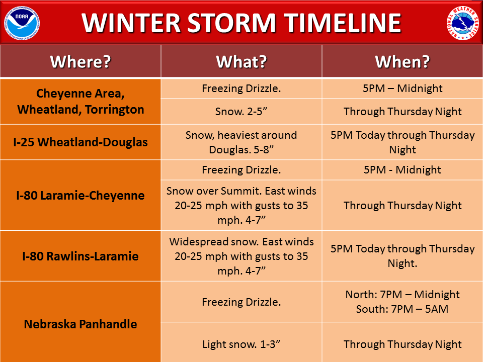
 Weather Story
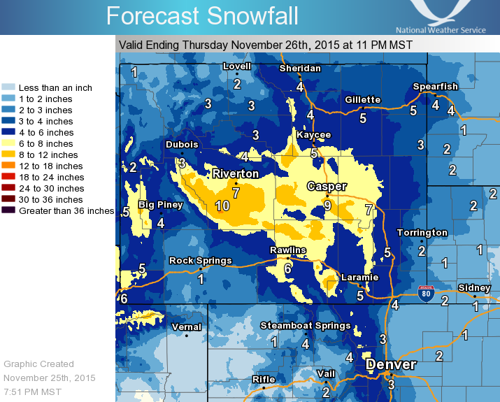
 Weather Map
 Local Radar