Cheyenne, WY
Weather Forecast Office

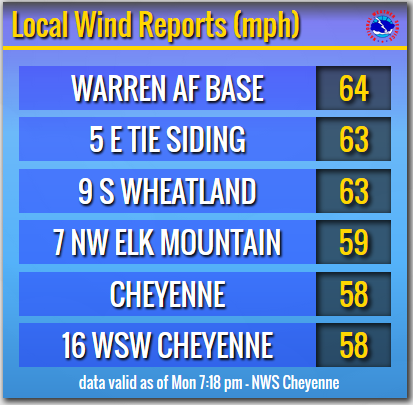
A strong cold front for July moved across the region earlier this morning, bringing cooler temperatures and very windy conditions to southeast Wyoming. Here's a look at a few of the highest wind speeds reported earlier this afternoon.
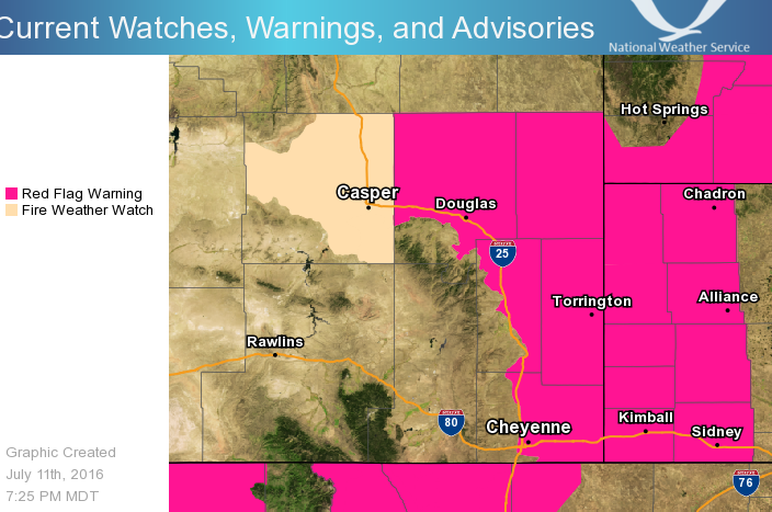
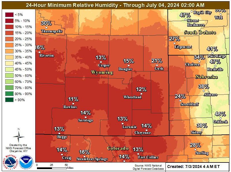
Breezy west winds of 25 to 35 mph will continue across the region through the evening. These winds will combine with very low relative humidity to keep the fire danger high for areas along and east of Interstate 25. A Red Flag Warning remains in effect. Outdoor burning is strongly discouraged!!!
 |
 |
| Maximum Temperature Monday | Maximum Wind Gusts Through Monday |
 |
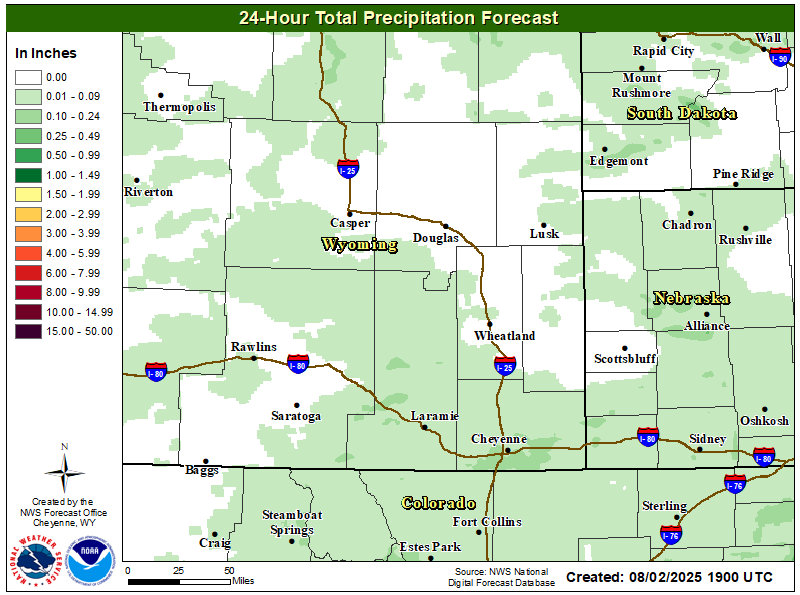 |
| Lowest Humidity Through Monday | Total Rainfall Through Monday |
US Dept of Commerce
National Oceanic and Atmospheric Administration
National Weather Service
Cheyenne, WY
1301 Airport Parkway
Cheyenne, WY 82001-1549
307-772-2468
Comments? Questions? Please Contact Us.


 Weather Story
 Weather Map
 Local Radar