Severe thunderstorms will be possible this afternoon across east-central Wyoming and portions of the western Nebraska Panhandle as a front approaches. Areas with the best chances to see severe thunderstorms will be across the northern Nebraska Panhandle, with less potential across southern portions of the Panhandle and in east-central Wyoming. Thunderstorms will develop around the North Platte River Valley in the early to mid afternoon, spreading east across the plains through the late afternoon and early evening. Heavy rain, large hail and damaging winds are the most likely hazards. The greater threat for tornadoes will be in areas closest to the Nebraska/South Dakota stateline. Severe potential will decrease this evening as storms move into central Nebraska.

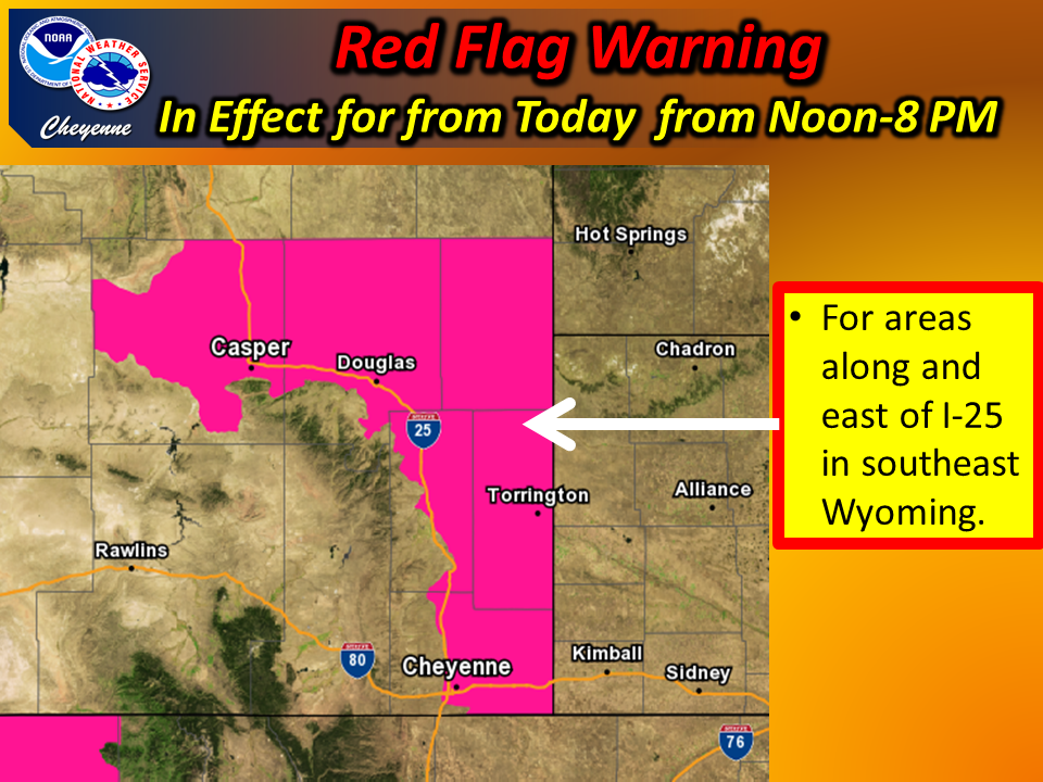
Hot...dry and breezy conditions will develop across southeast Wyoming by around midday today and will continue into early this evening. West wind gusts of 25 to 35 mph combined with humidity values that will fall below 15 percent will produce critical fire weather conditions capable of rapid fire growth. Outdoor burning is NOT recommended today.


 Weather Story
 Weather Map
 Local Radar