Overview
|
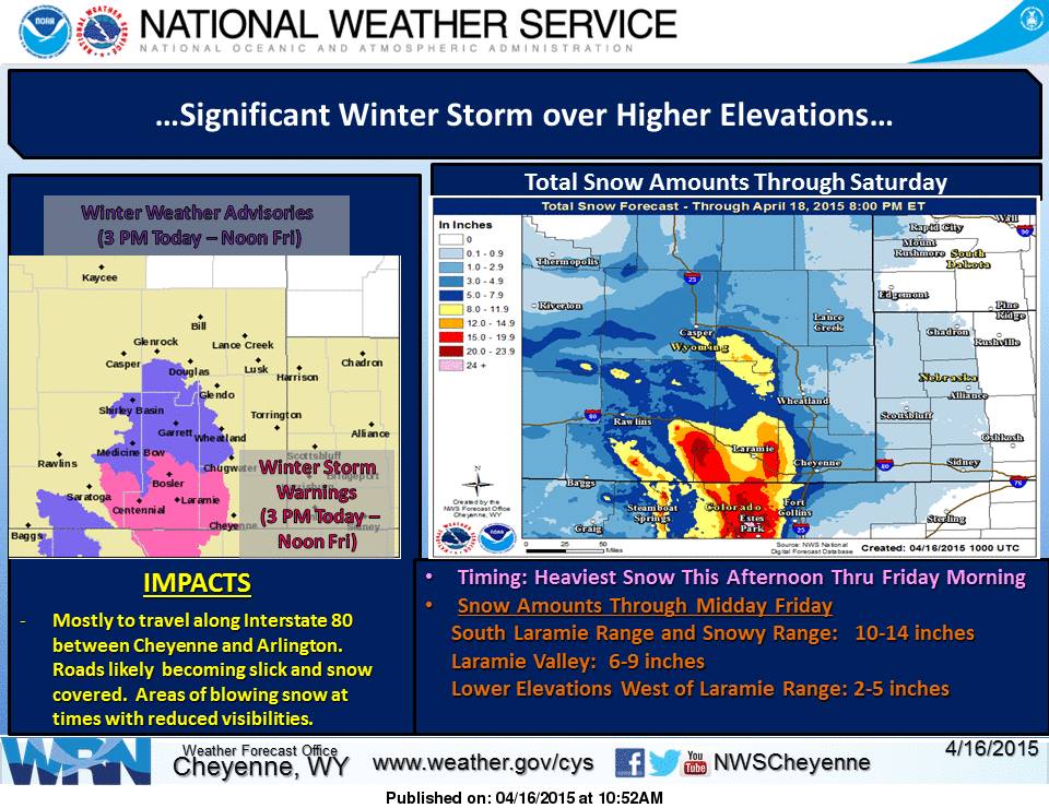
A late season winter storm impacted southeast Wyoming on April 16, 2015. A Pacific cold front moved into Wyoming during the night of April 15th. The days leading up to the event were warm and dry. Colder temperatures produced snow in the mountains and rain changing to snow across lower elevations. Total snow accumulations for elevations above 7000 ft were three to six inches, with more than 15 inches over the mountains. Elevations below 7000 ft received little to no snow accumulation. |
 |
 |
|
|
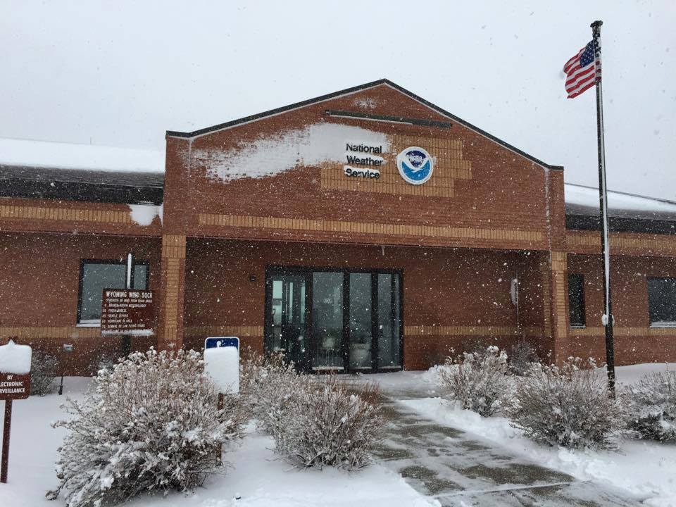
Snow falling at the Weather Service Office in Cheyenne
|
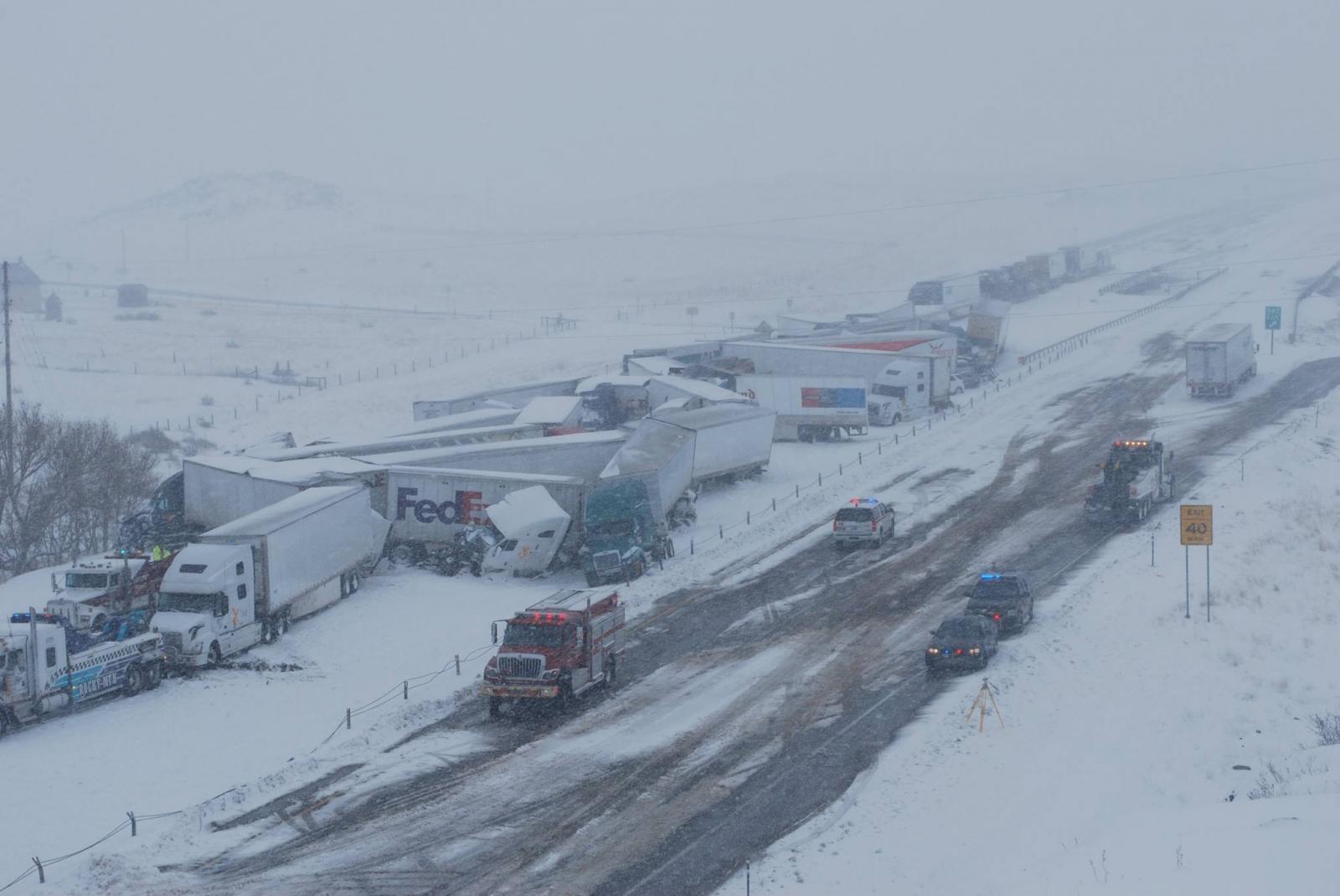
Video Massive Vehicle Pileup on I 80 Credit Marci Hugentobler |
April 16, Weather Story Graphic |
Snow Reports:
|
|
|
The markers on the map indicate snow amounts at various locations. Click on the marker for the exact snow totals and locations
|
Photos & Video:
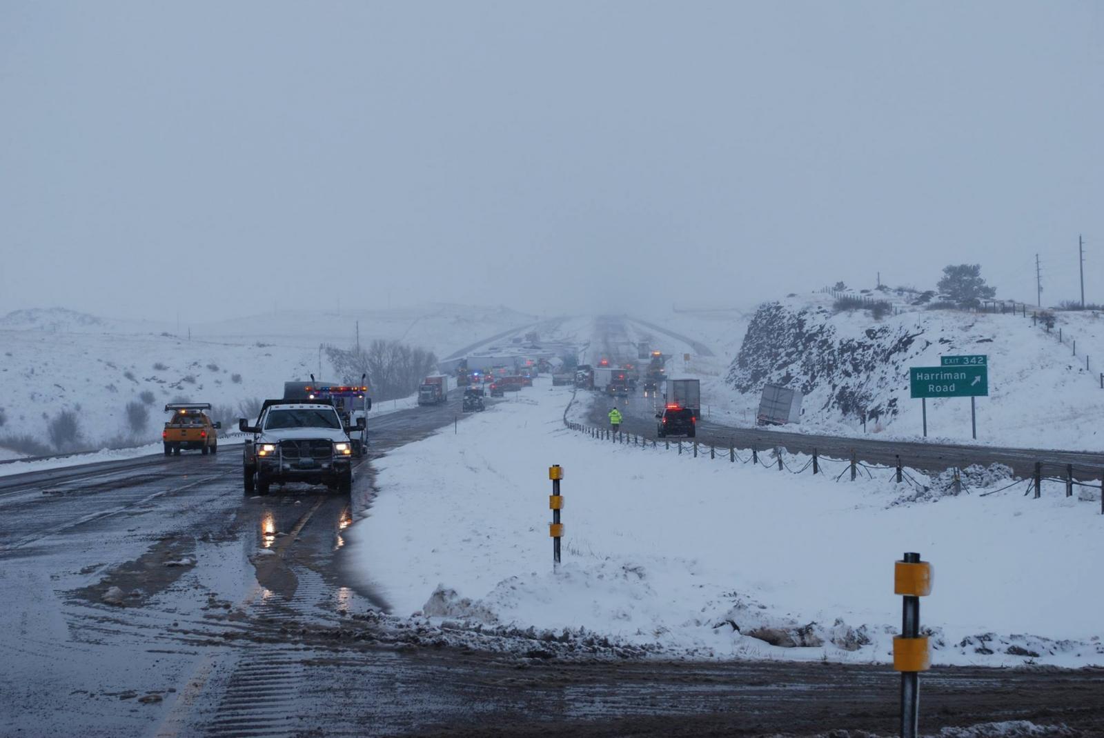
Snow and Vehicle Pileup on Interstate 80
 |
 |
 |
|
Arial View of the I 80 Pileup Credit: Wyoming Highway Patrol |
Harriman Road Exit on I 80 Credit: Wyoming Highway Patrol |
View of the Trucks Stuck on I 80 Credit: Wyoming Highway Patrol |


 Weather Story
 Weather Map
 Local Radar