Flash flooding threatens areas from the Tennessee Valley to the Carolinas as storms repeat along a stalled front. Monsoonal storms may trigger flooding in the Southwest. Dangerous heat expands across the Desert Southwest, Plains, mid-Mississippi Valley and Southern Tier. Critical fire weather for interior Pacific Northwest. Cooler, drier air brings brief relief to the Great Lakes and Northeast. Read More >
Overview
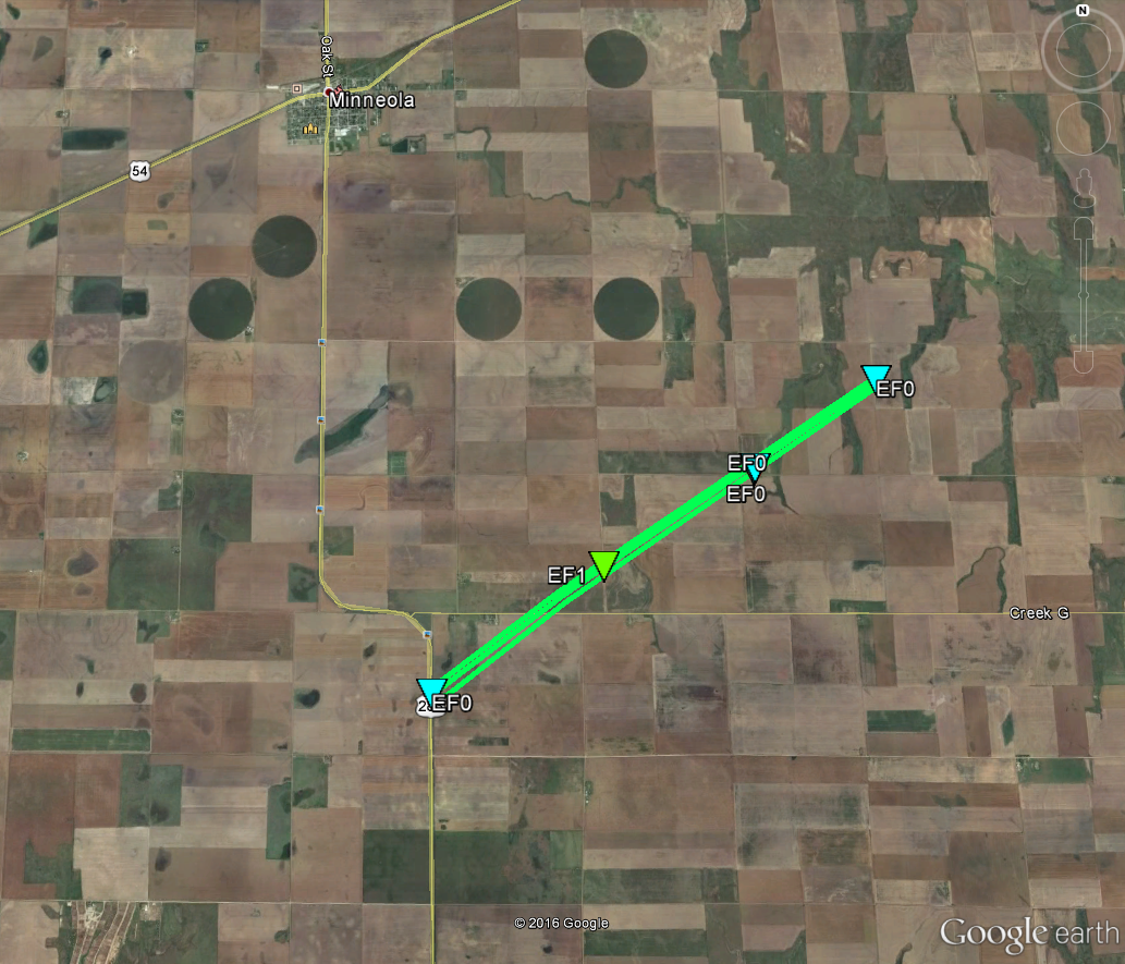
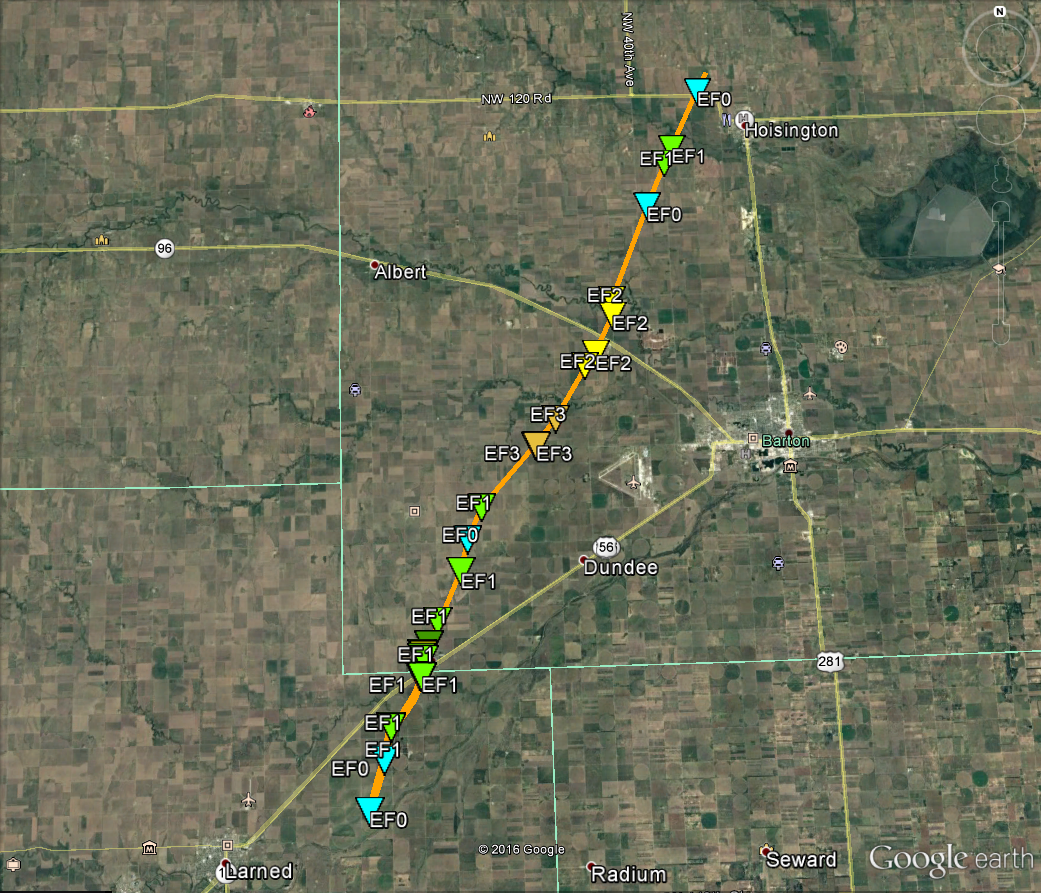
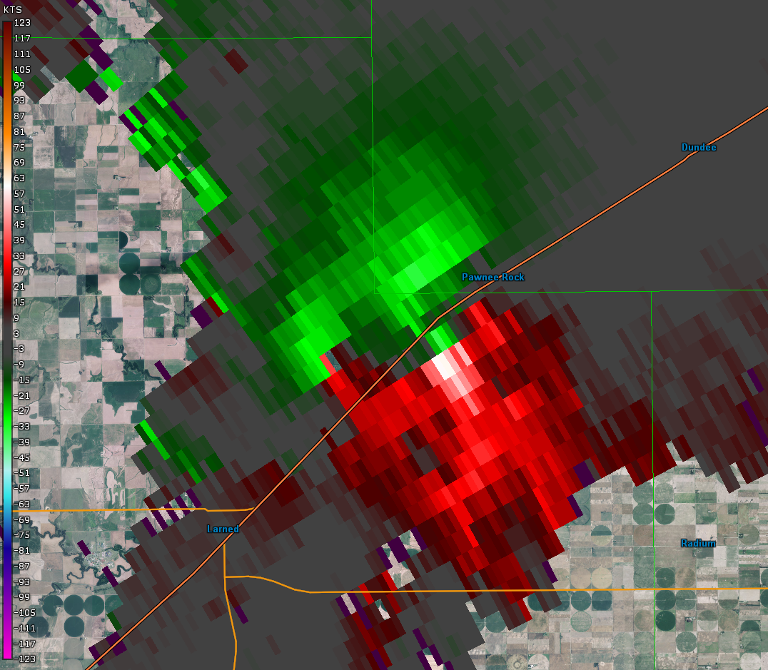
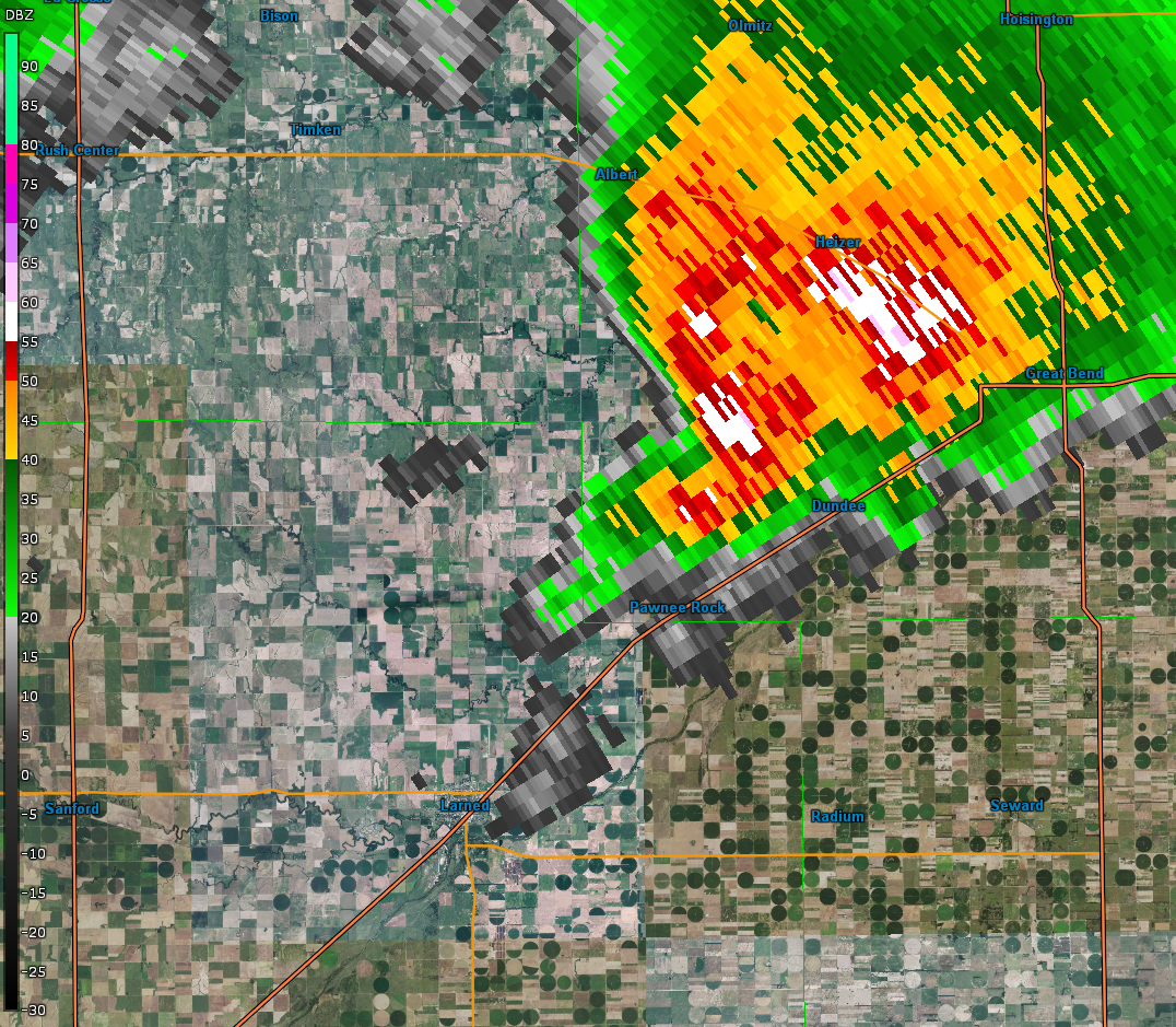
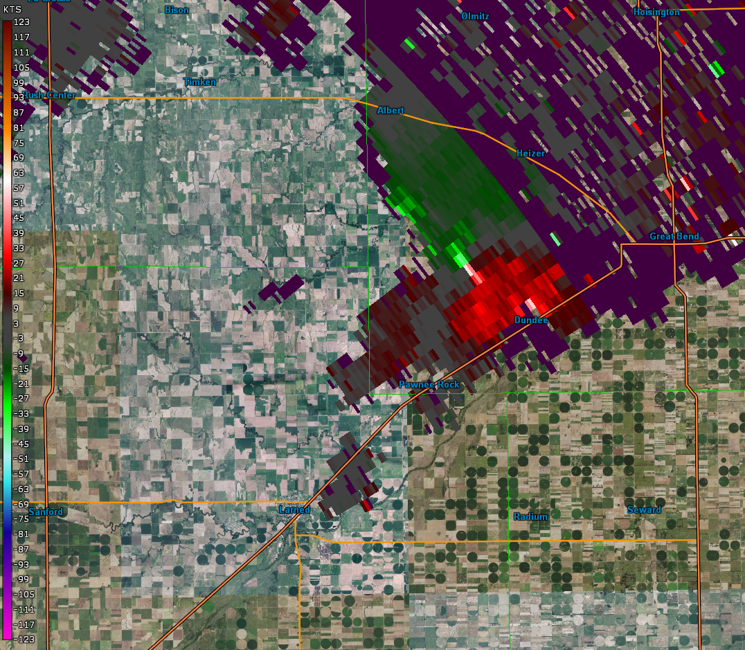
An outbreak of severe thunderstorms and tornadoes from the Texas Panhandle/western Oklahoma northward into southwest and central Kansas and into the Upper Midwest occurred during the afternoon to evening hours of 16 May 2017. Several supercells developed over southwest into central Kansas with one of these storms resulting in several tornado reports. An initial tornado with this storm occurred south-southeast of Minneola shortly before 6 pm CDT and was rated EF1 with a path length of 4 miles. A second, EF3 tornado started shortly before 8 pm CDT 4 miles east of Larned in Pawnee County and tracked a total of 27 miles across Pawnee into Barton Counties before lifting northwest of Hoistington in Barton County at 840 pm CDT.
Tornadoes:
|
Tornado - 5 S-SE of Minneola KS
|
||||||||||||||||
|
Tornado - Pawnee/Barton
|
||||||||||||||||
The Enhanced Fujita (EF) Scale classifies tornadoes into the following categories:
| EF0 Weak 65-85 mph |
EF1 Moderate 86-110 mph |
EF2 Significant 111-135 mph |
EF3 Severe 136-165 mph |
EF4 Extreme 166-200 mph |
EF5 Catastrophic 200+ mph |
 |
|||||
Photos & Video:
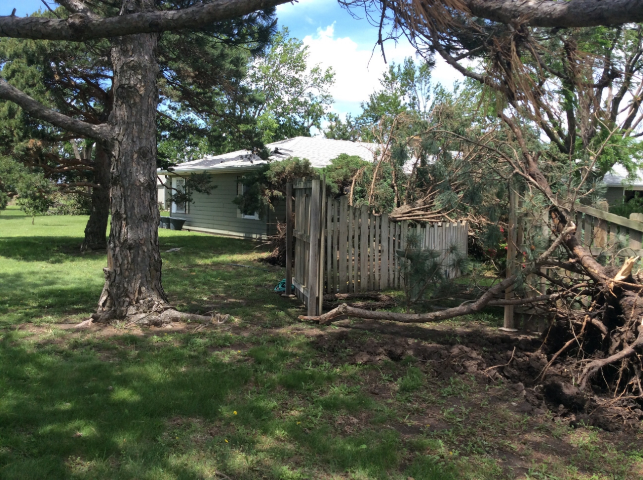
Clark County Tornado
 |
 |
 |
 |
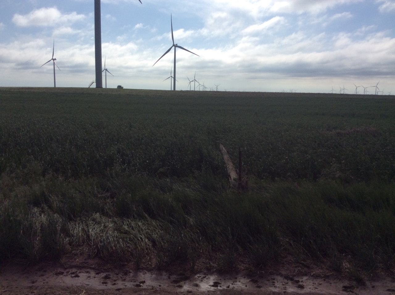
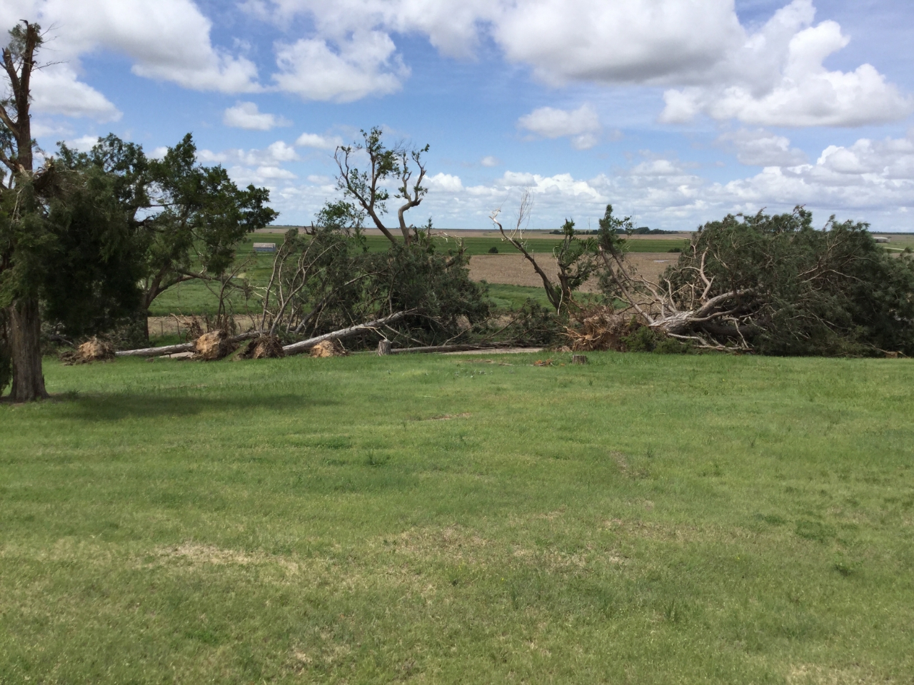
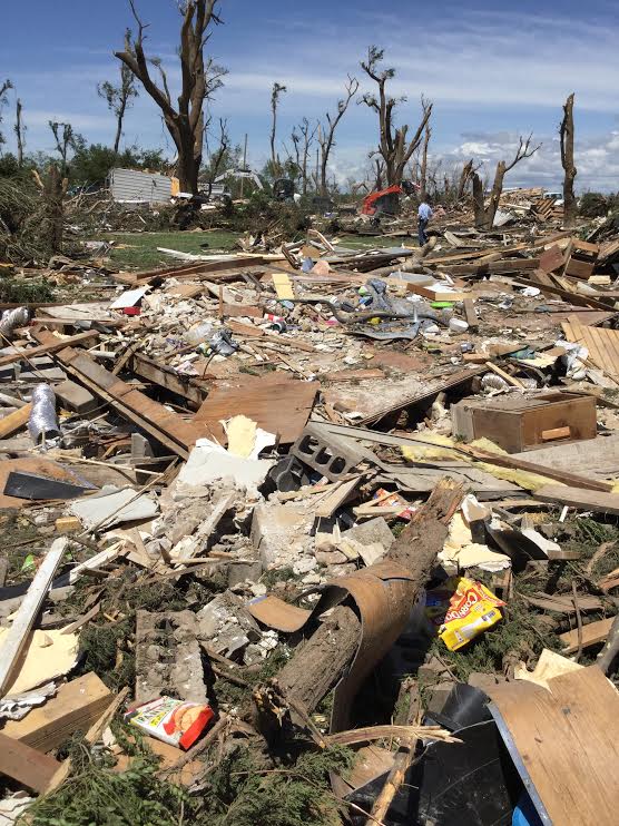
| EF1 damage 5 miles south of Minneola | EF0 damage 5 miles south-southeast of Minneola | EF0 damage 5 miles south-southeast of Minneola | EF0 damage 5 miles south-southeast of Minneola |
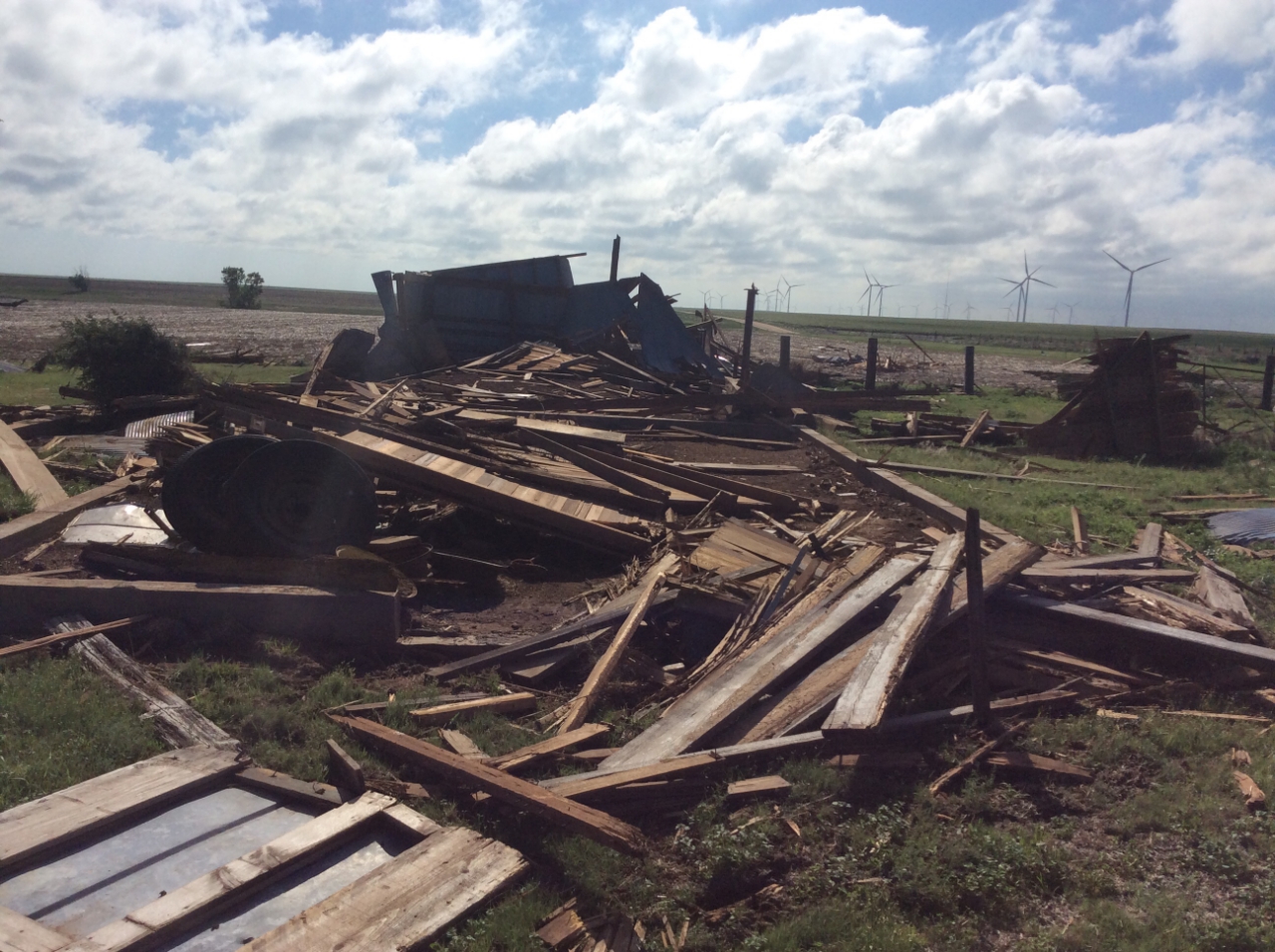
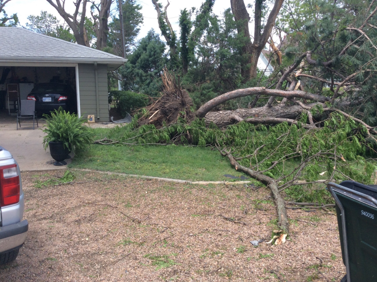
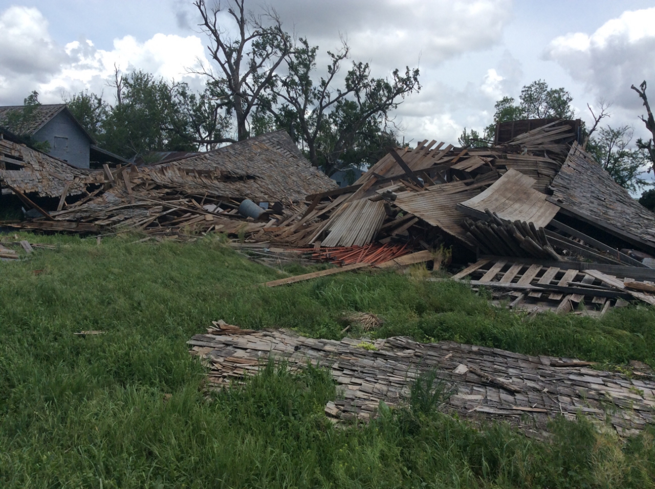
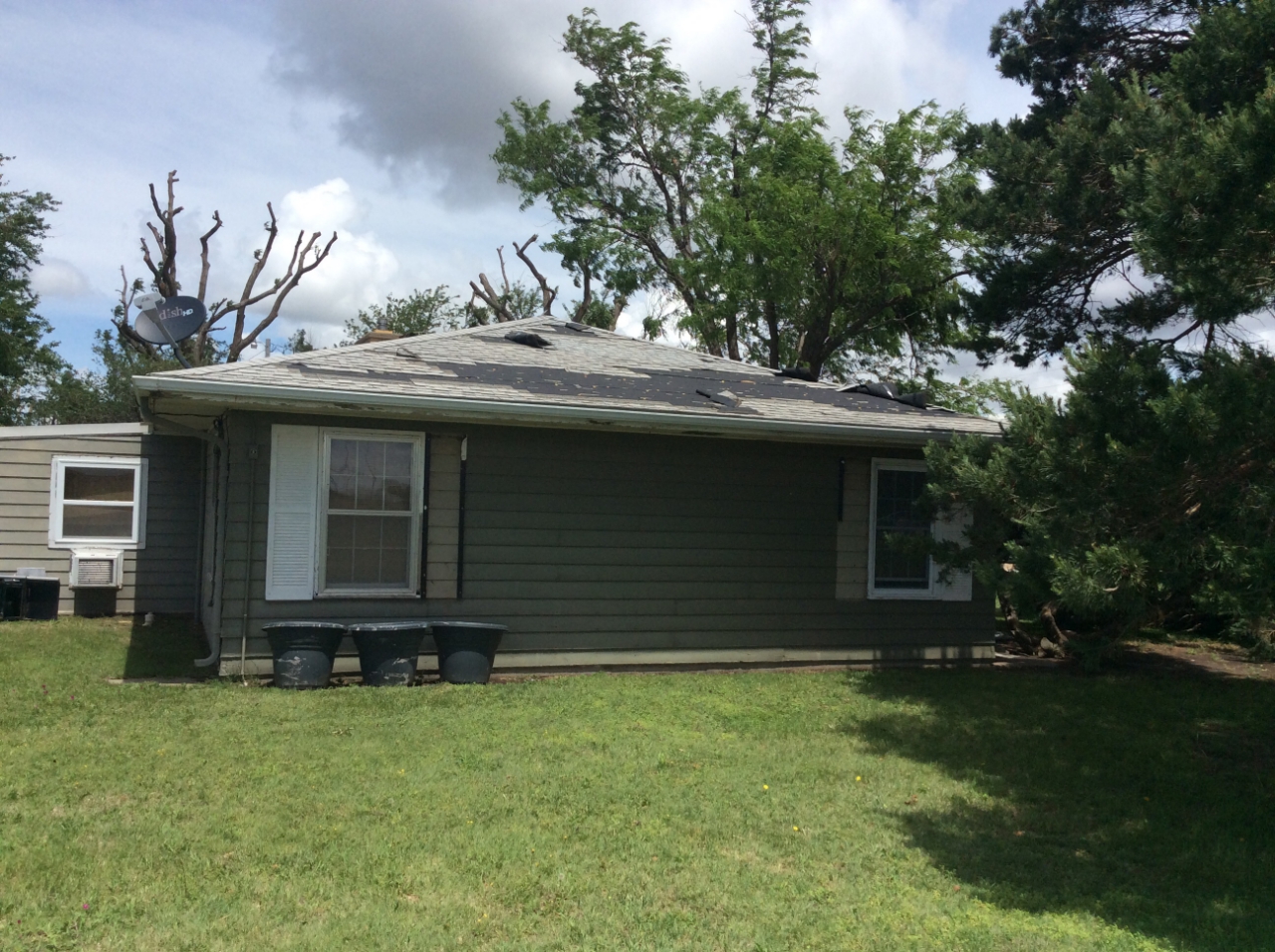
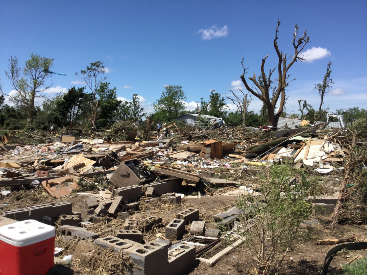
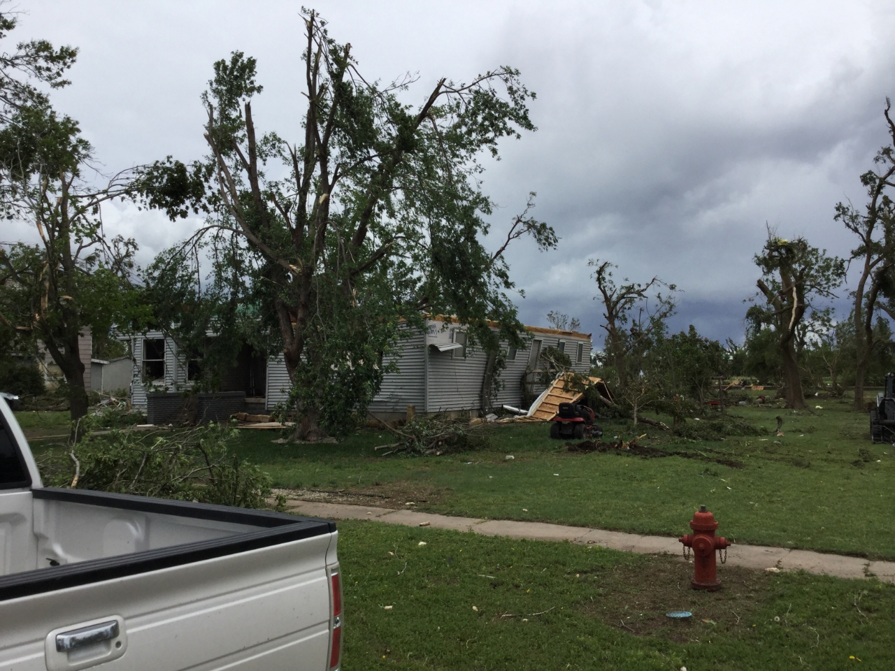
Pawnee/Barton County Tornado
 |
 |
 |
 |
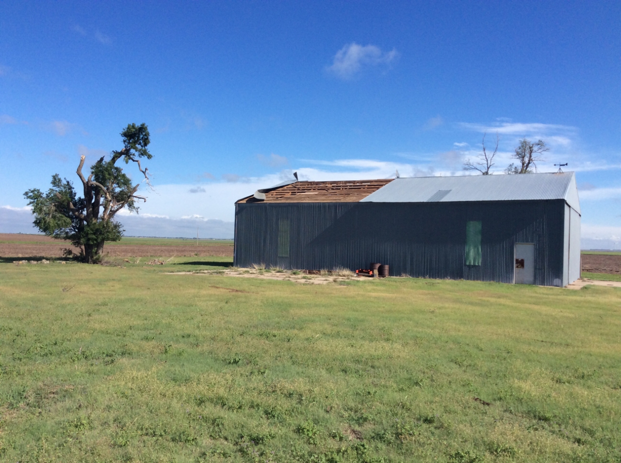
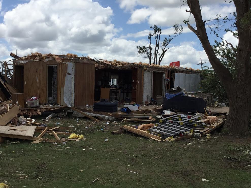
| EF1 damage 0.5 mile southwest of Pawnee Rock | EF0 damage 0.5 mile southwest of Pawnee Rock | EF0 damage 0.5 mile southwest of Pawnee Rock | EF1 damage 0.5 mile southwest of Pawnee Rock |
|
|
 |
 |
||
|
|
|
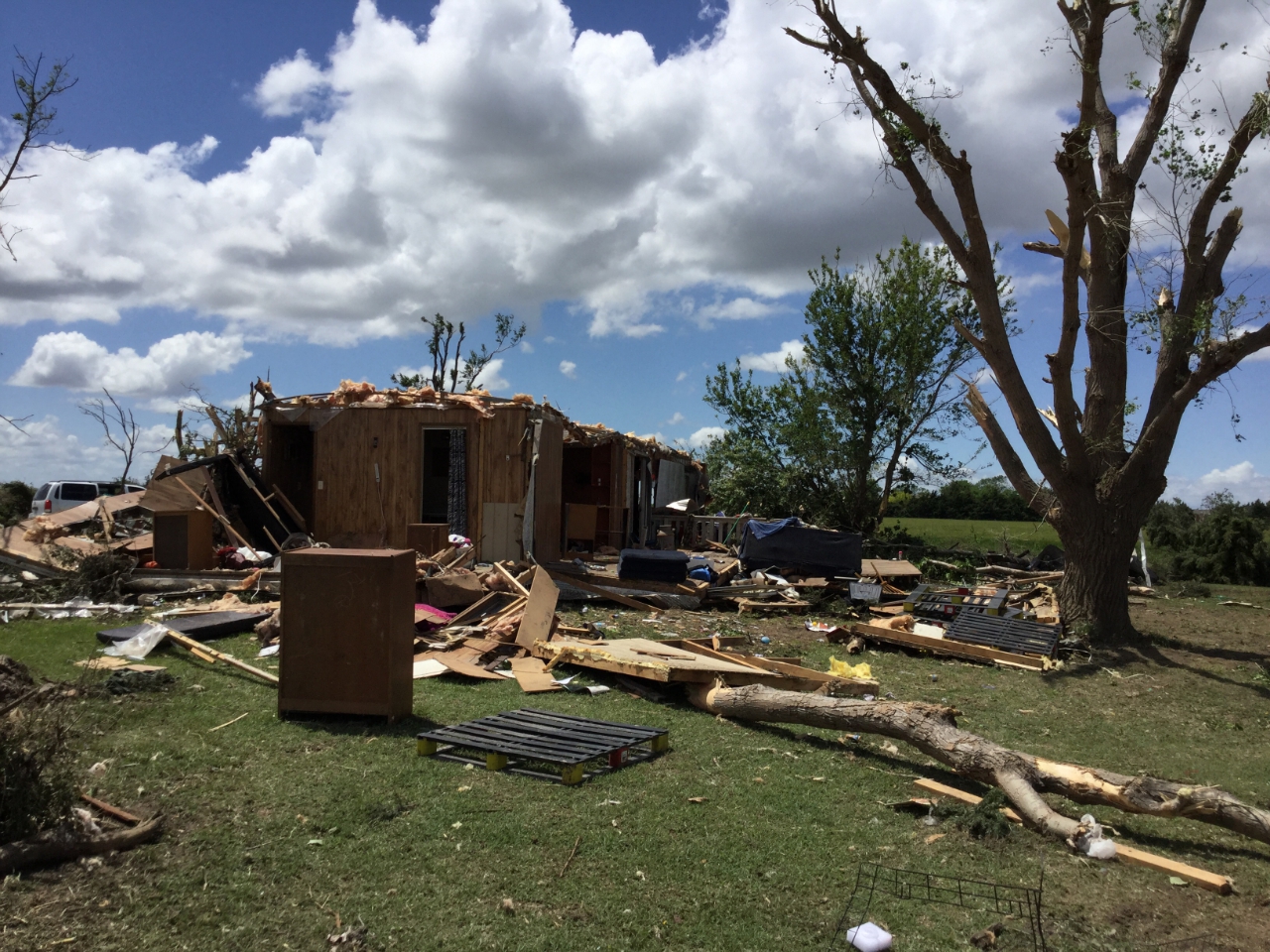
High end EF3 damage around 2 miles northwest of Great Bend Airport | EF3 damage around 2 miles west/northwest of the Great Bend Airport |
 |
 |
 |
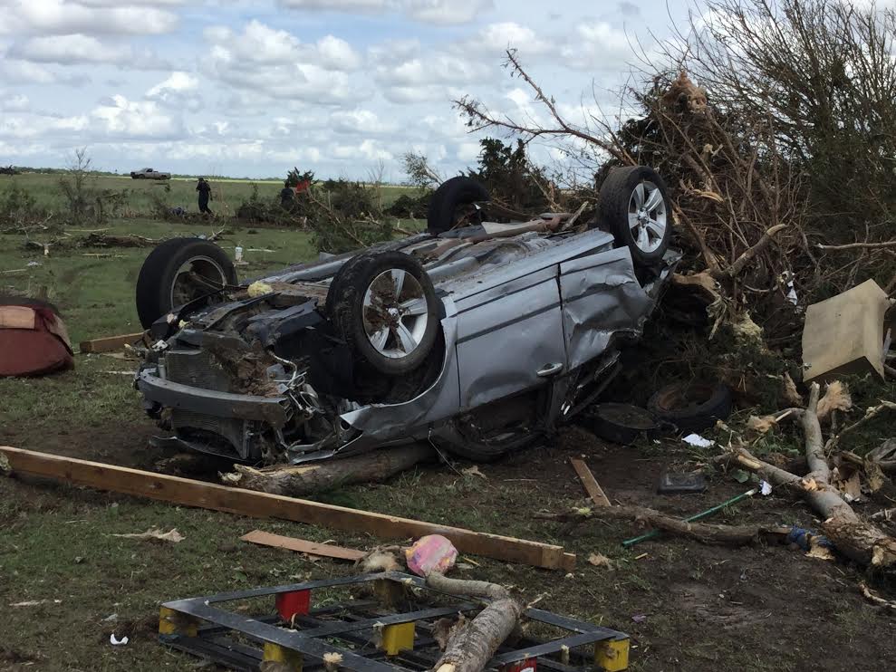 |
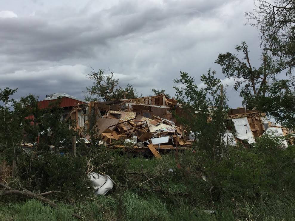
| EF2 damage on west side of Pawnee Rock | EF1 damage in Pawnee Rock State Park | EF2 damage in Pawnee Rock | EF3 damage 2 W of Great Bend Airport |
 |
 |
 |
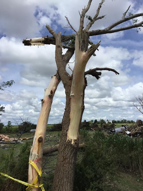
| Bark stripped off of trees 2 W of Great Bend | EF3 damage 2 W of Great Bend Airport | Damage 2 W of Great Bend Airport |
Radar:
Clark County Tornado Radar Imagery
 |
 |
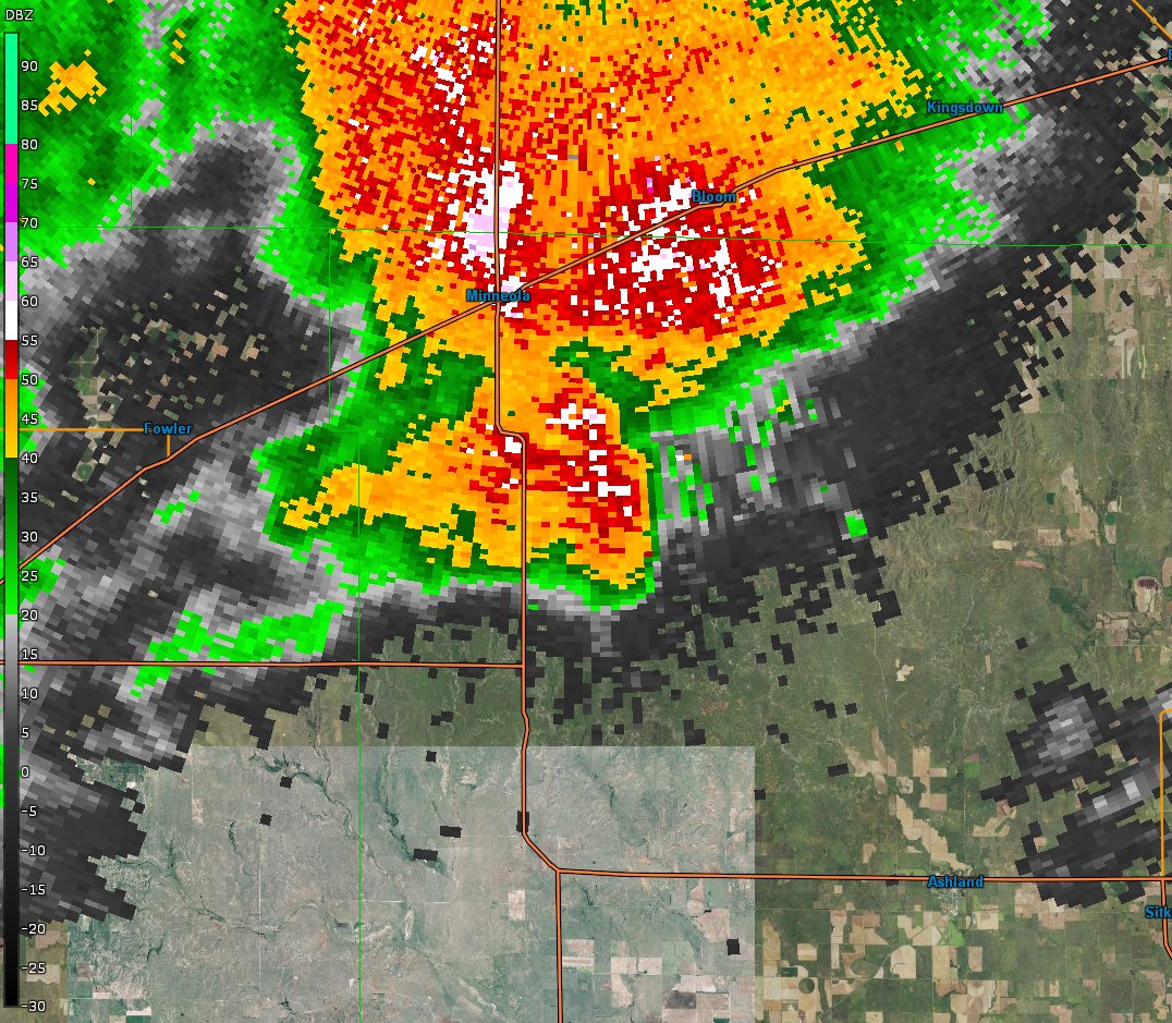
| Radar reflectivity from the Dodge City radar from around 5:53 PM as the storm was south-southeast of Minneola. | Storm relative velocity from the Dodge City radar from around 5:53 PM as the storm was south-southeast of Minneola. |
Pawnee/Barton County Tornado Radar Imagery
 |
 |
 |
 |
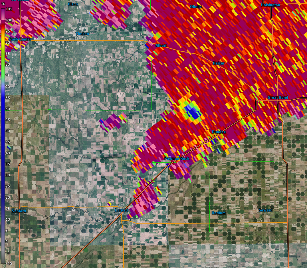 |
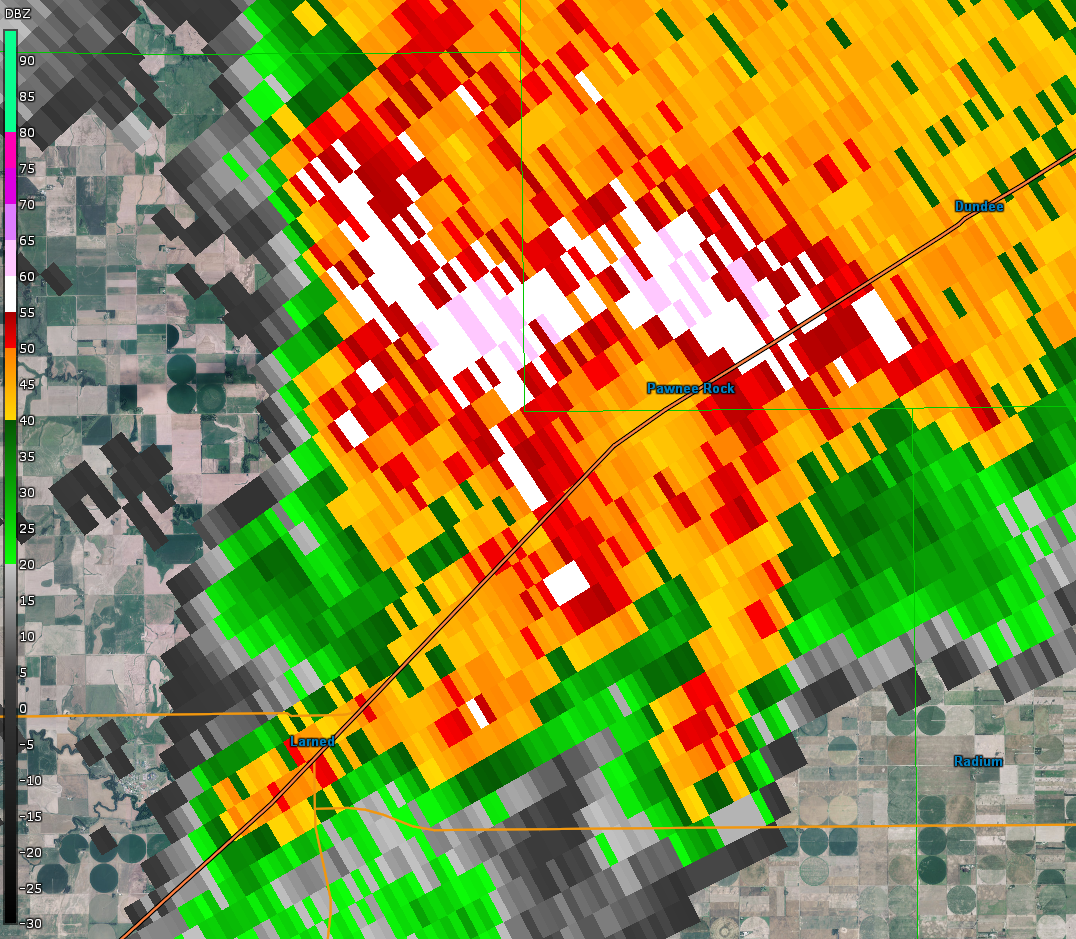
| Radar reflectivity from the Dodge City radar from around 8:03 PM as the storm was approaching Pawnee Rock. | Storm relative velocity from the Dodge City radar from around 8:03 PM as the storm was approaching Pawnee Rock. | Radar reflectivity from the Dodge City radar from around 8:12 PM northeast of Pawnee Rock. | Storm relative velocity image from Dodge City's radar around 8:12 PM northeast of Pawnee Rock. | Dual-pol product (Correlation Coefficient) from around 8:12 PM, showing debris being lifted by the tornado. |
 |
Media use of NWS Web News Stories is encouraged! Please acknowledge the NWS as the source of any news information accessed from this site. |
|