
Tropical Depression Two is expected to gradually strengthen and could bring tropical storm conditions to the Florida Panhandle beginning late Monday. Areas of flash flooding will be possible through Thursday along the eastern and central Gulf Coast. Severe thunderstorms will develop and move along a cold front crossing the Upper Midwest Monday, and through the Ohio Valley/Mid-Atlantic on Tuesday. Read More >
Dodge City, KS
Weather Forecast Office
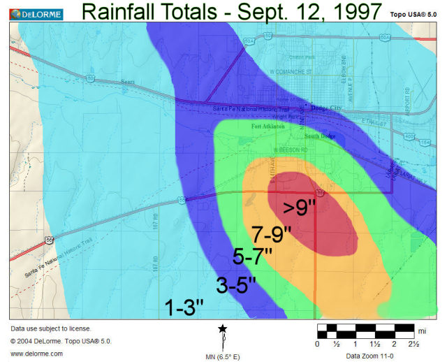
Twenty-five years ago on September 12, 1997, a major flash flood swept through parts of Dodge City. Around 200 homes and businesses in Dodge City were damaged from flooding waters. One thousand citizens had to be evacuated, but fortunately there were no injuries or deaths reported.
The flooding was the result of extremely heavy rain that fell in just a short period of time. There were numerous reports of 5 to 6 inches of rainfall. One location reported 9.5" just south of the city limits.
The thunderstorms that brought the heavy rain entered the northwest part of Ford county shortly after 730 pm. In fact, the first storm that approached the western sections of Dodge City was showing some signs of becoming tornadic. No tornadoes ever formed though.
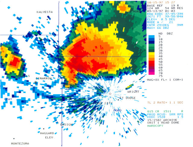
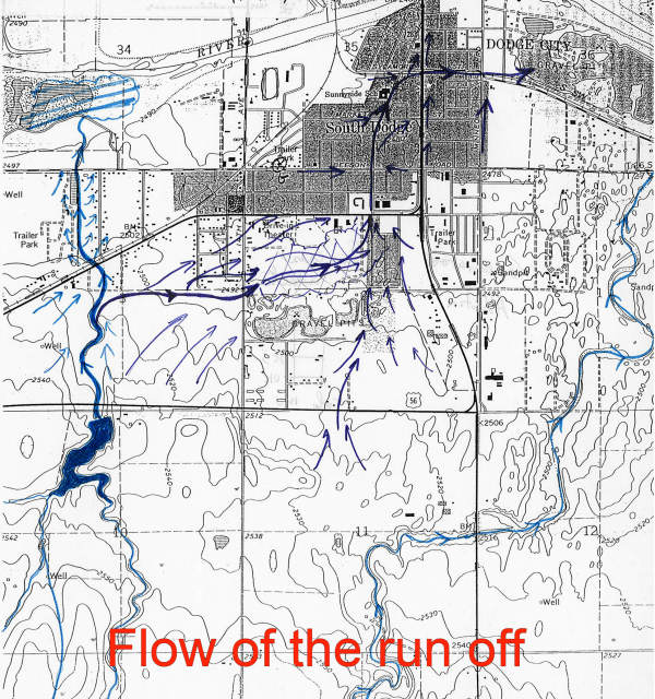
Other storms developed and "trained" over the same area...in other words each new development would move over the same area. The result was the very heavy rainfall. To complicate matters, the location of the rainfall was such that runoff took only a few routes heading towards the river. Rain water basically "piled up" on the south side with much of it channeled into a city street (Sunnyside).
US Dept of Commerce
National Oceanic and Atmospheric Administration
National Weather Service
Dodge City, KS
104 Airport Road
Dodge City, KS 67801-9351
620-225-6514
Comments? Questions? Please Contact Us.

