Severe thunderstorms which can bring large hail, damaging winds, and isolated tornadoes will be possible over parts of the central U.S. through this weekend. Thunderstorms with heavy to excessive rainfall moving from Texas into the mid-Mississippi Valley through this weekend may produce areas of flooding. Read More >
Overview
|
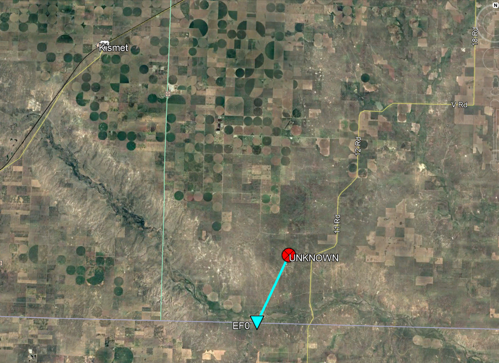
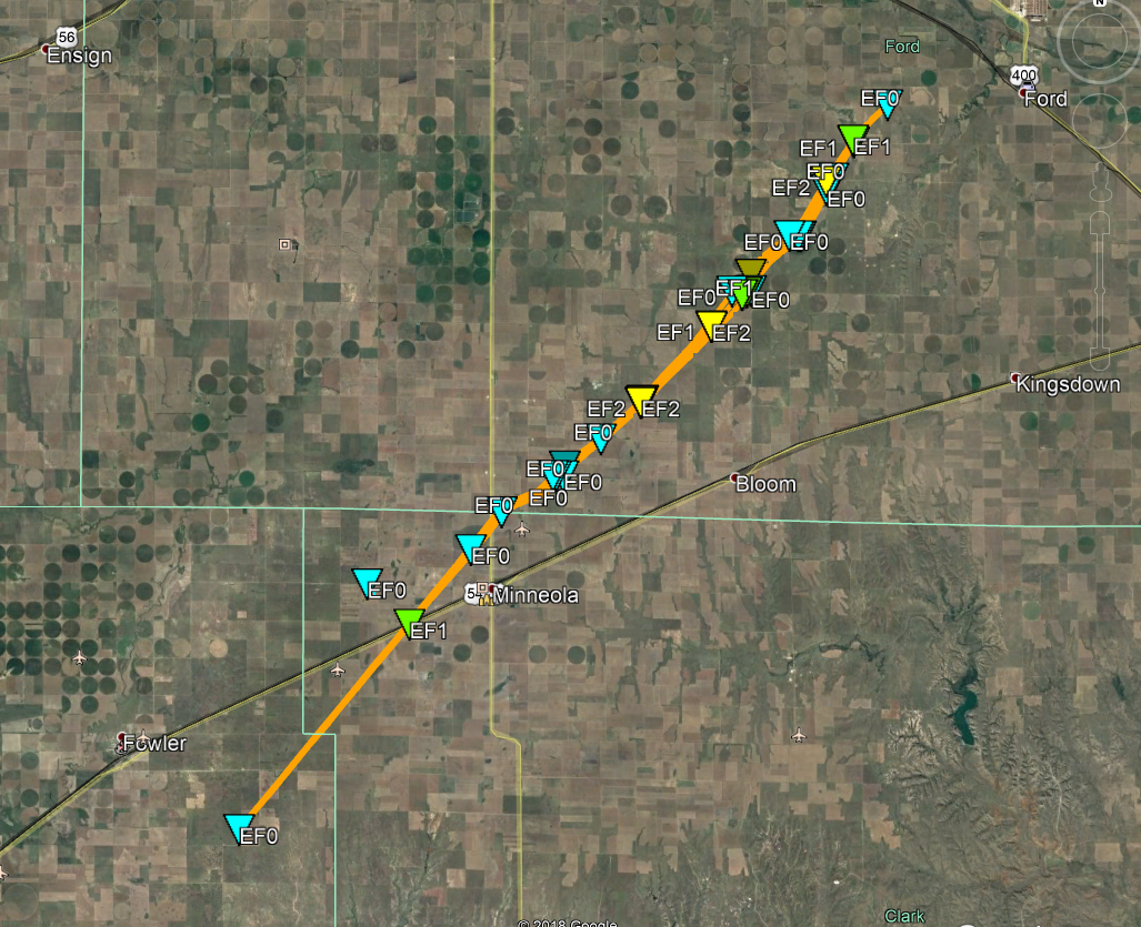
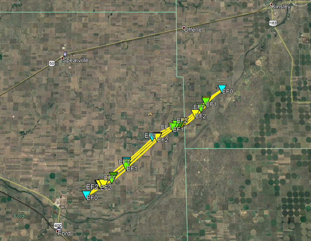
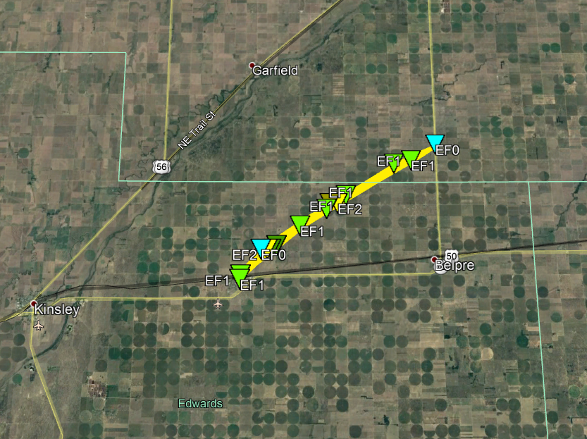
An explosive severe weather setup existed across the Central Plains on 17 May 2019 with this setup resulting in several tornadic storms from southwest Kansas into western Nebraska. While tornadic storms occurred earlier in the day over northwest Kansas into southwest Nebraska, storms did not develop farther south along a slow-moving dryline until early evening. Initial storm formation occurred from near Garden City to points southeast of Liberal over the Oklahoma Panhandle. A storm developing in Beaver County Oklahoma became a supercell (rotating storm) quickly after formation with the first of several longer track tornadoes developing in the Oklahoma Panhandle and tracking into Meade County KS. This tornado dissipated a few miles north of the state line as it existed mostly over open country with no intensity assigned (EFU) due to a lack of damage indicators. This same storm subsequently created several more tornadoes as it moved northeast across Meade, Clark, Ford, Edwards, Pawnee, and Stafford counties. The second longer-track tornado occurred along a 26 mile path starting southeast of Fowler and ending west of Ford with an EF3 peak intensity. The third longer-track tornado occurred along a 15 mile path starting northeast of Ford and ending south-southwest of Kinsley with an EF2 peak intensity. The final longer-track tornado track occurred along a 11 mile path starting in Lewis and ending about 4 miles north of Belpre in Pawnee County with an EF2 peak intensity. There was one final brief tornado near the Stafford-Barton County line but with no intensity assigned (EFU) due to a lack of damage indicators. |
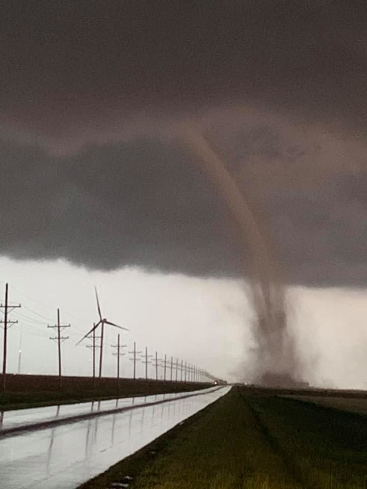 Image Courtesy Wesley Hovorka |
Tornadoes:
|
Tornado - KS/OK Border Crosser
|
||||||||||||||||
|
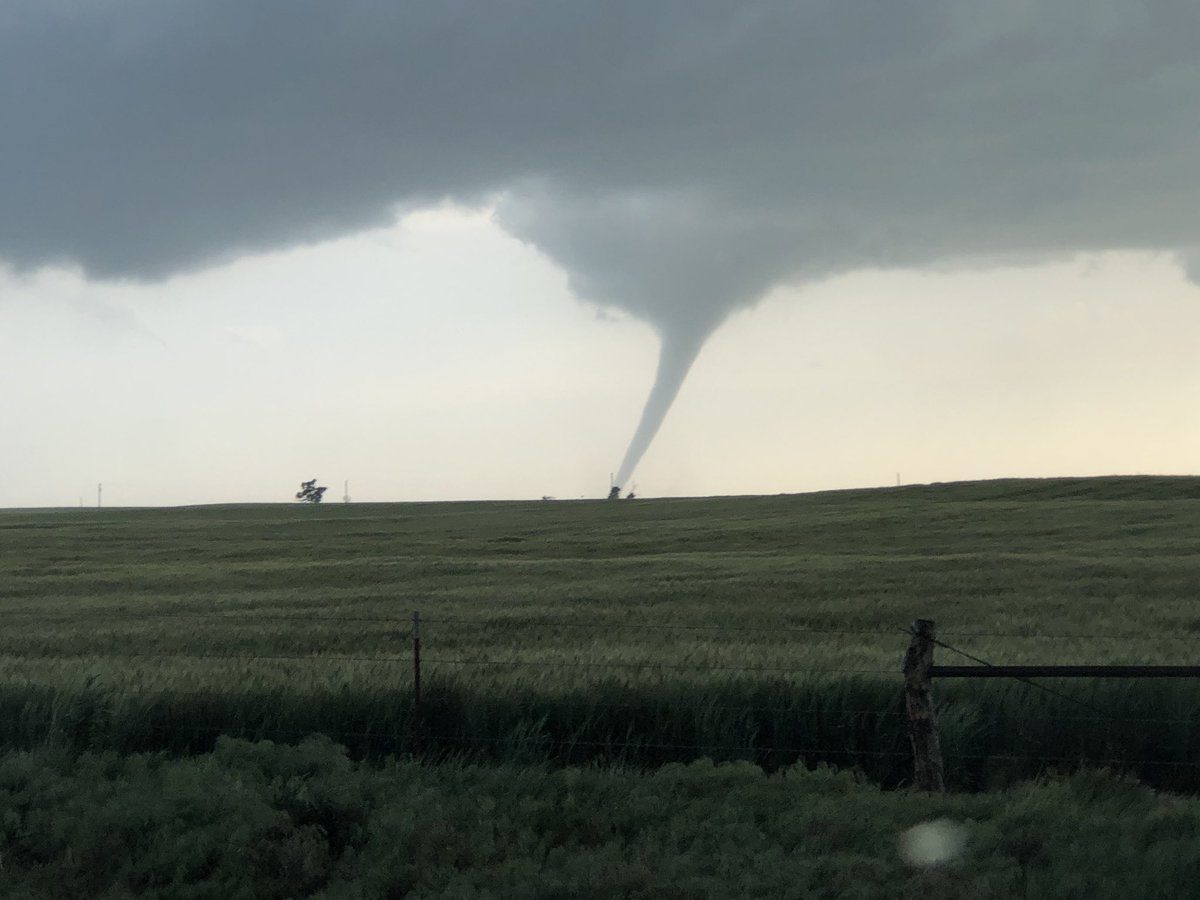
Tornado - Fowler to Minneola to Ford
|
||||||||||||||||
|
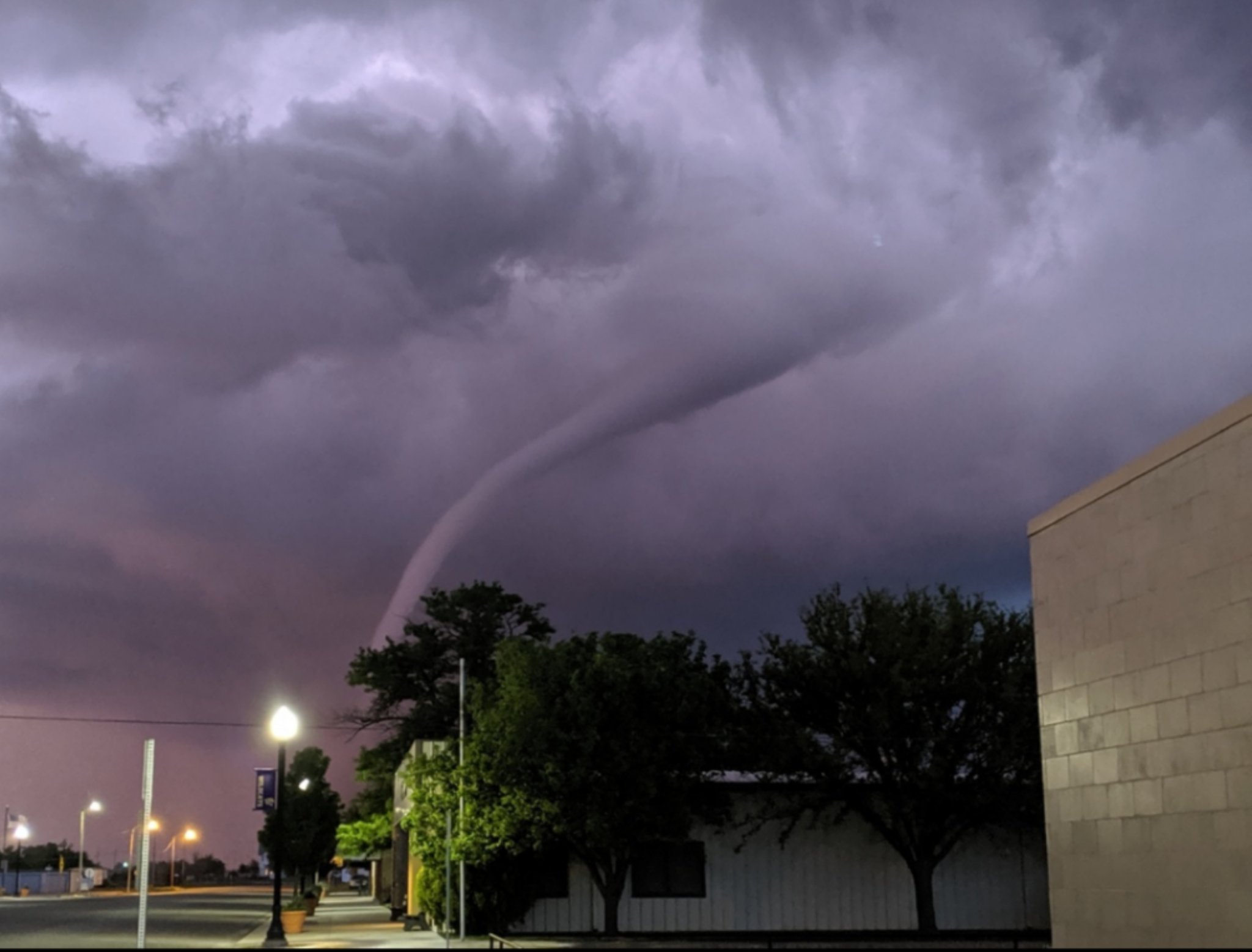
Tornado - Ford to Kinsley
|
||||||||||||||||
|
Tornado - Lewis to north of Belpre
|
||||||||||||||||
The Enhanced Fujita (EF) Scale classifies tornadoes into the following categories:
| EF0 Weak 65-85 mph |
EF1 Moderate 86-110 mph |
EF2 Significant 111-135 mph |
EF3 Severe 136-165 mph |
EF4 Extreme 166-200 mph |
EF5 Catastrophic 200+ mph |
 |
|||||
Photos & Video
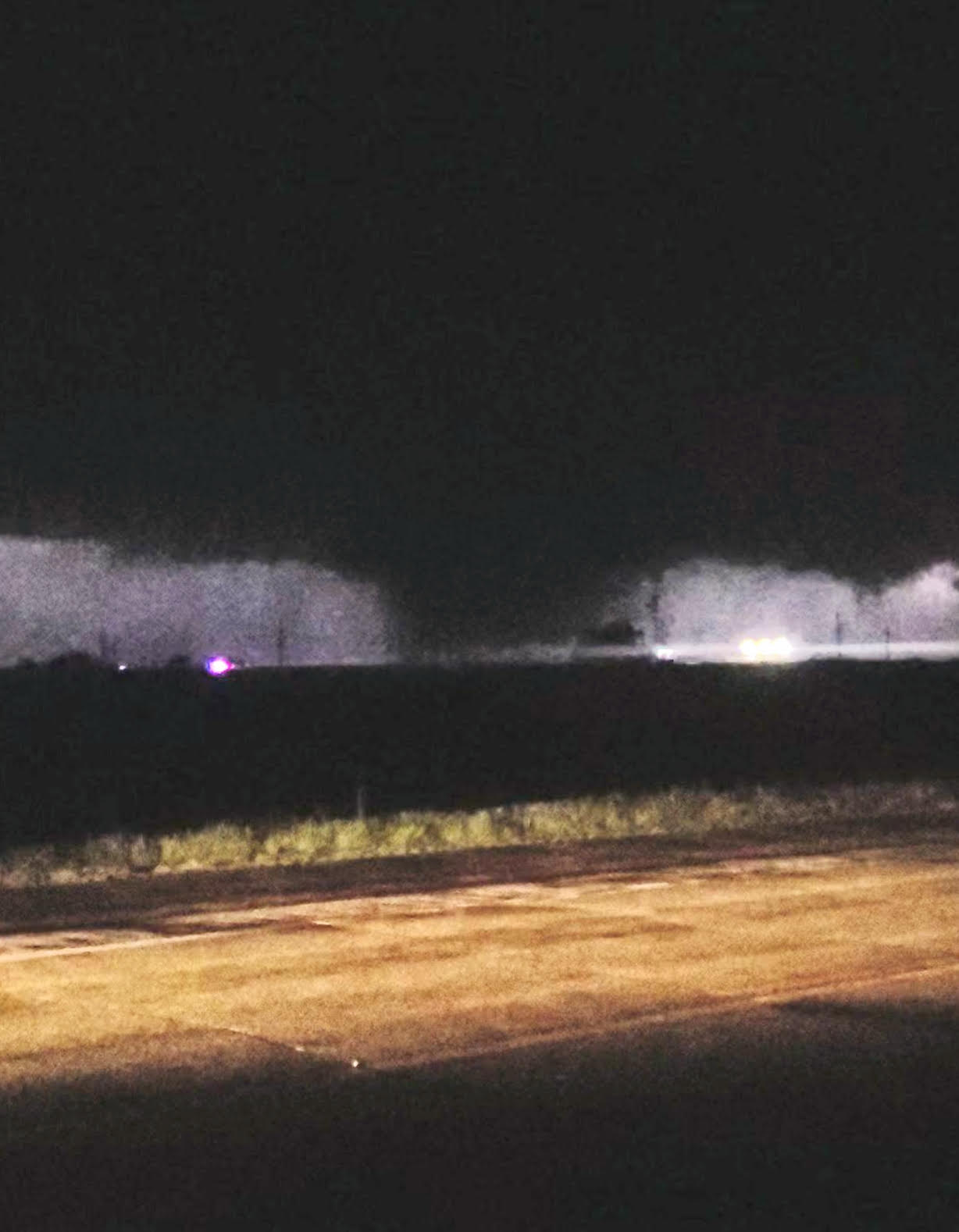
Tornado - KS/OK Border Crosser
 |
|
| Tornado over southern Meade County (Image Courtesy of Micah Hart) |
Tornado over northern Beaver County OK into Southern Meade County KS (Val and Amy Caster - KWTV 9 News) |
Tornado - Fowler to Minneola to Ford
 |
|
|
|
| Tornado north of Minneola (Image Courtesy of Jon Borchard) |
Tornado immediately west of Minneola (Val and Amy Caster - KWTV 9 News) |
Tornado from immediately west of Minneola to north of Bloom (Val and Amy Caster - KWTV 9 News) |
Tornado from immediately west of Minneola to north of Bloom (Kyle Bower - Kyle Bower Imagery) |
 |
 |
 |
 |
| Damage northeast of Minneola |
Damage northeast of Minneola | Damage northeast of Minneola | Damage northeast of Minneola |
 |
 |
 |
| Damage northeast of Minneola |
Damage north of Bloom | Damage north of Bloom |
Tornado - Ford to Kinsley
 |
 |
 |
 |
| Tornado northeast of Ford (Image Courtesy of Zac Riddle) |
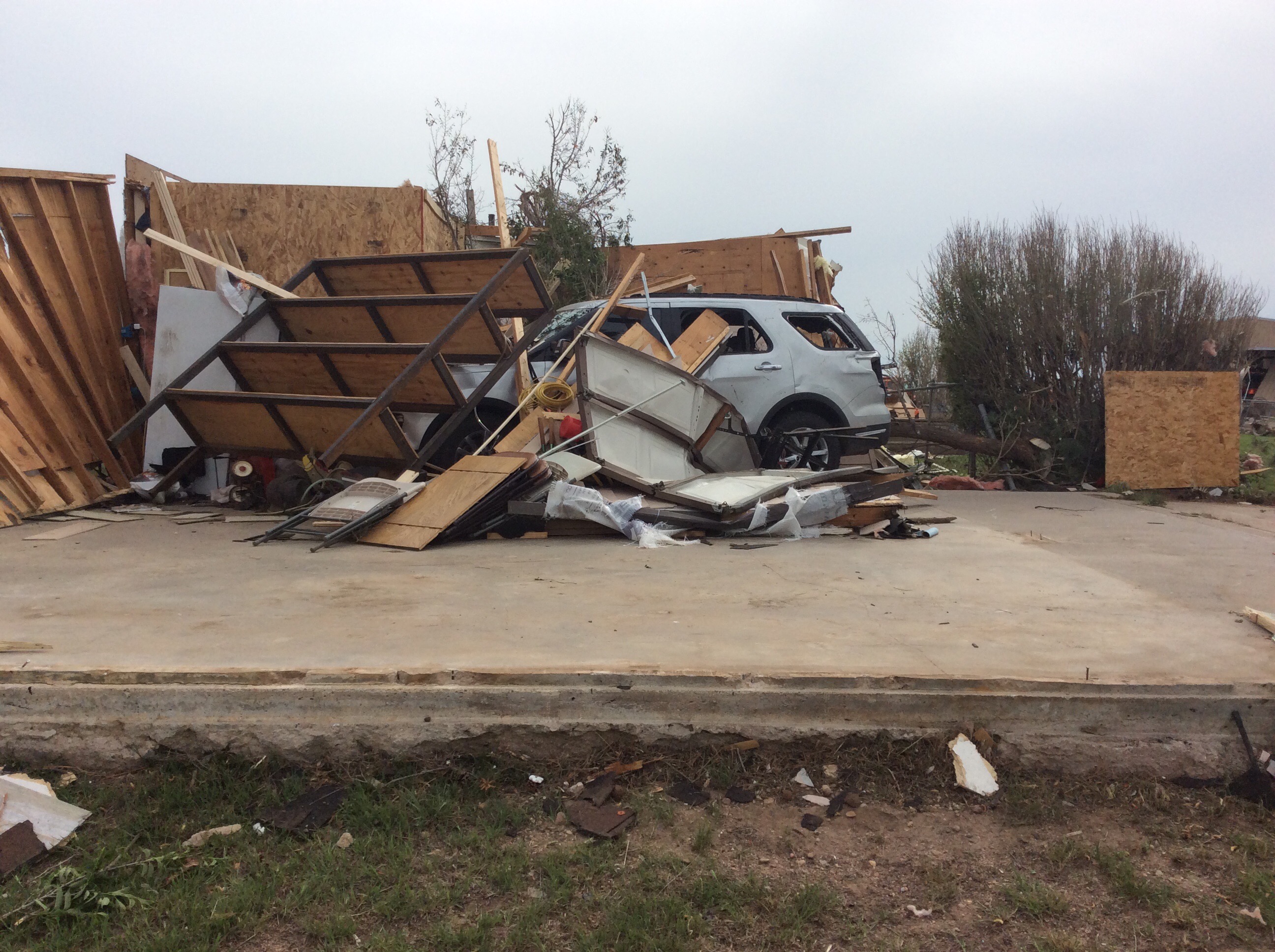
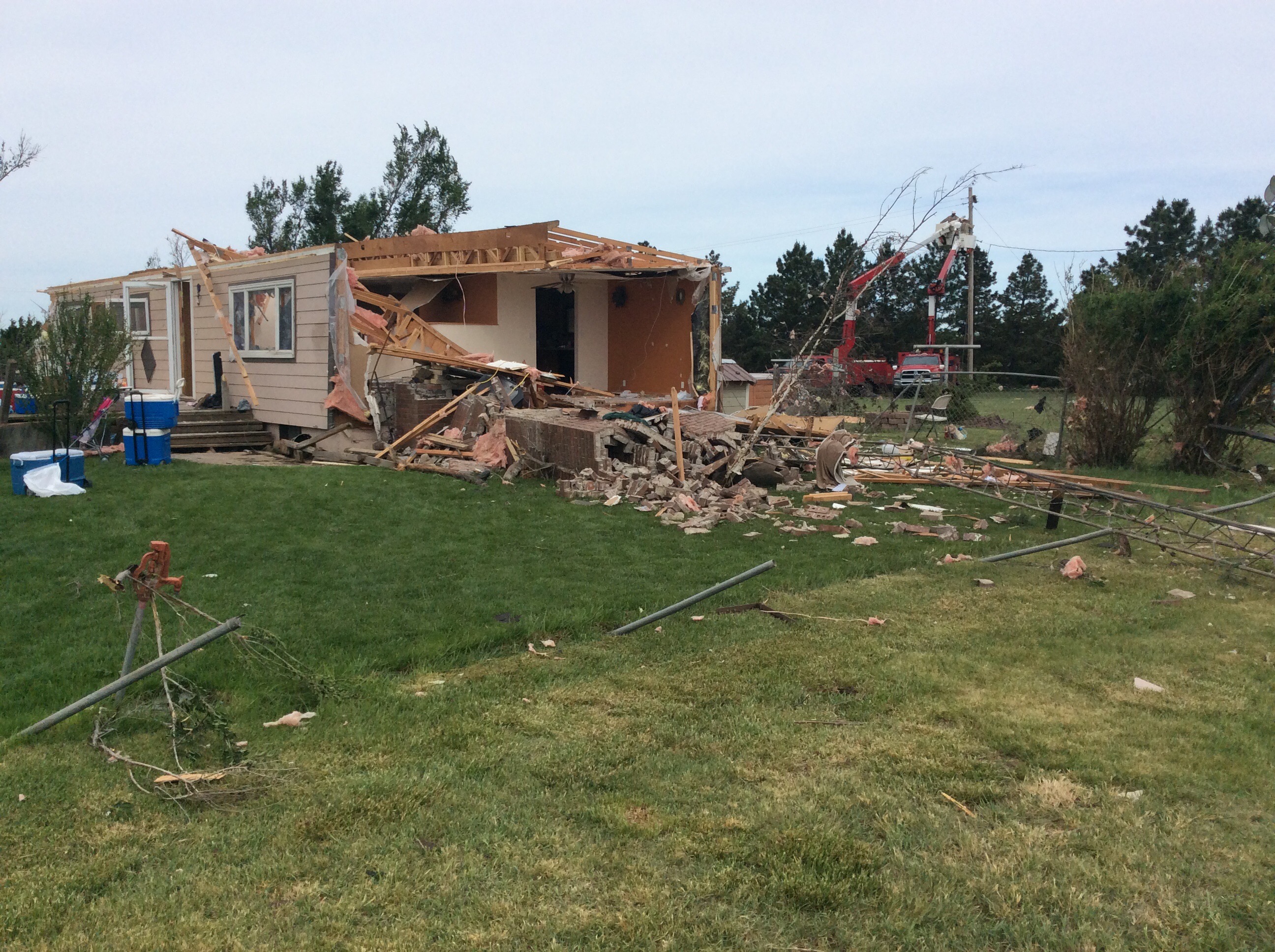
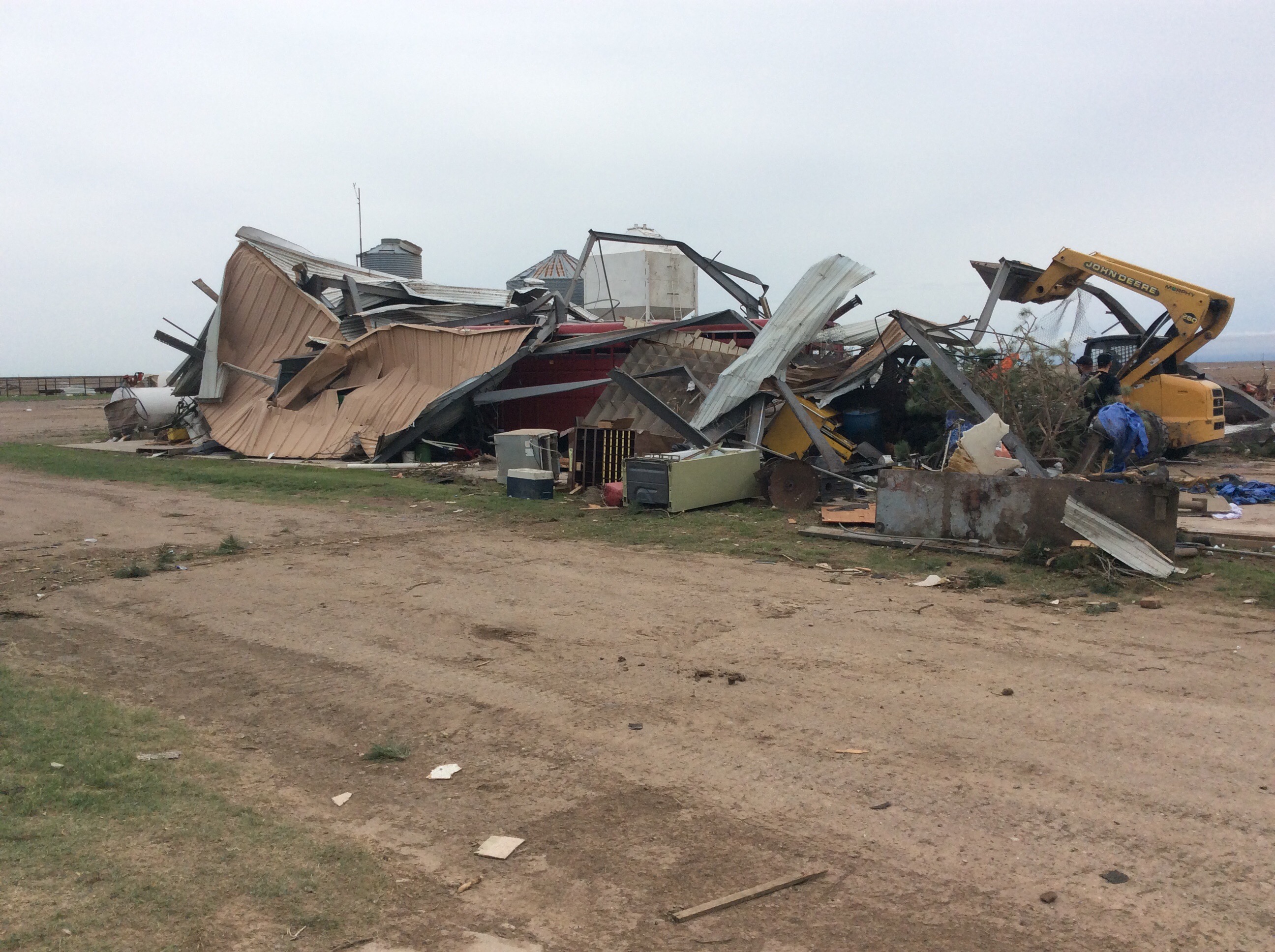
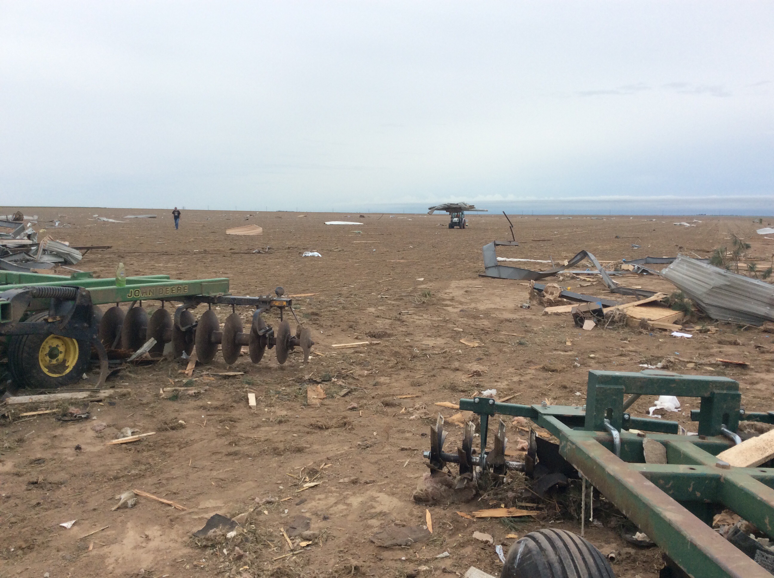
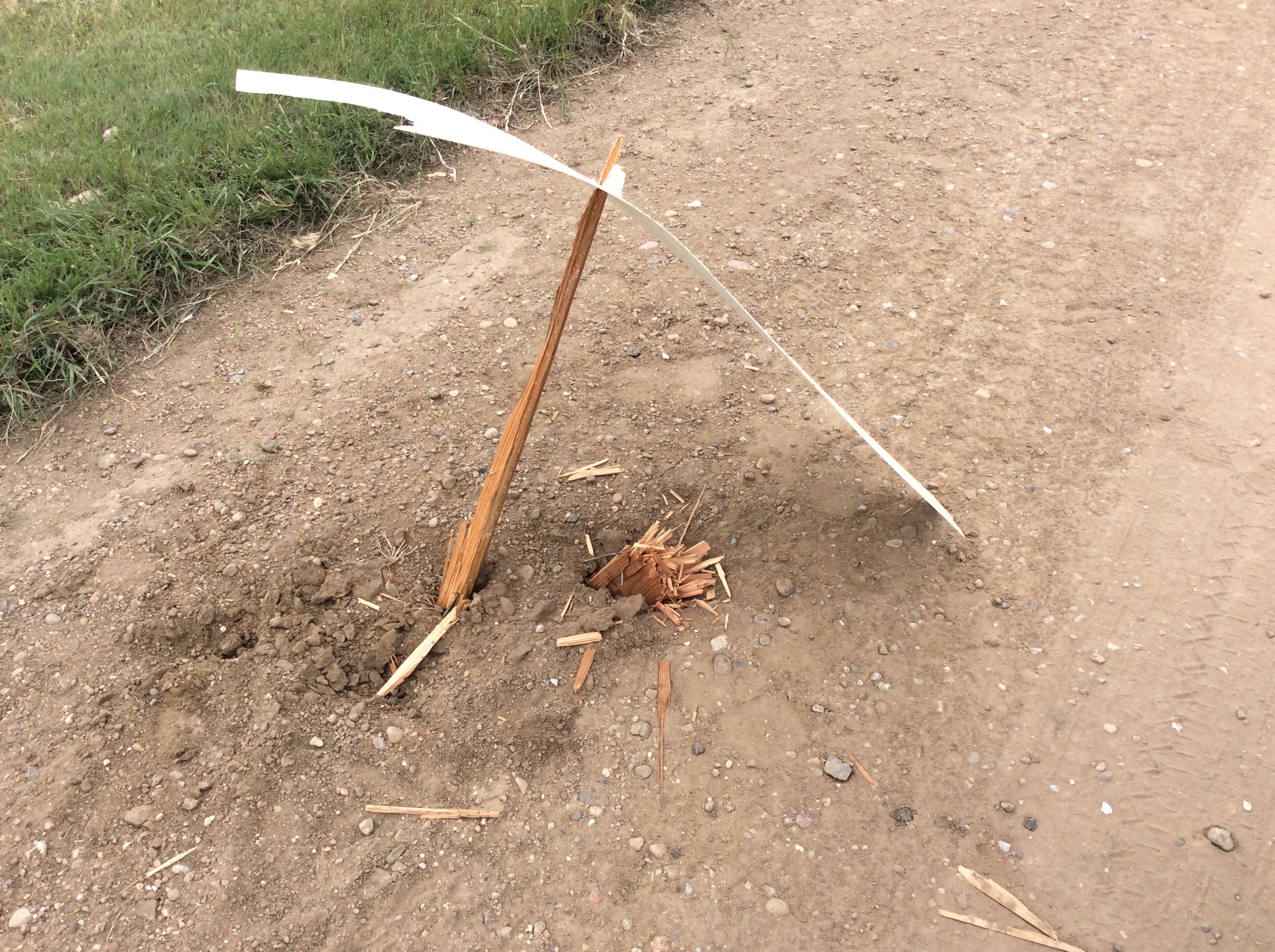
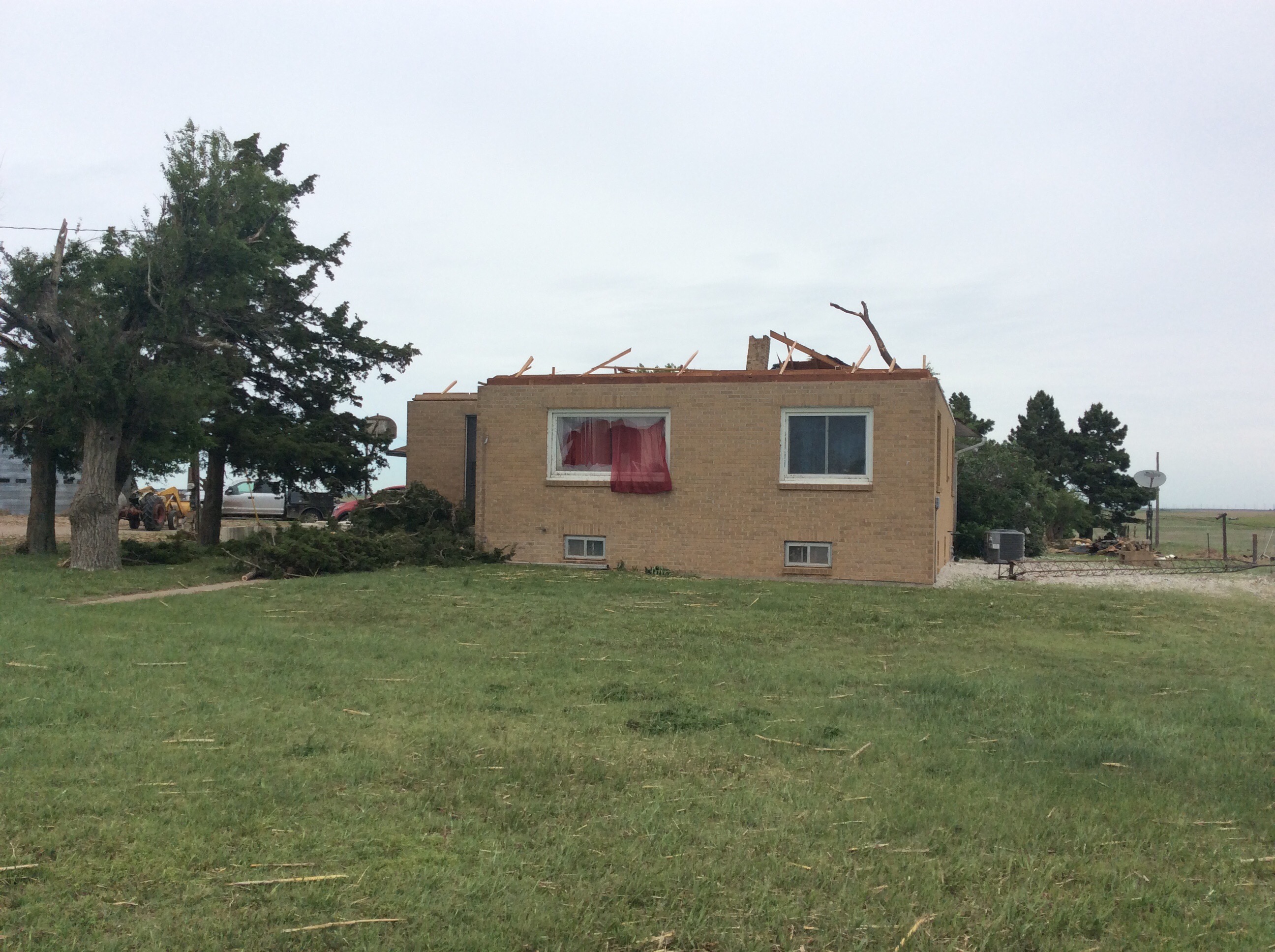
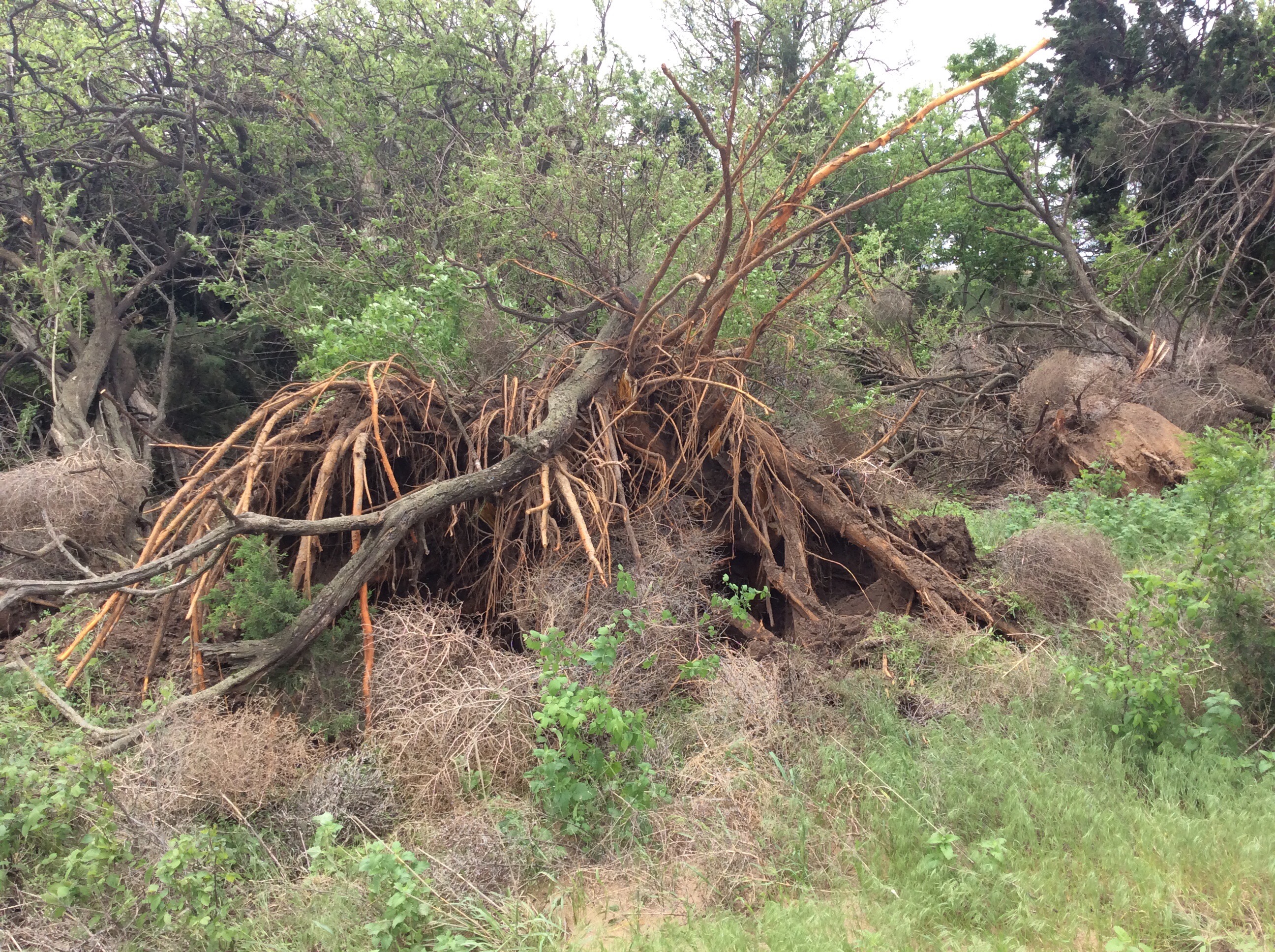
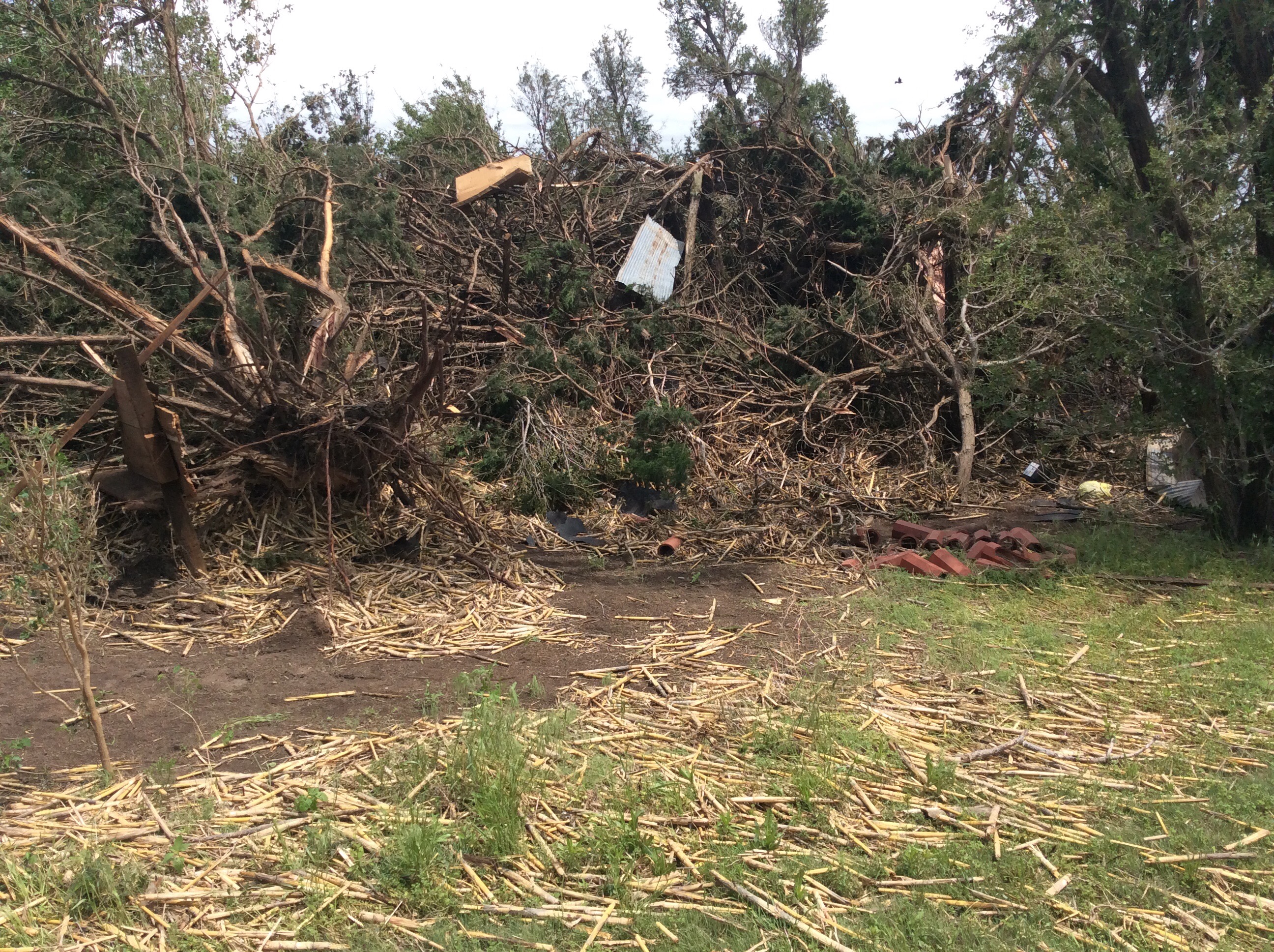
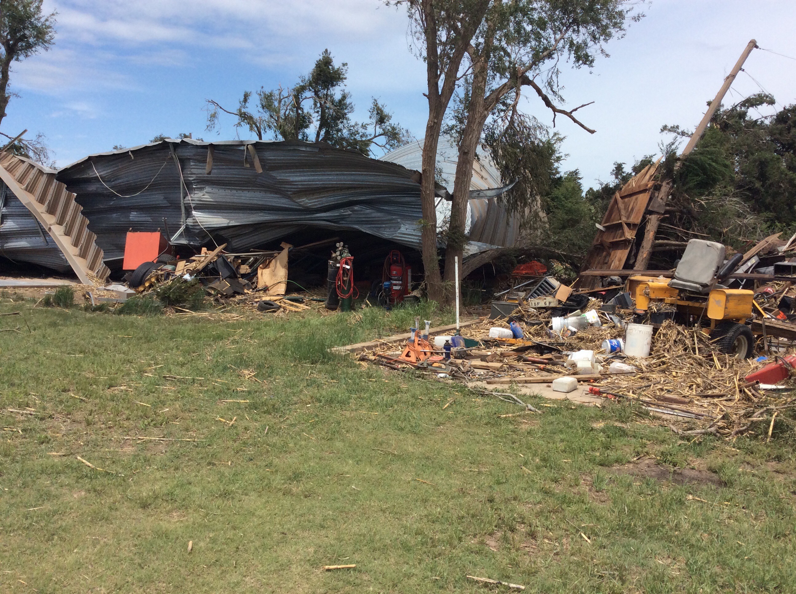
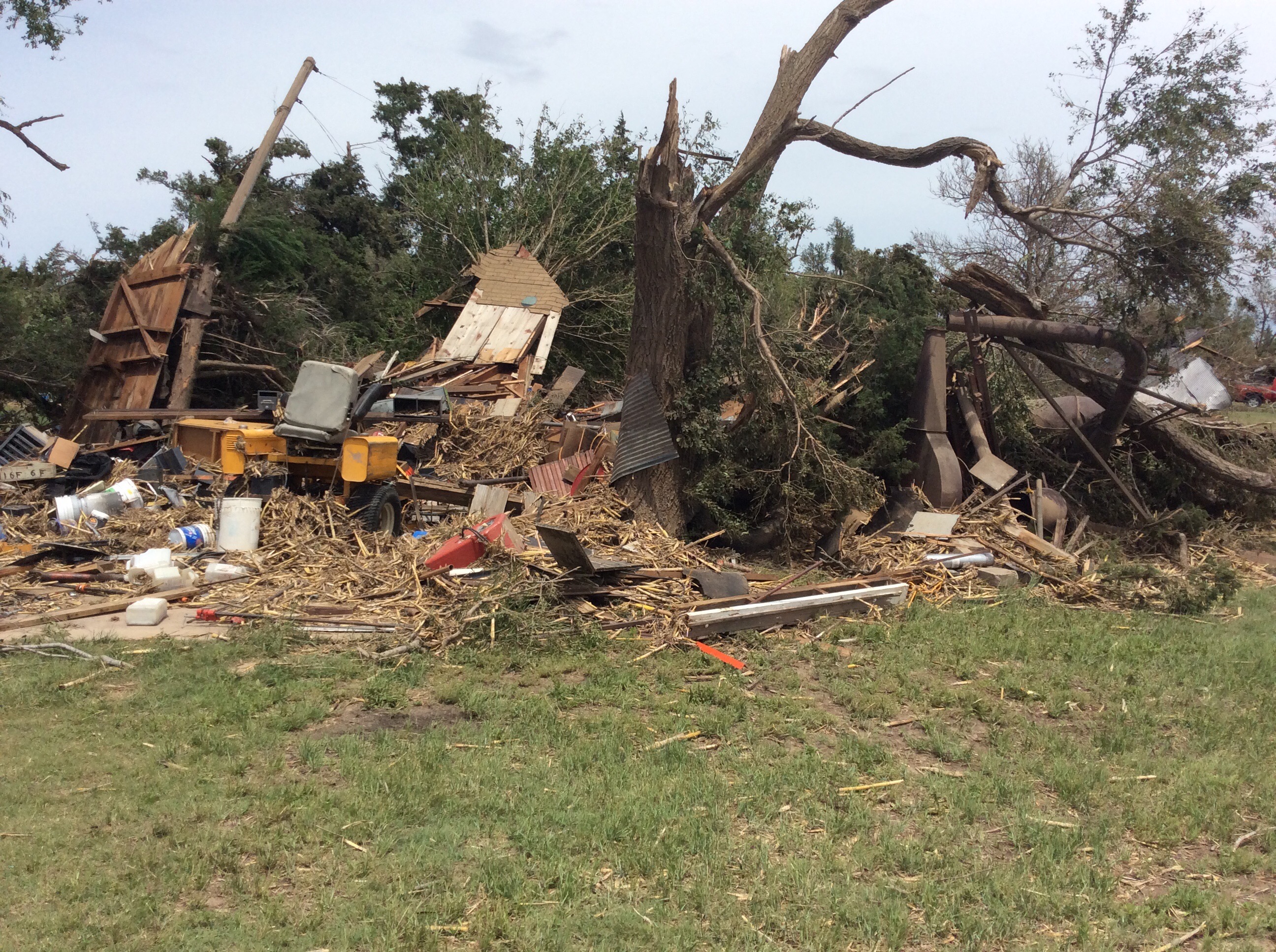
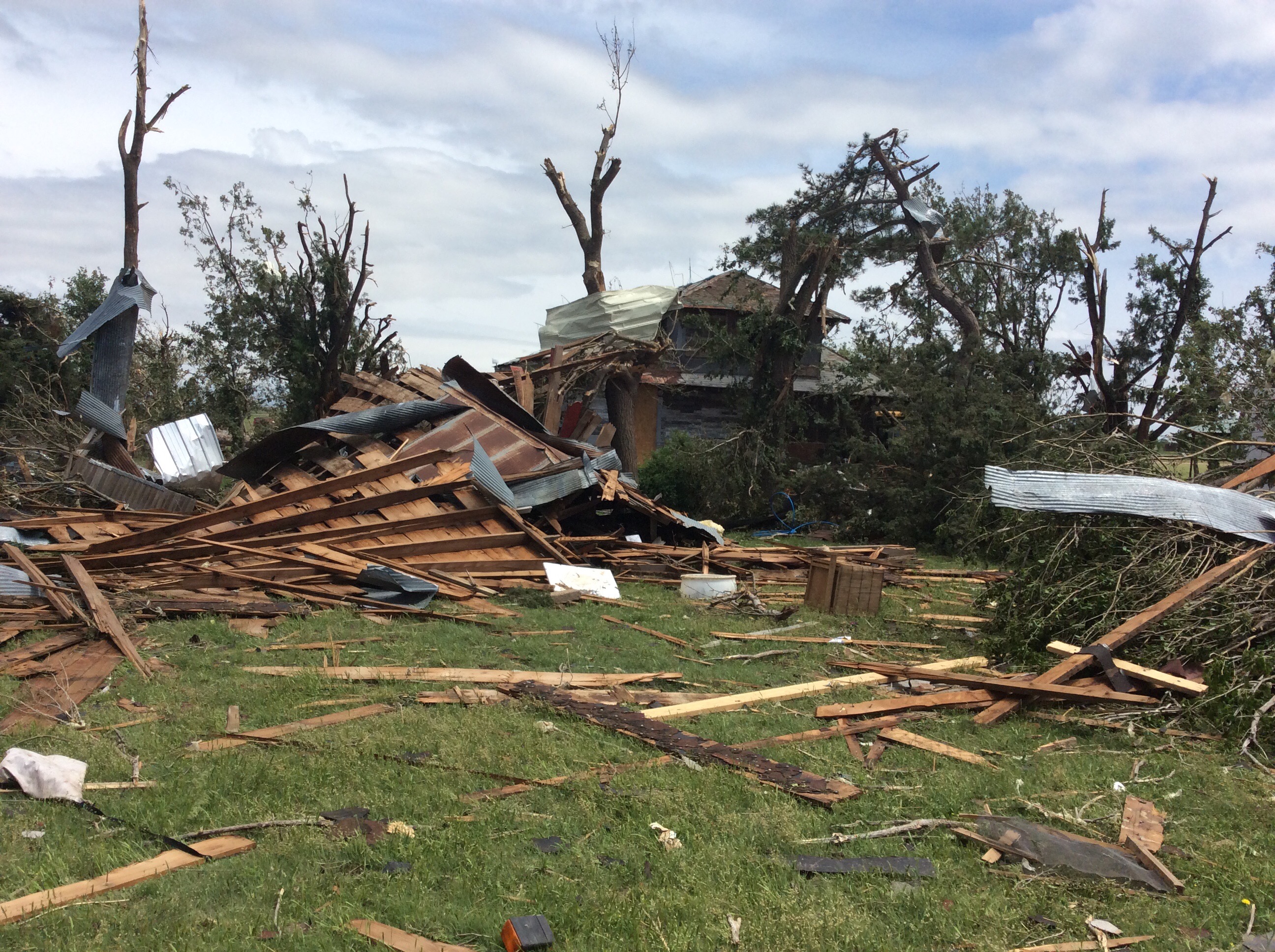
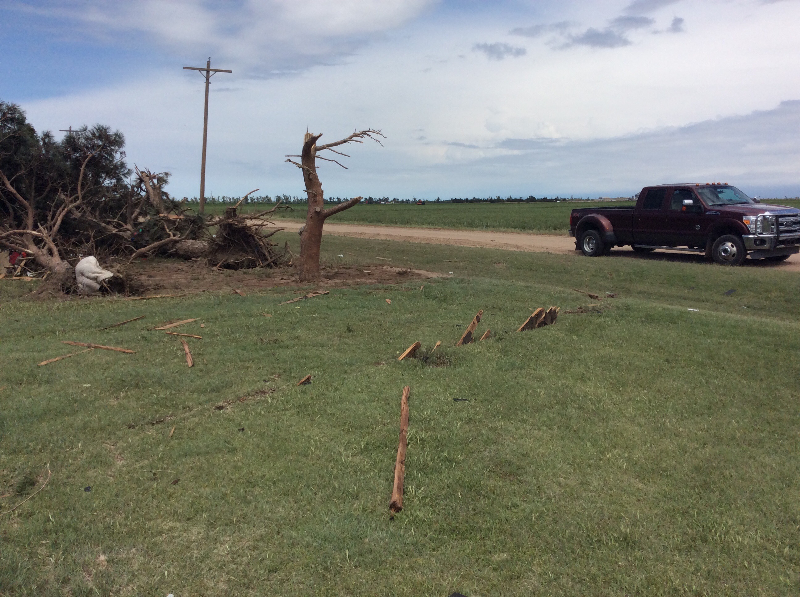
Uprooted Tree damage 5 miles northeast of Ford | Tree and building damage 3.5 miles southeast of Windhorst | Tree and building damage 3.5 miles southeast of Windhorst |
 |
 |
 |
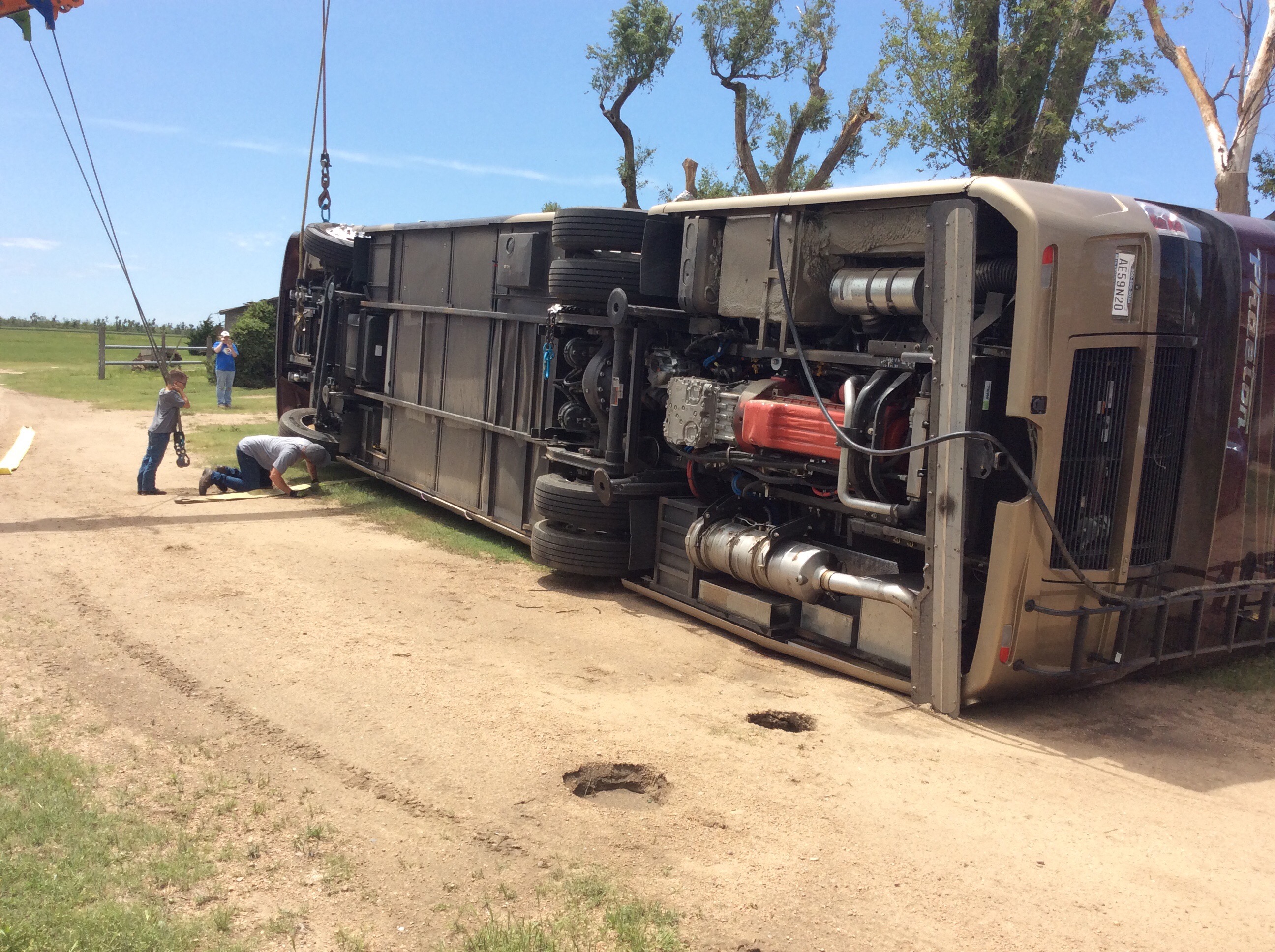 |
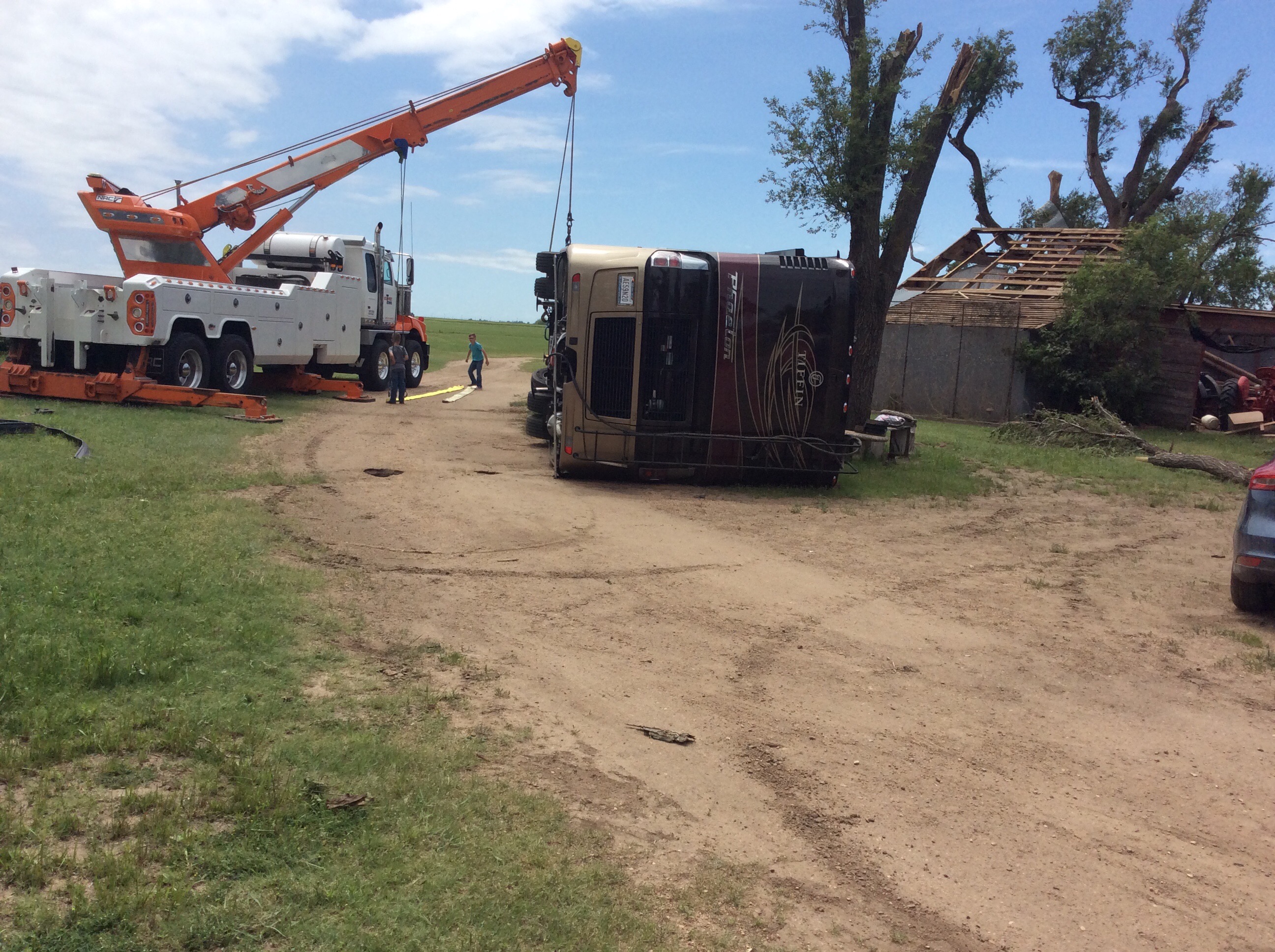
| Tree and building damage 3.5 miles southeast of Windhorst | Tree and home damage 8 miles south of Offerle | Class A RV/Motorhome Flipped 8 miles south of Offerle | Class A RV/Motorhome Flipped 8 miles south of Offerle |
 |
 |
 |
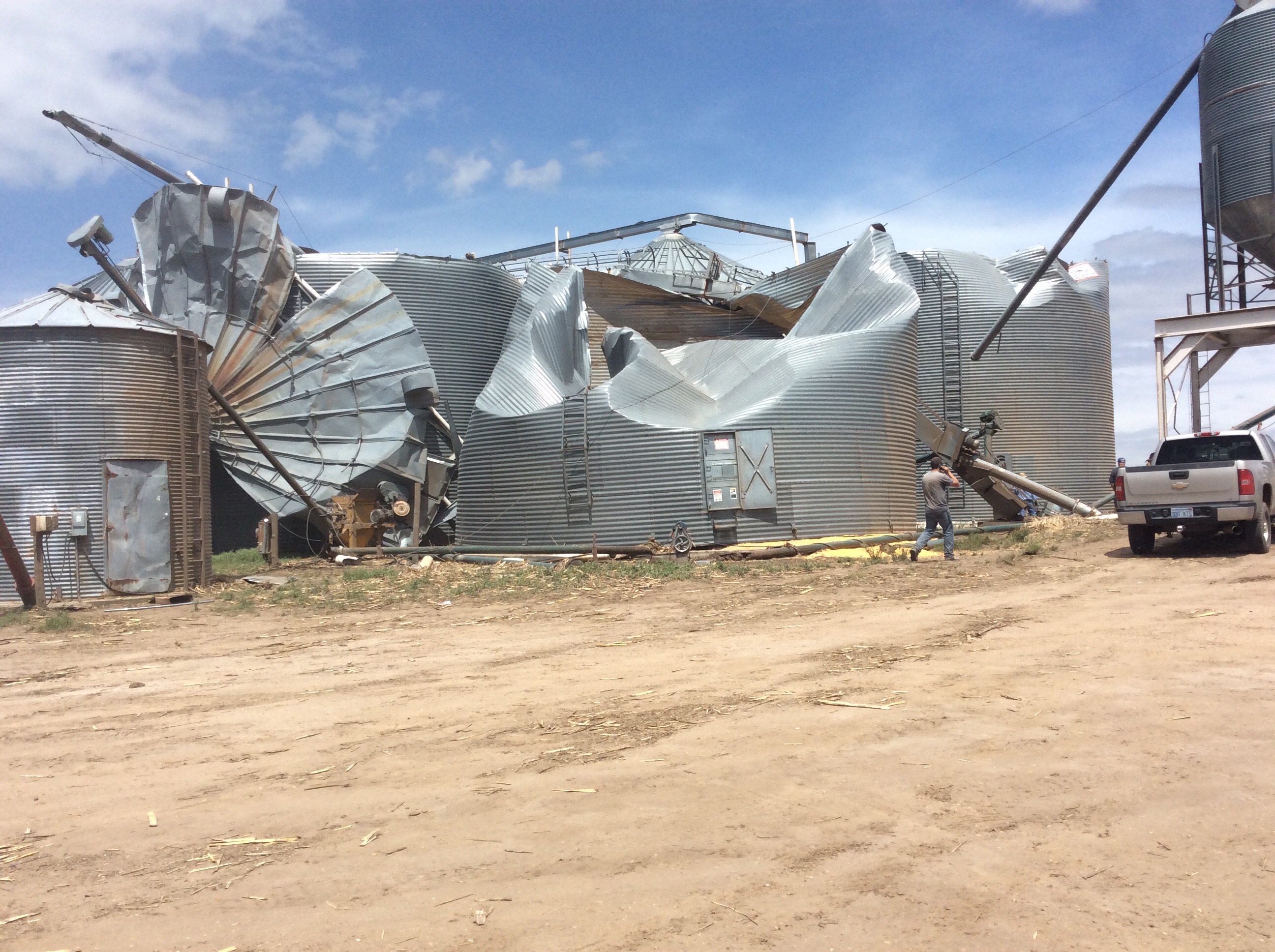 |
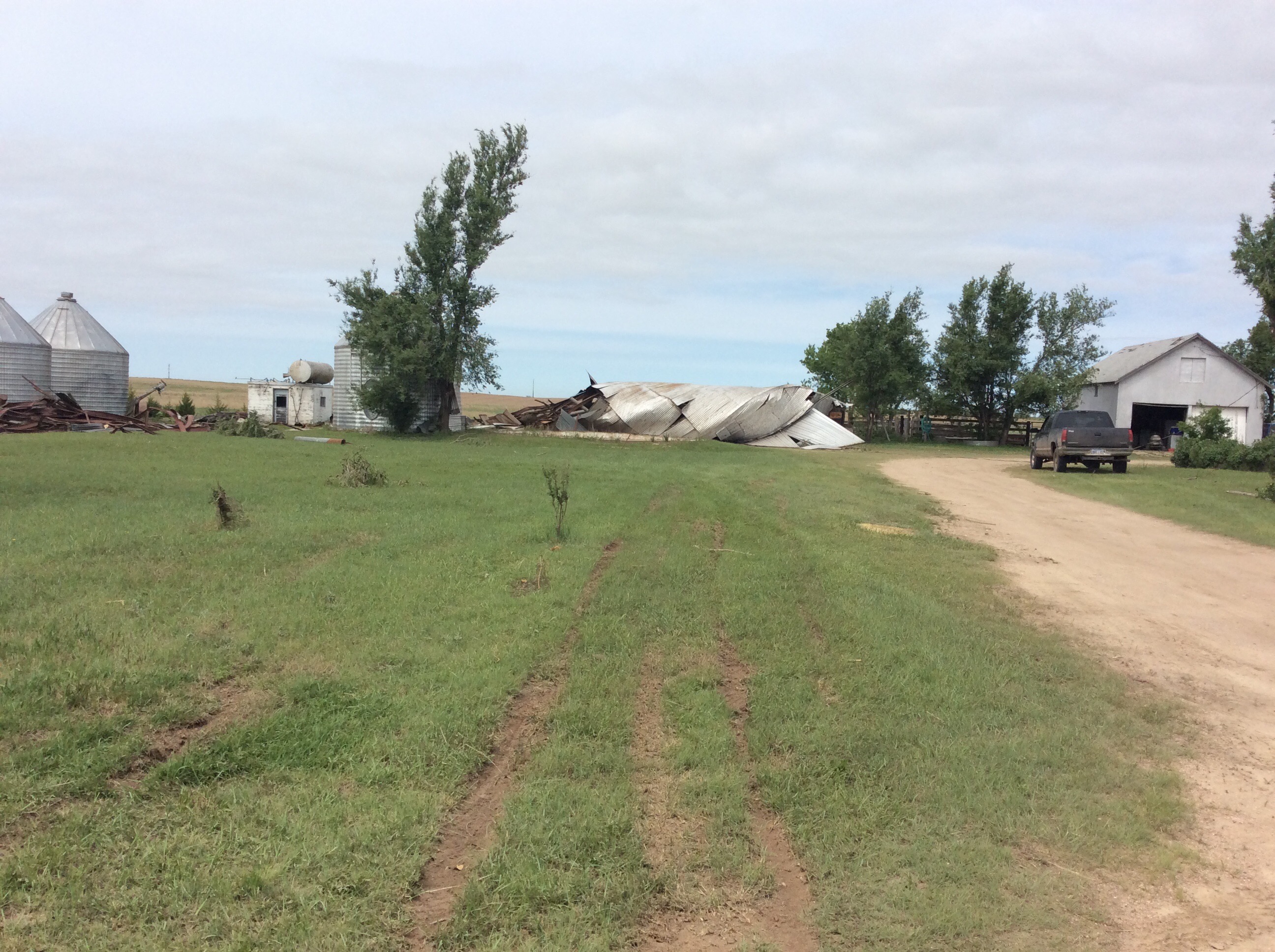
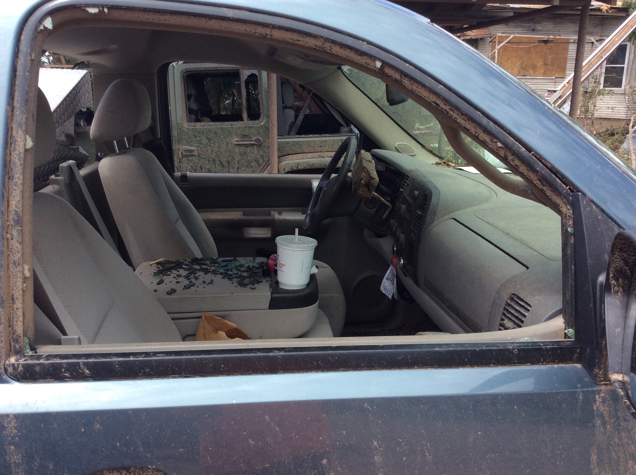
| Tree and building damage 8 miles south of Offerle | Vehicle damage 8 miles south of Offerle | Tree damage 8 miles south of Offerle | Grain bin damage 8 miles south-southeast of Offerle |
Tornado - Lewis to north of Belpre
 |
 |
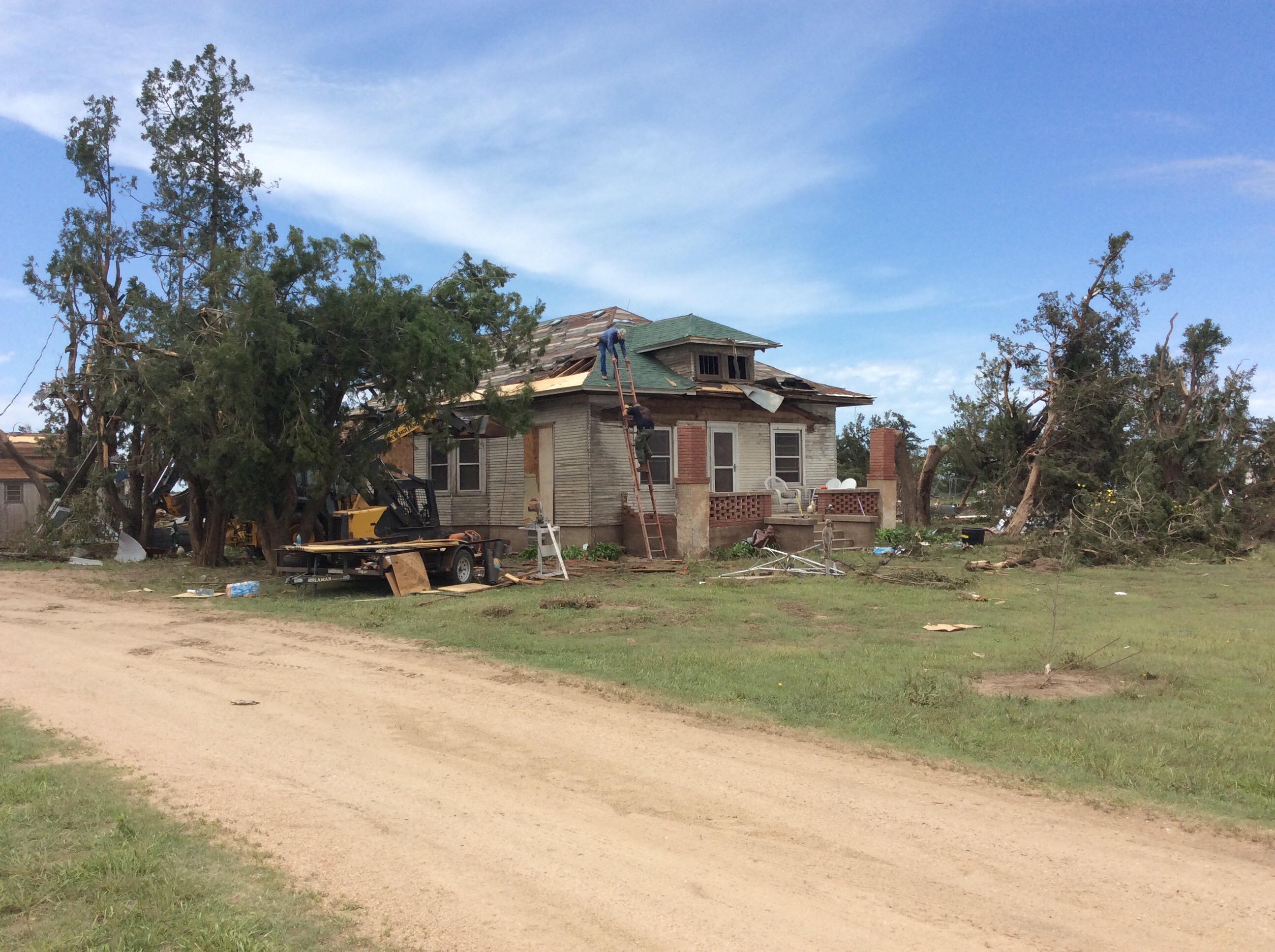
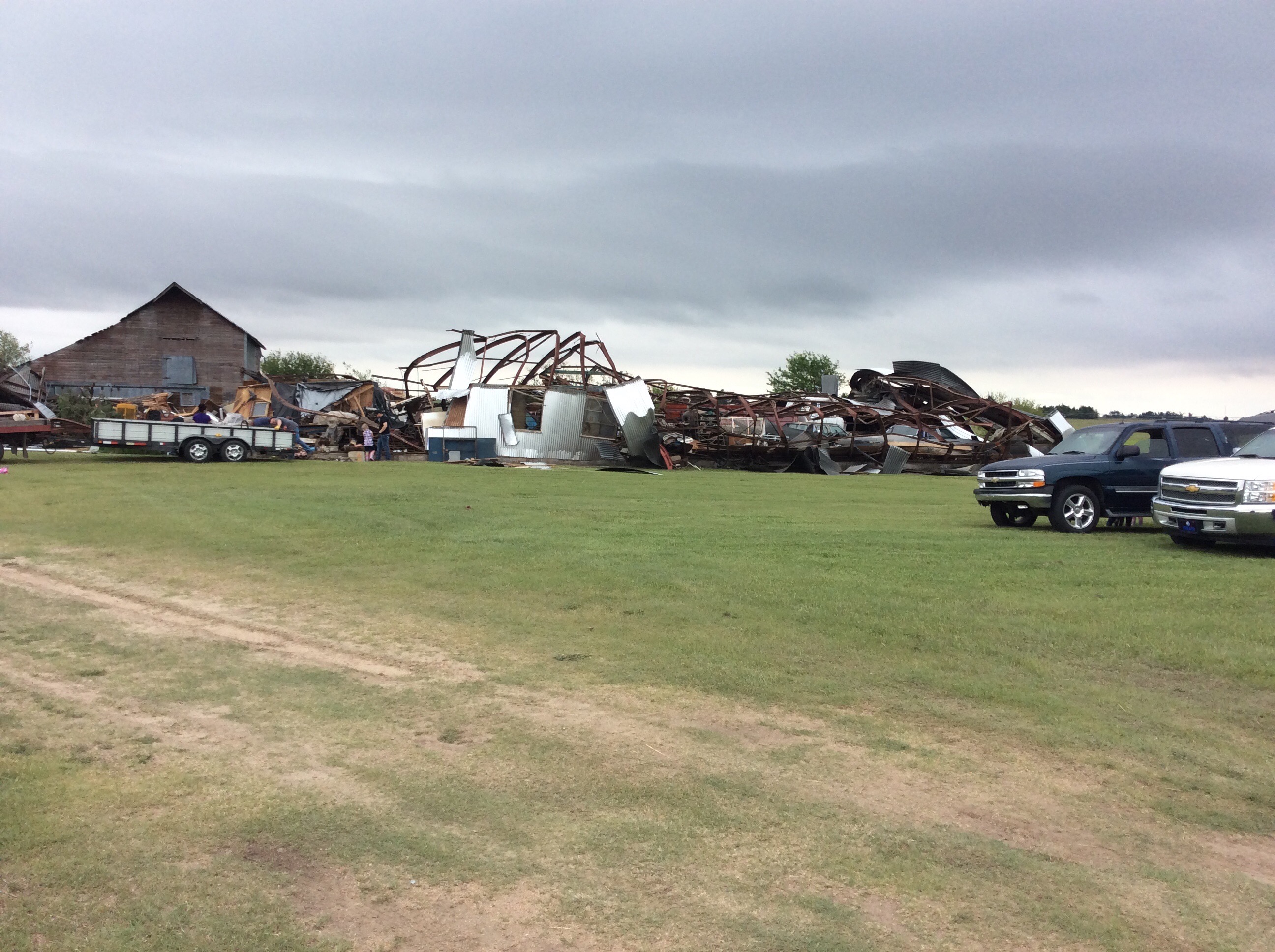
| Building damage 2 miles northeast of Lewis | Damage in Lewis (Image Courtesy Tony Laubach) |
Radar
Tornado - KS/OK Border Crosser
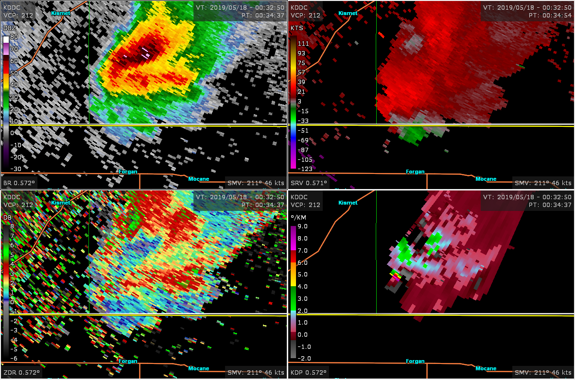 |
| KDDC WSR-88D data for southern Meade County tornado |
Tornado - Fowler to Minneola to Ford
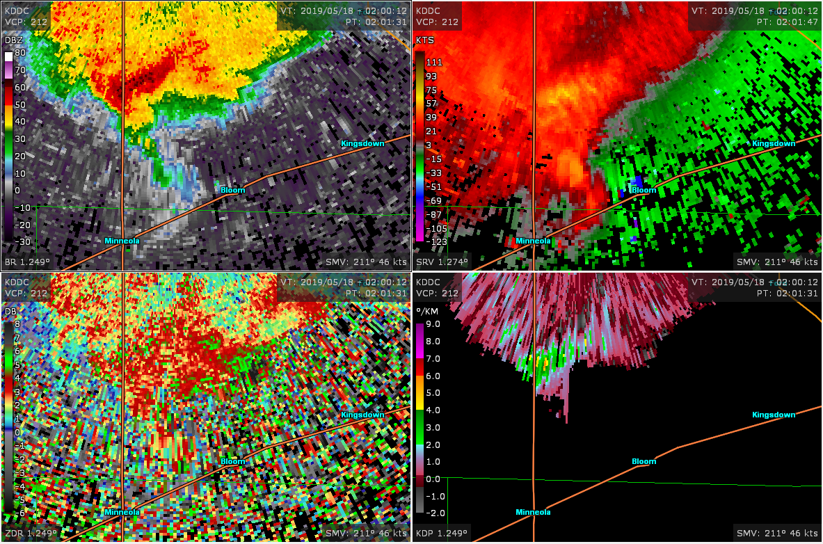 |
| KDDC WSR-88D data for tornado northeast of Minneola/southern Ford County |
Tornado - Ford to Kinsley
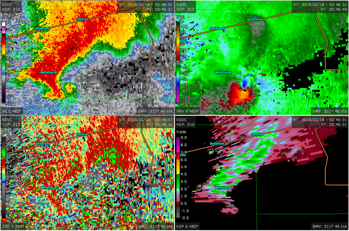 |
| KDDC WSR-88D data for tornado south-southeast of Windhorst |
Tornado - Lewis to north of Belpre
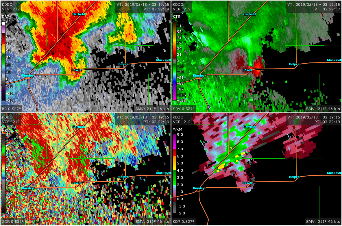 |
| KDDC WSR-88D data for tornado near Lewis KS |
 |
Media use of NWS Web News Stories is encouraged! Please acknowledge the NWS as the source of any news information accessed from this site. |
|