
A frontal boundary extending from the western High Plains to the Southeast will focus additional showers and thunderstorms this weekend. Some of these storms may become severe, alongside frequent lightning, and isolated instances of flash flooding. Meanwhile dry conditions will continue for the Great Basin where fire weather concerns linger. For the mid-Atlantic and Northeast, seasonable weather. Read More >
Overview
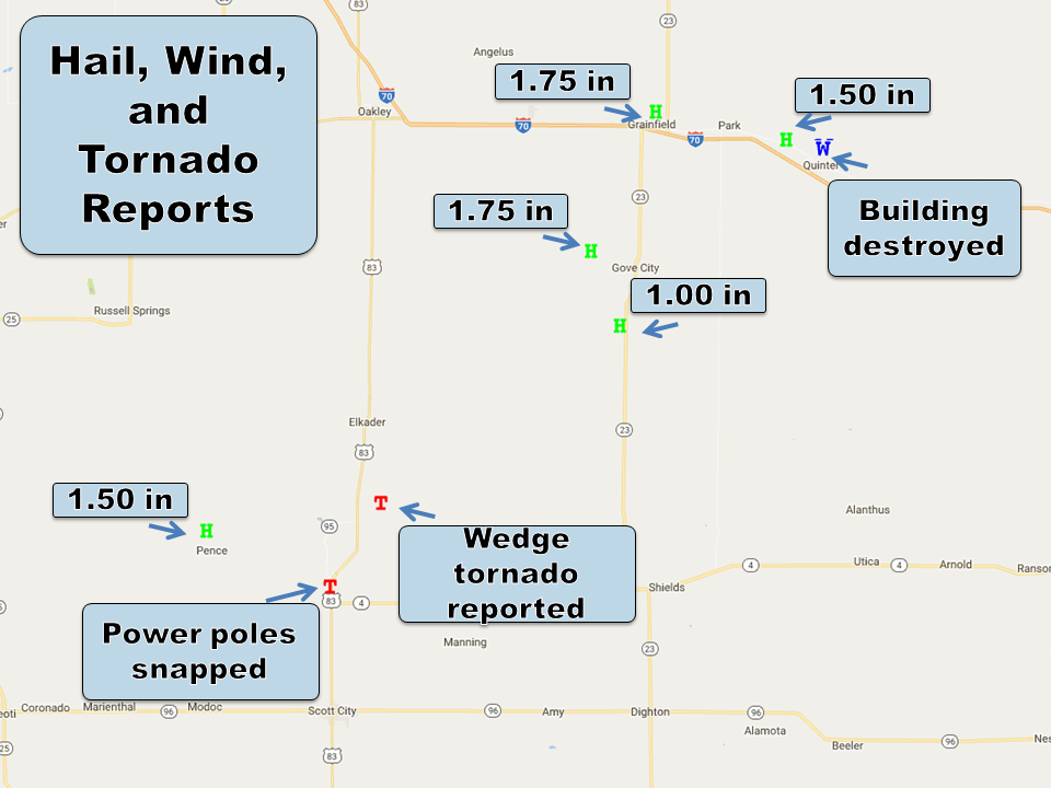
Supercell thunderstorm developed late in the afternoon of 2 October across northern Hamilton County
and moved northeast across west central Kansas entering into Scott County early Monday evening.
Tornadoes:
|
Tornado - 6 NNW Modoc to 9 N Modoc
|
||||||||||||||||
|
Tornado - 5 NNE Modoc to 7 NW Scott City
|
||||||||||||||||
|
Tornado - 5 S Scott State Lake into Gove Co.
|
||||||||||||||||
The Enhanced Fujita (EF) Scale classifies tornadoes into the following categories:
| EF0 Weak 65-85 mph |
EF1 Moderate 86-110 mph |
EF2 Significant 111-135 mph |
EF3 Severe 136-165 mph |
EF4 Extreme 166-200 mph |
EF5 Catastrophic 200+ mph |
 |
|||||
Storm Reports
 |
Media use of NWS Web News Stories is encouraged! Please acknowledge the NWS as the source of any news information accessed from this site. |
|


