A heat wave over the Southwest will intensify this week, peaking and expanding into the Intermountain West and northern High Plains this weekend. Critical to extremely critical fire weather conditions are forecast from the Northwest and the northern Great Basin this weekend. Particularly Dangerous Situation Red Flag Warnings have been issued. Read More >
Dodge City, KS
Weather Forecast Office
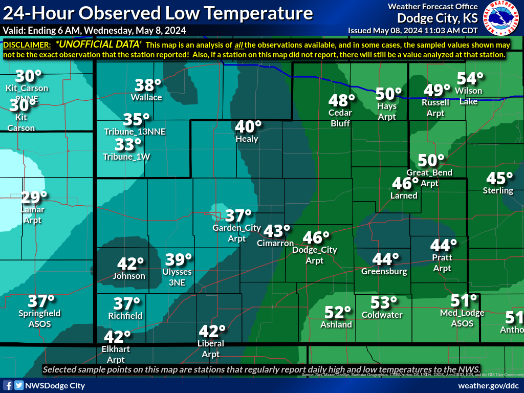
The map below represents the observed minimum temperatures during the past 24 hours across southwest Kansas. Please note that this data is not official. The data is compiled using reports from ASOS sites, volunteer spotters, and cooperative observers.
A text version of the latest data is available on the Regional Temperature and Precipitation Summary.
You can view ALL the data that was used to create this image HERE.
Also Available: High Temperatures | Precip | Snowfall | Snow Depth | Maps Home
US Dept of Commerce
National Oceanic and Atmospheric Administration
National Weather Service
Dodge City, KS
104 Airport Road
Dodge City, KS 67801-9351
620-225-6514
Comments? Questions? Please Contact Us.