Record setting heat is expected over the next several days from the Intermountain West through the northern Plains. Furthermore, fire weather concerns increase with dry and breezy conditions. Meanwhile, heavy rainfall and severe thunderstorm threats for the Ohio/Tennessee Valleys, central Appalachians and Southeast today. The threat shifts to central Gulf Coast and across central Texas this week. Read More >
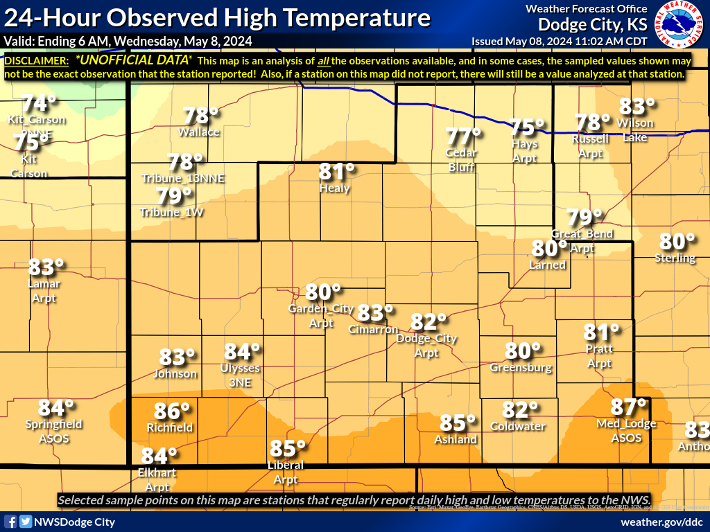
The map below represents the observed maximum temperatures during the past 24 hours across southwest Kansas. Please note that this data is not official. The data is compiled using reports from ASOS sites, volunteer spotters, and cooperative observers.
A text version of the latest data is available on the Regional Temperature and Precipitation Summary.
You can view ALL the data that was used to create this image HERE.
Also Available: Low Temperatures | Precip | Snowfall Maps | Snow Depth Maps |Maps Home