
A significant heat wave continues for the Rockies, Northern Plains, and Great Lakes into the Mid-Atlantic, peaking in intensity through midweek and lingering across parts of the Northern Plains and Midwest until this weekend. Excessive rainfall my bring life-threatening and locally catastrophic flash and urban flooding across portions of southwestern Texas through early Friday. Read More >
Dodge City, KS
Weather Forecast Office
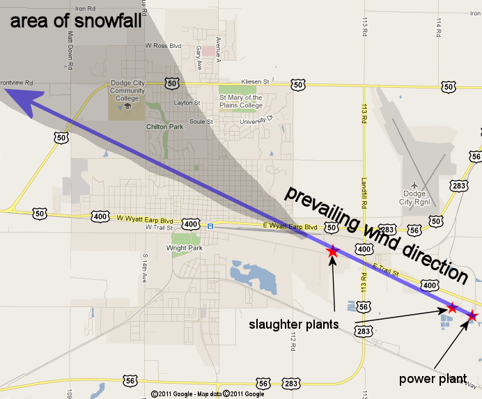
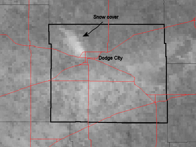
An unusual weather setup produced a very narrow and isolated band of snow across parts of Dodge City and Ford county on 1/19/11. The atmosphere was cold and moist with low clouds and fog preceding the formation of the snow. It appears that two slaughter plants and a power generating plant contributed to the snow as ice nuclei and copious amounts of water vapor were fed into the boundary layer. East/southeast winds carried the vapor and nuclei aloft into the lower clouds and then precipitated out as snow downwind of the source. Snowfall of as much as 0.7" was reported in the snowfield with no snow observed at all outside of this area.
The image below shows the source of the snow and the area of Dodge City and Ford county that was covered by the snow.
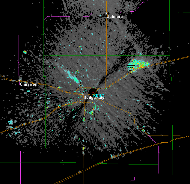
The next image shows a radar image depicting the snow band at 1124 AM. The orange and pink colors show where the heaviest snow was falling at the time.
.jpg)
The following 2 1/2 hour radar loop shows where the snow persisted (this may take a minute to load). Also of note, try and pick out the moving object that is headed towards the southwest from Dodge City along the highway. This is actually a train that was headed slowly towards Montezuma, parallel to the highway!
US Dept of Commerce
National Oceanic and Atmospheric Administration
National Weather Service
Dodge City, KS
104 Airport Road
Dodge City, KS 67801-9351
620-225-6514
Comments? Questions? Please Contact Us.

