National Weather Service United States Department of Commerce

Minimum Wind Chill Forecasts


Minimum Wind Chill Forecasts


This series of maps shows the probability (that is, the likelihood) that snowfall will equal or exceed specific amounts during the time period shown on the graphic. These forecasts are based on many computer model simulations of possible snowfall totals.


Hover over thumbnails below to scroll through images or click each image to view a larger image.


Day 1 Min Wind Chill

>=0.1"
>=0.1"


Night 1 Min Wind Chill

>=1"
>=1"


Day 2 Min Wind Chill

>=2"
>=2"


Night 2 Min Wind Chill

>=4"
>=4"


Day 3 Min Wind Chill

>=6"
>=6"


Night 3 Min Wind Chill

>=7"
>=7"


Day 4 Min Wind Chill

>=9"
>=9"


Night 4 Min Wind Chill

>=11"
>=11"


Day 5 Min Wind Chill

>=13"
>=13"


Night 5 Min Wind Chill

>=15"
>=15"


For additional information on watches, warnings, and advisories in effect check out the latest Weather Story


For a text product listing of current hazards in effect for your specific county, click here


Current City of Detroit Observation (Updated Hourly)


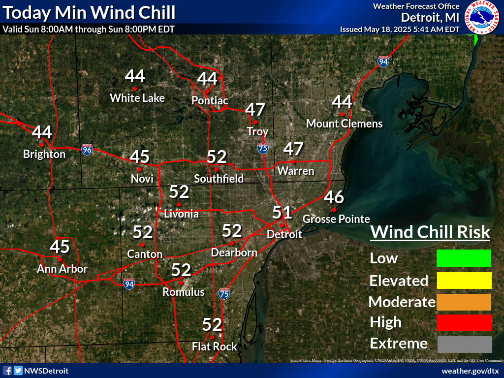
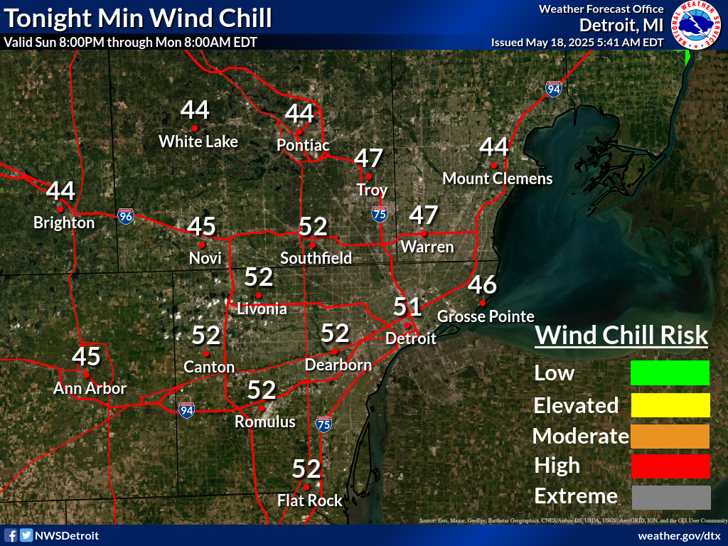
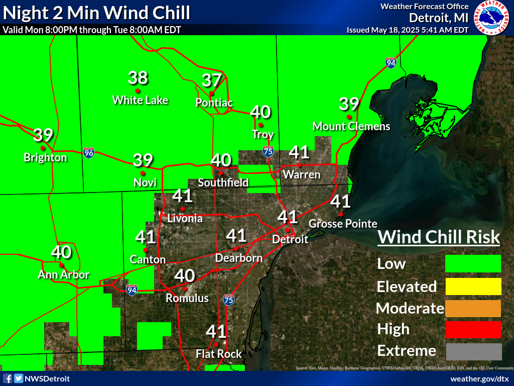
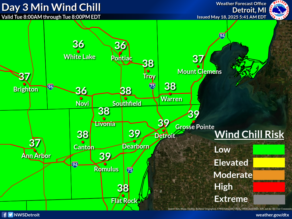
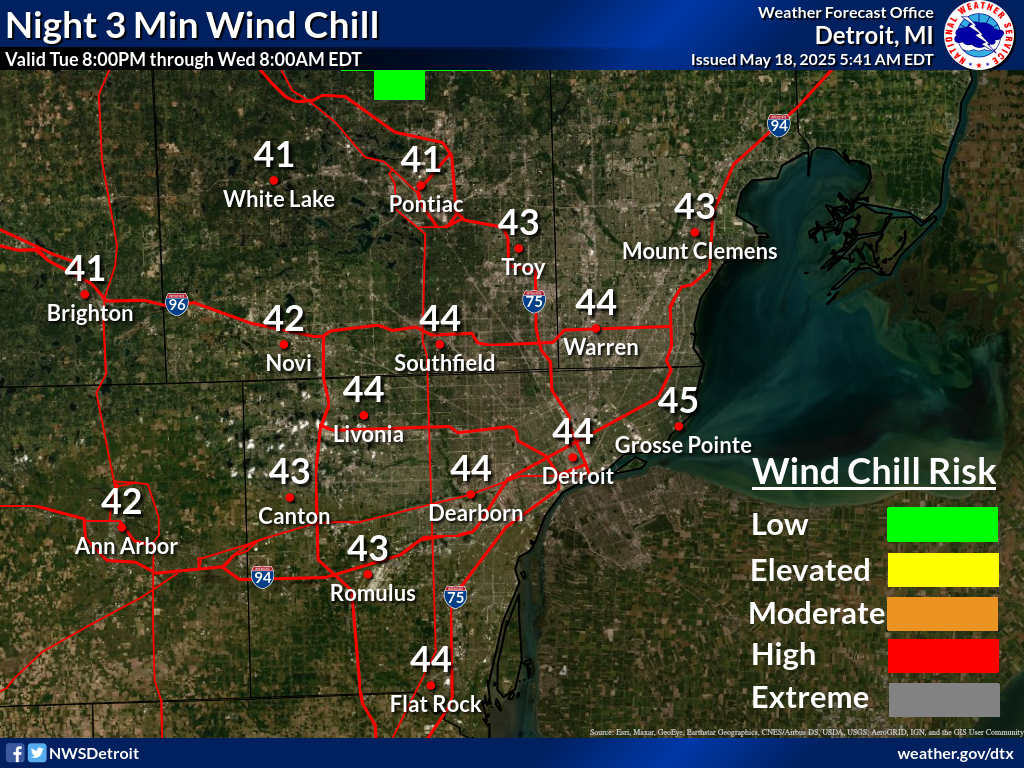
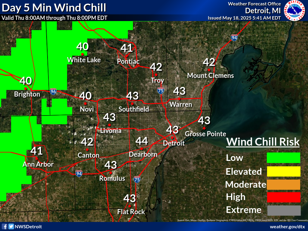
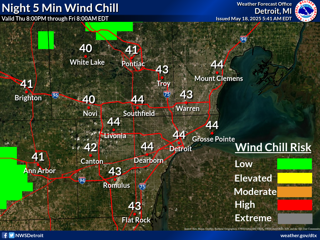
Latest 48 Hour Forecast For The City of Detroit


Freezing Rain Risk


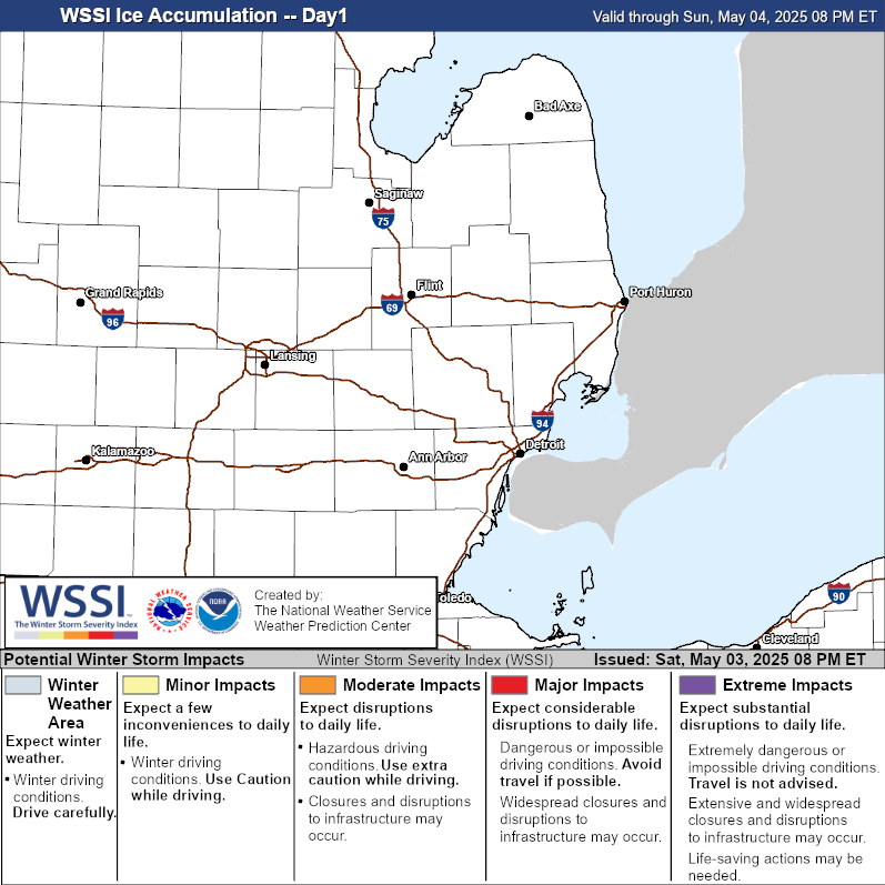
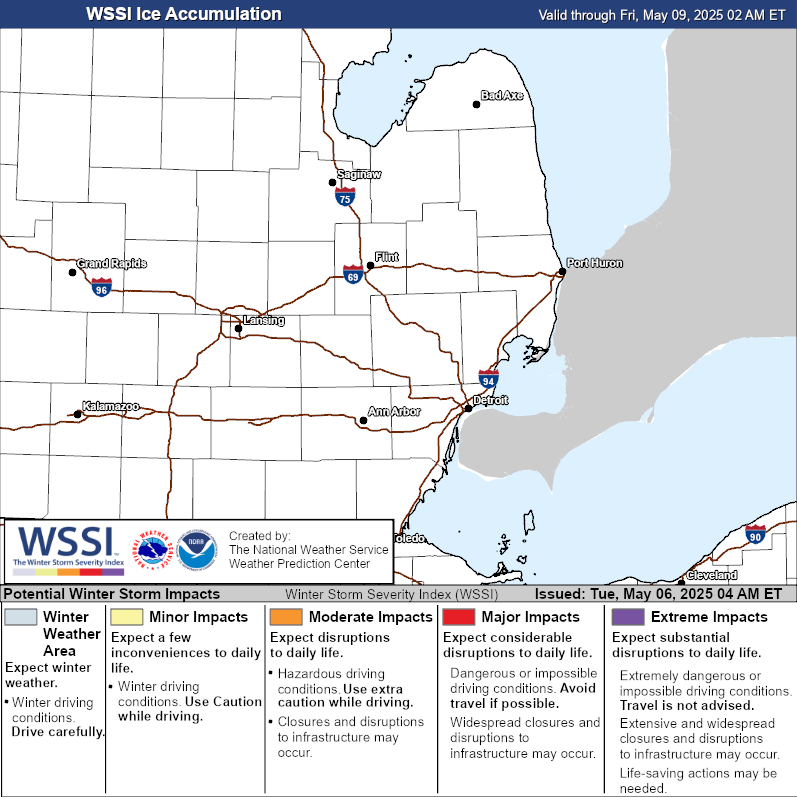
What is the Winter Storm Severity Index? (click here)

 
Hover over thumbnails below to scroll through images or click each image to view a larger image.


Today's Ice Risk

>=0.1"
>=0.1"


Tomorrow's Ice Risk

>=1"
>=1"


Day 3 Ice Risk

>=2"
>=2"


Days 1-3 Combined Ice Risk

>=2"
>=2"

Extended Outlooks


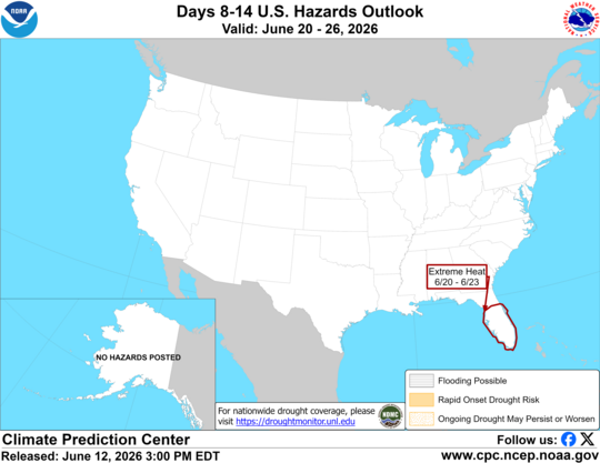
Climate Prediction Center Guidance

NOTE: the guidance below is meant for planning purposes only)

Click each image to view a larger image.


Day 3-7 U.S. Hazards Outlook

>=0.1"
3-7 hazards outlook

Risk of Hazardous Temperatures (Next Week)

>=1"
next week hazardous temps


8-14 Day Temperature Outlook

>=0.1"
8-14 temps


Weeks 3-4 Temperature Outlook

>=1"
8-14 precip


Additional Resources


  WindChillChart


NWS Extreme Cold Definitions


Cold Weather Advisory: Issued anytime the actual air temperature or wind chill index reaches -15 to -24 degrees F.

Extreme Cold Watch: Issued when wind chill values or actual air temperatures are forecast to fall to -25 degrees F or colder within the next 24 to 48 hours.

Extreme Cold Warning: Issued when wind chill values or actual air temperatures are forecast to fall to -25 degrees F or colder with the next 24 hours.


ColdNWS Cold Weather Safety (click here)


CDC Cold Weather/Winter Storm Safety

- Before the Storm (click here)

- During the Storm (click here)

         - Hypothermia/Frostbite (click here)


Red Cross Winter Weather Safety Tips (click here)

Want to Provide Feedback?


For additional general feedback or inquiries regarding information on this webpage, please contact the following:

Steve Considine (Steve.Considine@noaa.gov)


For technical inquiries regarding information on this webpage, please contact the following:

Ian Lee (Ian.Lee@noaa.gov)