
Strong to severe thunderstorms are expected Wednesday from the Central Plains into western Texas. An Enhanced Risk (level 3 of 5) has been issued for parts of Kansas and Oklahoma. The main threats will be tornadoes, very large hail, and damaging winds. Additionally, heavy rain and flash flooding is likely across portions of the Midwest into the Central and Southern Plains. Read More >
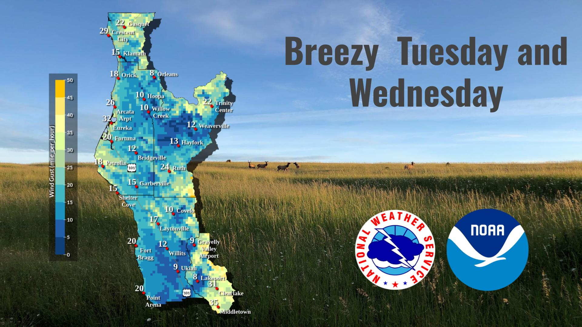
Last Map Update: Tue, Apr. 30, 2024 at 11:32:14 pm PDT
|
Text Product Selector (Selected product opens in current window)
|
|


 KBHX Radar
 Social Media
 Satellite
 Weather Map
 Forecast Weather Tables
 Climate Graphs
 Become A Rain/Snow/Hail Observer
 TsunamiReady
 Water Temperatures for NW California
 NW CA Mtn Pass Forecasts
 NW CA Daily Graphicast
 Subscribe to our Newsletter
 Area Smoke Forecast
 Drought Monitor
 Air Quality
 Follow us on YouTube