
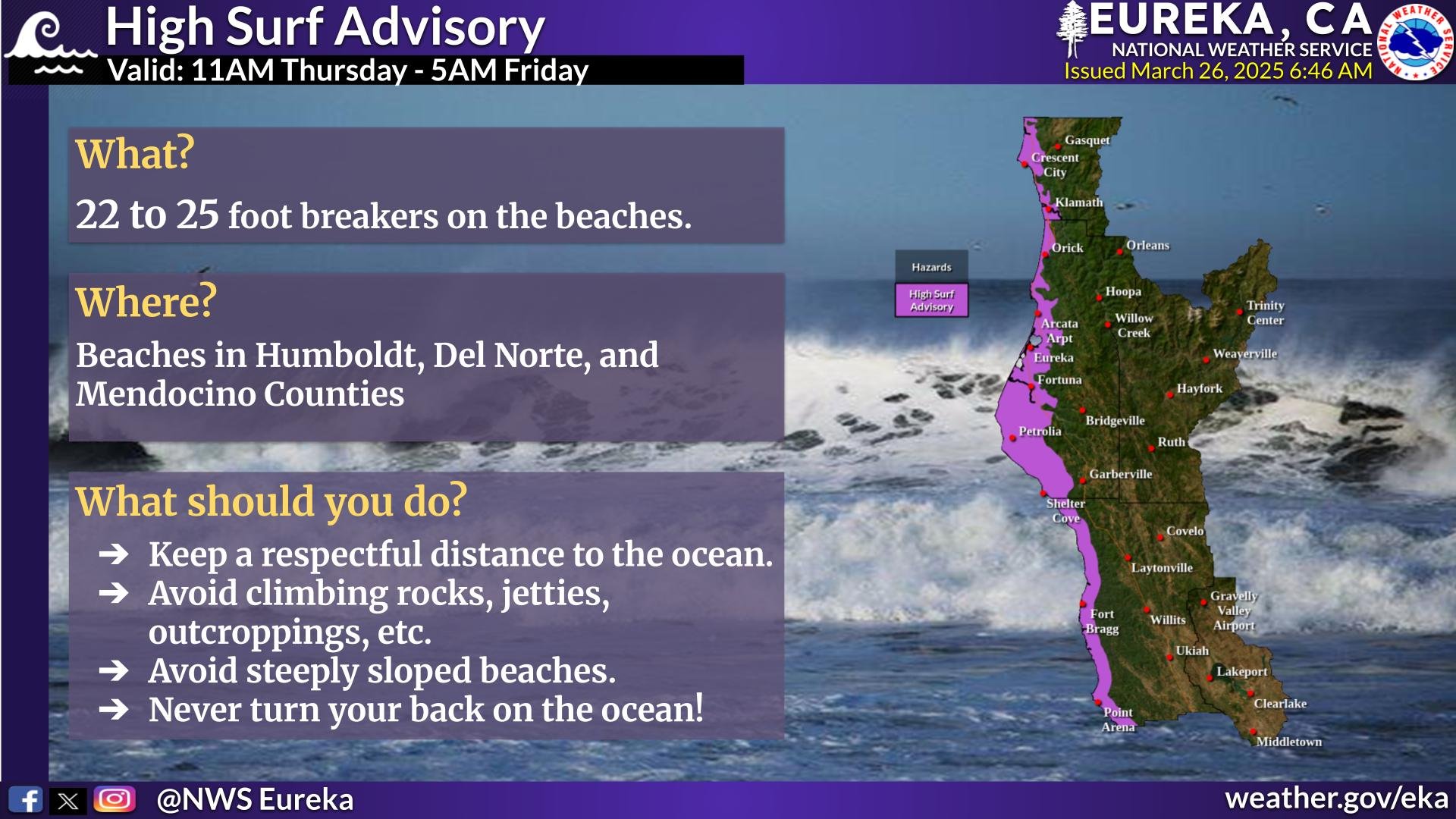
Severe thunderstorms will continue today across portions of the Southeast as this system tracks offshore. Meanwhile, dry and breezy conditions will increase fire weather concerns for areas of central Florida today; The threat shifts into portions of the northern Plains on Friday. Record warmth will spread for the southern Plains, Southwest, central Great Basin and interior California next week. Read More >
Last Map Update: Thu, May 7, 2026 at 12:48:21 pm PDT

|
Text Product Selector (Selected product opens in current window)
|
|


 KBHX Radar
 Satellite
 Weather Map
 Forecast Weather Tables
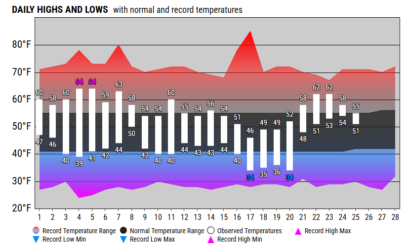 Monthly Past Weather Graphs
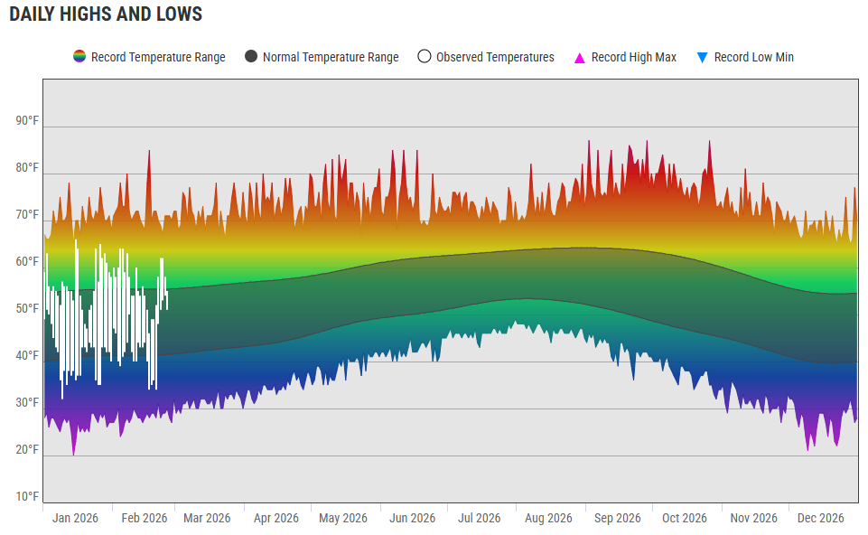 Yearly Past Weather
 Become A Rain/Snow/Hail Observer
 TsunamiReady
 Water Temperatures for NW California
 NW CA Mtn Pass Forecasts
 NW CA Daily Graphicast
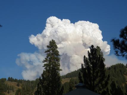 Area Smoke Forecast
 Drought Monitor
 Air Quality
 Winter Weather
 Probabilistic QPF Experiment
 Submit a Storm Report