
Dangerous and extreme heat will remain across portions of the Central U.S. this week, persisting across the Mid to Lower Mississippi Valleys, Gulf Coast, Southern Plains and portions of Texas. A heat wave over the Southwest will intensify late this week. Severe thunderstorms and flash flooding will spread from the Great Lakes/Ohio Valley to the Mid-Atlantic and Northeast the next few days. Read More >
El Paso, TX
Weather Forecast Office
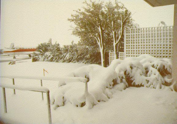
All time heavy snowfall events for El Paso
Monthly Extreme, 25.9 inches in December 1987 |
|
|
||
| National Weather Service El Paso Area 7955 Airport Rd Santa Teresa, NM 88008 Ph: (505) 589-4088 Page Author: WFO El Paso, TX Web Masters email: SR-EPZ.webmaster@noaa.gov |
Disclaimer Credits Glossary |
Privacy Policy About Us Career Opportunities |
Current Hazards
Outlooks
Hazardous Weather Outlook
Local Storm Reports
Public Information Statement
National
Heat Risk
Current Conditions
Drought Monitor
Holloman AFB Radar
Regional highs/lows/precip
El Paso Radar
Rivers and Lakes
Local Observations
Satellite
Forecasts
Forecast Discussion
Graphical Forecast
Hourly Forecast
Activity Planner
Fire Weather
Aviation Weather
Climate
El Paso Climate Data
Monthly Weather Digest
Climate Graphs
Monthly Climate Data
Climate Prediction
Storm Events Database
Santa Teresa Climate Data
US Dept of Commerce
National Oceanic and Atmospheric Administration
National Weather Service
El Paso, TX
7955 Airport Rd
Santa Teresa, NM 88008
(575) 589-4088
Comments? Questions? Please Contact Us.

