
Heat expands across the Desert Southwest, Plains, Mississippi Valley and Midwest into Monday. Fire weather concerns continue for portions of the Intermountain West. Active monsoonal moisture fuels thunderstorms over the Southwest with possible flash flooding. Tropical cyclone Fausto in the Pacific, should weaken as it approaches Hawaii; Dangerous surf, swells and rip currents are expected. Read More >
El Paso, TX
Weather Forecast Office
| El Paso Wind Rose Data |
|
Wind roses can be used to graphically depict the predominant transport direction of an area's winds. Air quality is often correlated with the dominant transport direction of the wind. Wind roses provide the best information regarding the percentage of time the direction(s) and speed(s) associated with a certain air quality can be expected over a long period of time. The following data was collected from 1970-2024 at the El Paso International Airport. |
Annual |
January |
February |
March |
April |
May |
June |
July |
August |
September |
October |
November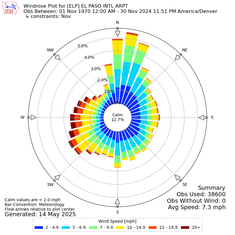 |
December |
Current Hazards
Outlooks
Hazardous Weather Outlook
Local Storm Reports
Public Information Statement
National
Heat Risk
Current Conditions
Drought Monitor
Holloman AFB Radar
Regional highs/lows/precip
El Paso Radar
Rivers and Lakes
Local Observations
Satellite
Forecasts
Forecast Discussion
Graphical Forecast
Hourly Forecast
Activity Planner
Fire Weather
Aviation Weather
Climate
El Paso Climate Data
Monthly Weather Digest
Climate Graphs
Monthly Climate Data
Climate Prediction
Storm Events Database
Santa Teresa Climate Data
US Dept of Commerce
National Oceanic and Atmospheric Administration
National Weather Service
El Paso, TX
7955 Airport Rd
Santa Teresa, NM 88008
(575) 589-4088
Comments? Questions? Please Contact Us.


