
Dangerous and extreme heat will remain across portions of the southern U.S. this week. Heavy rainfall may bring significant flash flooding across portions of the Mid-Atlantic and Northeast through the night, and additional flash flooding concerns across New England on Wednesday. Monsoonal thunderstorms will bring a flash flood risk to the Four Corners region, especially in burn scar areas Read More >
El Paso, TX
Weather Forecast Office
Click on image to enlarge
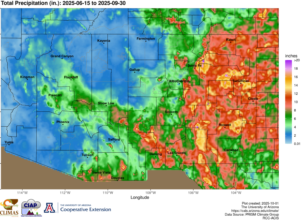
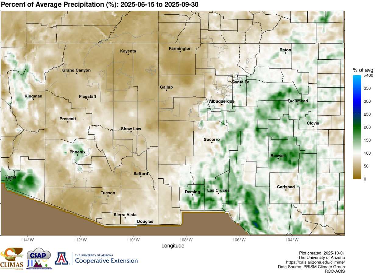
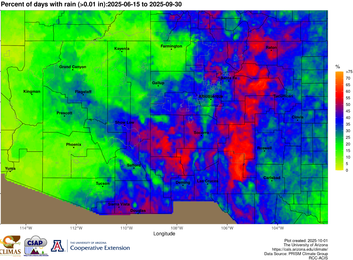
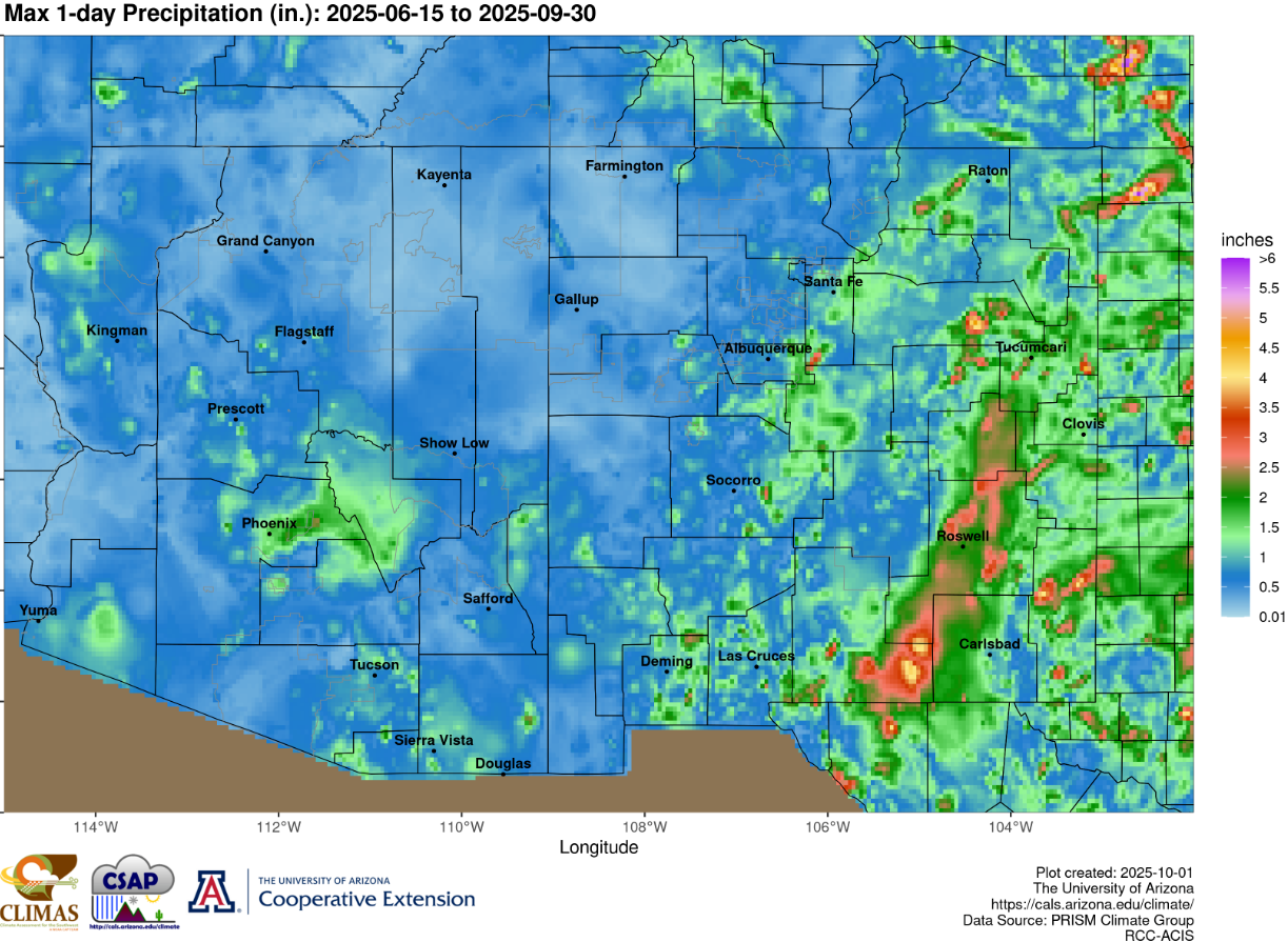
Source: https://cales.arizona.edu/climate/misc/SWMonsoonMaps/historical/past_SWUS_monsoon.html
Current Hazards
Outlooks
Hazardous Weather Outlook
Local Storm Reports
Public Information Statement
National
Heat Risk
Current Conditions
Rivers and Lakes
Local Observations
Satellite
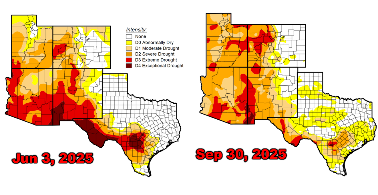
Drought Monitor
Holloman AFB Radar
Regional highs/lows/precip
El Paso Radar
Forecasts
Forecast Discussion
Graphical Forecast
Hourly Forecast
Activity Planner
Fire Weather
Aviation Weather
Climate
El Paso Climate Data
Monthly Weather Digest
Climate Graphs
Monthly Climate Data
Climate Prediction
Storm Events Database
Santa Teresa Climate Data
US Dept of Commerce
National Oceanic and Atmospheric Administration
National Weather Service
El Paso, TX
7955 Airport Rd
Santa Teresa, NM 88008
(575) 589-4088
Comments? Questions? Please Contact Us.

