National Weather Service United States Department of Commerce

Severe Weather and Excessive Rain from the Southern Plains into the Mississippi Valley

Clusters of severe storms are possible through early tonight, with the most concentrated threat for wind damage, large hail and a few tornadoes from the ArkLaTex southward into east Texas. These storms will also bring heavy rains that may result in isolated to scattered flash flooding. Above average temperatures will spread from Midwest into Mid-Atlantic into early week. Read More >

Click a location below for detailed forecast.

Last Map Update: Sun, Apr. 28, 2024 at 4:47:27 pm MDT
National Weather Service NWS Flagstaff, AZNational Weather Service Albuquerque, NMNational Weather Service Lubbock, TX
National Weather Service NWS Tucson ArizonaZoom
Out

National Weather Service Midland/Odessa
There are no watches, warnings, or advisories at this time.

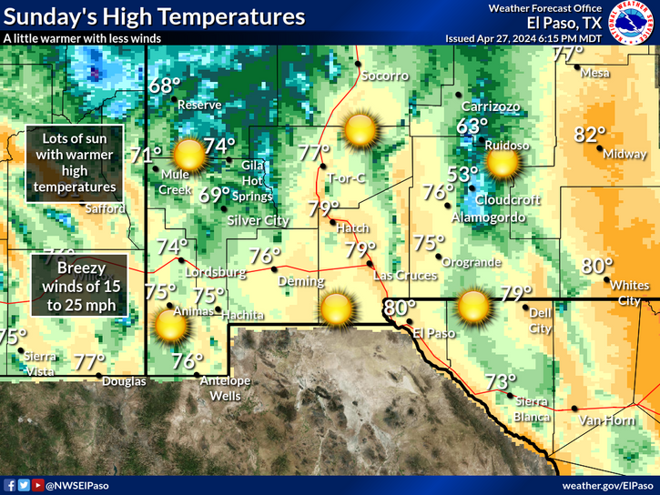
We will see less winds and a little warmer temperatures on Sunday. Our winds will be breezy at 15 to 25 mph under sunny skies.

Link to Briefing page
Briefing

Forecast
Discussion
Weather Hazards Outlook icon
Weather Hazards
Outlook

Hourly Forecast

Gridded Forecast

Weather Calculator

Link to Observation Page
Current
Observations


Satellite


Climate
Data


Past Weather

Drought

Hydrology

Wx Radio

Skywarn

Fire Weather

Volunteer

Aviation

Social Media