Grand Forks, ND
Weather Forecast Office
Overview
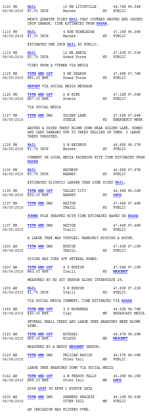
Severe thunderstorms broke out over portions of central and south central North Dakota during the mid to late evening of Tuesday, June 5th. These storms eventually organized into a line and tracked southeast, mainly affecting areas along and south of the highway 200 corridor in eastern North Dakota and west central Minnesota during the late evening of June 5th and early morning hours of June 6th. These storms produced some large hail, strong winds, and localized heavy rain.
Wind & Hail:
Many strong wind reports were received, but there were a few reports of large hail as well.
Wind
Here are the wind reports from around the area.

Hail
The largest hail report received was 1.75 inches in diameter, at both 5W Kathryn in Barnes County ND and 5W Buxton in Traill County ND. See the storm reports section for further information.
Radar:
| Mayville Radar Imagery |
Storm Reports
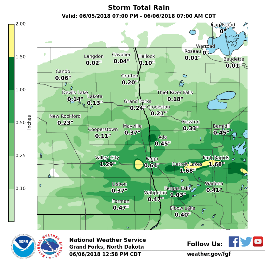
Rain Reports

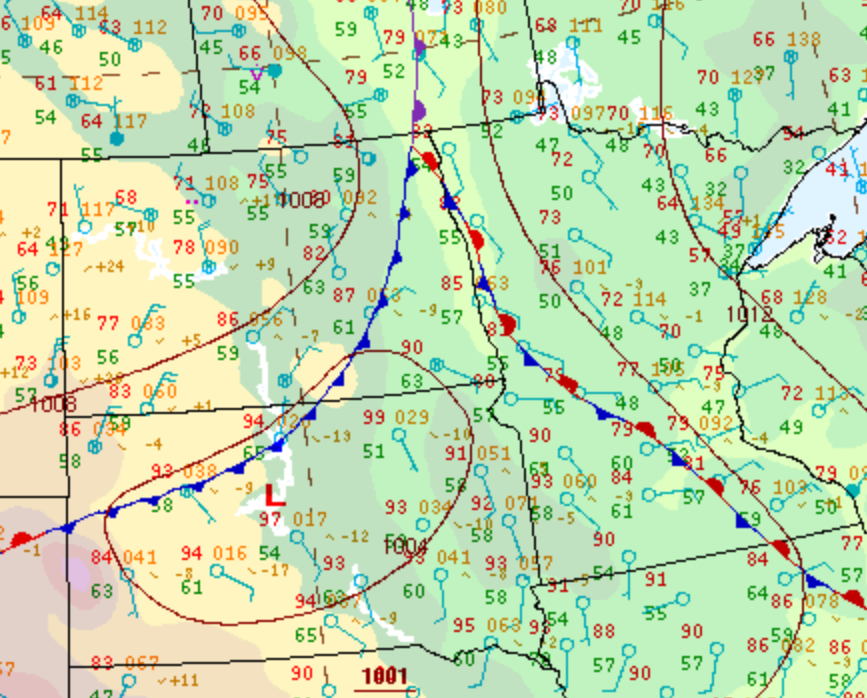
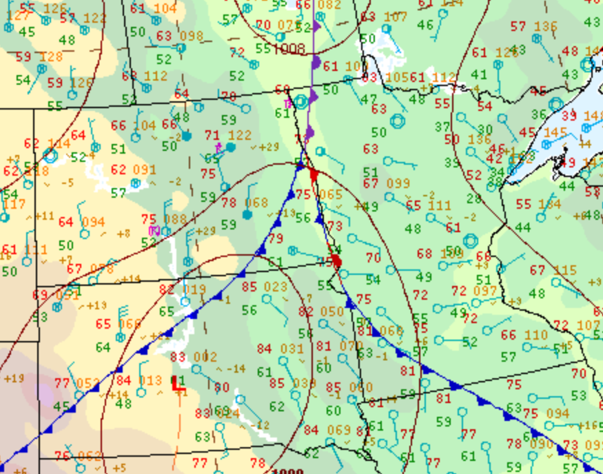
Environment
Several surface boundaries were moving through the area.
 |
 |
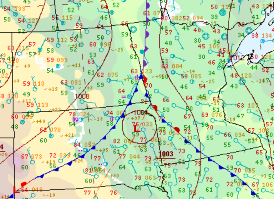 |
| 7 PM TUE SFC MAP | 10 PM TUE SFC MAP | 1 AM WED SFC MAP |
Additional Information
 |
 |
 |
|
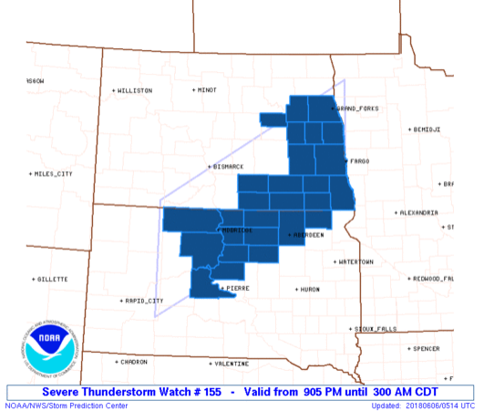
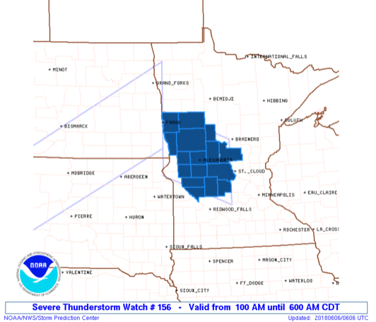
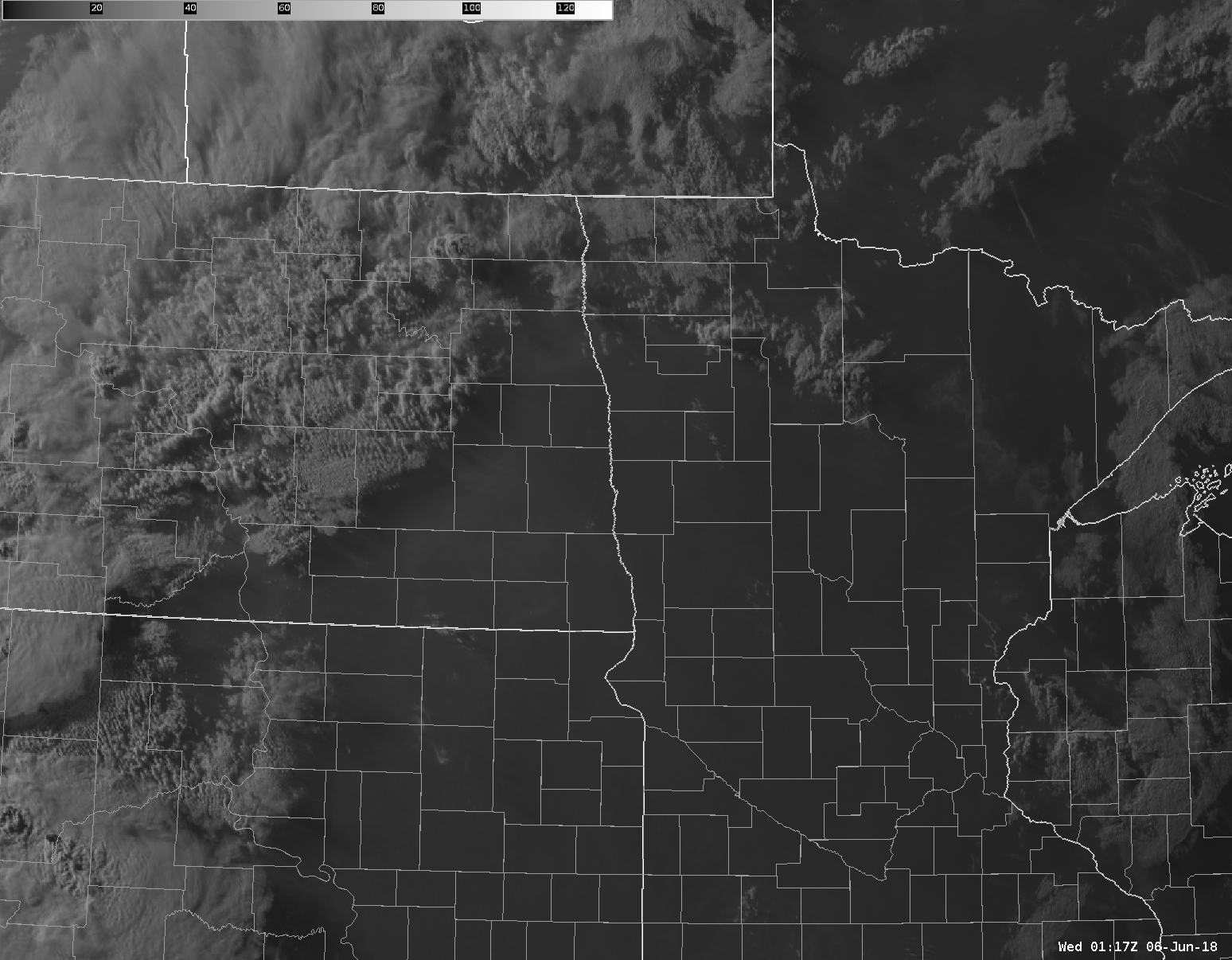
| Warnings Loop | Severe Thunderstorm Watch 1 | Severe Thunderstorm Watch 2 | Visible Satellite Tuesday Evening |
 |
Media use of NWS Web News Stories is encouraged! Please acknowledge the NWS as the source of any news information accessed from this site. |
|
US Dept of Commerce
National Oceanic and Atmospheric Administration
National Weather Service
Grand Forks, ND
4797 Technology Circle
Grand Forks, ND 58203-0600
701-772-0720
Comments? Questions? Please Contact Us.

