Overview
|
On the evening of July 2, 2018, severe thunderstorms developed over portions of the southern Red River Valley into west-central and northwest Minnesota. The strongest of storms produced significantly large hail (up to the size of baseball), briefly heavy rainfall, and a couple of very picturesque wall clouds. |
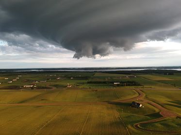 Wall cloud over Pelican Lake in northern Ottertail County, MN. Wall cloud over Pelican Lake in northern Ottertail County, MN. |
Photos & Video:
 |
 |
 |
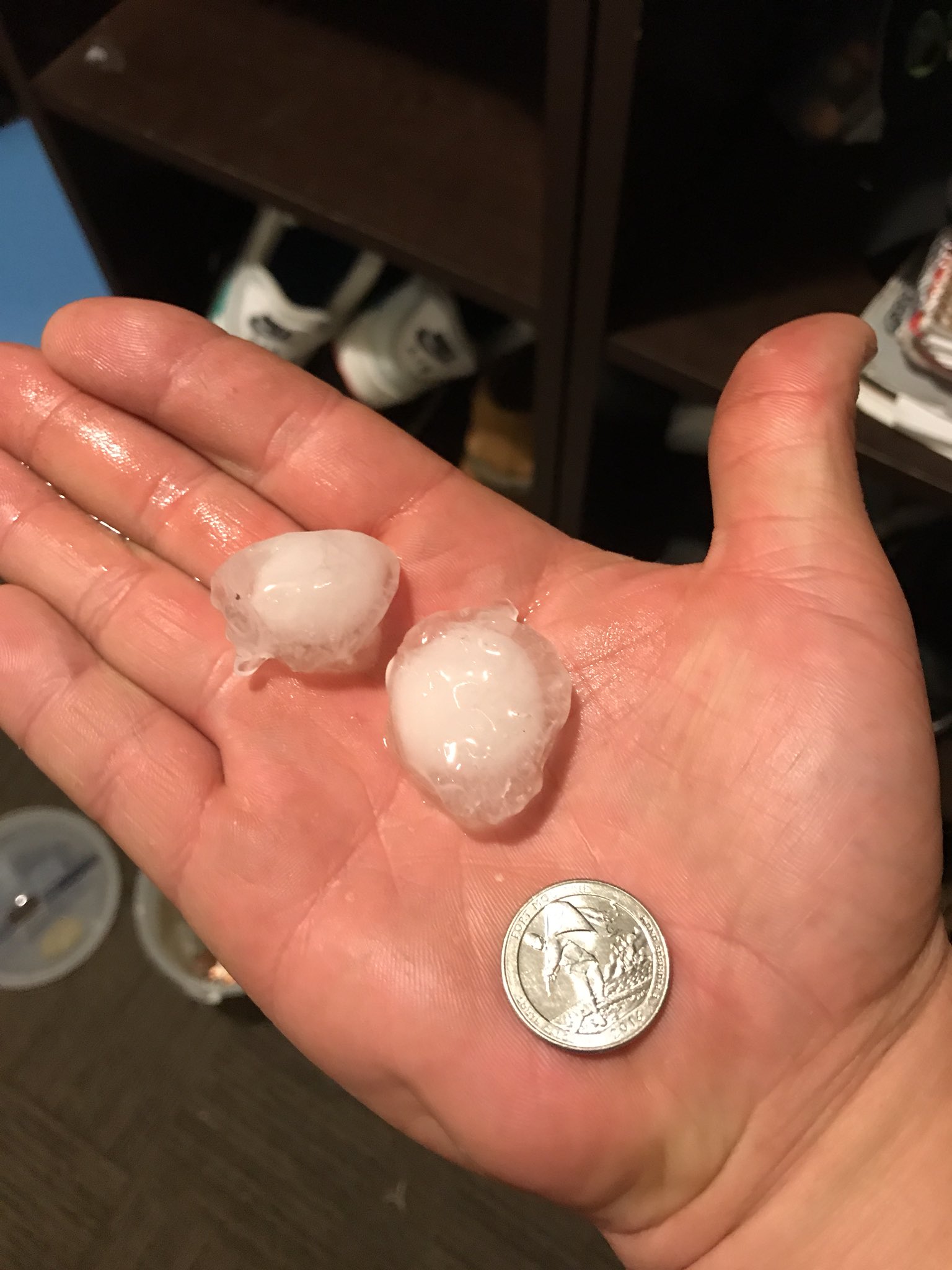 |
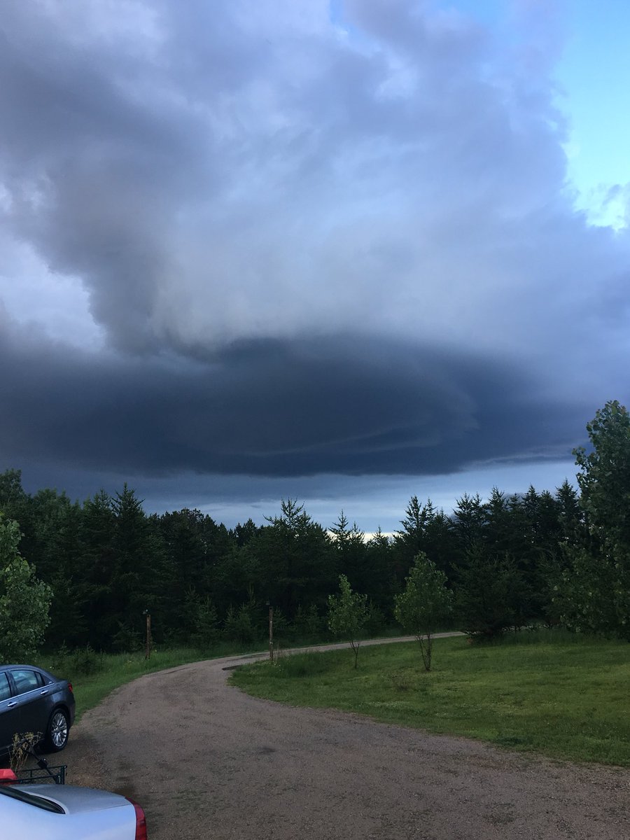
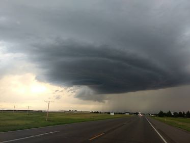
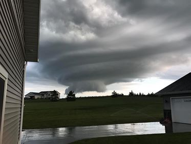
| Rear of wall cloud near Park Rapids (Hubbard County), MN, around 8 PM. Courtesy of Robert Adkins. | Another view of wall cloud north of Park Rapids (Hubbard County), MN, around 8:30 PM. Courtesy of David Bjorklund. | Wall cloud on a different cell near the border of Ottertail and Becker Counties, MN, between 8-9 PM. | Hail in Argusville (Cass County), ND, around 11 PM. Courtesy of Nate VanWechel |
Radar:
 |
 |
 |
|
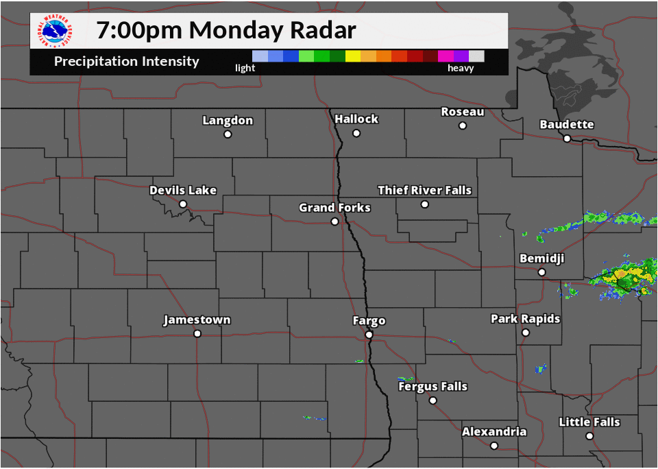
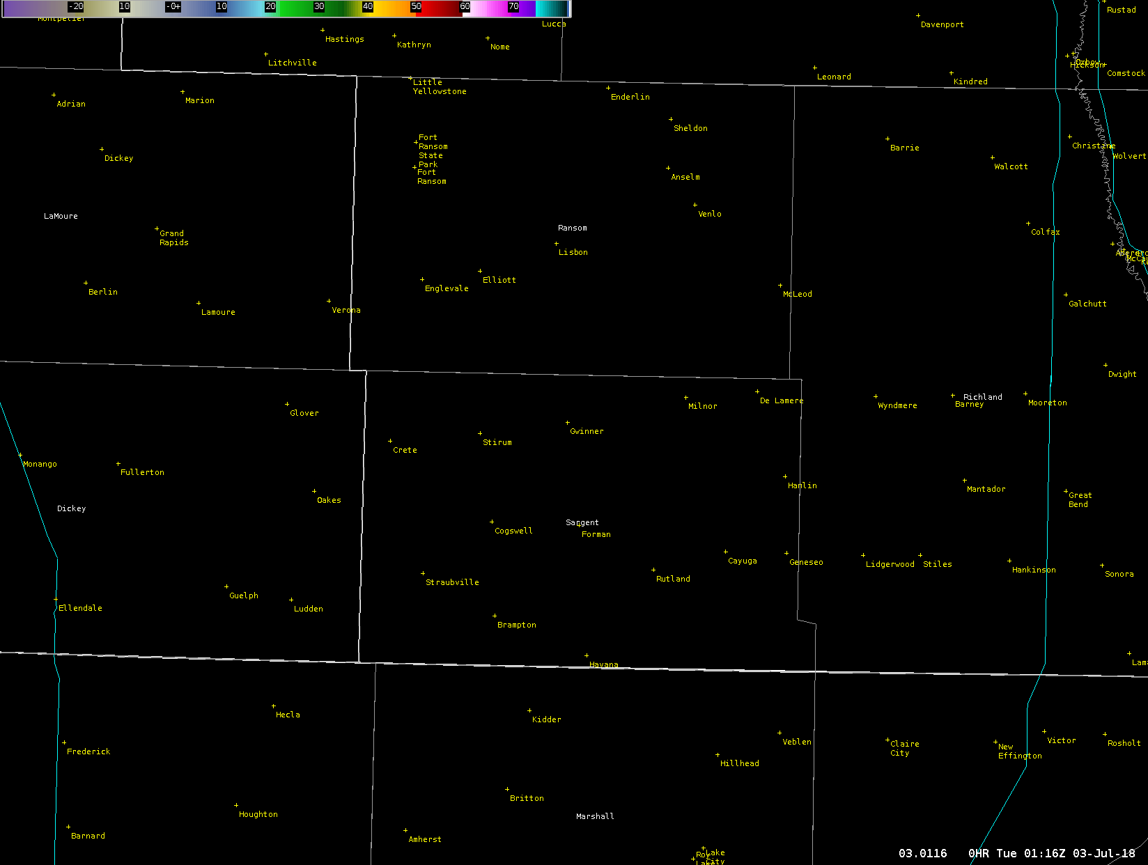
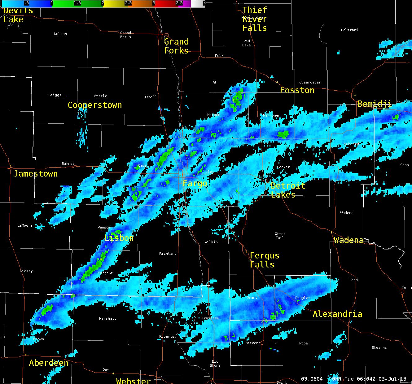
| Area radar between 7:00 PM - 1:00 AM. | Close up of left split supercell that produced baseball sized hail near Cogswell, ND. Loop between 7:15 - 8:30 PM. | Weak supercells responsible for the very structured wall clouds within west-central Minnesota. Loop between 7:30-11:00 PM | Radar based hail tracks over the southern Red River Valley into west-central and northwestern Minnesota. |
Storm Reports
PRELIMINARY LOCAL STORM REPORT...SUMMARY
NATIONAL WEATHER SERVICE EASTERN ND/GRAND FORKS ND
1235 PM CDT TUE JUL 3 2018

..TIME...   ...EVENT...      ...CITY LOCATION...     ...LAT.LON...
..DATE...   ....MAG....      ..COUNTY LOCATION..ST.. ...SOURCE....
            ..REMARKS..

0904 PM     FUNNEL CLOUD     1 SSE SHOREHAM          46.74N 95.89W
07/02/2018                   BECKER             MN   LAW ENFORCEMENT

            CALL FROM BECKER COUNTY SHERIFFS OFFICE RELAYING MULTIPLE
            FUNNEL CLOUD REPORTS NEAR LAKE MELISSA.

0905 PM     HAIL             COGSWELL                46.11N 97.78W
07/02/2018  E2.75 INCH       SARGENT            ND   BROADCAST MEDIA

            PUBLIC REPORTS RECEIVED VIA BROADCAST MEDIA OF 2.8 INCH

            DIAMETER HAIL IN COGSWELL. TIME ESTIMATED BASED ON RADAR.

0914 PM     HAIL             2 N COGSWELL            46.14N 97.78W
07/02/2018  E1.50 INCH       SARGENT            ND   PUBLIC

            LOTS OF QUARTER SIZED AND LARGER HAIL. SOME PING PING
            BALL SIZED.

0929 PM     HAIL             10 SSE LISBON           46.30N 97.60W
07/02/2018  E1.00 INCH       RANSOM             ND   PUBLIC

            VERY HEAVY RAINS AND A FEW LARGE HAIL.

0944 PM     HAIL             7 ESE LISBON            46.40N 97.55W
07/02/2018  E1.25 INCH       RANSOM             ND   PUBLIC

1004 PM     HAIL             7 ESE CHAFFEE           46.74N 97.22W
07/02/2018  E1.75 INCH       CASS               ND   TRAINED SPOTTER

1009 PM     HAIL             3 SW WEST FARGO         46.84N 96.94W
07/02/2018  E1.25 INCH       CASS               ND   BROADCAST MEDIA

            BROADCAST METEOROLOGIST OBSERVED A FEW HALF DOLLAR SIZED
            HAIL LASTING 2-3 MINUTES WITHIN ALONG WITH QUARTER SIZED
            HAIL.

1022 PM     HAIL             2 N GLYNDON             46.90N 96.58W
07/02/2018  E1.00 INCH       CLAY               MN   PUBLIC

            DIME TO QUARTER SIZED HAIL FELL FOR 3 TO 4 MINUTES.

1038 PM     HAIL             PROSPER                 46.96N 97.02W
07/02/2018  E1.50 INCH       CASS               ND   PUBLIC

1040 PM     HAIL             NW HARWOOD              46.98N 96.88W
07/02/2018  M1.00 INCH       CASS               ND   PUBLIC

            RELAYED BY BROADCAST MEDIA OF PUBLIC REPORT AS MEASURED
            BY COMPARISON TO A QUARTER.

1050 PM     HAIL             ARGUSVILLE              47.05N 96.94W
07/02/2018  M1.00 INCH       CASS               ND   PUBLIC

            PHOTO OF QUARTER SIZED HAIL IN ARGUSVILLE VIA SOCIAL
            MEDIA.

1050 PM     HAIL             ARGUSVILLE              47.05N 96.94W
07/02/2018  E1.75 INCH       CASS               ND   PUBLIC

            RELAYED FROM BROADCAST MEDIA.

1104 PM     HAIL             6 W BORUP               47.18N 96.63W
07/02/2018  E1.25 INCH       NORMAN             MN   PUBLIC

1108 PM     HAIL             16 E WAUBUN             47.18N 95.60W
07/02/2018  E1.00 INCH       MAHNOMEN           MN   PUBLIC

            PUBLIC REPORT OF HAIL BETWEEN HALF AN INCH TO AN INCH.

1150 PM     HAIL             3 WNW RANUM             47.47N 96.19W
07/02/2018  E1.00 INCH       NORMAN             MN   PUBLIC

            INTERMITTENT DIME TO QUARTER SIZED HAIL.
Environment
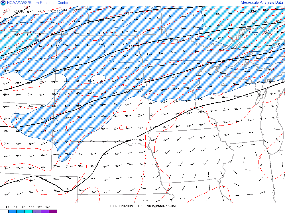
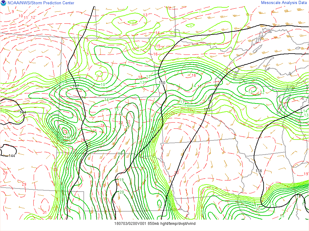
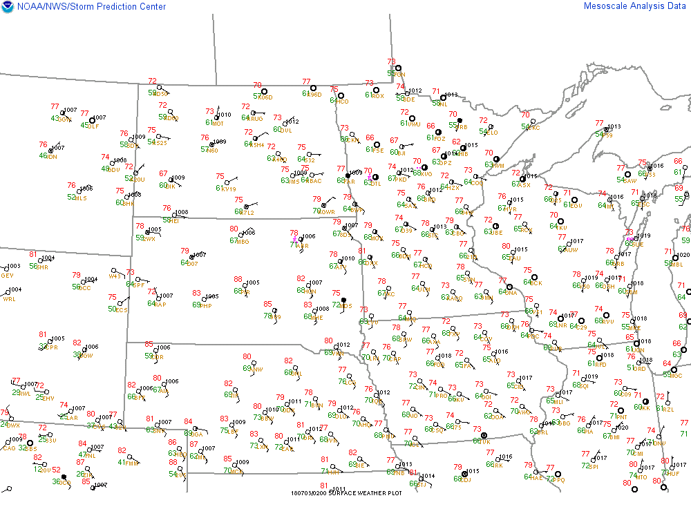
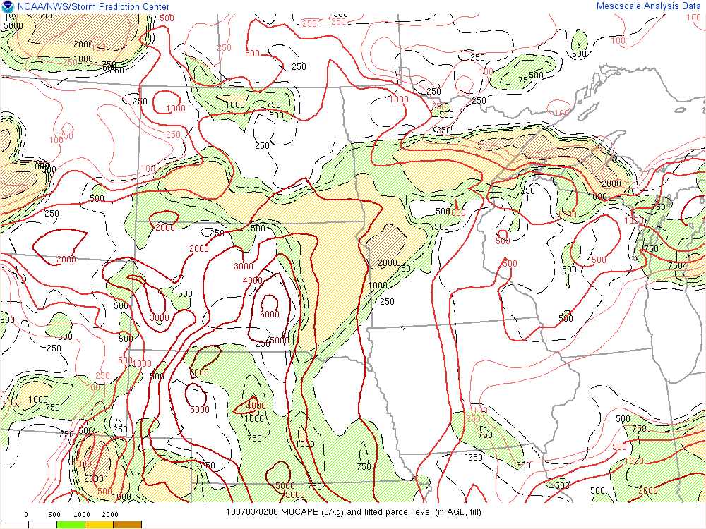
All images from SPC Mesoanalysis page are valid between 8-9 PM CDT July 2, 2018. Strong west-southwesterly winds aloft overspread the region with a mid level shortwave trough moving over the Northern High Plains. In the lower levels, strong southerly winds over eastern South Dakota pushed warmth and moisture into South Dakota and western Minnesota. At the surface, a low pressure was developing in northern Wyoming and South Dakota with a warm front extending eastward near the Dakotas' border into central Minnesota. The warm front can be seen within the surface wind field near the Tri-State area where southerly flow quickly turns easterly.
 |
 |
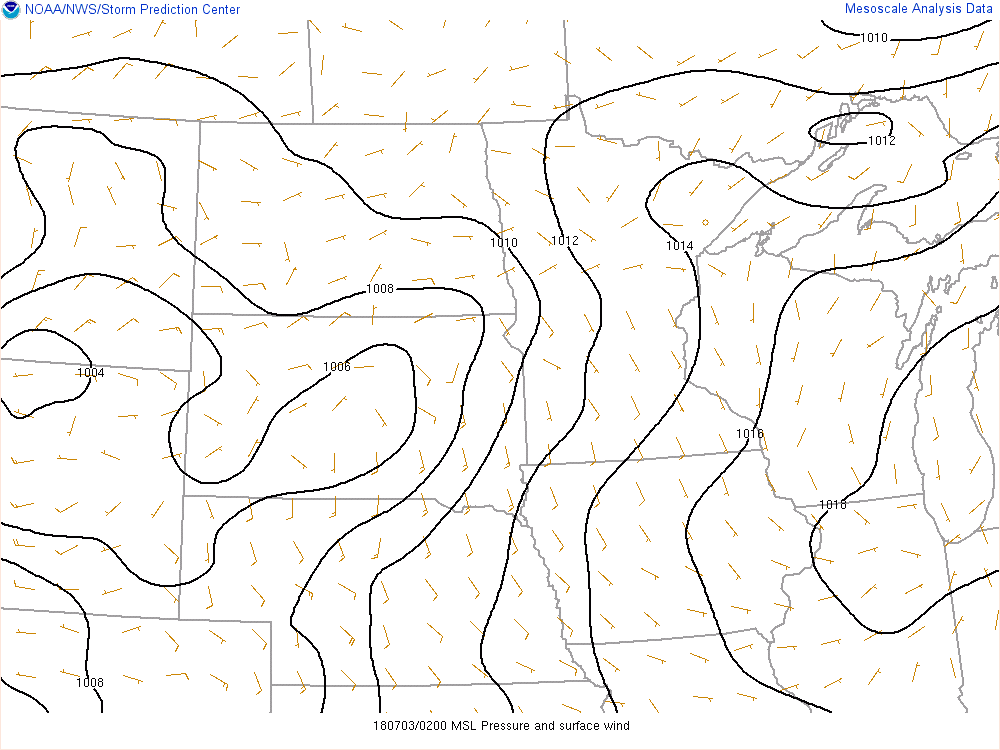 |
| 500 mb Height, Wind, Temp | 850 mb Height, Wind, Temp, Dew Point | Mean Sea Level Pressure, Surface Wind |
 |
 |
 |
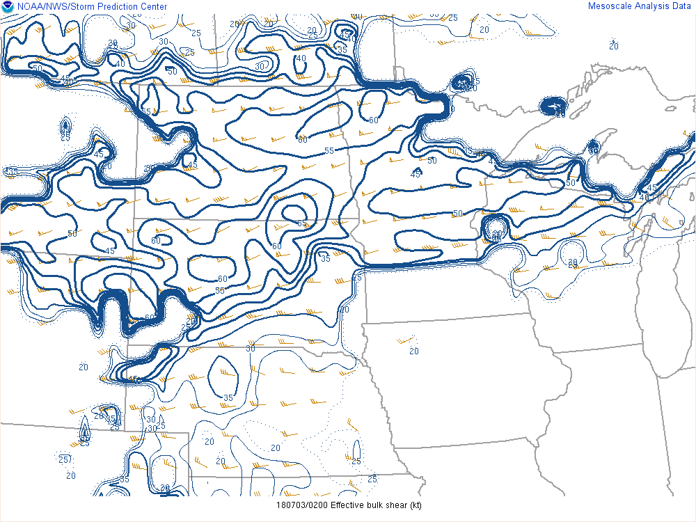 |
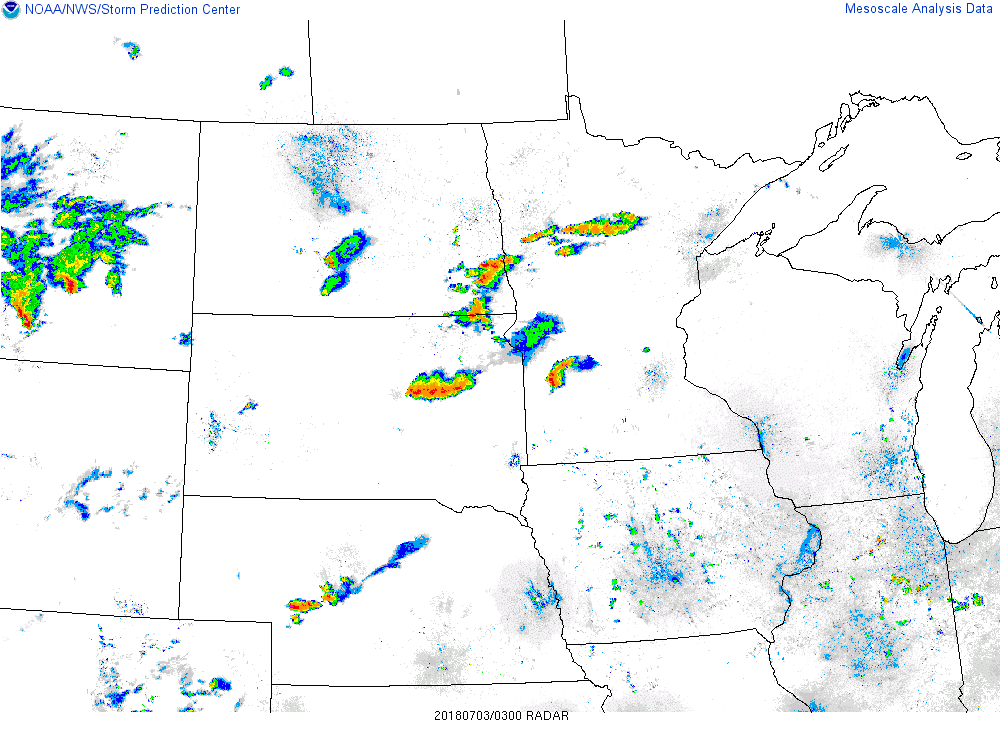
| Regional Radar | Surface Observations | Most Unstable CAPE, Lifted Parcel Level | Effective Bulk Shear |
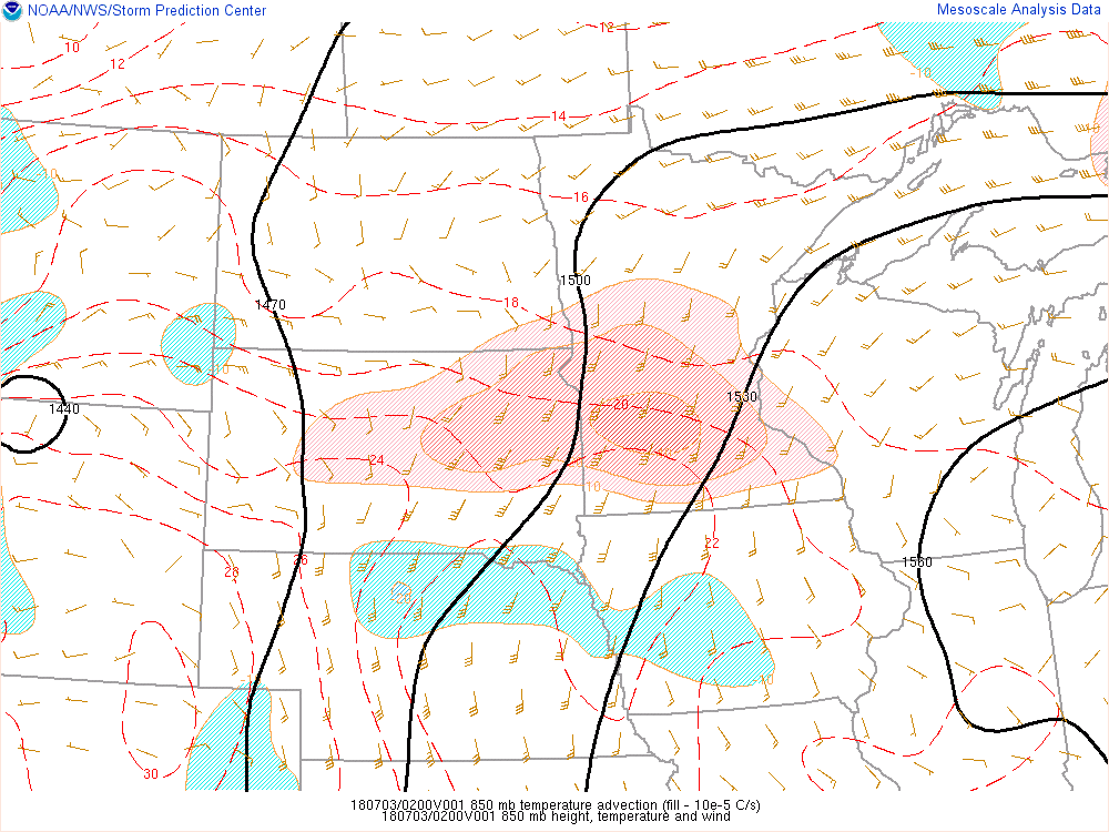
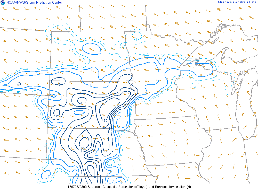
Strong warm air advection fed convection along the warm front on the nose of the lower level jet over eastern South Dakota/western Minnesota. Giving confidence to the development of supercells were the high values of the supercell composite parameter. Hail parameter spacing was as equally impressive with southeastern North Dakota locally highlighted. With a left split supercell moving within this environment, significantly large hail was realized.
 |
 |
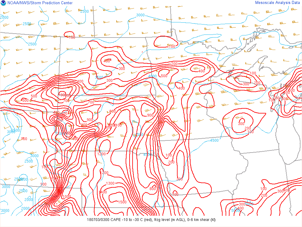 |
| 850 mb Temp Advection, Height, Temp, Wind | Supercell Composite Parameter, Storm Motion | Hail Parameters |
 |
Media use of NWS Web News Stories is encouraged! Please acknowledge the NWS as the source of any news information accessed from this site. |
|

