Grand Forks, ND
Weather Forecast Office
Overview
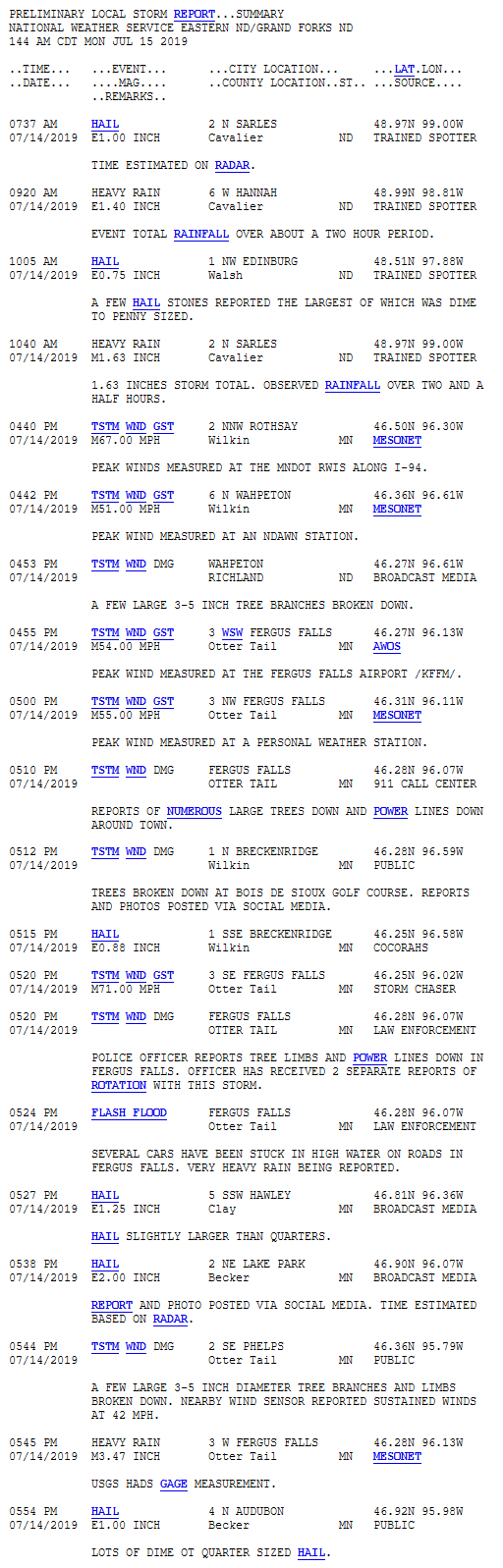
East-southeast moving storms tracked across southwest Manitoba early Sunday morning (July 14th). Just after sunrise, these storms moved into the Hansboro to Sarles (ND) area. By mid-morning, these storms had shifted into Walsh County (ND), before weakening again. Then there was a break of a few hours before storms flared up again across southeast North Dakota and west central Minnesota just after 3 pm. These storms were slow movers, but finally exited the area by 7 pm.Storm Reports
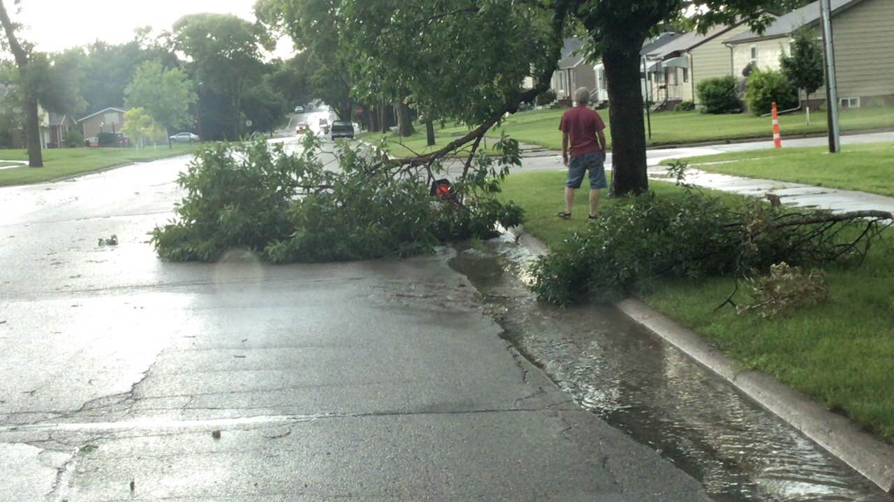
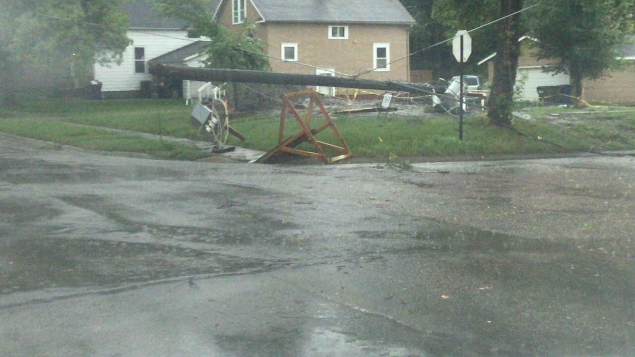
Photos & Video
_343pm.jpg) |
 |
 |
 |
| Near Park Rapids, MN (Amber Doll) |
Near Wahpeton, ND (Ashley Lynn) |
Fergus Falls, MN (Eric Whitehill) |
Fergus Falls (Eric Whitehill) |
Radar
Radar loop from 7:00 a.m. to 1:00 p.m.
Radar loop from 1:00 p.m. to 7:00 p.m.
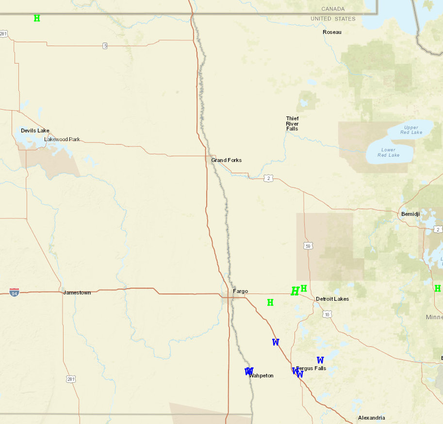
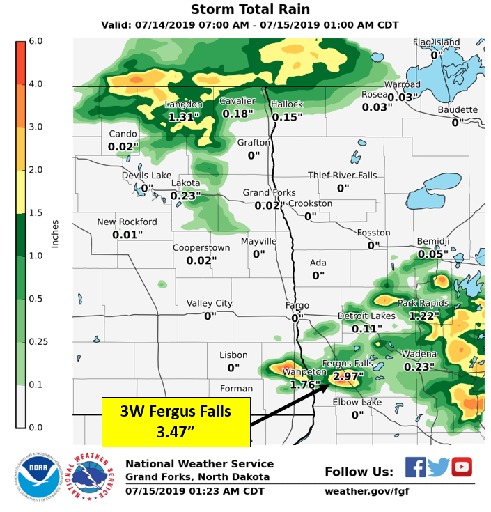
Rain Reports
These reports/map may not match all areas exactly, but they do give a good idea of where the rain fell on Sunday.
Additional Information
 |
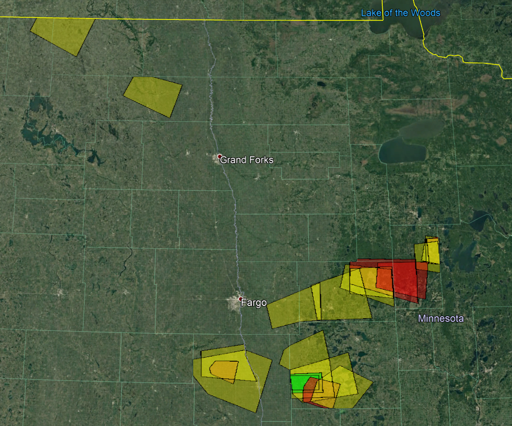 |
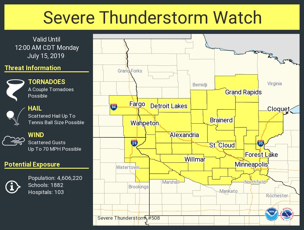
| SPC Watch | NWS Grand Forks Warnings |
 |
Media use of NWS Web News Stories is encouraged! Please acknowledge the NWS as the source of any news information accessed from this site. |
|
US Dept of Commerce
National Oceanic and Atmospheric Administration
National Weather Service
Grand Forks, ND
4797 Technology Circle
Grand Forks, ND 58203-0600
701-772-0720
Comments? Questions? Please Contact Us.

