Overview
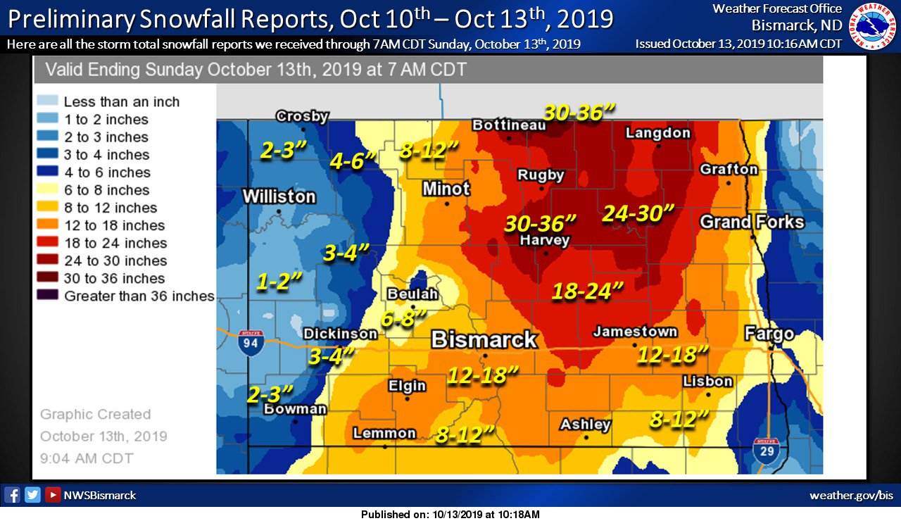
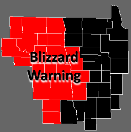
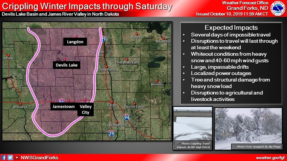
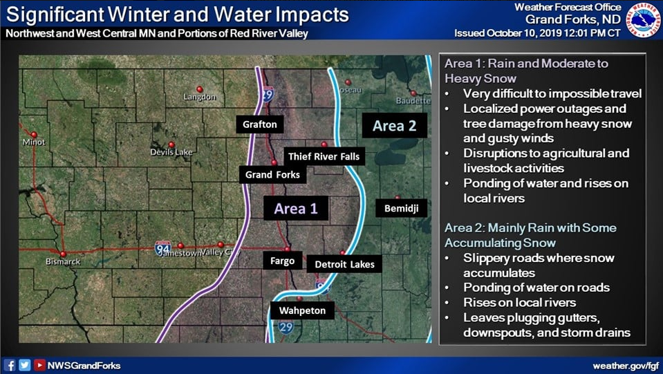
A crippling blizzard impacted central and eastern North Dakota and the Red River Valley from Thursday October 10th to Saturday October 12th, 2019. The storm began with rain and drizzle, and this gradually transitioned to snow. Snow persisted for the longest over the Devils Lake basin, James River Valley, and portions of northeast North Dakota, where snowfall totals of up to 3 feet and drifts up to 5 feet were observed. Further east in the Red River Valley and northwest and west central Minnesota, a longer period of rain and wintry mix occurred with a slower transition to snowfall.
Additional details will be added to this page as they become available
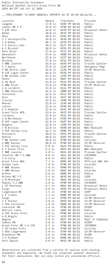
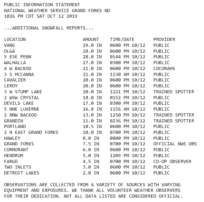
Snow Reports
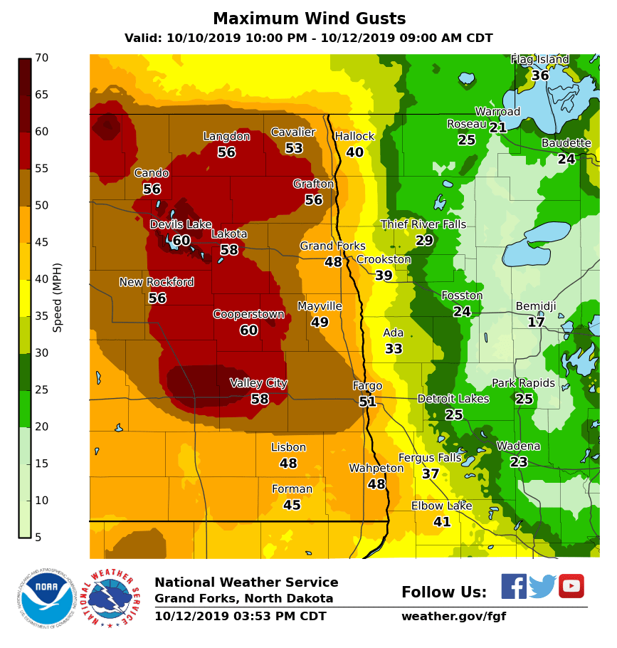
Wind Reports

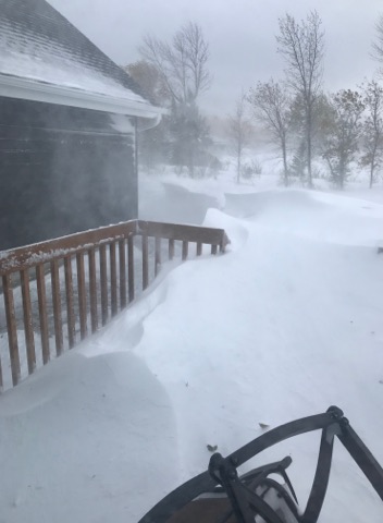
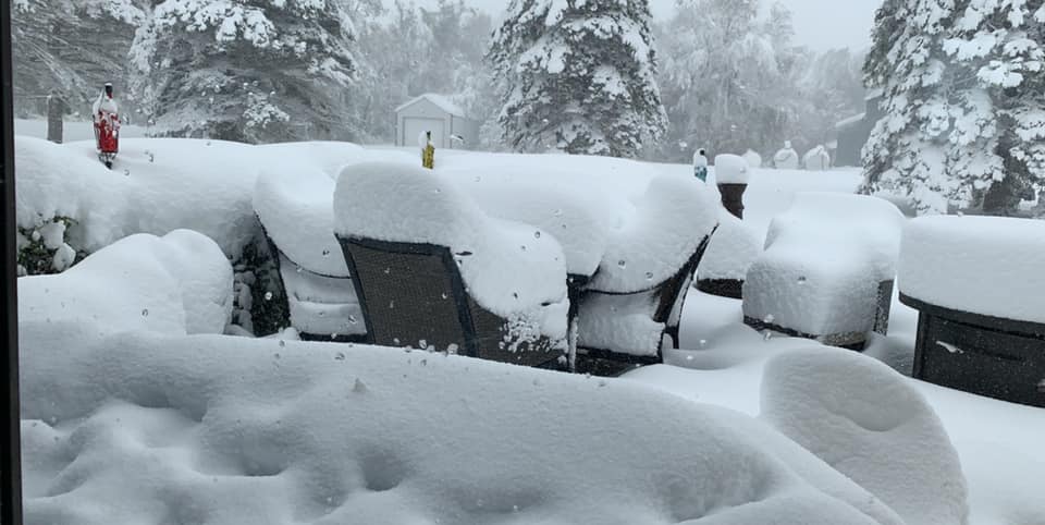
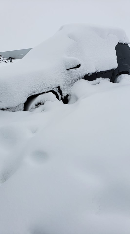
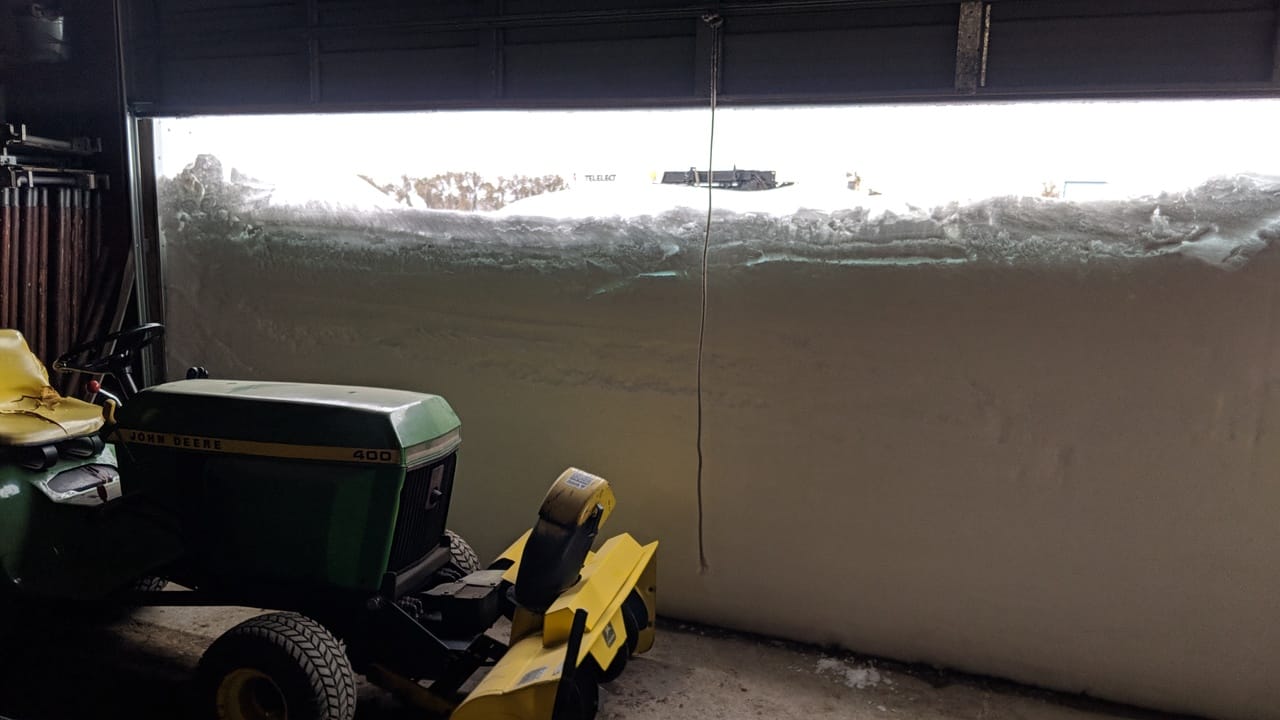
Photos
These photos from across the region show some impacts from this widespread winter storm.
 |
 |
 |
 |
| Large snow drifts near Devils Lake, ND (Marla Luehring) |
Large snow drifts near Devils Lake, ND (Marla Luehring) |
Snow Removal near Lakota, ND (Heather Dahl) |
Car submerged in a water-filled ditch after sliding off of the slick roads (ND Highway Patrol) |
 |
.jpeg) |
 |
 |
| Heavy Snow in Petersburg, ND (Ashley Yoney) |
Snow measurement near Devils Lake (Jeff Frith) |
Car buried near Langdon, ND (Kristin Beaucham) |
Heavy snow near Langdon, ND (Cory Hoffarth) |
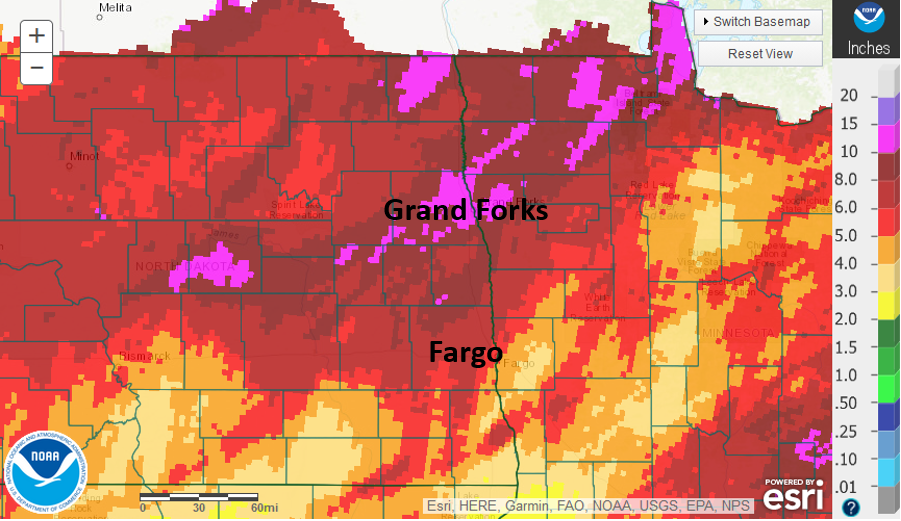
Radar
Rain Reports
Fall 2019 will go down as the wettest fall period (Sept, Oct, Nov) on record (as of Oct 13, 2019). Between October 5-12, the region has received widespread precipitation amounts between 1-3 inches.
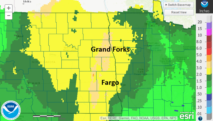
Over the past month, locations have received anywhere from 5 to 15 inches of precipitation!
This has been highly detrimental to area farmers as this heavy precipitation has come in the middle of the harvest season.
Environment
Wednesday October 9th:
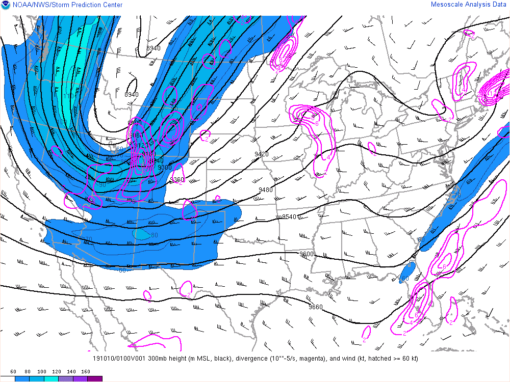
Through the day on October 9th meteorologist across the country were monitoring an upper level wave as it moved southeastward into the northwest United States (Figures 1 and 2). Ahead of this wave was was a pocket of unseasonably cold low-level air (Figures 4 and 5). As the upper level wave move over the Rocky mountains, west-to-east winds induced lee cyclogenesis over the Denver, CO region. Falling surface and low level pressure in Colorado induced northerly winds across the northern Plains that helped drag the cold low level air southward along the lee of the Rocky mountains.
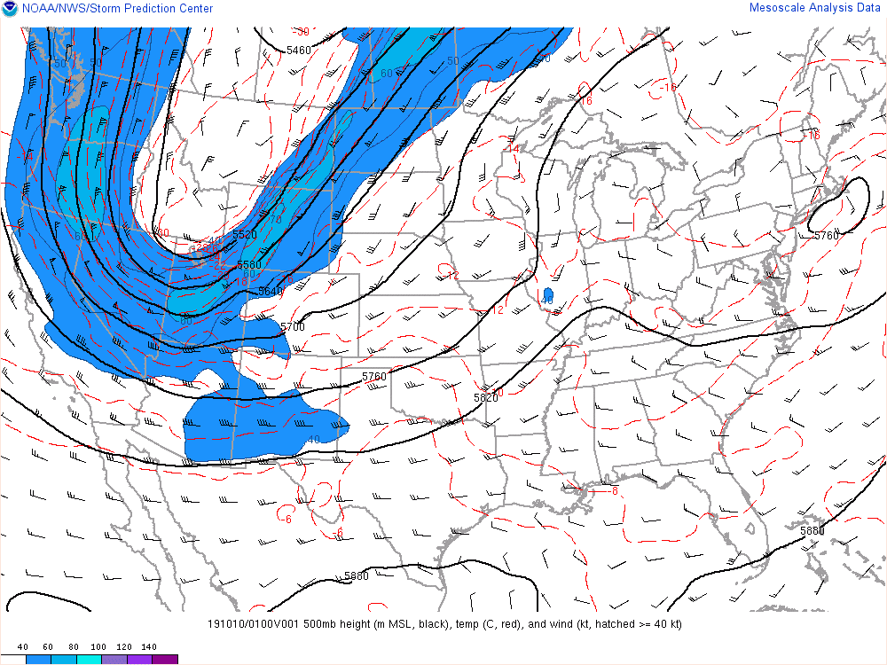
Locally, this colder air moved southeastward through North Dakota behind a notable cold front. Although there was little precipitation as the cold front passed through, many locations reported thick cloud cover and fog as warmer air was lifted over the shallow layer of colder air pushed through. By Wednesday night, the cold front had stalled out from southeast North Dakota into north central Minnesota (this can be see early in the loop in Figure 6).
Thursday, October 10th:
Although the cold front stalled out across the Red River Valley region, cold air continued to advect southward through the day Thursday. The southward movement of the cold air tightened the low level temperature gradient across the south central U.S. (as seen in Figures 4 and 5), which induced a thermal wind response and upper level height falls over the Great Plains. This enabled the wave to strengthen during the day Thursday and into Friday (in other words, the wind speeds in the wave increased and the pressure of the wave lowered).
While this was occurring over the south/central U.S., the stalled cold front remained entrenched along the Red River Valley. Winds advecting low level warm air from Minnesota over the colder air in North Dakota brought precipitation across the region. Snow began to fall during the morning hours for central and eastern North Dakota where surface temperatures were at or just below freezing. However, slightly warmer surface air in the Red River Valley and into Minnesota allowed mostly rain and sleet for much of the day.
Two rounds of heavier snow and rain were noted on Thursday. The first came during the morning hours as a weak shortwave trough (noted in morning water vapor imagery) embedded in the southwesterly flow in the upper portion of the atmosphere increased wind winds over the frontal boundary. This increased the amount of lift over the region, which enabled heavier precipitation over the entire region. The second round came later in the afternoon hours as a second wave once again increased lift over the frontal boundary. (Note: this frontal boundary can be seen very well as a tight temperature gradient in Figure 4).
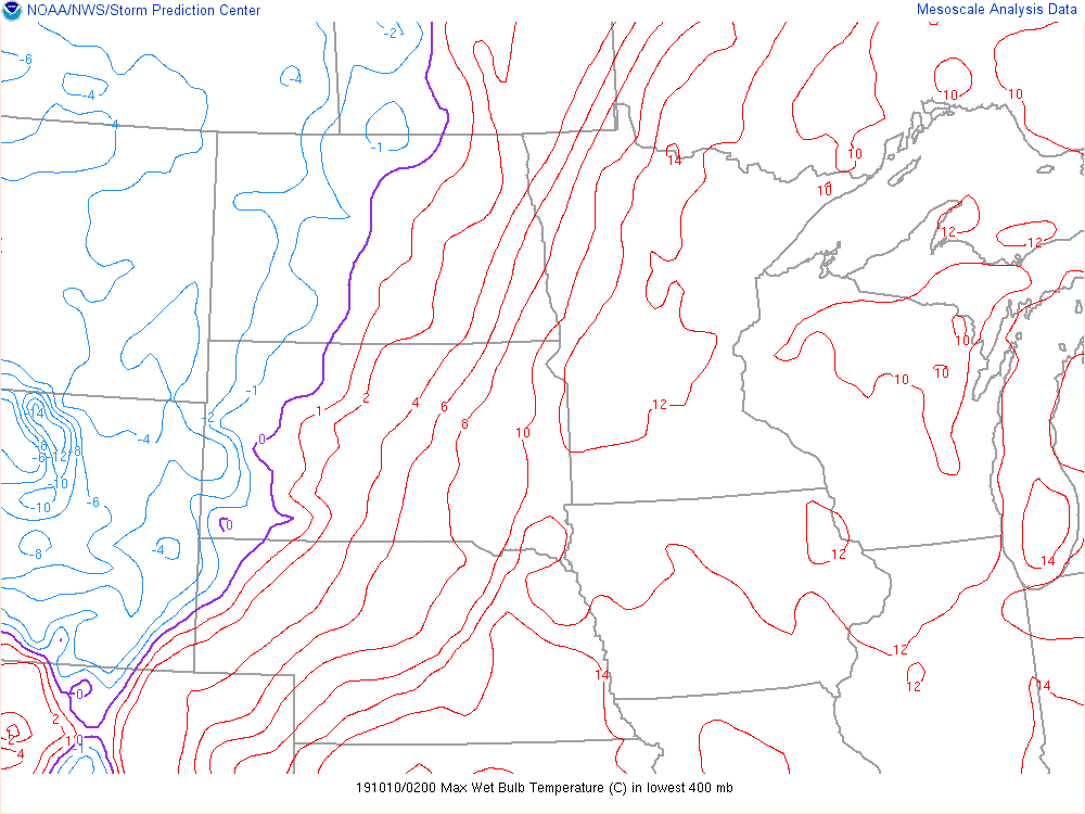
By sunset, the surface freezing line began to move eastward into the Red River Valley (Figure 9). Sleet was reported across the Red River Valley before precipitation changed to all snow.
Friday, October 11th:
As the upper level wave strengthened over the central U.S., divergence aloft increased, resulting in greater surface pressure falls at the surface just ahead of the wave. This, in turn, allowed for the surface trough across the central Plains to strengthen and consolidate over Minnesota by the morning hours on Friday. As this occurred, continued cold air advection to the southwest across the central and high Plains induced surface pressure rises. With pressure increasing over the central and high plains and pressure falling over central and northern Minnesota, the increasing pressure gradient pushed wind speeds well above blizzard criteria range (sustained for frequently gusting to 35 mph) across the eastern two thirds of North Dakota.
As winds increased, the snow did not let up. The cyclone over Minnesota wrapped warm, moist air from the middle portion of the atmosphere from the Mississippi river valley region north and westward around the center of the low. The advection of this mid-level warm air brought widespread snowfall across north central and northeast North Dakota through the day Friday and into Saturday morning. This combination of persistent moderate to heavy snowfall and strong winds brought widespread blizzard conditions to central and eastern North Dakota.
Saturday, October 12th:
By Saturday morning, the surface low had become occluded and was becoming vertically stacked with the upper level wave (i.e. the center of the upper level low and the surface low are in the same place - when this occurs, both the upper level and surface low begin to weaken due to a lack of vorticity and temperature advection). Although blizzard conditions continued in open country across parts of North Dakota early Saturday morning, the gradual weakening of the surface low in Minnesota lead to a reduction of the surface pressure gradient and weakening wind speeds through the day. As this occurred, mid level warm air advection began to diminish due to the overall weakening of the wave - leading to a reduction in snowfall rates across the region. By the early afternoon hours winds had fallen well below blizzard criteria with only scattered light snow being reported across the region. The blizzard was finally over!
Additional Notes:
One reason this particular storm was so impactful was because of the time of year. By early to mid October trees across the region have begun to change into their fall colors, but have not yet dropped all of their leaves. These leaves acted as snow catchers and greatly increase the amount of snow being caught by trees. Additionally, the combination of a (relatively) warm temperature profile and high precipitable water (Figure 7) values allowed for heavy, wet snow. These factors coupled with the strong winds brought down numerous trees and tree branches across North Dakota and the Red River Valley.
 |
 |
 |
|
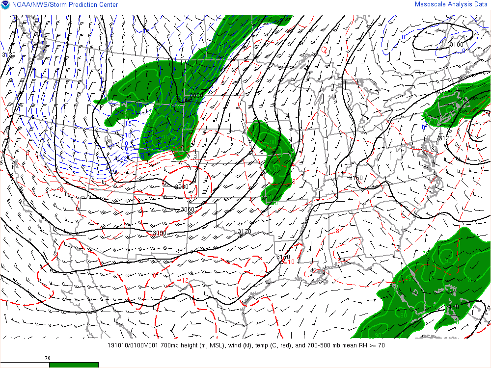
Figure 1: 300 mb analysis |
Figure 2: 500 mb analysis |
Figure 3: 700 mb analysis |
 |
 |
 |
|
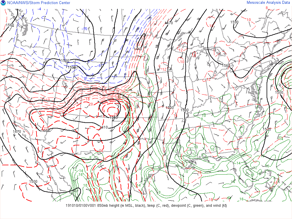
Figure 4: 850 mb analysis |
Figure 5: 925 mb analysis |
Figure 6: Surface analysis |
 |
 |
 |
|
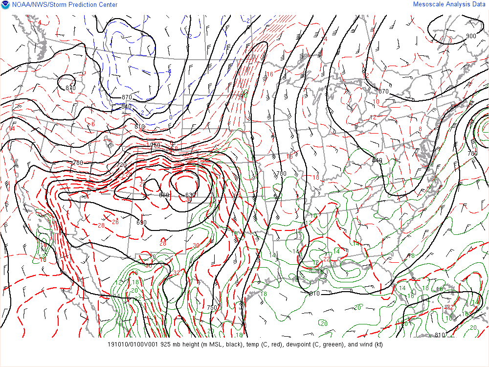
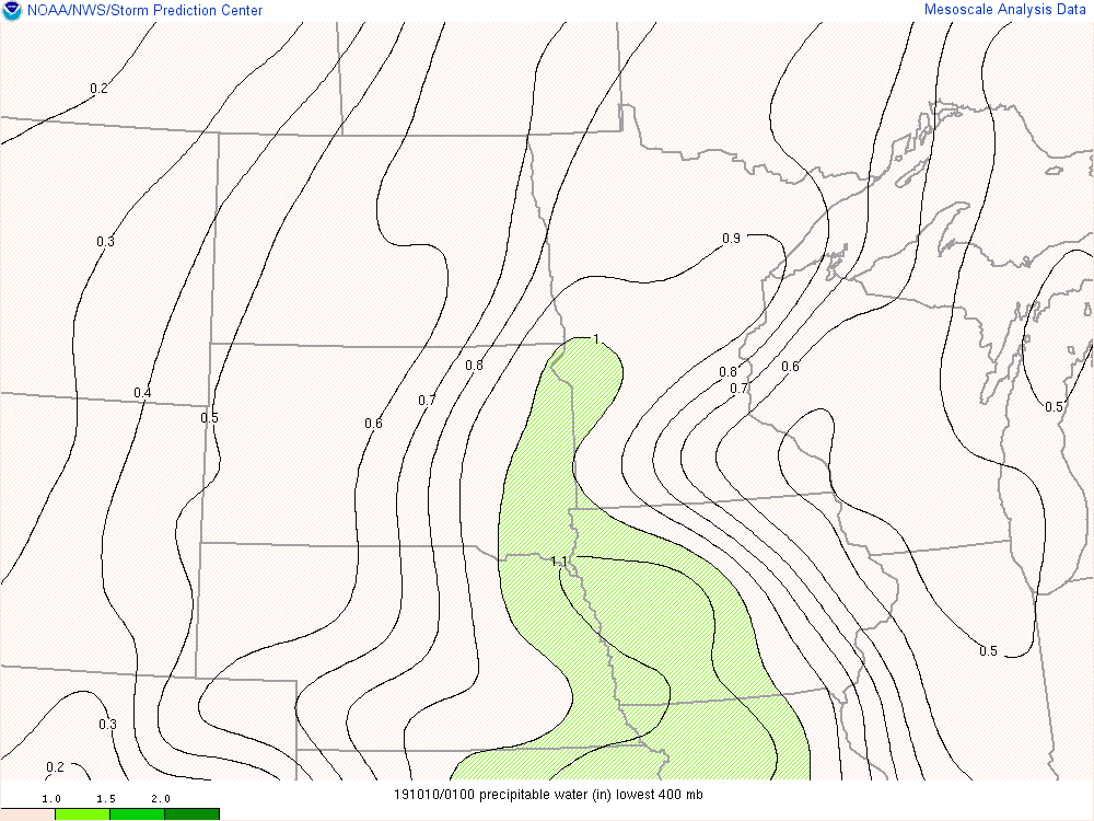
Figure 7: Precipitable Water analysis |
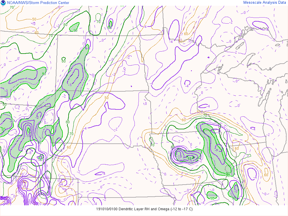
Figure 8: Dendritic Growth Zone RH and Omega (lift) analysis |
Figure 9: Layer Maximum Wet Bulb Temperature analysis |
 |
 |
 |
|
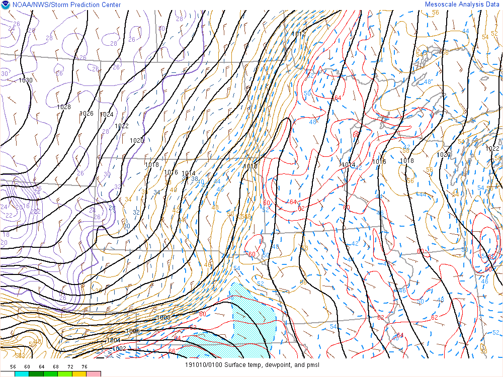
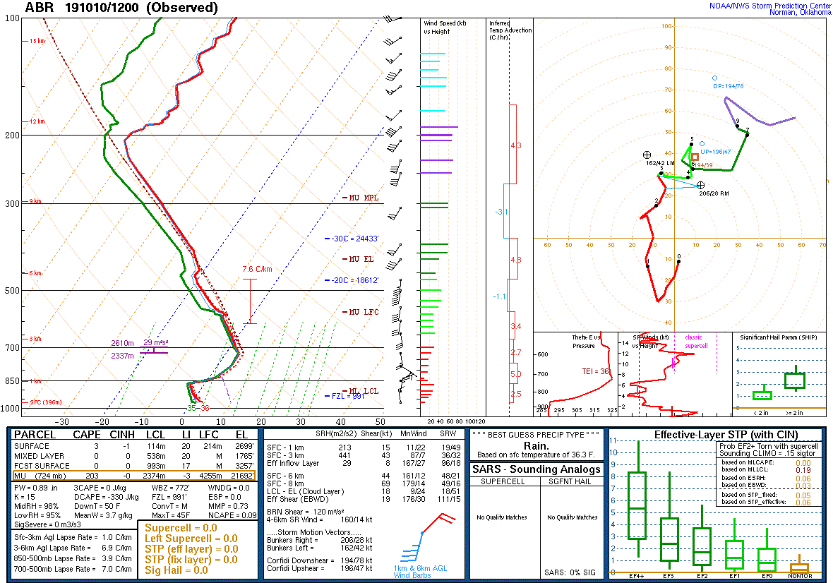
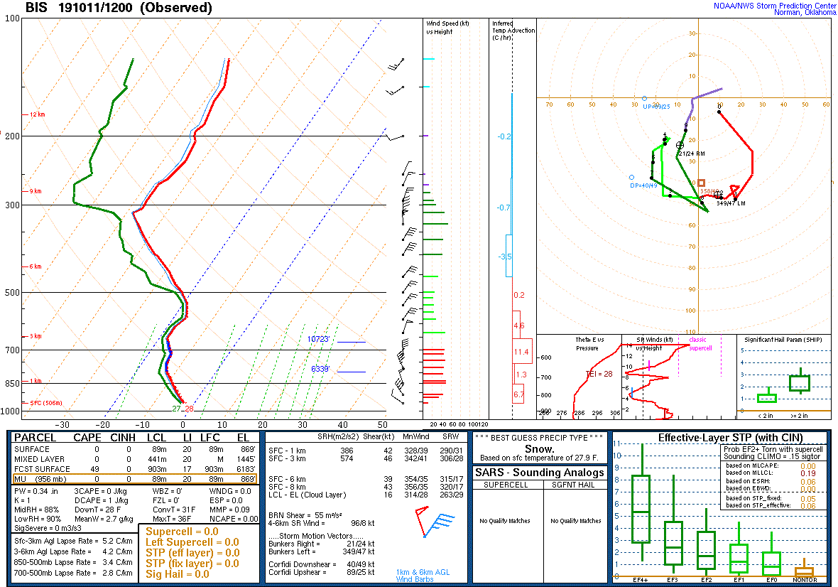
Figure 10: Observed Sounding from Aberdeen, SD on 10/10/19 12 UTC Note the warm layer above the surface - this warm nose lead to a variety of precip types during the day Thursday. |
Figure 11: Observed Sounding from Bismarck, ND on 10/11/19 12 UTC Note the strong warm air advection within the dendritic growth zone near 700 mb. This was responsible for some of the heavy snow rates. |
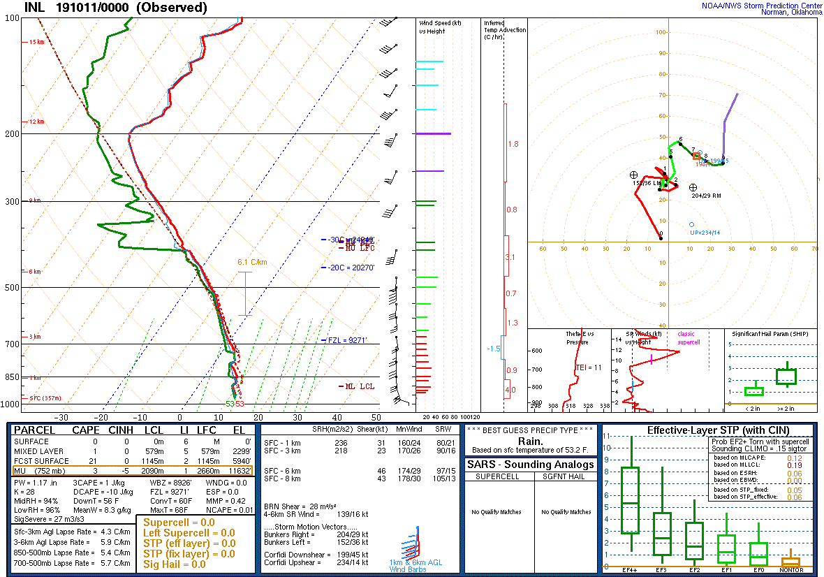
Figure 12: Observed Sounding from International Falls, MN on 10/11/19 00 UTC Note the warm low level temperatures as compared to the other soundings. MN remained on the warm side of the front for most of the storm, allowing for mostly rain. |
Additional Information
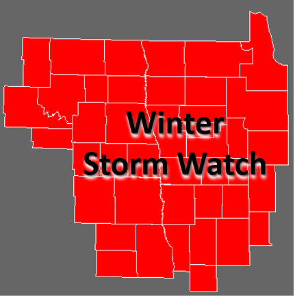
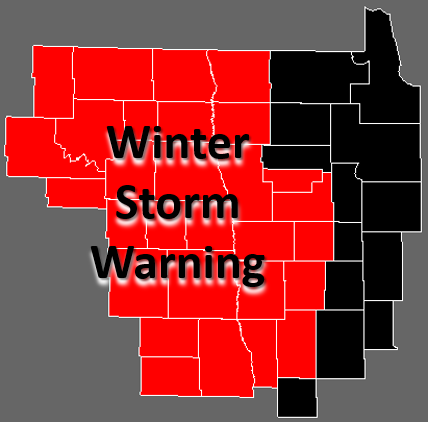
Watches and Warnings
 |
 |
 |
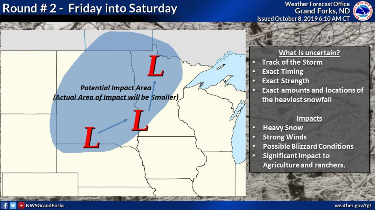
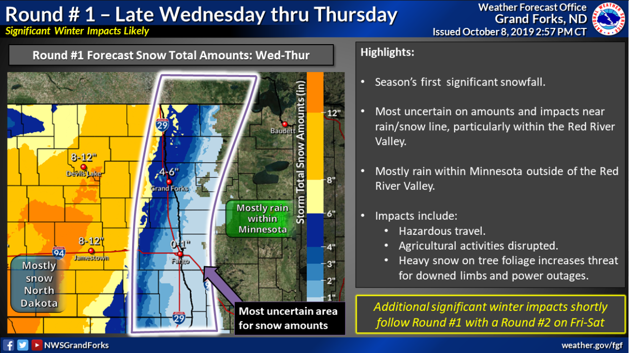
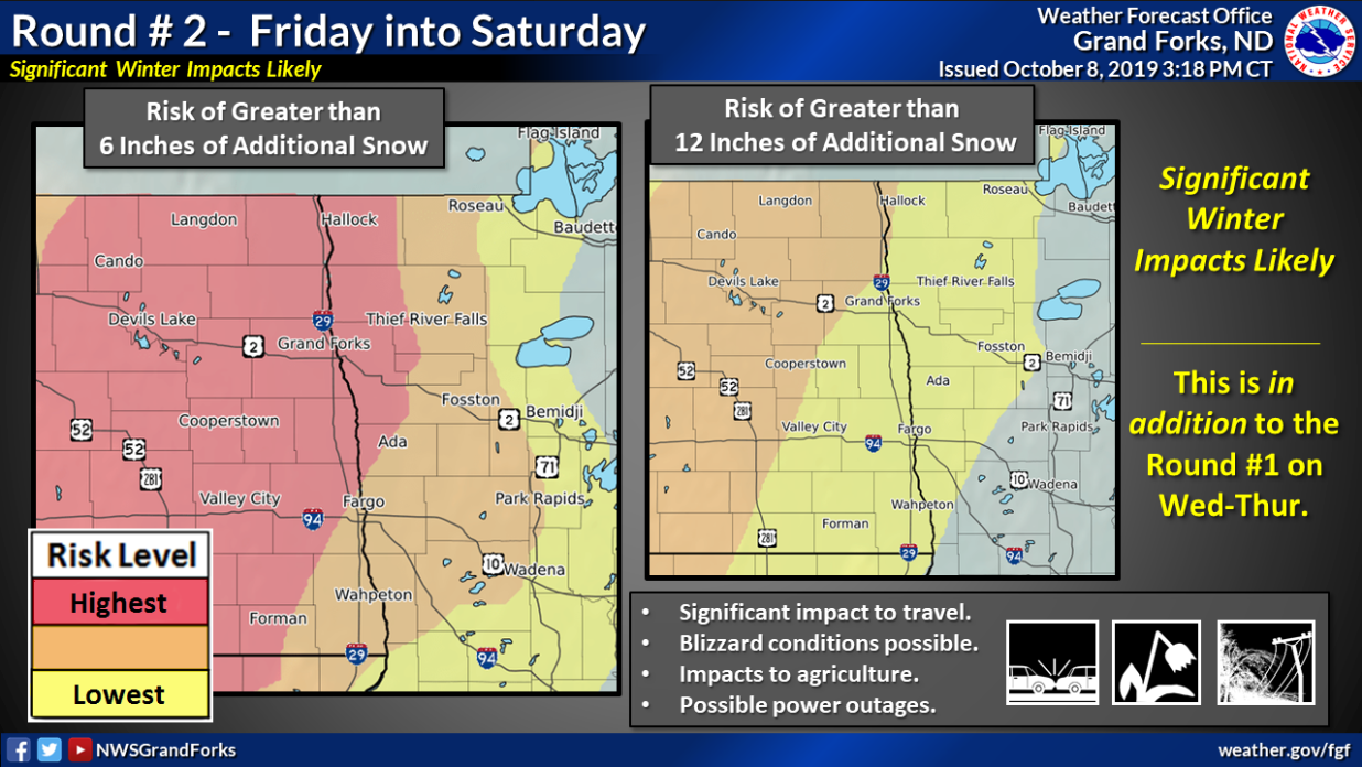
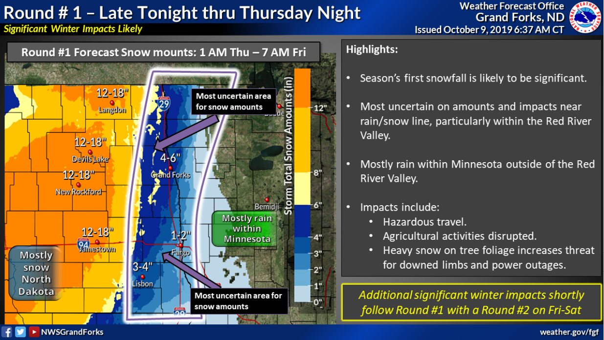
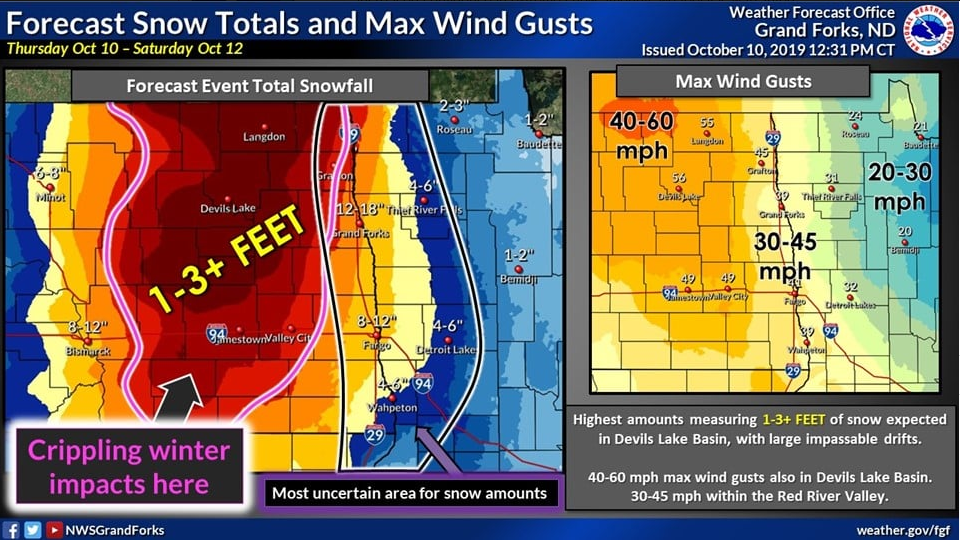
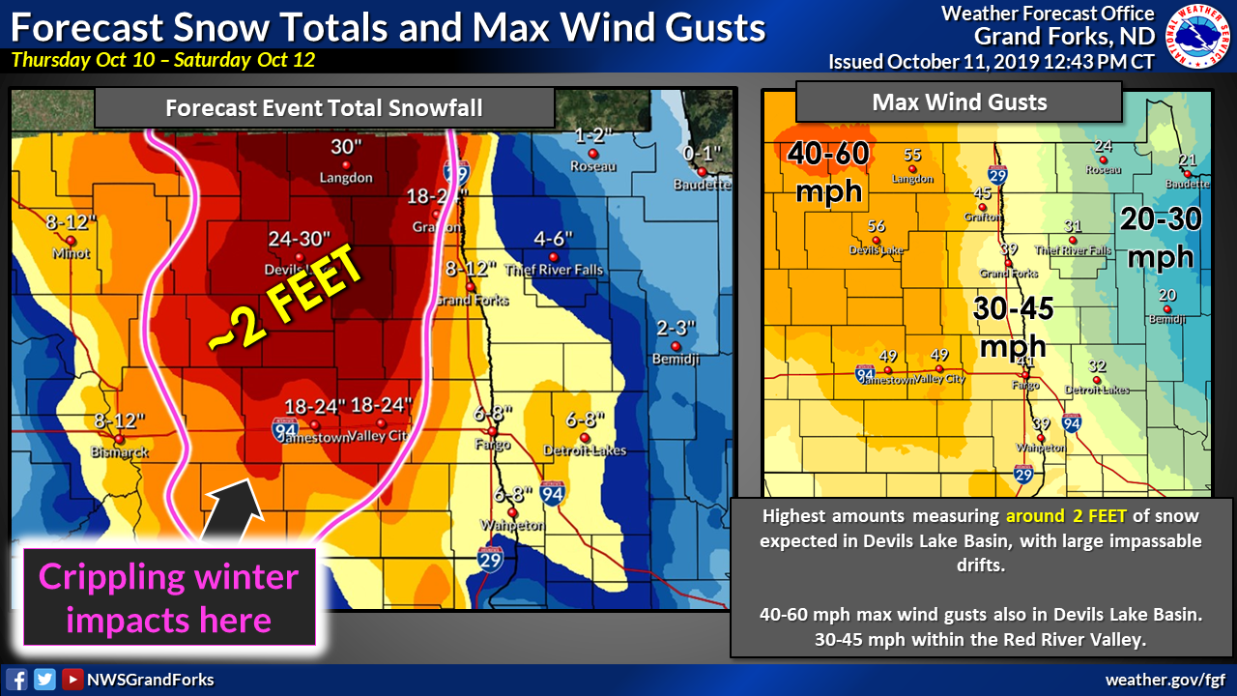
Forecast Graphics
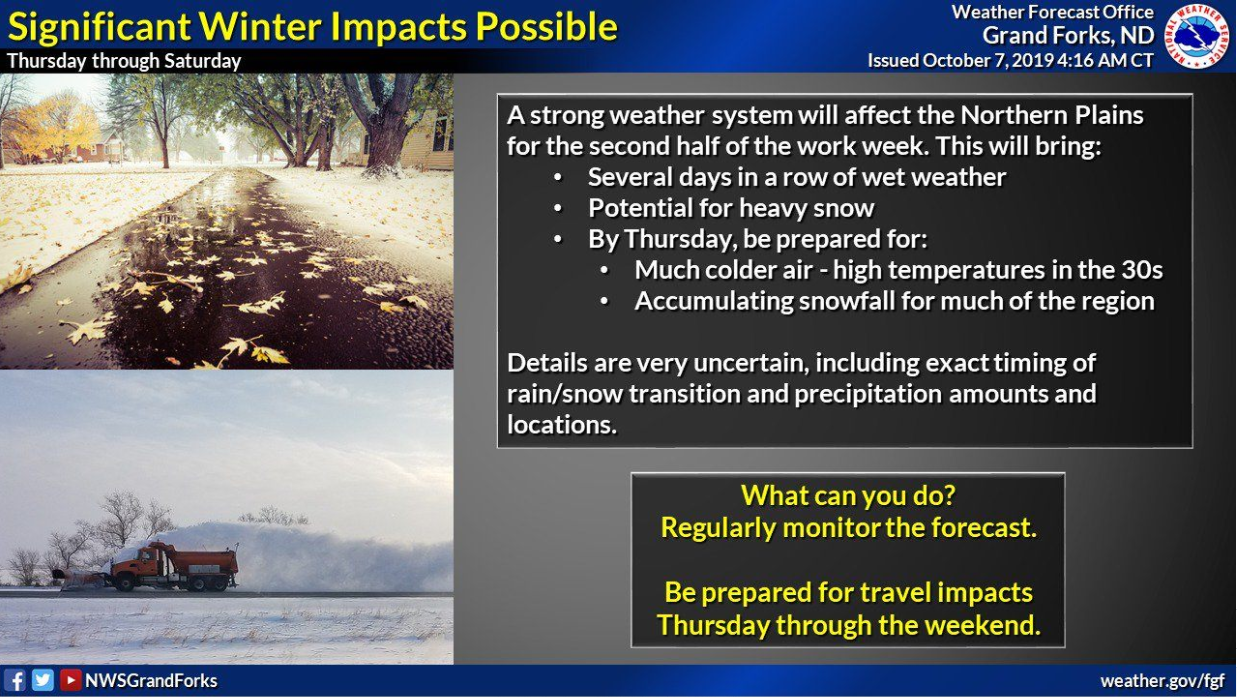
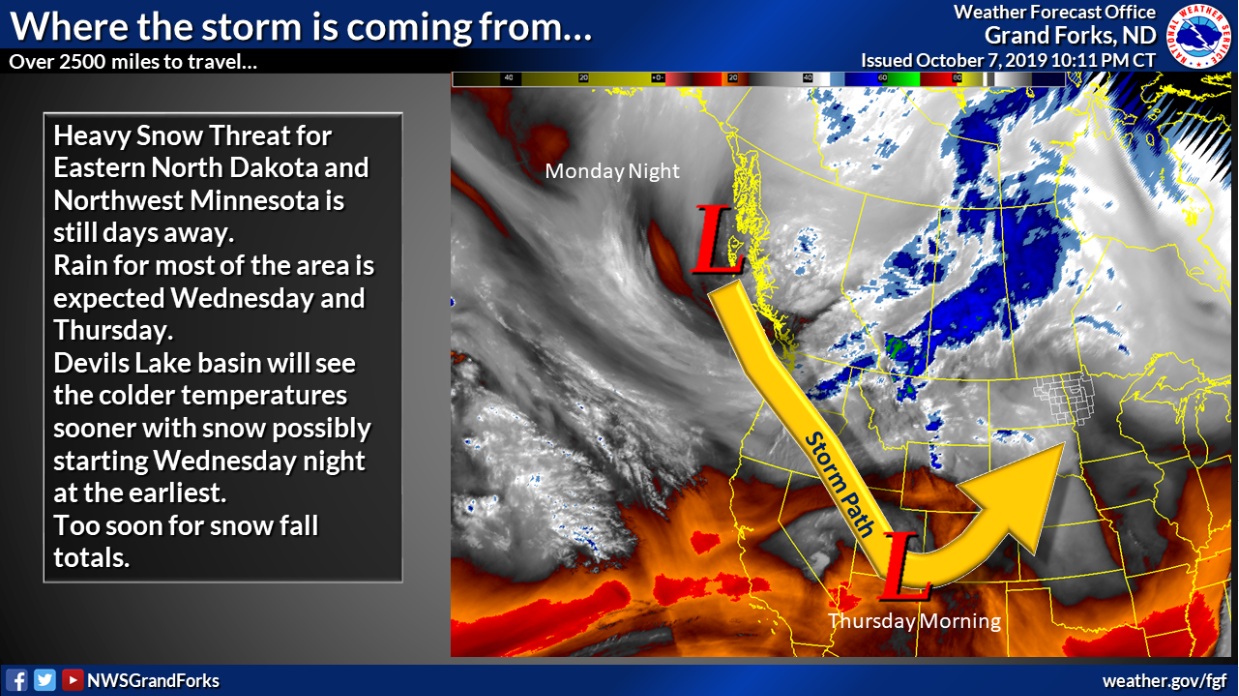
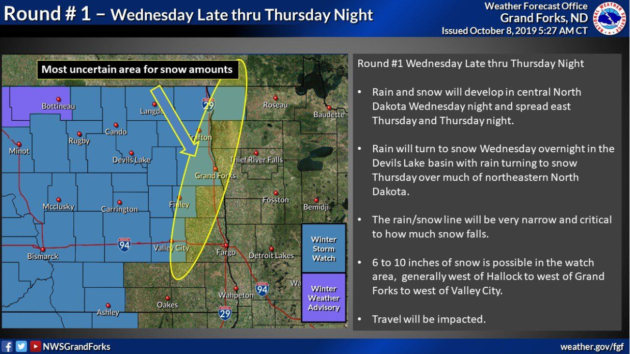
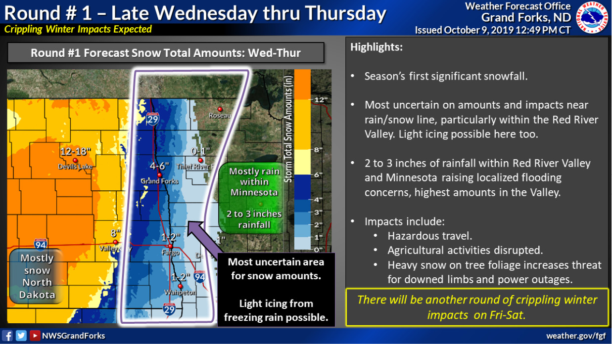
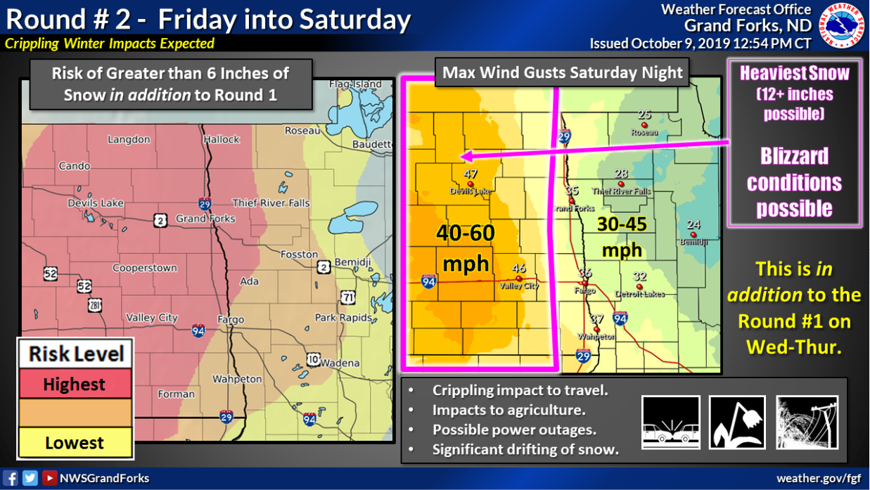
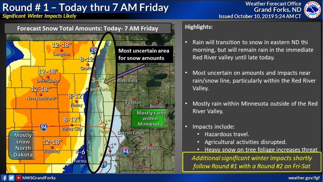
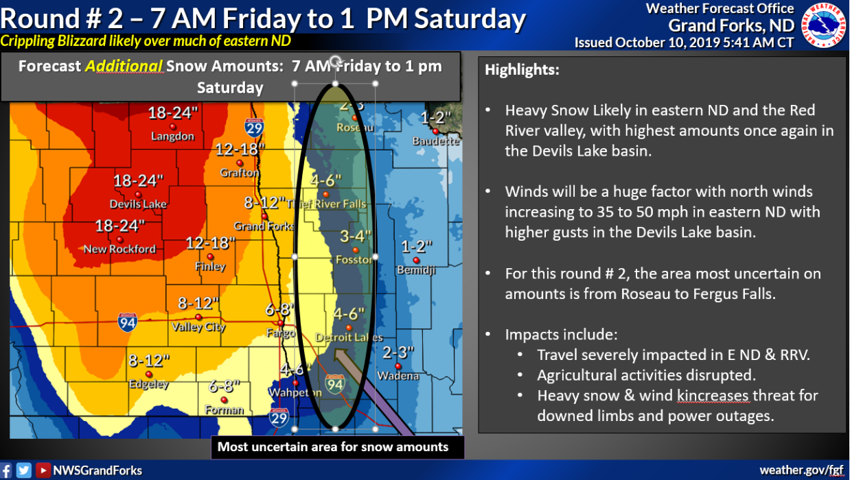
The graphics below show the evolution of the forecast message in the days leading up to the storm.
(Earliest is in the top left, latest in the bottom right.)
 |
 |
 |
 |
 |
 |
 |
 |
 |
 |
 |
 |
 |
 |
 |
|
Summaries from other NWS Offices
Impacts
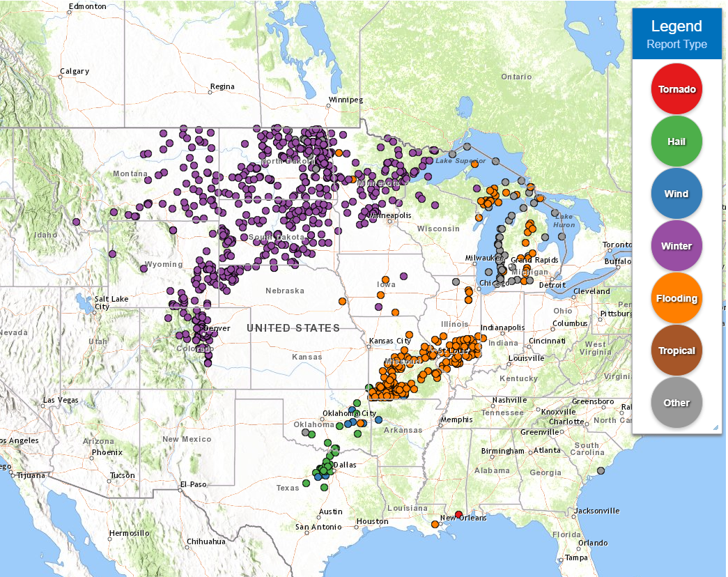
The October 10-12th blizzard brought a variety of impacts to the Dakotas and northwest Minnesota, including:
The map below shows just how widespread impacts were from this single weather system. Each dot represents a weather report, such as heavy snowfall, flooding impacts, or wind damage.
 |
Media use of NWS Web News Stories is encouraged! Please acknowledge the NWS as the source of any news information accessed from this site. |
|

