Overview
All severe components came together on Memorial Day (Monday, May 30th) to be a dangerous severe weather day. Damaging winds and significant tornadoes looked to be the main threats, as a bowing line of severe thunderstorms lifted northeast through the lakes country of west central Minnesota during the afternoon and early evening. As it turned out, numerous reports of wind damage were received, with possible embedded tornadoes.Tornadoes:
Overview: During the afternoon into early evening of May 30, 2022, a well organized, fast moving mesoscale convective system (MCS) tracked north-northeast through west-central and northwest Minnesota. This MCS developed broad areas of extreme downburst winds along with a number of embedded tornadic circulations, characteristic of a Quasi-Linear Convective System (QLCS). Evidence of six distinct tornadoes were found within the NWS Grant, Otter Tail, and Wadena counties within Minnesota. The progression of the line ranged from 70 to 90 mph, with commensurate downburst wind speeds across a several county area.
A text summary of the tornado survey can be found here.
|
Tornado - South Elbow Lake Tornado
Track Map 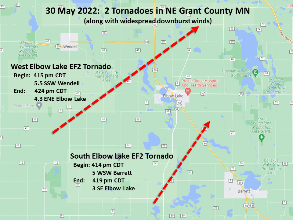 
Downloadable KMZ File |
||||||||||||||||
|
Tornado - West Elbow Lake Tornado
Track Map
Downloadable KMZ File |
||||||||||||||||
|
Tornado - Urbank Area Tornado
Track Map 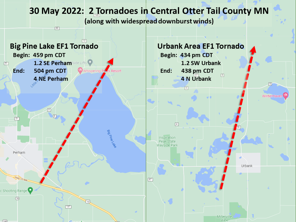
Downloadable KMZ File |
||||||||||||||||
|
Tornado - Big Pine Lake Tornado
Track Map
Downloadable KMZ File |
||||||||||||||||
|
Tornado - Old Wadena Tornado
Track Map 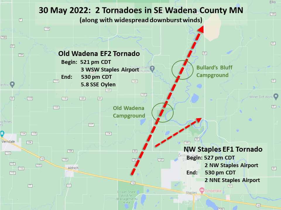
Downloadable KMZ File |
||||||||||||||||
|
Tornado - Northwest Staples Airport Tornado
Track Map
Downloadable KMZ File |
||||||||||||||||
The Enhanced Fujita (EF) Scale classifies tornadoes into the following categories:
| EF0 Weak 65-85 mph |
EF1 Moderate 86-110 mph |
EF2 Significant 111-135 mph |
EF3 Severe 136-165 mph |
EF4 Extreme 166-200 mph |
EF5 Catastrophic 200+ mph |
 |
|||||
Wind & Hail:
Here are the peak measured wind reports from May 30th. It is worth mentioning additional and potentially higher wind gusts may not have been measured due to widespread power outages as a result of the strong wind gusts themselves.
Hail reports are shown in the Storm Reports section.

SPC - WPC Graphics
Here are various SPC and WPC products issued before and during the event.
 |
 |
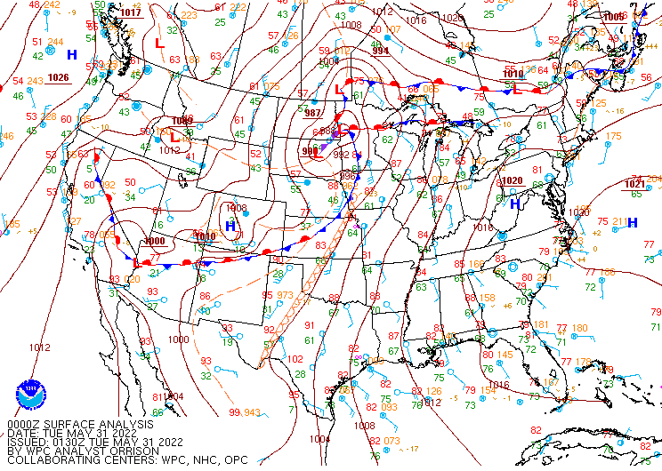 |
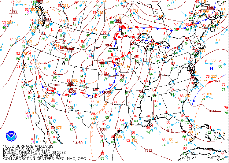
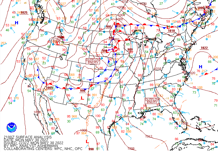
| Figure 1: 18z surface analysis | Figure 2: 21z surface analysis | Figure 3: 00z surface analysis |
 |
 |
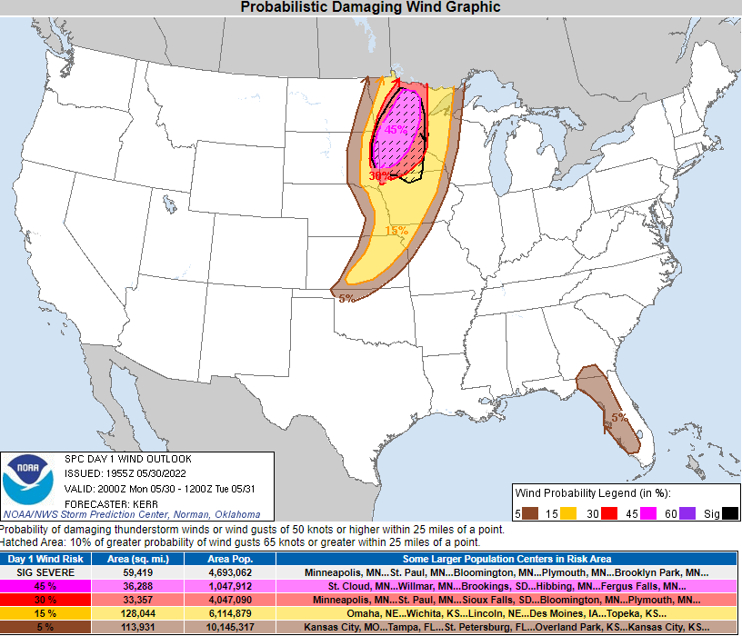 |
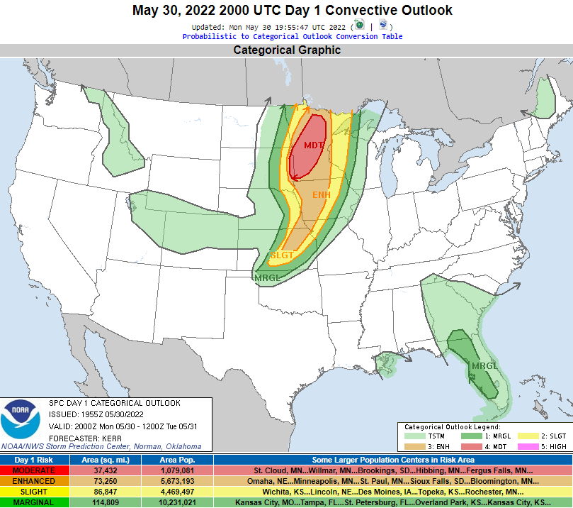
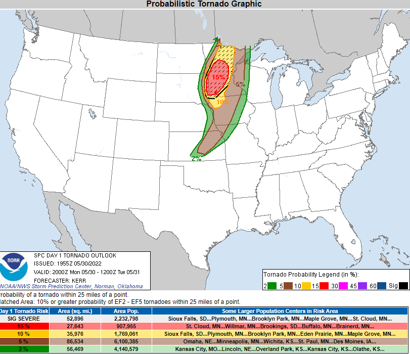
| Figure 4: Morning Day 1 Convective Outlook | Figure 5: Morning Day 1 Tornado Prob | Figure 6: Morning Day 1 Wind Prob |
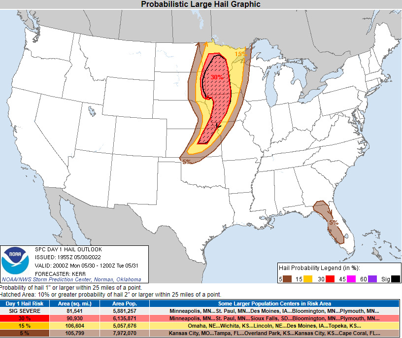 |
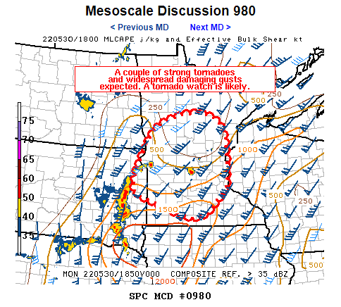 |
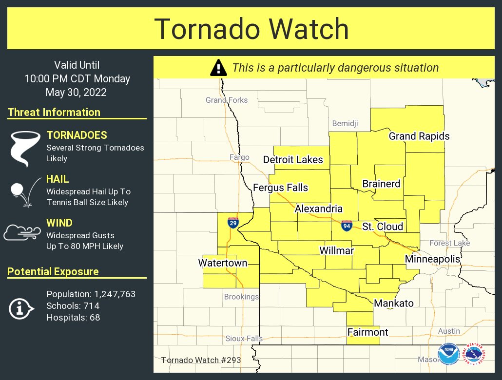 |
| Figure 7: Morning Day 1 Hail Prob | Figure 8: MCD before watch | Figure 9: Tornado Watch |
Written Day 1 Convective Outlook:

Written MCD before Watch:

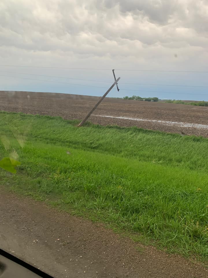
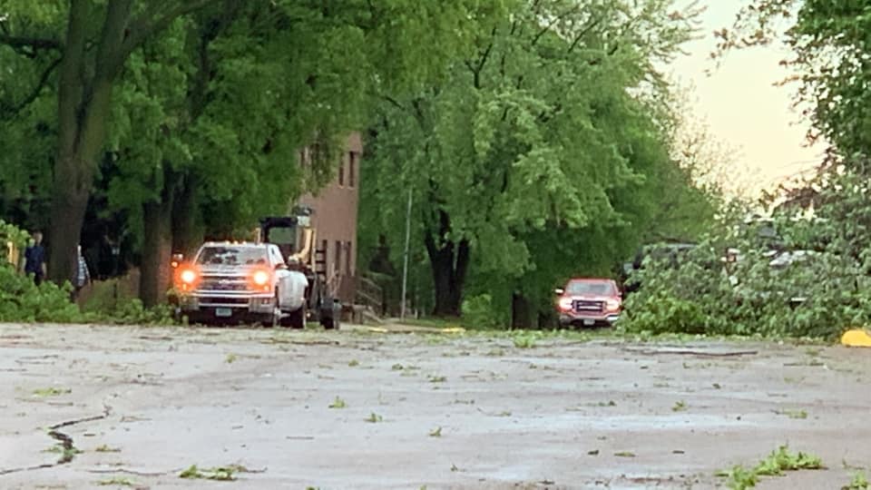
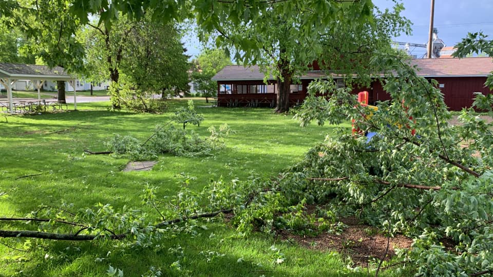
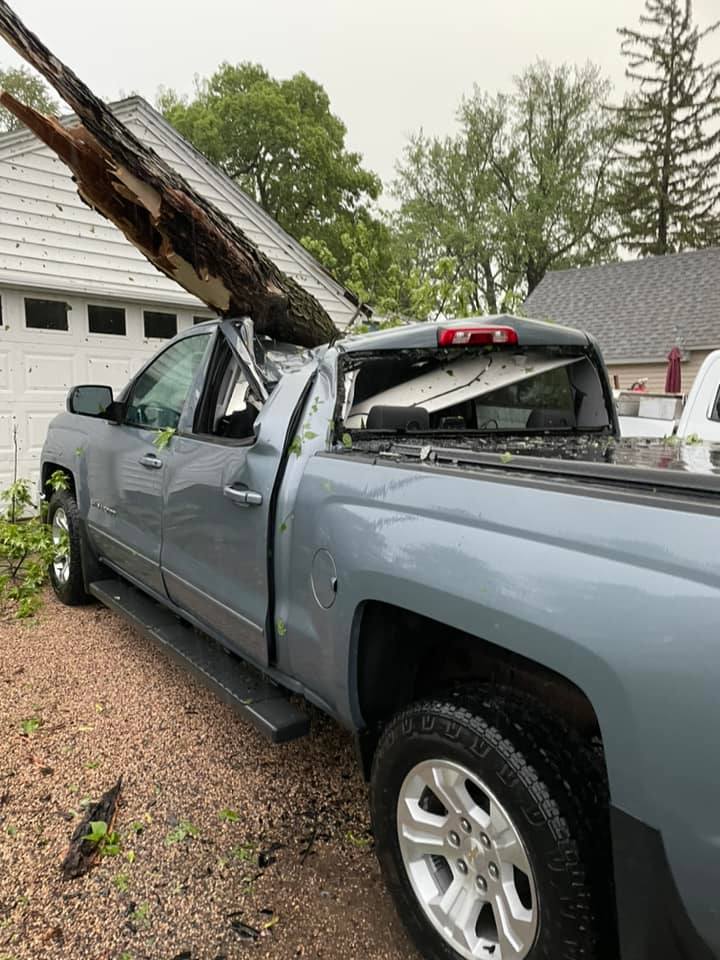
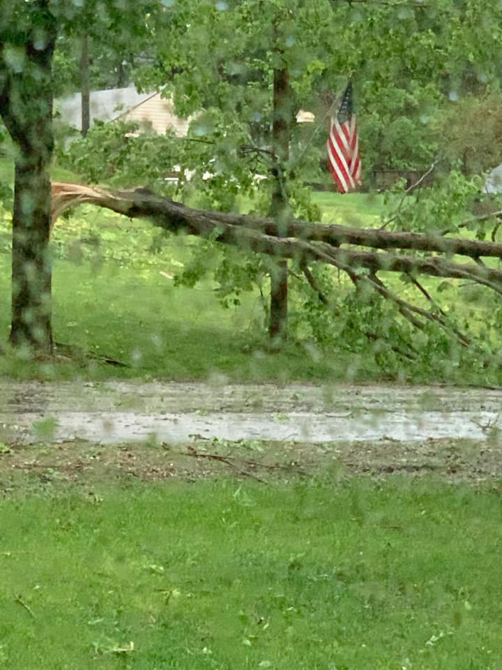
Photos & Video
 |
 |
 |
 |
| Ashby MN (Ashby MN) |
Ashby MN (Heidi Johnson) |
Ashby MN (Heidi Johnson) |
Ashby MN (Heidi Johnson) |
 |
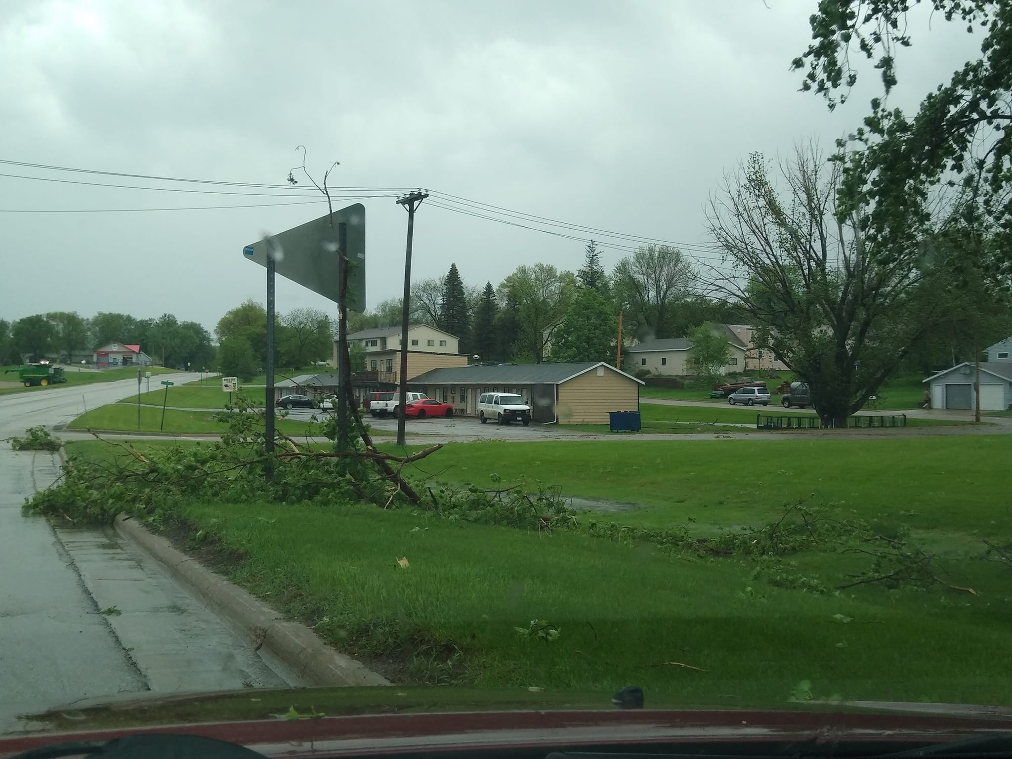 |
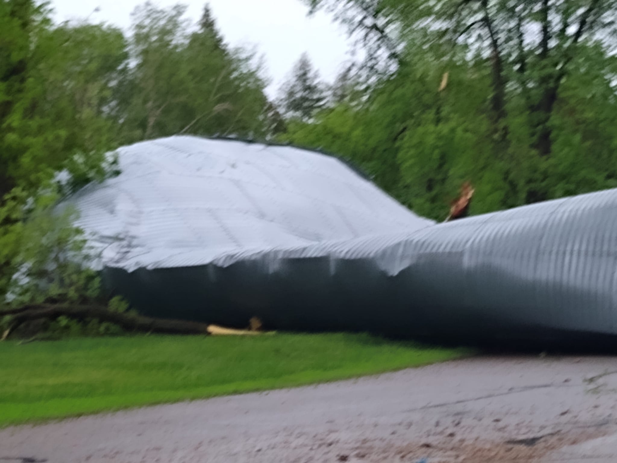 |
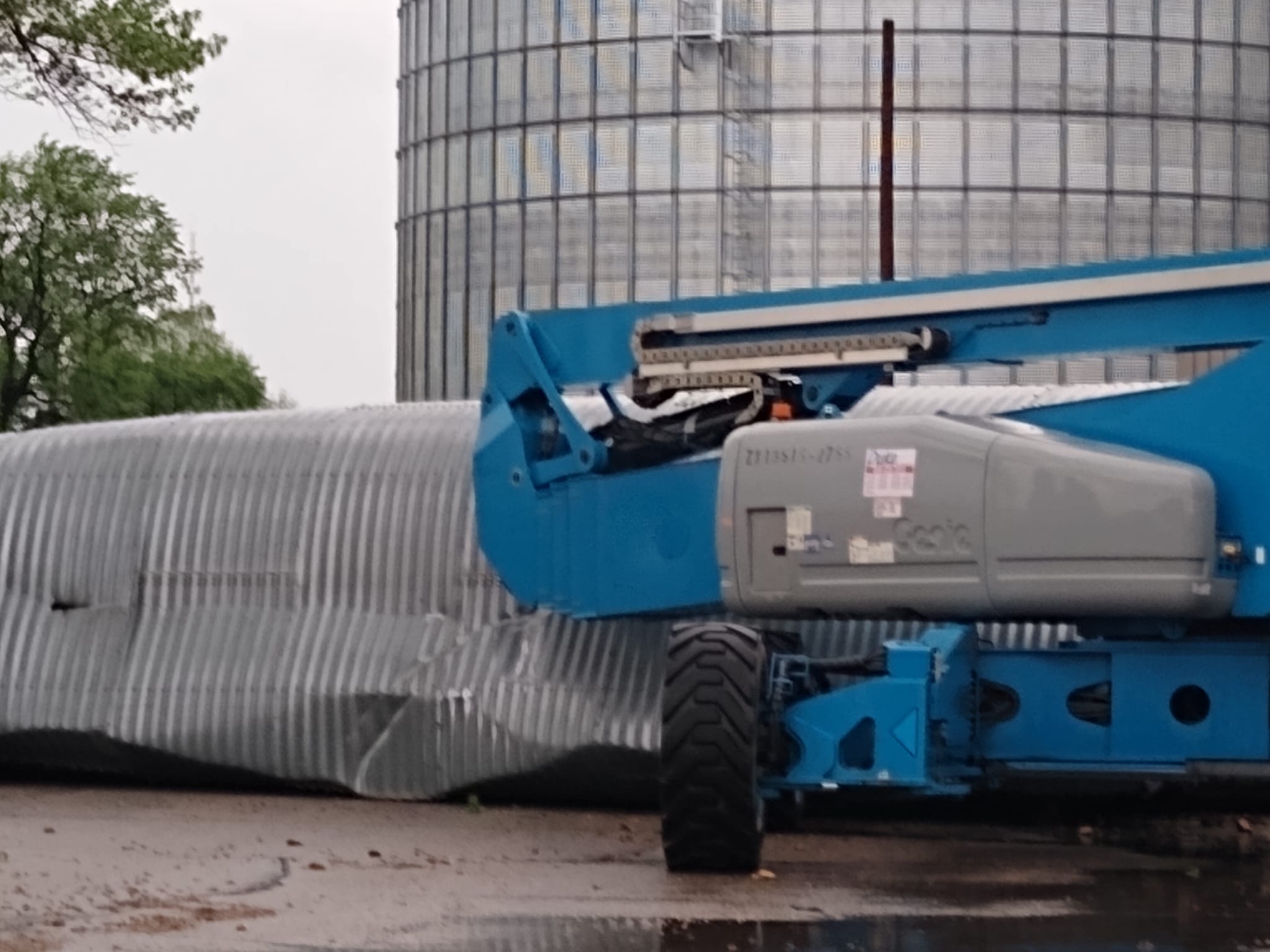 |
| Ashby MN (Heidi Johnson) |
Elbow Lake MN (Stacy Kerwin) |
Elbow Lake MN (Stacy Kerwin) |
Elbow Lake MN (Stacy Kerwin) |
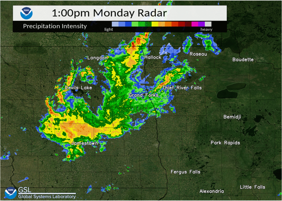
Radar
 |
||
Storm Reports


Rain Reports
This map shows an estimate of rainfall totals from 7 am on May 30th through 7 am on May 31st.

Environment
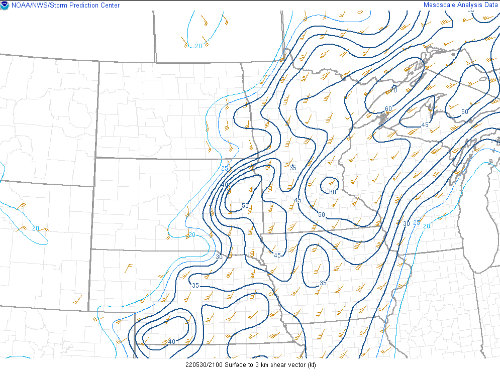 |
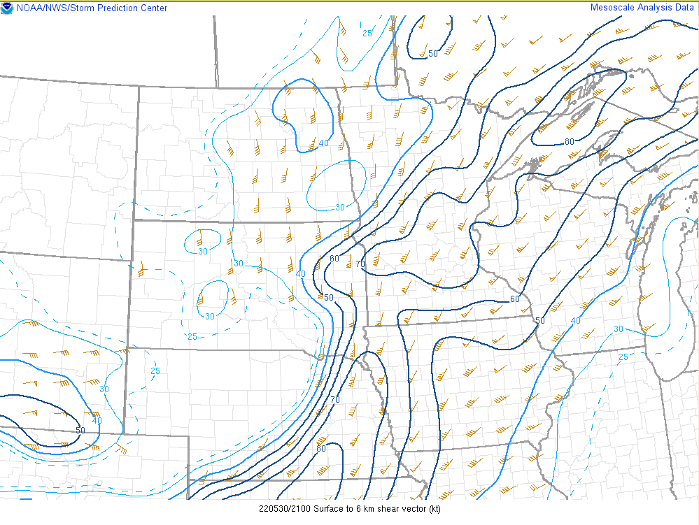 |
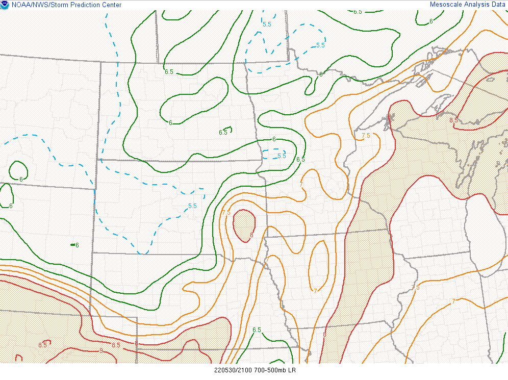 |
| Figure 1: 21z 0-3km Shear | Figure 2: 21z 0-6km Shear | Figure 3: 21z 700-500 mb lapse rates |
 |
 |
 |
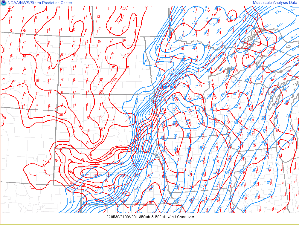
| Figure 4: 21z 850 & 500mb winds | Figure 5: 21z DCAPE | Figure 6: 21z MLCAPE |
 |
 |
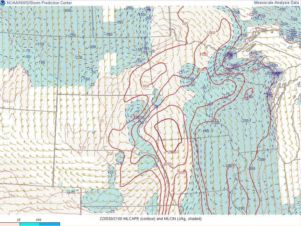
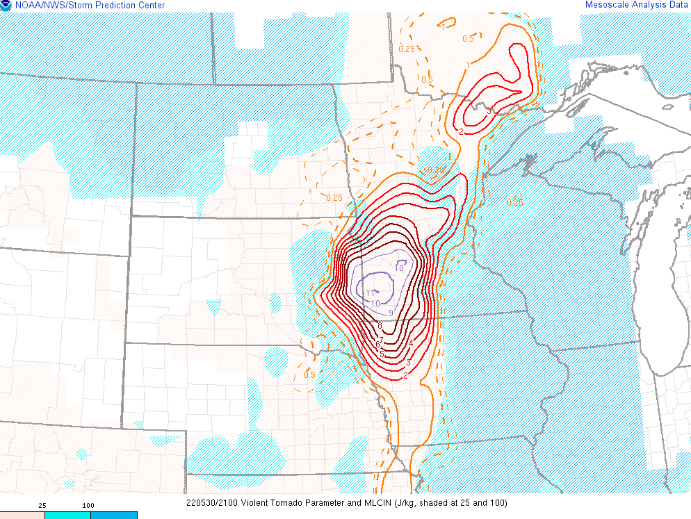 |
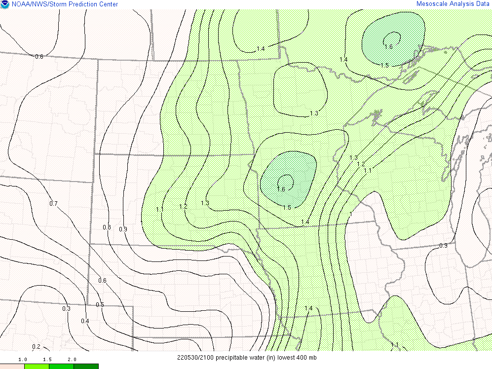
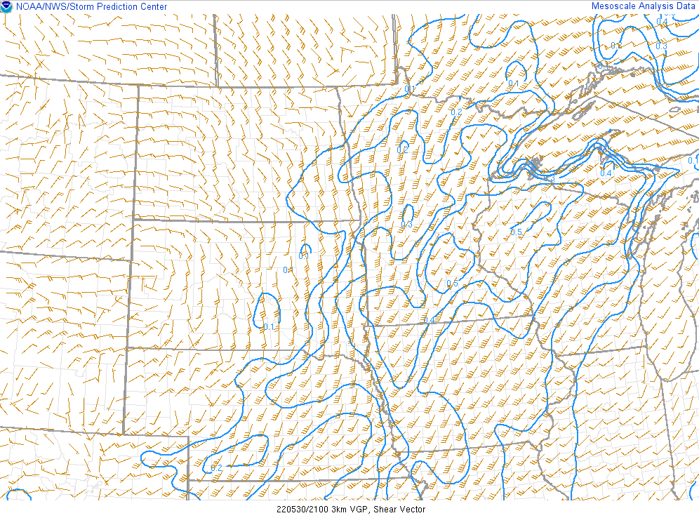
| Figure 7: 21z Precipitable Water | Figure 8: 21z VGP | Figure 9: 21z Violent Tornado Parameter |
 |
Media use of NWS Web News Stories is encouraged! Please acknowledge the NWS as the source of any news information accessed from this site. |
|

