Grand Forks, ND
Weather Forecast Office
Upper Air Charts
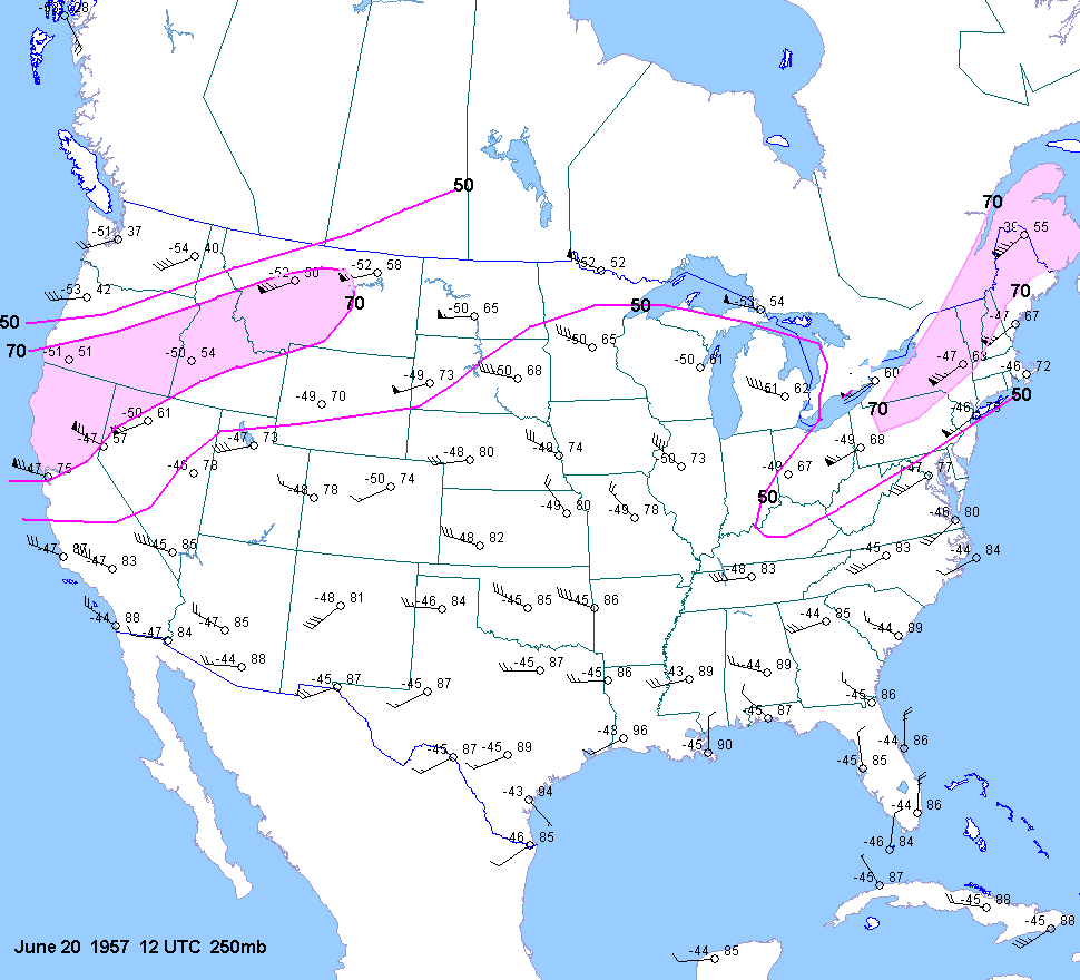
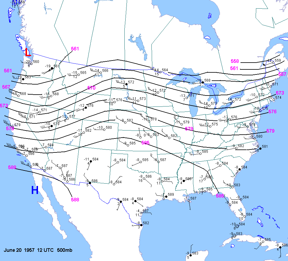
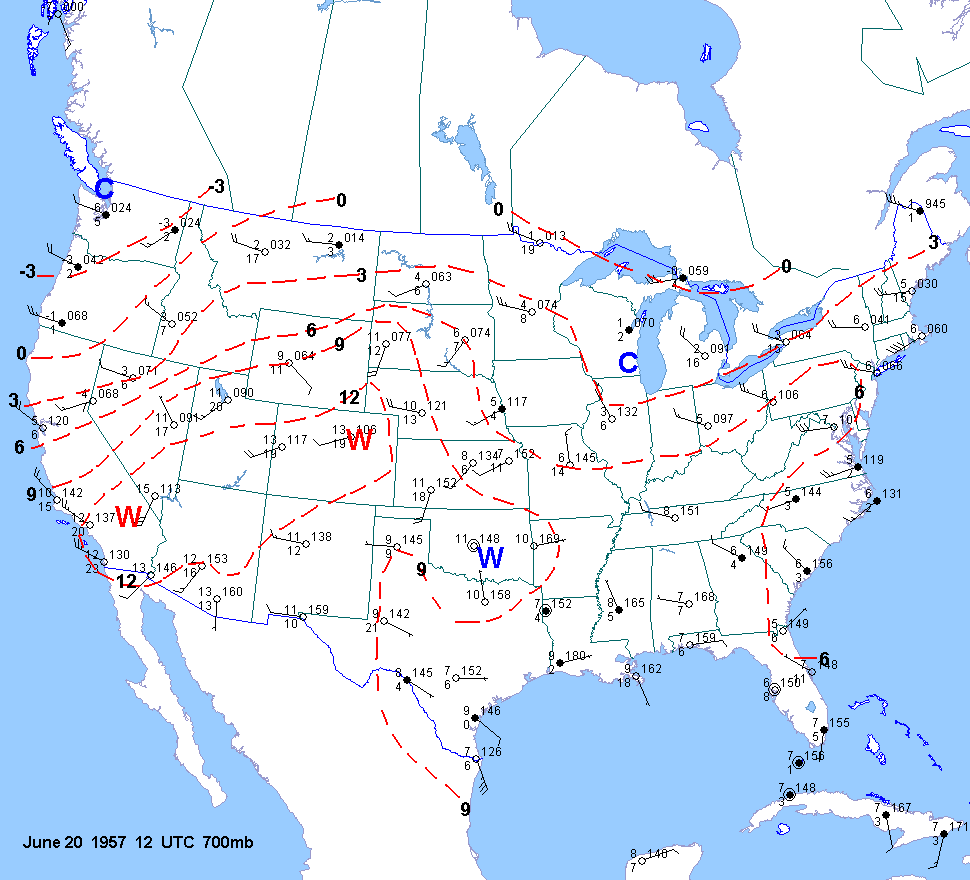
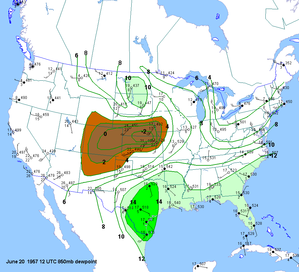
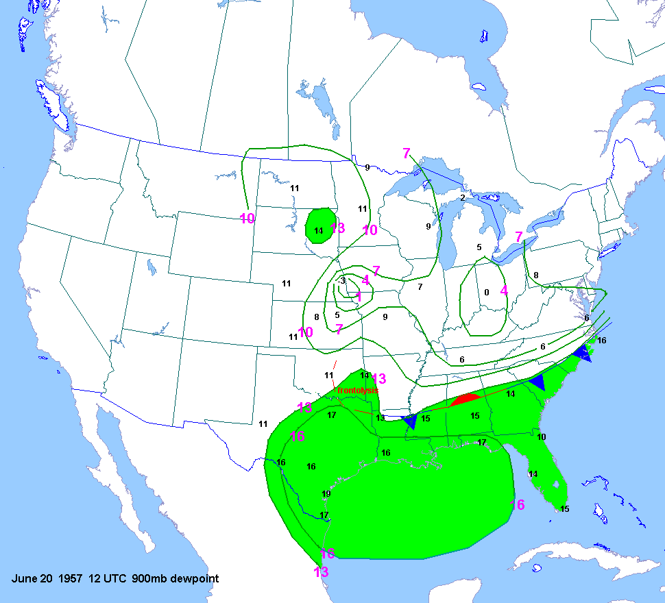
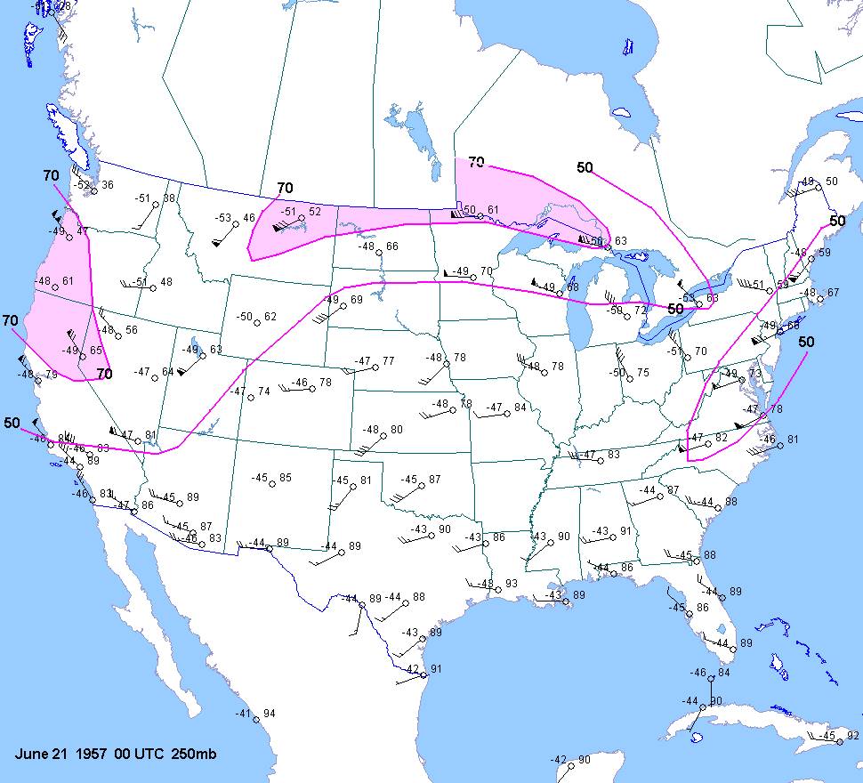
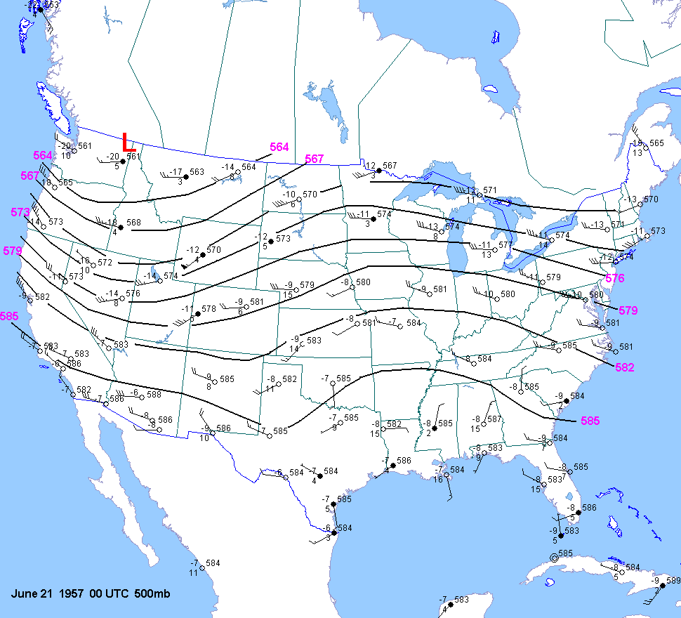
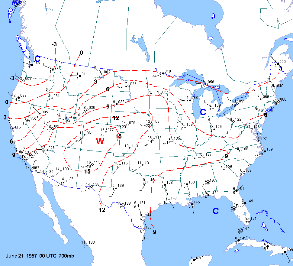
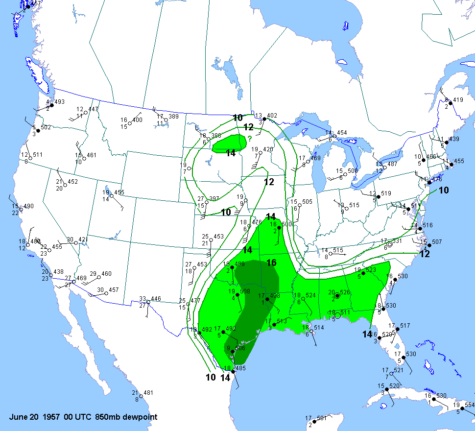
Here is a series of upper air maps from 20 June 1957 at 6 am CST (12 UTC), and 6PM CST (00 UTC) on 20 June 1957 (around the time of the tornado). The upper air pattern was characterized by a southwest flow aloft, and moisture returning into the northern plains. Images courtesy of Jonathan Finch (NWS).
|
6 AM CST (12 UTC) 20 JUNE 1957 |
|||
|
|||
|
|||
|
6 PM CST (00 UTC) 20 JUNE 1957 |
|||
|
|||
|
US Dept of Commerce
National Oceanic and Atmospheric Administration
National Weather Service
Grand Forks, ND
4797 Technology Circle
Grand Forks, ND 58203-0600
701-772-0720
Comments? Questions? Please Contact Us.

