Grand Forks, ND
Weather Forecast Office
The Probabilistic Flood Outlook Summary (PFOS) is a product/service local to the NWS Grand Forks, ND office depicting the spring flood threat in the Red River of the North basin.
We encourage your comments or suggestions for improvement! Your feedback will help us determine product/service utility and if modifications are needed. Feedback/comments regarding this product can be directed to Amanda Lee, NWS Grand Forks Service Hydrologist, through e-mail: amanda.lee@noaa.gov.
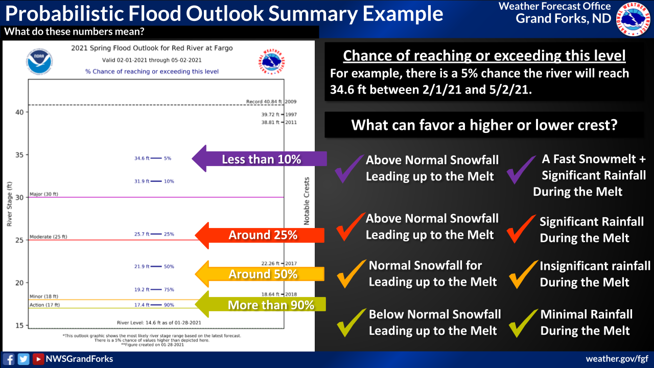
This product/service is a graphic that depicts the probabilities of reaching certain river stages based on the standard probabilities of 95%, 90%, 75%, 50%, 25%, 10%, and 5%. This product is intended to give users an overview of the flood risk in the Red River of the North Basin for the next 90 days during the spring snowmelt season.
This page was last updated on March 12, 2026.
For instructions on how to read the PFOS graphics, click the thumbnail image below.
US Dept of Commerce
National Oceanic and Atmospheric Administration
National Weather Service
Grand Forks, ND
4797 Technology Circle
Grand Forks, ND 58203-0600
701-772-0720
Comments? Questions? Please Contact Us.

