Overview
|
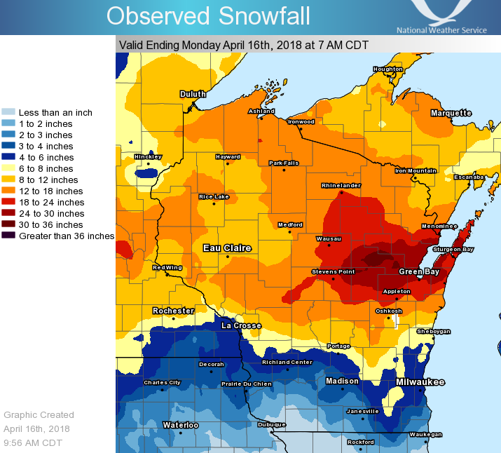
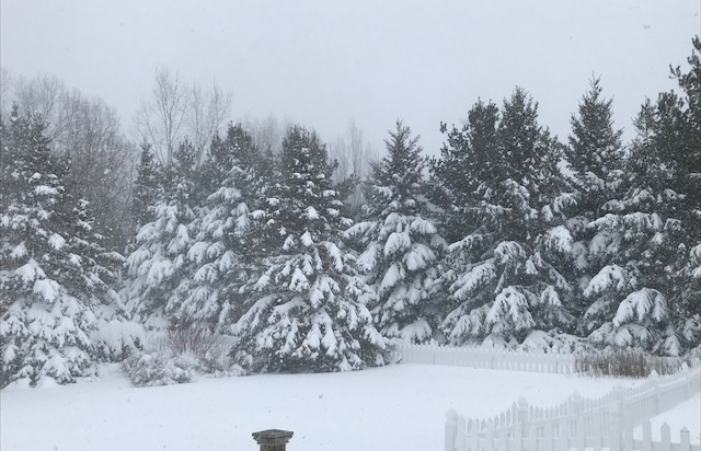
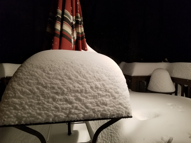
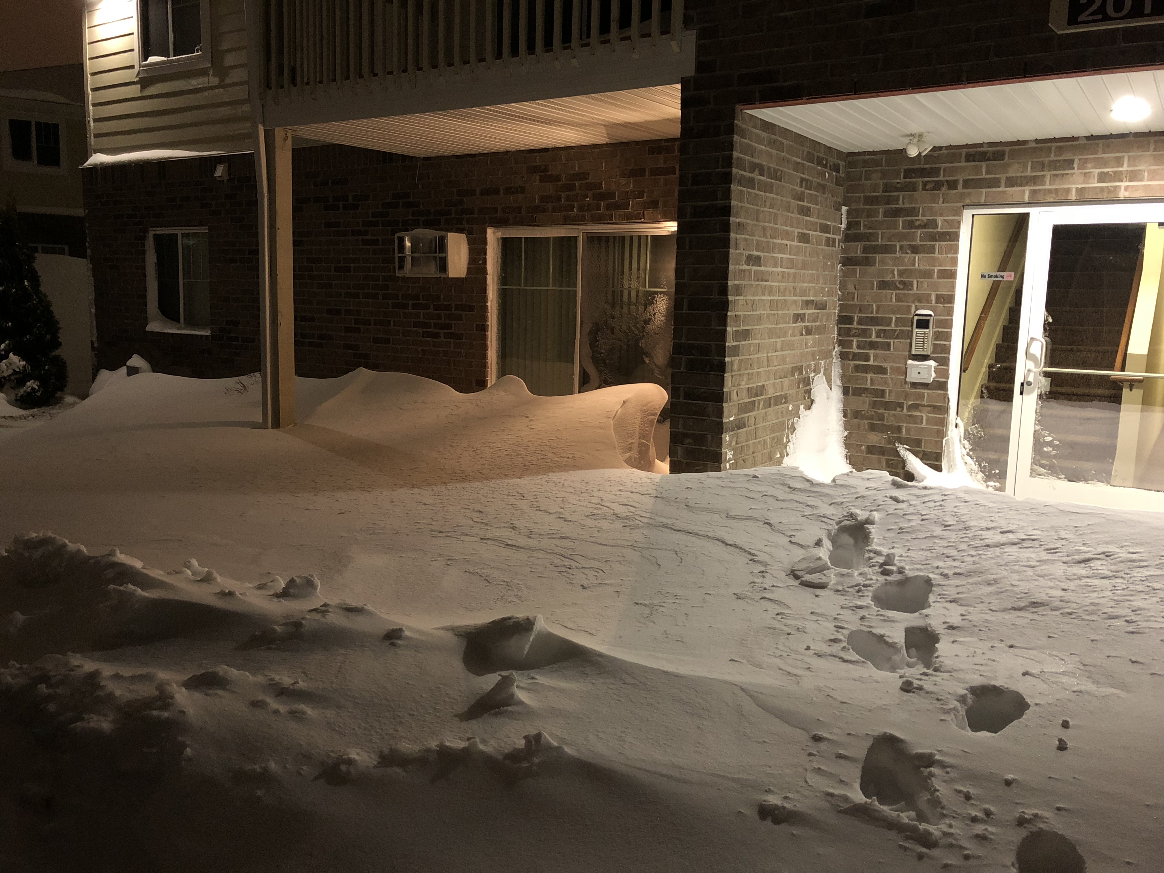
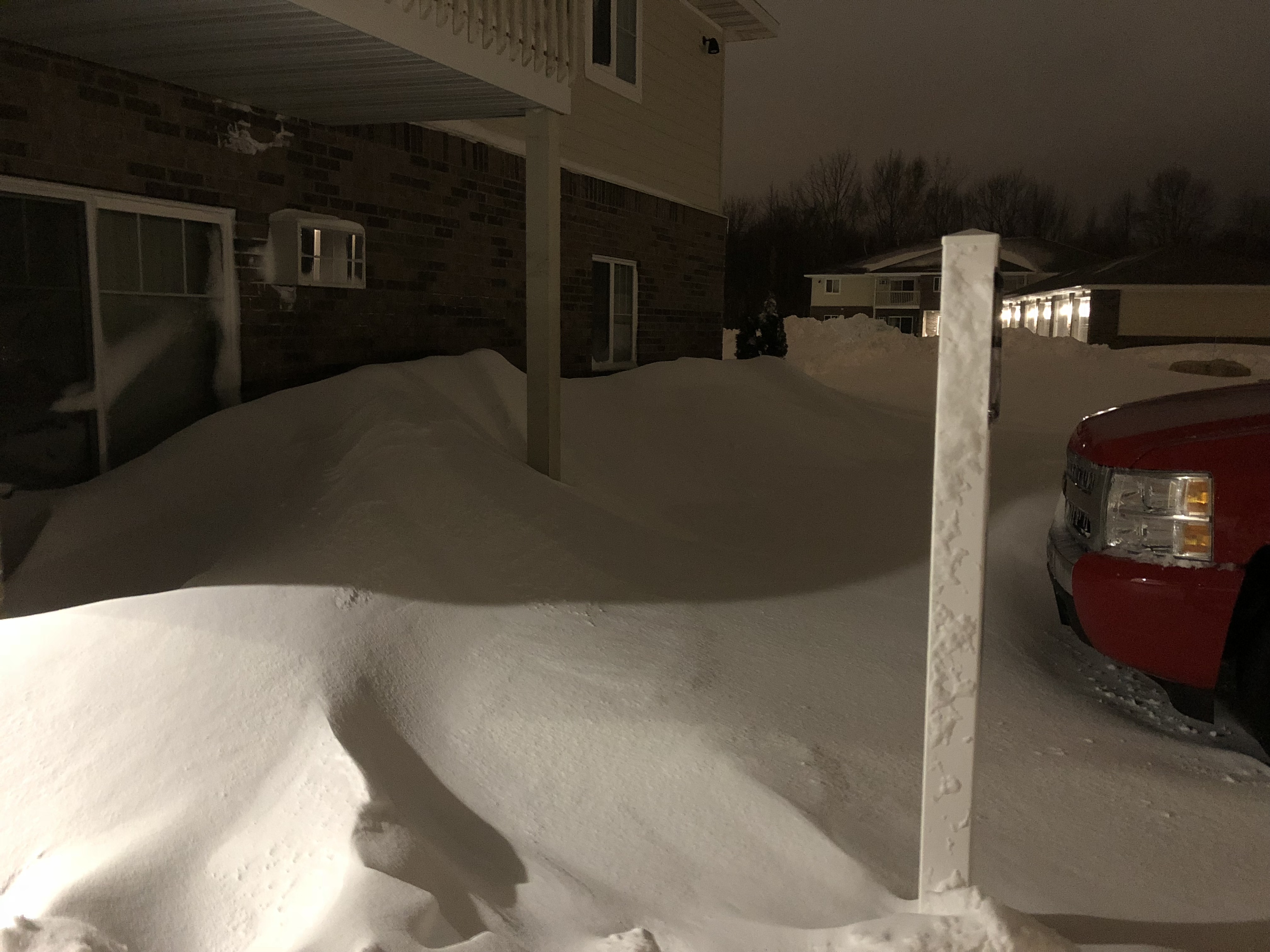
A historic late season blizzard pummeled northeast and north-central Wisconsin on April 13-15, 2018. A large area of 15 to 30 inches of snow and winds gusting over 45 mph rewrote the record books for many locations across the area. The heavy weight of the snow caused several roofs to collapse. Part of a roof at a motel in Green Bay collapsed over the pool area, and roofs of several barns in Brown and Outagamie counties were damaged. The storm brought blizzard or near-blizzard conditions to much of the area and made roads impassable from time-to-time. Winds of 35 to 50 mph caused sporadic power outages and created waves of 10 to 16 feet on Lake Michigan. The persistent northeast wind created shoreline erosion along the western shores of the lake. Many businesses were closed for part or all the weekend.
Please see tabs below for more information.
|
|
Snow Reports
Location                     Amount    Time/Date

...Wisconsin...

...Brown County...
Suamico                      25.5 in   0700 AM 04/16
NWS Green Bay                24.2 in   0700 AM 04/16
Ashwaubenon                  23.7 in   0100 AM 04/16
Allouez                      22.0 in   0700 AM 04/16
2 SSW Allouez                19.8 in   0645 AM 04/16
Wrightstown                  16.3 in   0700 AM 04/16

...Calumet County...
Darboy 3 SE                  15.2 in   0700 AM 04/16
Chilton                      11.5 in   0800 AM 04/16

...Door County...
Carlsville 2 NW              31.6 in   0630 AM 04/16
Ephraim 1 NE - WWTP          25.0 in   0700 AM 04/16
2 WNW Baileys Harbor         24.8 in   0700 AM 04/16
Sister Bay                   20.5 in   0800 AM 04/16
Sister Bay 1 N               20.5 in   0700 AM 04/16
Forestville 4 E              20.2 in   0800 AM 04/16
Baileys Harbor 3 ENE         18.2 in   0700 AM 04/16

...Florence County...
Spread Eagle 1 NW            18.0 in   0700 AM 04/16
Aurora                       14.1 in   0730 AM 04/16
1 NW Spread Eagle            13.0 in   0700 AM 04/16

...Forest County...
Argonne 1.5 NW               14.1 in   0720 AM 04/16

...Kewaunee County...
Kewaunee                     18.5 in   0700 AM 04/16

...Langlade County...
White Lake 1 SE              20.1 in   0800 AM 04/16
Summit Lake                  17.4 in   0630 AM 04/16

...Lincoln County...
3 WSW Bradley                19.2 in   0700 AM 04/16
Merrill 7 W                  18.5 in   0600 AM 04/16
Merrill 8 W                  18.5 in   0600 AM 04/16
Rice Reservoir No. 2         15.2 in   0700 AM 04/16

...Manitowoc County...
Two Rivers                   11.0 in   0700 AM 04/16
Manitowoc                    10.5 in   0600 PM 04/16

...Marathon County...
Weston                       20.5 in   0800 AM 04/16
Wausau WSAW TV               20.5 in   1145 PM 04/15
Schofield                    20.0 in   0500 AM 04/16
Wausau-Northeast             17.1 in   0530 AM 04/16
Eau Pleine Tender            16.0 in   0700 AM 04/16
Spencer - Wwtp               12.9 in   0730 AM 04/16

...Marinette County...
Peshtigo                     27.5 in   0730 AM 04/16
Athelstane                   13.0 in   0600 AM 04/16
Crivitz High Falls           11.4 in   0800 AM 04/16

...Oconto County...
Stiles 1 S                   30.5 in   0730 AM 04/16
Oconto 4 W                   29.0 in   0700 AM 04/16
Pulaski - WWTP               28.0 in   0700 AM 04/16

...Oneida County...
Mc Naughton 3 SSE            19.4 in   0700 AM 04/16
Hazelhurst                   18.5 in   0700 AM 04/16
Rhinelander                  18.4 in   0523 AM 04/16

...Outagamie County...
Appleton                     21.2 in   0700 AM 04/16
Appleton WHBY Radio          21.1 in   0800 AM 04/16
2 WSW Kimberly               19.0 in   0800 AM 04/16

...Portage County...
Stevens Point                20.7 in   0730 AM 04/16
Plover                       19.8 in   1223 AM 04/16
Rudolph 1 NNE                17.9 in   0530 AM 04/16
Almond 5 NE                  15.7 in   0800 AM 04/16
3 NNW Junction City          14.5 in   0800 AM 04/16

...Shawano County...
Tigerton                     30.6 in   0852 AM 04/16
Shawano 2 SSW                29.8 in   0800 AM 04/16
Krakow                       24.5 in   0800 AM 04/16

...Vilas County...
Lac Du Flambeau              19.5 in   1011 AM 04/16
Eagle River 4 E              14.8 in   0627 AM 04/16
Eagle River - South          14.0 in   0630 AM 04/16
Land O Lakes 3 W             13.8 in   0730 AM 04/16
Boulder Junction 9 ENE       11.3 in   0710 AM 04/16

...Waupaca County...
Waupaca                      28.4 in   0800 AM 04/16
New London                   28.3 in   0530 AM 04/16
Scandinavia                  28.0 in   0800 AM 04/16

...Waushara County...
Wild Rose                    16.7 in   0700 AM 04/16
Wautoma Silver Lake Sanitary 11.9 in   0830 AM 04/16

...Winnebago County...
Neenah                       12.6 in   0700 AM 04/16
Omro 1 WSW                   12.0 in   0700 AM 04/16
Omro 2 SW                    12.0 in   0700 AM 04/16
Oshkosh-north                11.6 in   0700 AM 04/16

...Wood County...
Nekoosa                      20.2 in   0927 AM 04/16
Pittsville - WWTP            18.5 in   0700 AM 04/16
Wisconsin Rapids-Southeast   17.3 in   0730 AM 04/16
Port Edwards 2 E             15.8 in   0830 AM 04/16
Marshfield                   12.0 in   0700 AM 04/16

Observations are collected from a variety of sources with varying
equipment and exposures. We thank all volunteer weather observers
for their dedication. Not all data listed are considered official.
Records Set
Green Bay
Largest April snowstorm - 24.2" (Previous record was 11.0" on April 4-5, 1977)
2nd largest snowstorm on record - 24.2" (Behind the 29.0" that fell March 1-2, 1888)
Snowiest April on record - 36.7" (Previous record was 15.1" in 1907)
Click HERE for additional record information for Green Bay.
Appleton
Largest April snowstorm - 21.2" (Previous record was 12.3" on April 15-16, 1904)
Largest snowstorm on record - 21.2" (Previous record was 19.5" on December 12-14, 1909)
Snowiest April on record - 30.8" (Previous record was 26.0" in 1907)
Click HERE for additional record information for Appleton.
Wausau
Largest April snowstorm - 20.7" (Previous record was 12.1" on April 15-16, 1993)
2nd largest snowstorm on record - 20.7" (Behind the 22.1" that fell March 5-6, 1959)
Snowiest April on record - 34.5" (Previous record was 25.5" in 1909)
Click HERE for additional record information for Wausau.
Rhinelander
Largest April snowstorm - 18.2" (Previous record was 13.0" on April 3-4, 1945)
3rd largest snowstorm on record - 18.2"
2nd snowiest April on record - 27.6" (through Apr 15) (Record is 28.1" in 2014)
Click HERE for additional record information for Rhinelander.
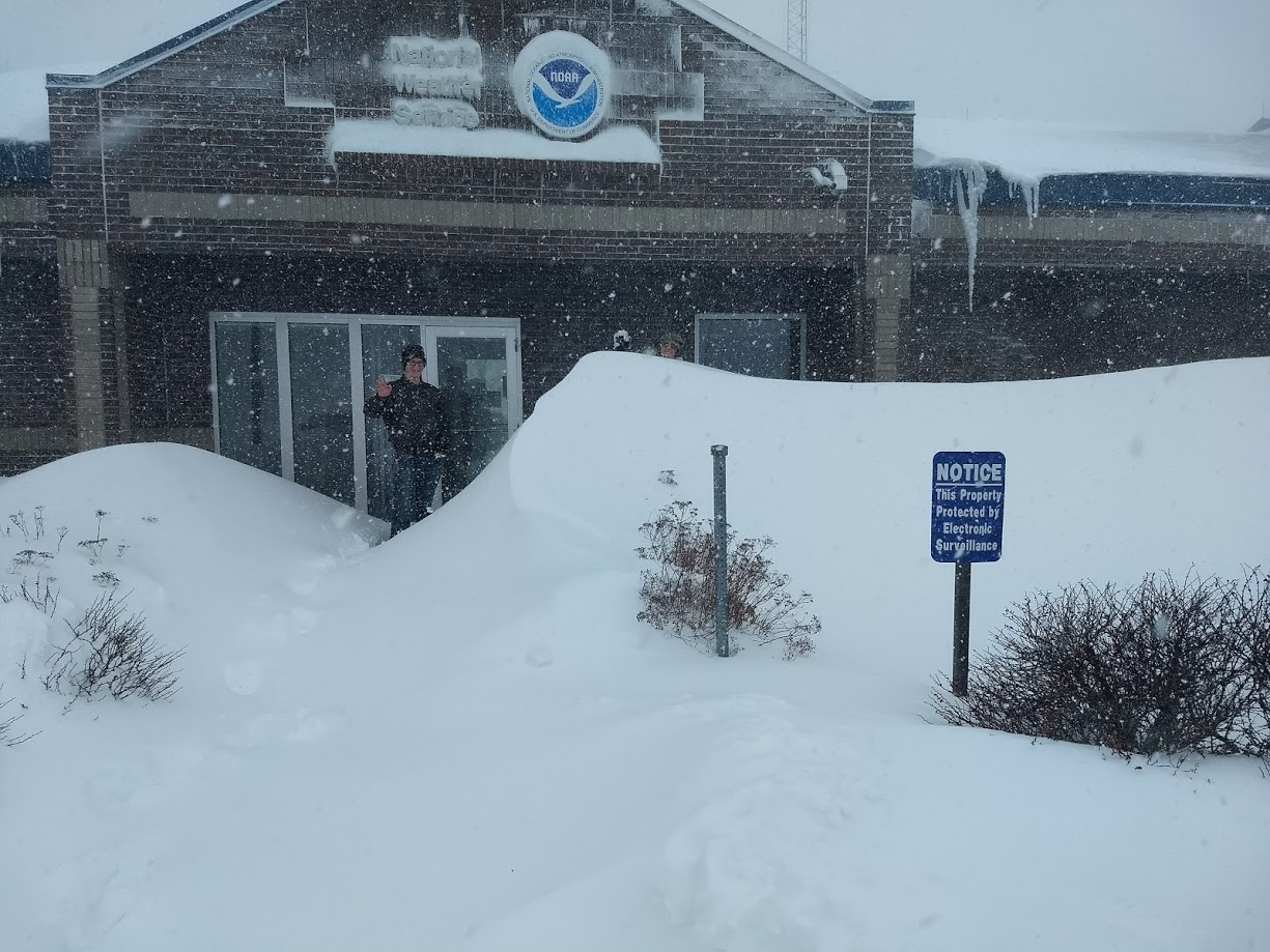
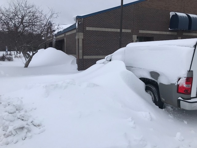
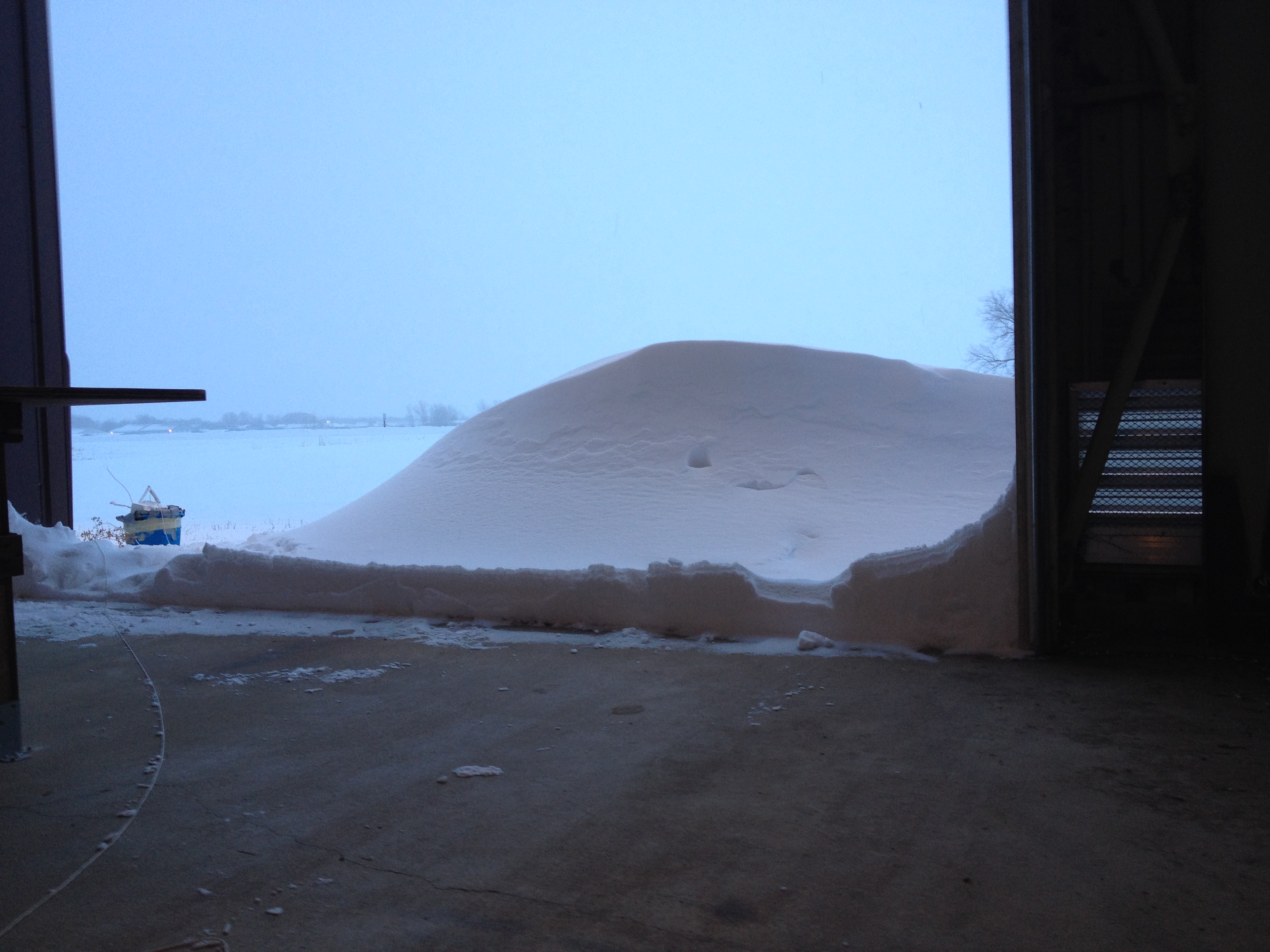
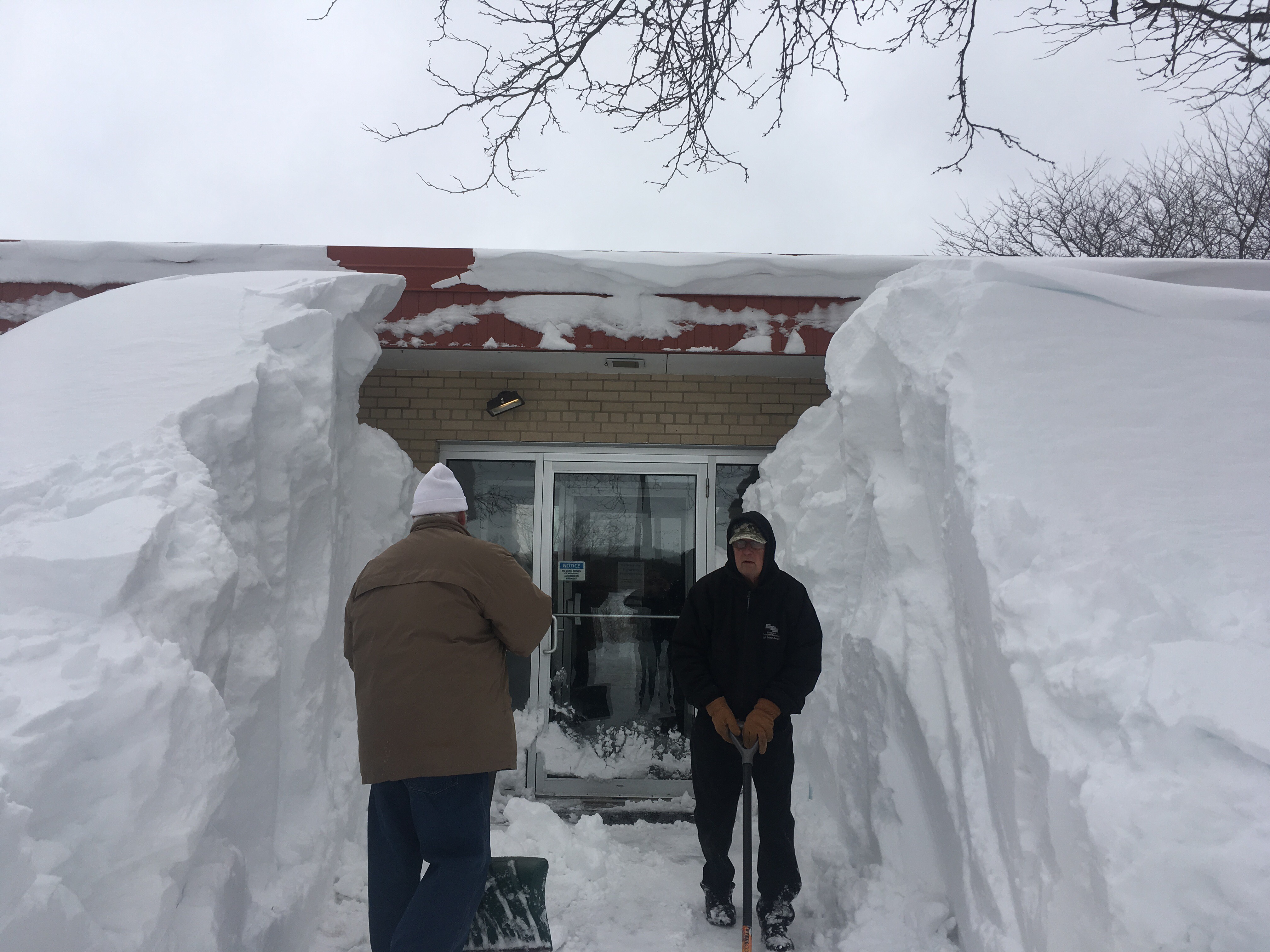
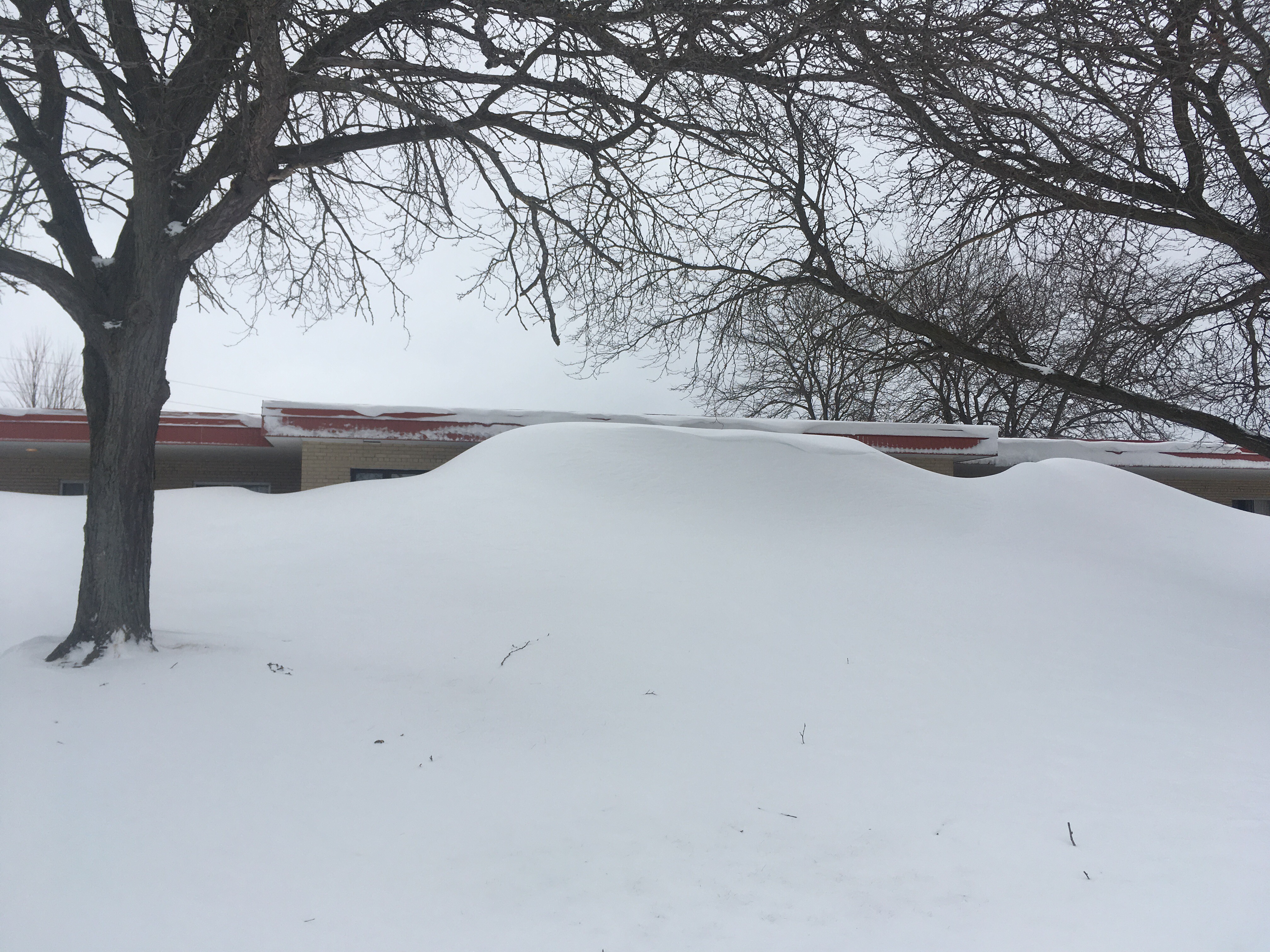
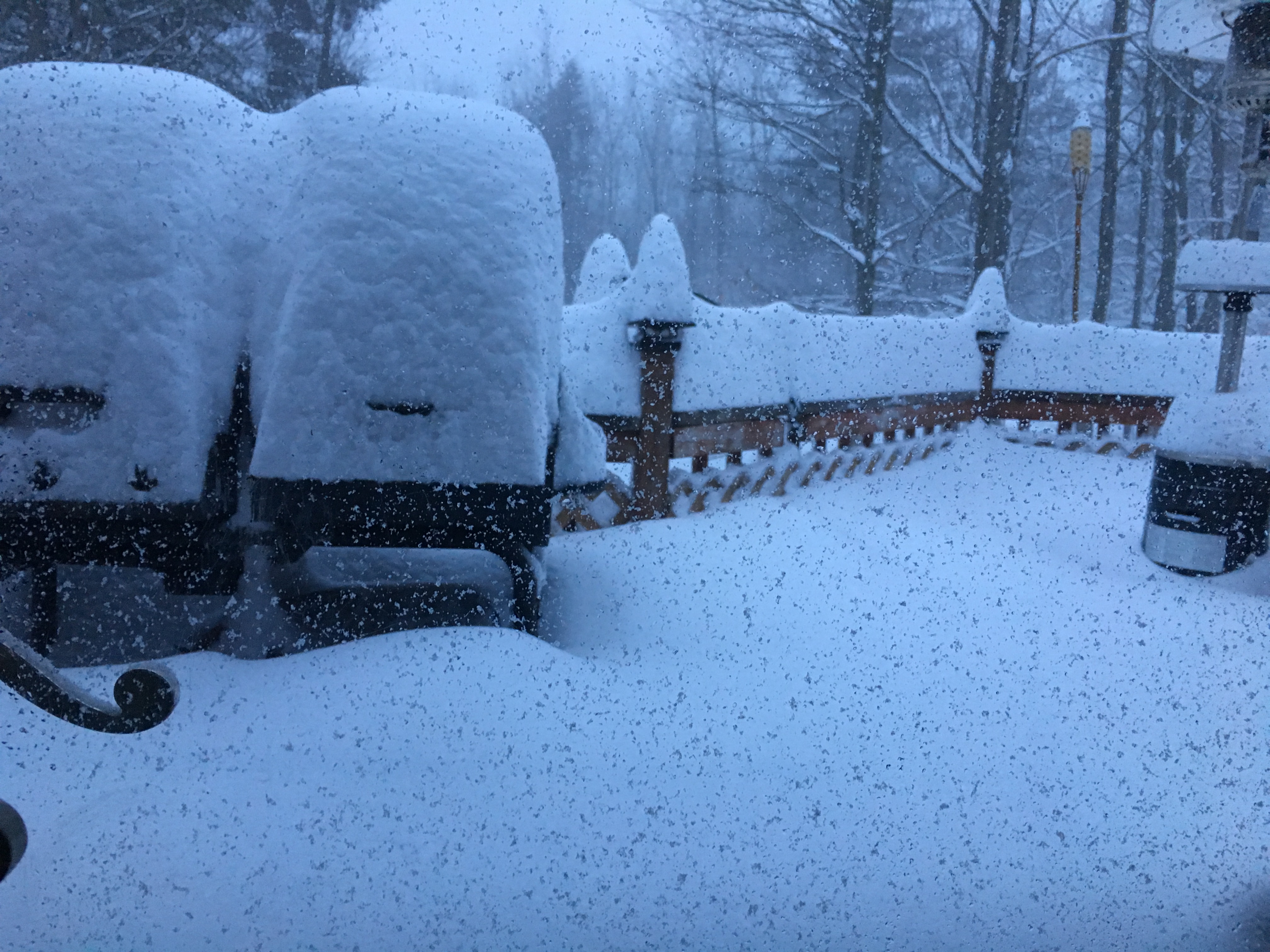
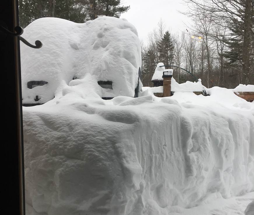
Photos:
 |
 |
 |
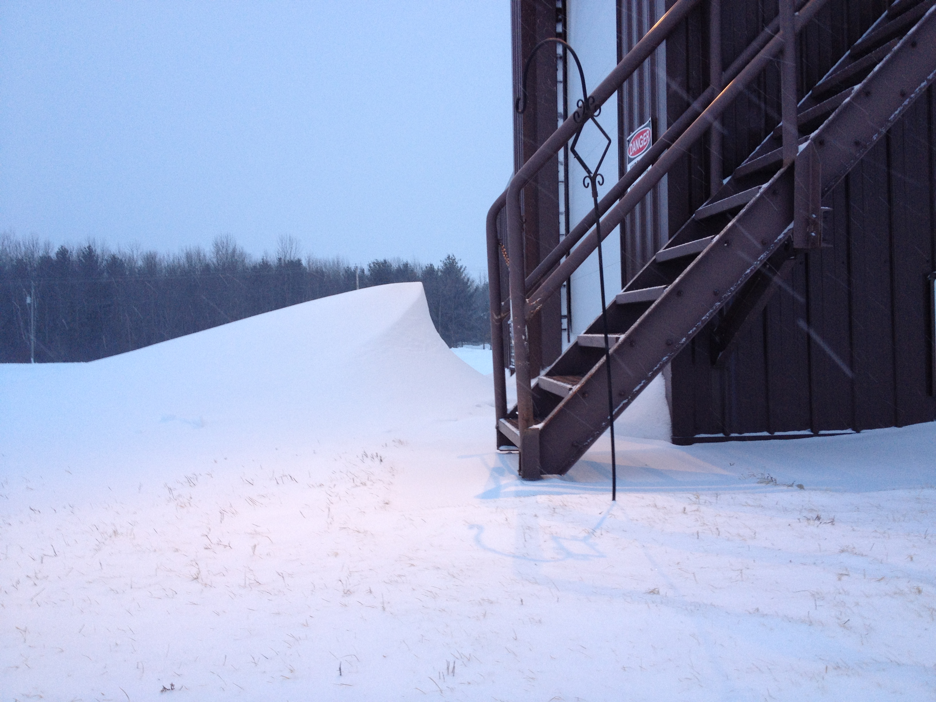 |
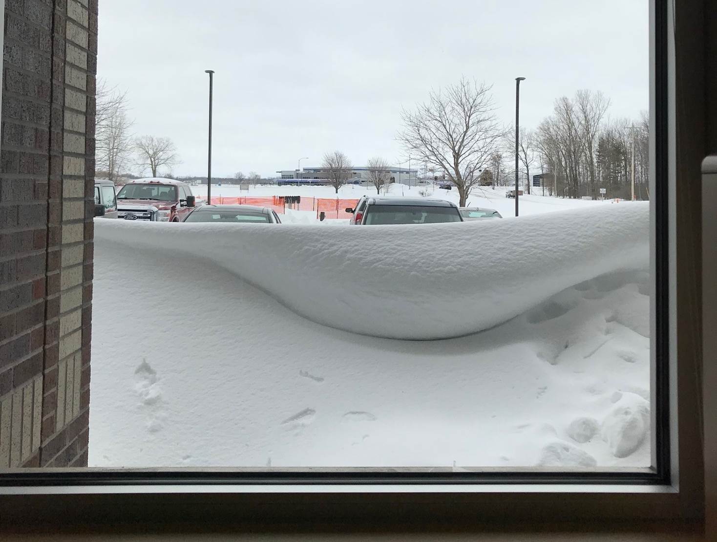
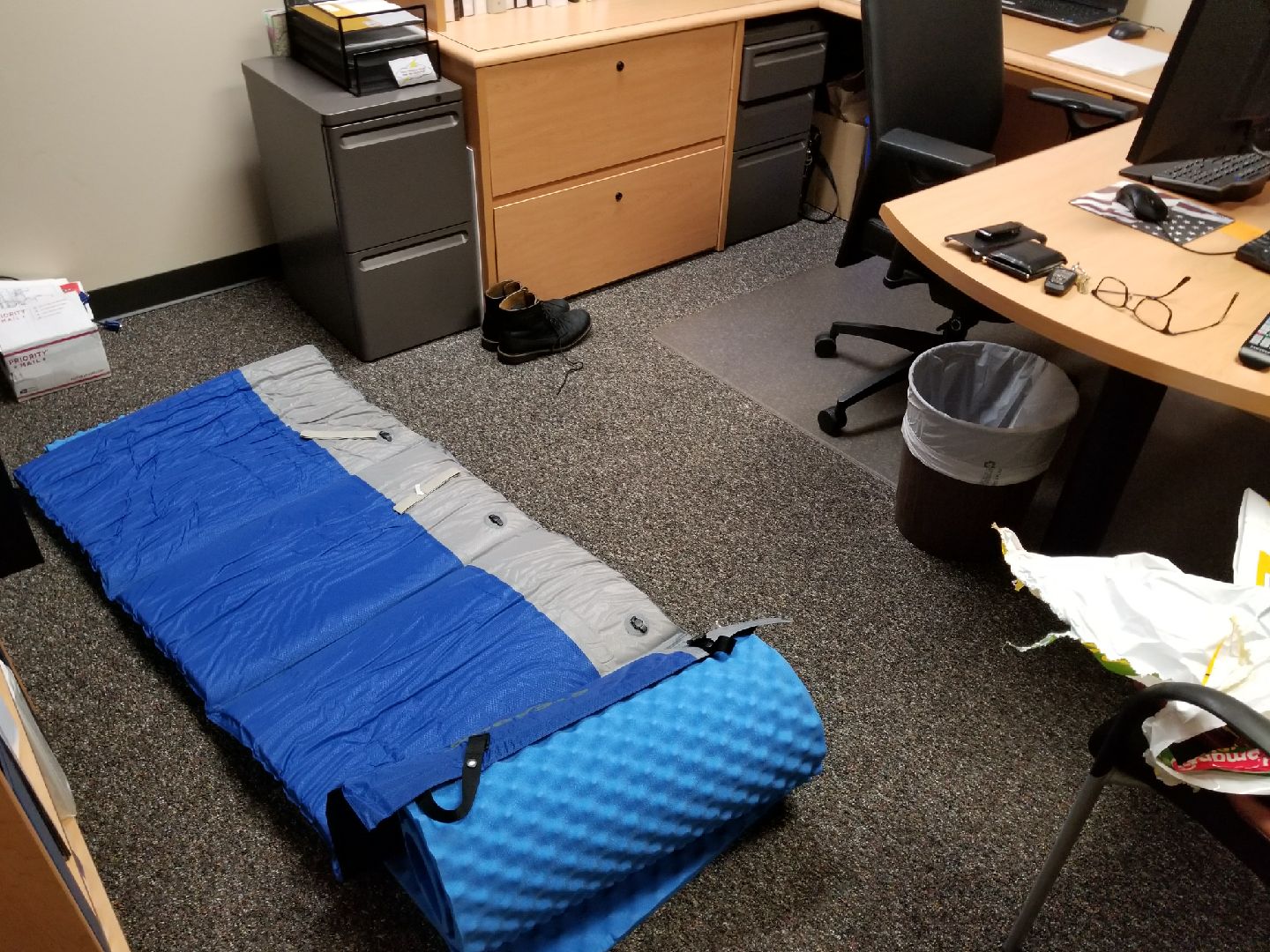
| NWS Green Bay Office | NWS Green Bay Office | NWS Green Bay Upper Air Building | NWS Green Bay Upper Air Building |
 |
 |
 |
 |
| A view of the 6 foot drift from the WCM's office | WCM Office where Lead Forecaster Slept |
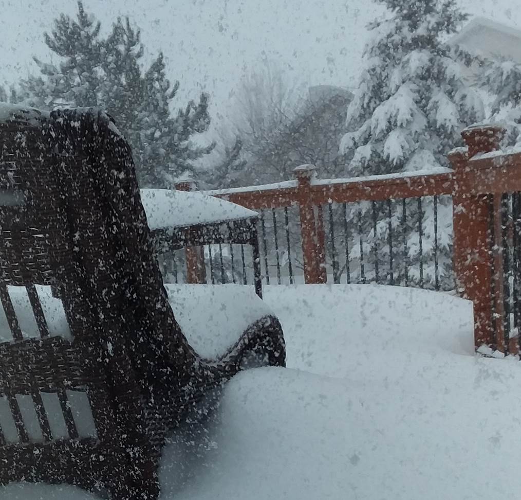
Ledgeview |
Hobart (Photo: Jeff Last) |
 |
 |
 |
|
| Green Bay (Photo: Phil Kurimski) |
West De Pere (Photo: Rebecca Hykin) |
West De Pere (Photo: Rebecca Hykin) |
|
 |
 |
 |
 |
| Oconto Falls (Photo: Thomas Thomson) |
Oconto Falls (Photo: Thomas Thomson) |
Stiles (Photo: Rick Belanger) |
Stiles (Photo: Rick Belanger) |
.jpeg) |
|||
| Manitowoc - Damage to SS Badger Pier Area (Photo: Alex Phillip) |
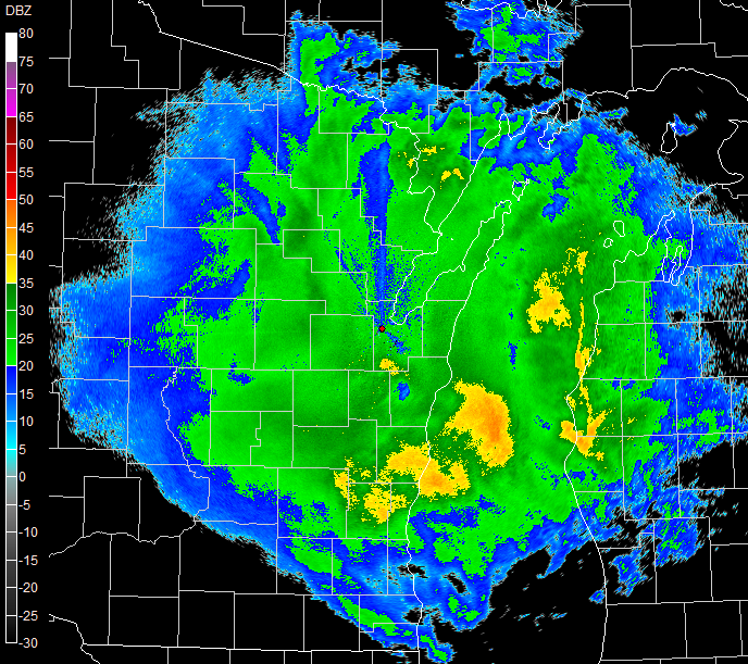
Radar:
NWS Green Bay Radar Animations
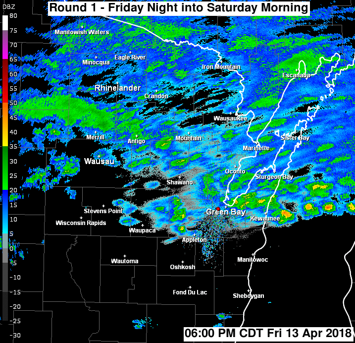
Radar animation of the first round of heavy snow that occurred Friday night into Saturday morning. Up to 18 inches of snow fell in a band from near Wausau to Shawano to northern Door county.
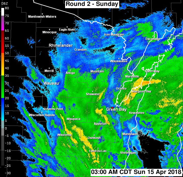
Radar animation of the second round of heavy snow that occurred Sunday. A widespread snowfall of 8 to 15 inches occurred across the entire area.
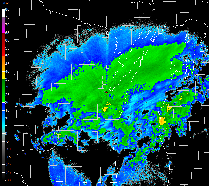
NWS Green Bay Single Radar Images
 |
 |
 |
|
| Evening April 13-- As event was starting, including a few thunderstorms |
Early morning April 14-- Heavy snow occurring across central to northeast Wisconsin |
Noon April 15-- Blizzard conditions across east-central Wisconsin |
Peak Winds
Location                     Speed     Time/Date       Lat/Lon
--------------------------------------------------------------------
Plover 1 WSW                 52 MPH    0652 AM 04/15   44.44N/89.55W
Marshfield Airport           51 MPH    0432 PM 04/14   44.64N/90.19W
Green Bay Airport            51 MPH    0839 AM 04/15   44.50N/88.11W
Menominee 2 SE               50 MPH    0524 AM 04/15   45.10N/87.59W
Rose Lawn 4 SE               50 MPH    0542 PM 04/14   44.54N/88.25W
Wautoma Airport              49 MPH    0528 AM 04/15   44.04N/89.30W
Stevens Point Airport        49 MPH    0535 PM 04/14   44.55N/89.53W
Appleton Airport             46 MPH    0445 PM 04/14   44.26N/88.52W
Oshkosh Airport              46 MPH    0411 PM 04/14   43.98N/88.56W
Antigo Airport               46 MPH    0715 AM 04/15   45.15N/89.11W
Wisconsin Rapids Airport     46 MPH    0408 PM 04/14   44.36N/89.84W
Mosinee Airport              45 MPH    0510 PM 04/14   44.78N/89.67W
Kewaunee                     45 MPH    0730 PM 04/14   44.47N/87.50W
Two Rivers 20 ESE            45 MPH    0700 AM 04/15   44.00N/87.20W
Combined Locks 1 W           43 MPH    1040 PM 04/14   44.24N/88.34W
Coloma 4 W                   43 MPH    0417 AM 04/15   44.02N/89.60W
Sister Bay 1 NNW             42 MPH    0157 AM 04/15   45.20N/87.12W
Washington Island 5 WNW      41 MPH    1200 PM 04/15   45.40N/87.00W
Keshena 2 WNW                41 MPH    0605 PM 04/14   44.89N/88.66W
Clintonville Airport         41 MPH    0535 PM 04/14   44.61N/88.73W
Oconto Airport               40 MPH    0815 PM 04/14   44.87N/87.91W
Omro                         40 MPH    0738 AM 04/15   44.03N/88.75W
Shawano Airport              39 MPH    0735 PM 04/14   44.79N/88.56W
Wausau Airport               39 MPH    0642 AM 04/15   44.93N/89.63W
Sturgeon Bay Airport         39 MPH    0335 AM 04/15   44.84N/87.42W
Manitowoc                    39 MPH    0930 PM 04/14   44.08N/87.68W
Antigo 2 ENE                 38 MPH    0805 AM 04/15   45.16N/89.11W
Washington Island 1 WNW      38 MPH    0555 AM 04/15   45.39N/86.92W
Moon 6 SW                    37 MPH    0505 PM 04/14   44.70N/89.87W
Manitowoc Airport            37 MPH    0814 PM 04/14   44.13N/87.68W
Rhinelander Airport          36 MPH    0648 PM 04/14   45.63N/89.47W
Wrightstown                  35 MPH    0805 AM 04/15   44.33N/88.17W
Wautoma 1 WSW                35 MPH    0612 AM 04/15   44.06N/89.29W
New Rome 4 ENE               34 MPH    0305 PM 04/14   44.26N/89.81W
Eagle River Airport          33 MPH    1015 AM 04/15   45.93N/89.28W
Howard 2 WNW                 33 MPH    0404 PM 04/14   44.58N/88.09W
Merrill Airport              33 MPH    0535 PM 04/14   45.20N/89.71W
Tomahawk 3 W                 33 MPH    0410 AM 04/15   45.47N/89.80W
Appleton 2 ENE               33 MPH    0714 PM 04/14   44.28N/88.37W
Manitowish Waters Airport    33 MPH    0515 AM 04/15   46.12N/89.88W
Wayside 1 SW                 32 MPH    0844 AM 04/15   44.23N/87.96W
Breed 5 NE                   32 MPH    0503 PM 04/14   45.12N/88.37W
Greenleaf 4 NNE              32 MPH    0637 PM 04/14   44.37N/88.07W
Hewitt 1 ENE                 32 MPH    0203 AM 04/15   44.64N/90.10W
Butte Des Morts 2 WSW        31 MPH    0801 AM 04/15   44.07N/88.69W
King                         31 MPH    0739 AM 04/15   44.34N/89.12W
Arbor Vitae Airport          30 MPH    0455 AM 04/15   45.93N/89.73W
Rankin 3 E                   30 MPH    0925 PM 04/14   44.60N/87.44W
Wabeno 2 NNW                 30 MPH    0701 PM 04/14   45.46N/88.68W
Wausaukee 2 NW               30 MPH    0605 PM 04/14   45.39N/87.97W

Observations are collected from a variety of sources with varying
equipment and exposures. We thank all volunteer weather observers
for their dedication. Not all data listed are considered official.
.
 |
Media use of NWS Web News Stories is encouraged! Please acknowledge the NWS as the source of any news information accessed from this site. |
|