Fire Weather
Spot Forecasts
Request a Spot Forecast -- Official Use Only
Daily Briefing
Daily Fire Weather Briefing -- From NWS MKX - graphics updated daily by 5:30 am
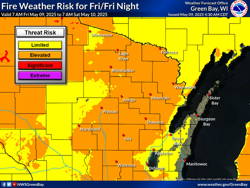
Fire Weather Forecasts
Regional Narratives
Northeast and North-Central Wisconsin
Southern Wisconsin
Southwest Wisconsin
Northern Minnesota and Northwest Wisconsin
Central Minnesota and West-Central Wisconsin
Upper Michigan
Fire Weather Watches / Red Flag Warnings
Northeast and North-Central Wisconsin
Southern Wisconsin
Southwest Wisconsin
Northern Minnesota and Northwest Wisconsin
Central Minnesota and West-Central Wisconsin
Upper Michigan
National Outlooks
National Fire Weather Outlook -- NWS Storm Prediction Center
Eastern Area Coordination Center
Observations
Airport Observations -- Wisconsin
Current RAWS Observations -- GRB Forecast Area -- MesoWest (University of Utah)
Fire Danger Indices
Daily Fire Danger Ratings for All Wisconsin Counties -- Wisconsin DNR
Great Lakes Fire/Fuels -- MesoWest
Hot Dry Windy Index - HDWI
GHWO Fire Weather Day 1 -- Day 2 -- Day 3
Fuel and Soil Moisture Maps
Palmer Drought Index -- Updated weekly, U.S.
U.S. Drought Monitor
U.S. Seasonal Drought Outlook
Satellite Fire Detection
FIRMS US/Canada
GOES-16 3.9 µm Imagery -- Great Lakes
Wisconsin Precipitation Data
Highs, Lows and Precip -- Updated daily
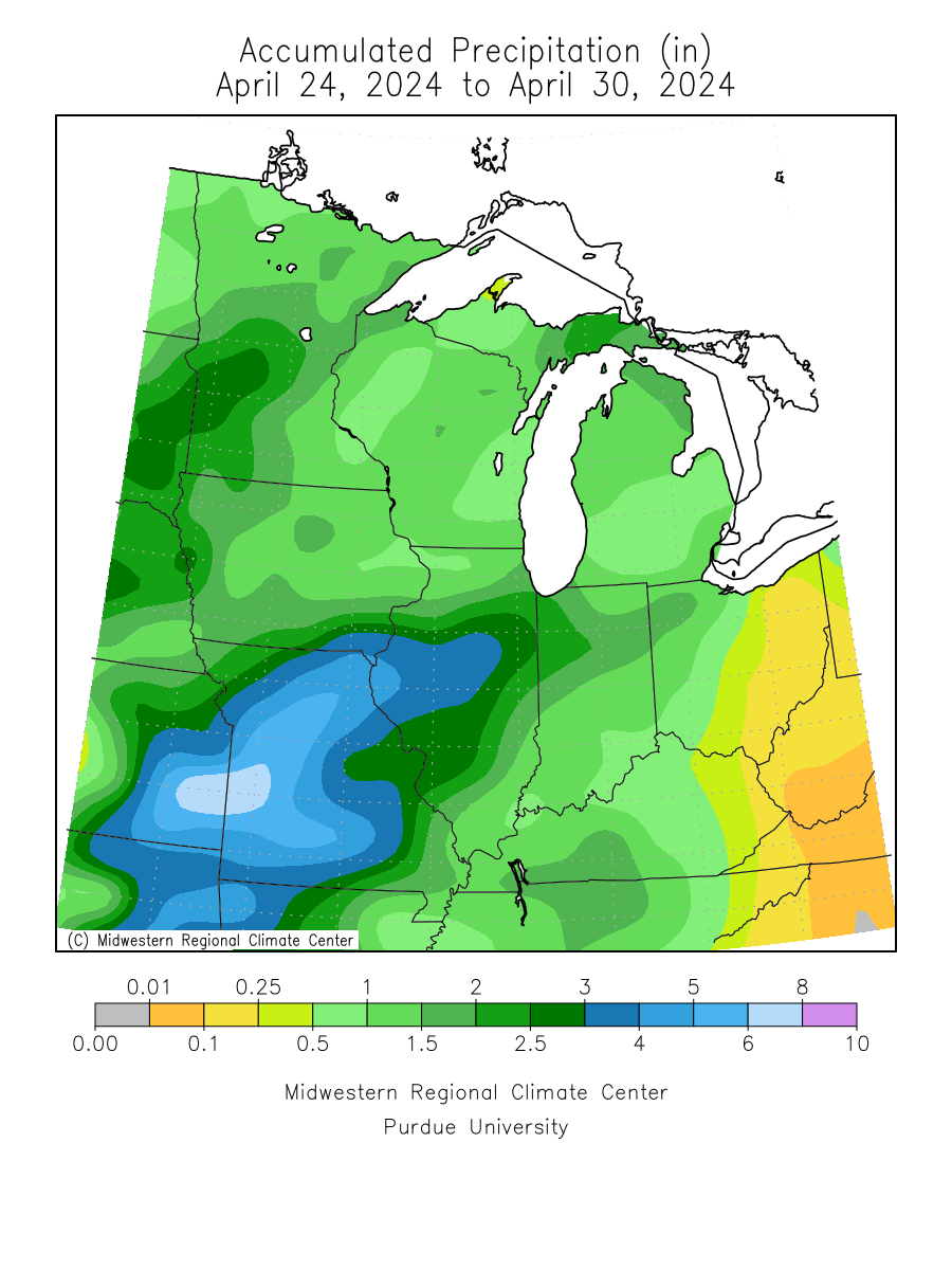
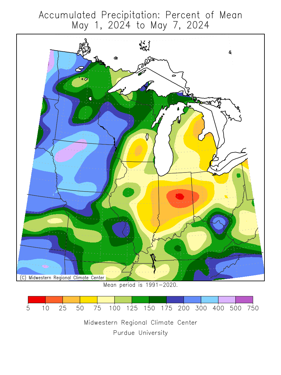
Precipitation - Last 7 days -- Wisconsin State Climatology Office
Precipitation - Departure from Normal - Last 7 days -- Wisconsin State Climatology Office
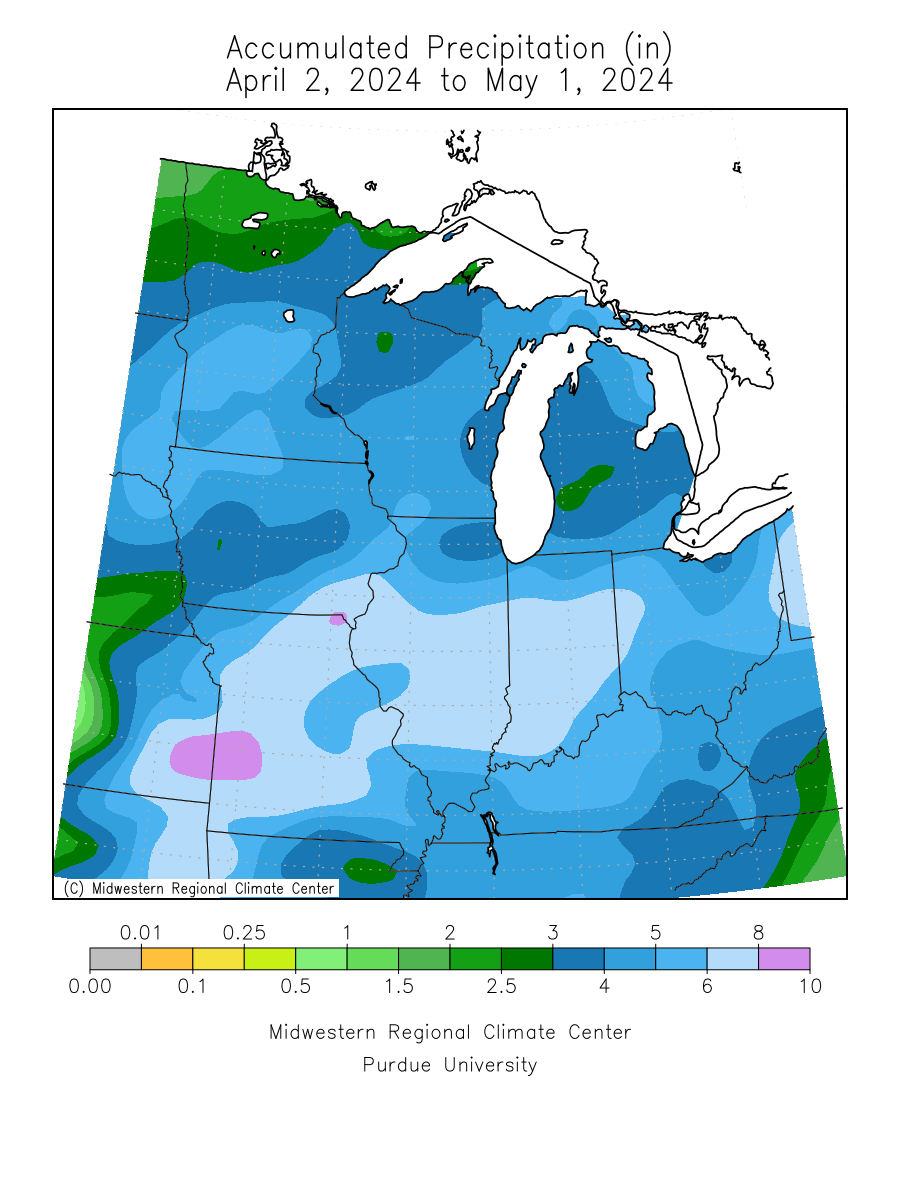
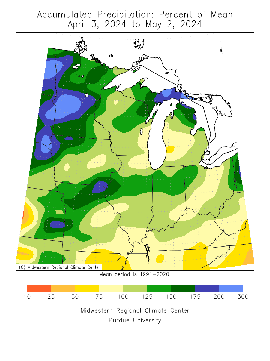
Precipitation - Last 30 days -- Wisconsin State Climatology Office
Precipitation - Departure from Normal - Last 30 days -- Wisconsin State Climatology Office
Related Links
Wisconsin Fire Weather Operating Plan
NWS National Fire Weather Page
Wisconsin DNR - Wisconsin Forest Fire Program
National Interagency Fire Center
Minnesota DNR Fire Danger Page
Michigan DNR Fire Danger Page
Wisconsin Burning Permits (WDNR)
WDNR Wildfire Dashboard
WDNR Prescribed Fire Dashboard
About the Program
The National Weather Service in Green Bay issues zone and specific "point" forecasts for various fire control agencies in Wisconsin.
The Zone Forecasts, issued twice daily, contain information about weather, wind, and humidity for a 7-day period over Wisconsin.
Point Forecasts issued by NWS Green Bay are site-specific forecasts which are issued daily for 1:00 PM Local Time the next day. Points contain forecasts for specific temperatures, humidities, and winds, and are made for ten locations in northeast and north-central Wisconsin.
Did you know that the most devastating forest fire in American history occurred in Wisconsin? Click here for the story.
Fire Weather Forecasts are issued from about April through November.

