Green Bay, WI
Weather Forecast Office
The June 10, 2016 severe storms that produced widespread wind damage across north-central and northeast Wisconsin also produced a weak tornado near Mackville in Outagamie County.
Radar and photographic evidence indicated a weak tornado (EF0) developed southwest of Mackville, about four miles north of Appleton, around 8:00 pm. The tornado formed as thunderstorms from the west moved over an old storm outflow boundary that was over the area. Except for a few tree branches, no damage was reported with the tornado.
| NWS Doppler radar images shortly after 8:00 pm on June 10. A small but pronounced velocity couplet and tornado debris signature (TDS) can be seen. The tornado photo was taken by Josh Vandewettering. Click image for larger view. |
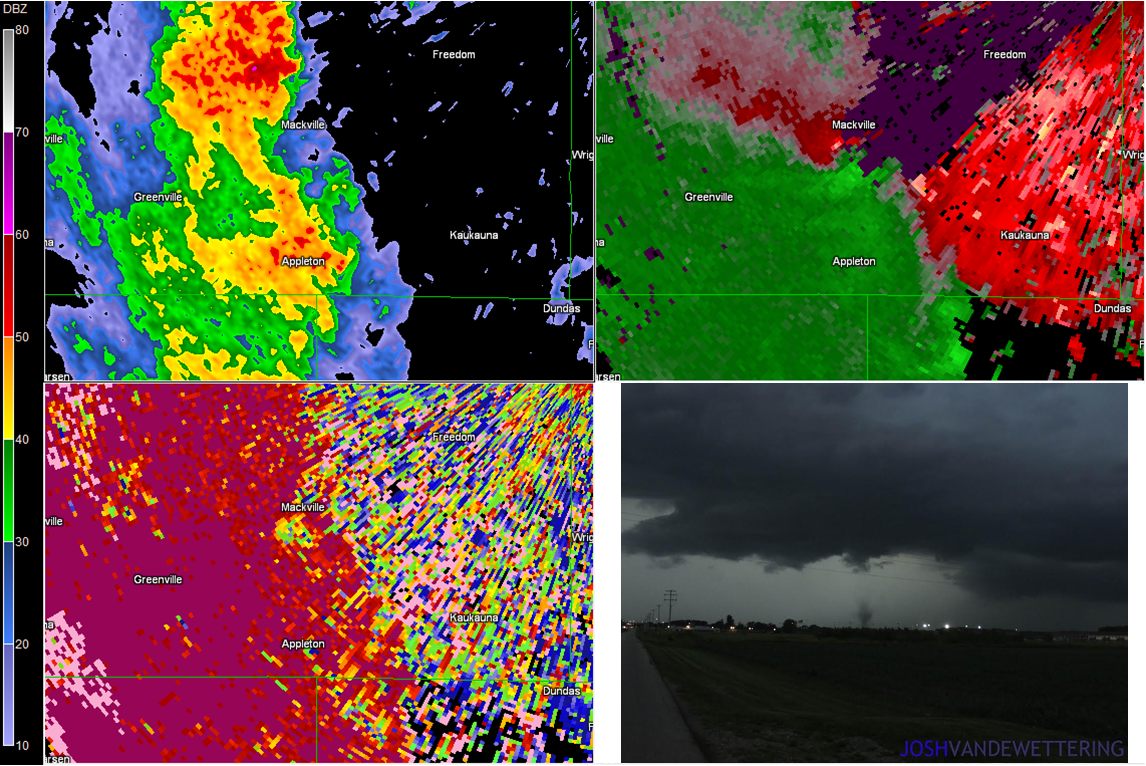 |
| Upper left: 0.5 deg base reflectivity. Upper right: 0.5 deg base velocity. Lower left: 0.5 deg correlation coefficient. |
US Dept of Commerce
National Oceanic and Atmospheric Administration
National Weather Service
Green Bay, WI
2485 South Point Road
Green Bay, WI 54313-5522
920-494-2363
Comments? Questions? Please Contact Us.

