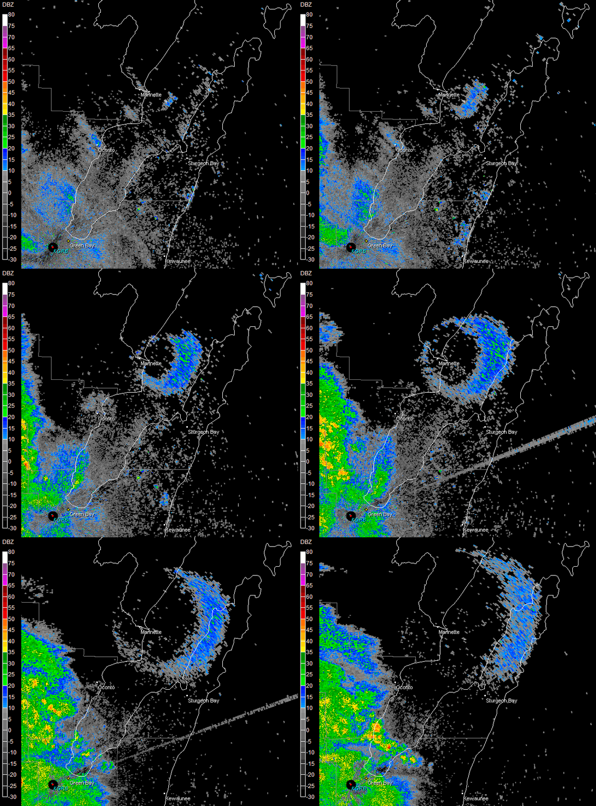
Autumn bird migration is starting and weather radar often detects large flocks of birds as they start their day. A large group of birds was detected leaving Green Island on Green Bay to feed just before sunrise on August 11, 2010. This feature, known as a "roost ring," occurs when the radar beam detects thousands of birds simultaneously taking off from their roosting site around dawn to forage for insects.
Leading up to fall migration, a number of bird species are known to gather at large communal roosting sites, which are often detected by NWS Doppler radar. The unique doughnut pattern of these roost rings is the result of birds departing their roosting site in all directions, roughly in equal densities. As they travel further from their roosting site and reach higher altitudes, they are detected by radar until they either rise above or drop below the radar beam. Some species typically return to the same roosting sites in the evening, which are usually situated near bodies of water. As a result, the roost rings are often observed in the same locations on radar over the course of several mornings.
Below is an animation of radar reflectivity from the NWS Green Bay Doppler radar. Green Island is the small crescent shaped island southeast of Marinette. The first radar picture is taken at 5:31 AM; the last one at 6:14 AM. Besides the roost ring, rain can also be seen moving into the area from the west. (Animated GIF image.)

A similar dramatic roost ring was documented on August 10, 2006.