Click on the icons on this page to see the full picture. All photographs are used with permission of the photographers.
|
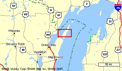
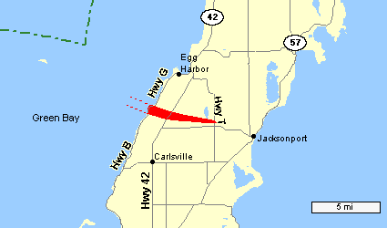
A strong tornado struck a rural section of central Door county in northeast Wisconsin during the evening of August 23, 1998. The multiple-vortex tornado was on the ground for nearly 14 minutes, and carved a path of damage 5.1 miles long, and 1/4 to over 1/2 mile wide at times. Damage was estimated at nearly $7 million. The tornado, which moved off the waters of Green Bay, moved on shore three miles southwest of Egg Harbor at 630 pm, near Horseshoe Bay. Thousands of trees were snapped or uprooted as the tornado moved across the heavily wooded area in Murphy Park. The width of the damage path just after it came on shore was nearly one-half mile! The tornado then crossed Highway 42 at about 634 pm, severely damaging several houses and businesses.
|
 |
About three minutes later the tornado ripped a two-story farm house off its foundation. Based on the house's construction, damage in this area was rated F3 (EF3), with winds estimated near 160 mph. Nearby, a campground was hit, causing considerable damage there to trees and campers. Amazingly, only two people were injured. The tornado weakened shortly thereafter, lifting off the ground three miles west-northwest of Jacksonport at around 644 pm.
|
|
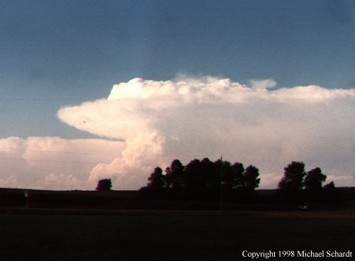
This photo was taken about the time the supercell thunderstorm was entering the waters of Green Bay, off the Menominee, Michigan coast, around 605 pm. The picture was taken 75 miles south of the storm. (Photograph © 1998 Michael Schardt) |
|
|
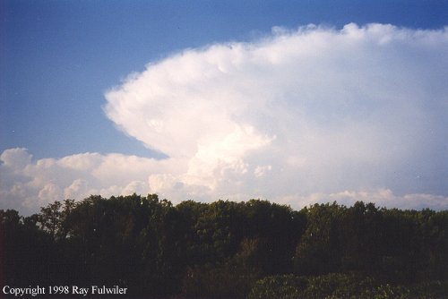
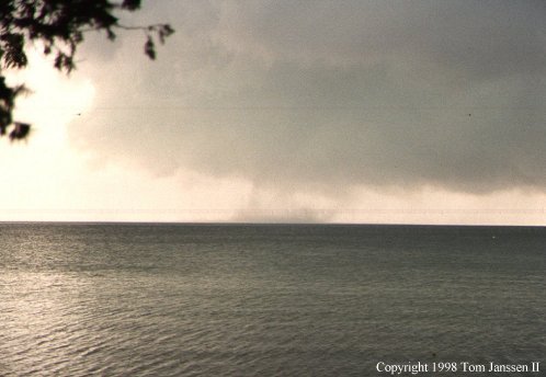
This picture was taken at around 615 pm, about the time the supercell was producing a waterspout on the bay. The picture was taken 25 miles south of the storm. (Photograph © 1998 Ray Fulwiler) |
|
|
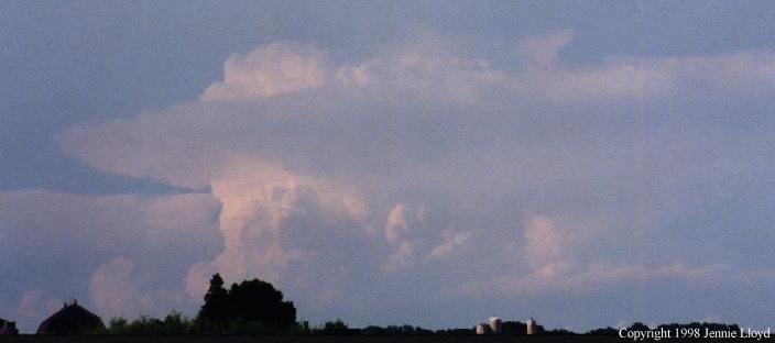
This long-distance photo was taken as the supercell thunderstorm was producing a tornado over Door county. (Photograph © 1998 Jennie Lloyd) |
|
|
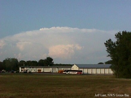
This photo was taken at 730 pm, 45 minutes after the tornado had dissipated. The storm is 70 miles away from the NWS Green Bay office at this point. (Photograph by Jeff Last) |
|
|
|
|
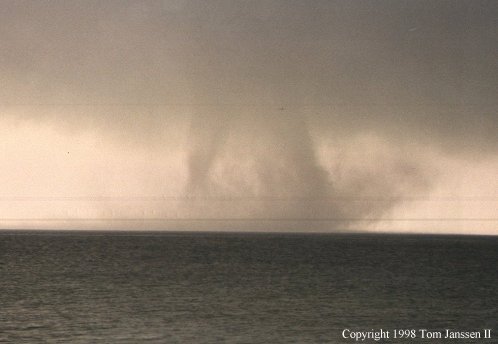
These photos were taken by Tom Janssen II at Murphy Park, which was hit by the tornado. The two on the left show the waterspout just after if developed, around 615 pm. The third picture was taken a little after 620 pm. The tornado was off the Door County shore over the waters of Green Bay. |
|
|
|
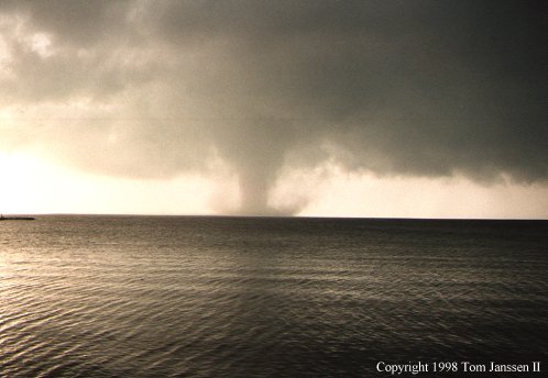
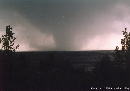
These pictures were taken by Gary Gridley, from Egg Harbor. The photo on the left was taken at 625 pm. The picture on the right was taken around 630 pm, as the tornado was coming onshore at Murphy Park. | |
|
|
|
|
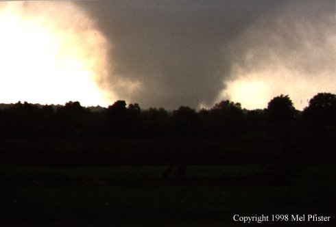
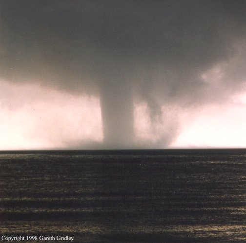
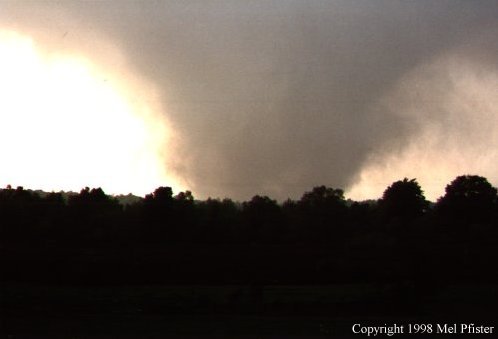
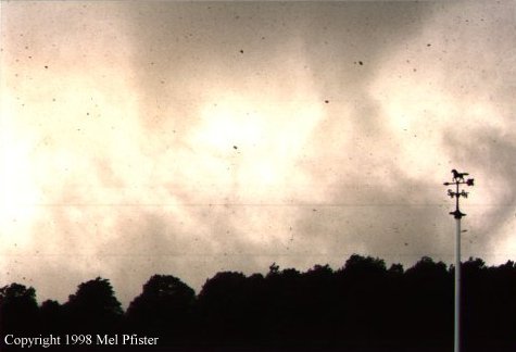
These pictures were taken by Mel Pfister, shortly after 630 pm. The tornado was two miles away from the photographer in the far left picture and about 1/2 mile away in the picture at right, where multiple vorticies and debris can be seen. The Pfister's home was damaged by the tornado shortly after the last picture was taken. |
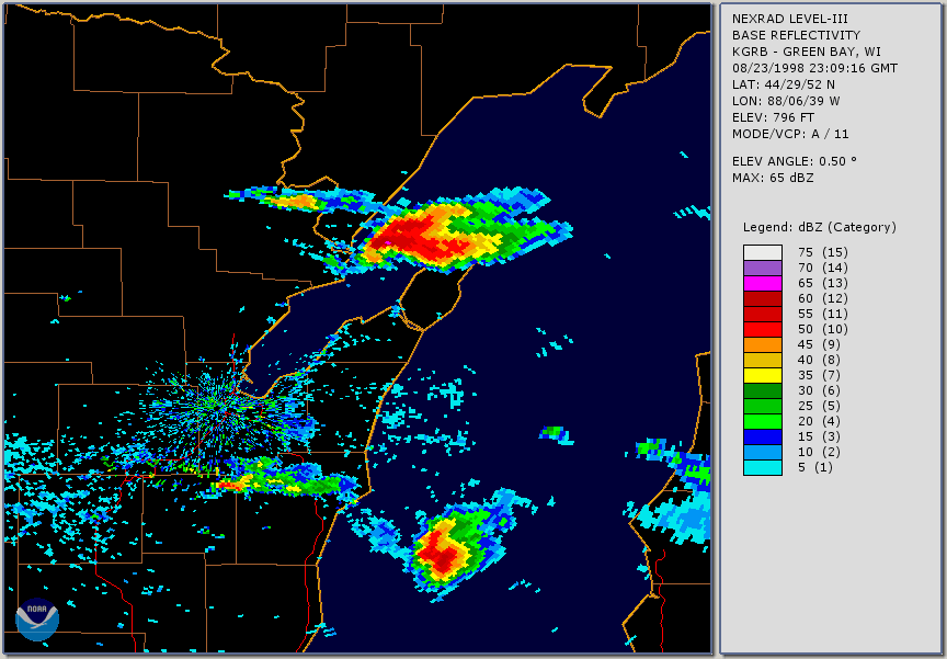
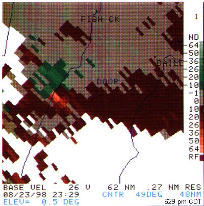
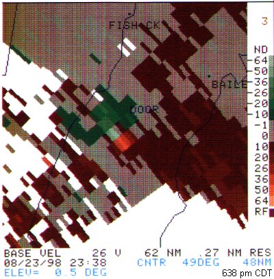
The tornado struck 53 miles northeast of the National Weather Service Office in Green Bay, which has a WSR-88D Doppler Radar. At the lowest radar elevation (0.5 degrees), the radar beam is roughly 4100 ft above the ground at this distance.
| Reflectivity | Velocity | Velocity |
|
|
|
|
|
This reflectivity animation (609 pm to 658 pm) shows the supercell thunderstorm as it moved across the county. Click image for larger view. |
This image shows the tornado vortex signature as the tornado was about to reach the west coast of Door county. | This image shows the tornado vortex signature 9 minutes later (638 pm) near the time it was producing F3 damage. |
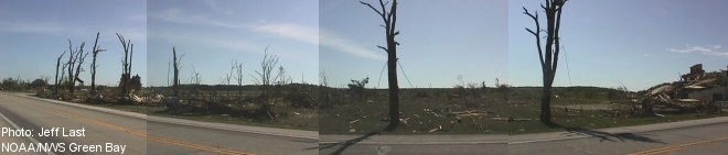
Here is a panoramic view looking east on Hwy 42. The damage width (which goes off the picture on both sides) was over 1/4 mile wide as it passed over Hwy 42. (Photograph by Jeff Last)
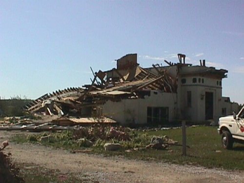
This building was on the south side of the tornado (right side of the picture above) as it passed over Hwy 42.
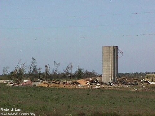
There used to be an old farm house and barn here. This damage occurred about 1.5 miles east-southeast of the picture above.

