Rare East-Central Wisconsin December Tornadoes of 1970
Usually by the first week of December, Wisconsin is firmly entrenched in winter with frigid temperatures and a fresh snow cover. On occasion, unseasonably mild air can make it into the the state. On December 1, 1970, a rare push of mild air provided the energy for severe storms and tornadoes in east-central Wisconsin.
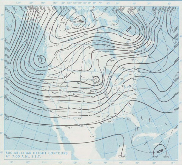
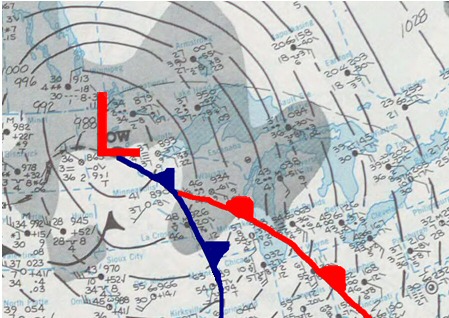
Why did four tornadoes develop across east-central Wisconsin on this date? For starters, a potent upper level storm system moved across the state, providing a source of energy and lift to produce the storms. At the same time, unseasonably mild and moist air was streaming north into central and southern Wisconsin along and south of a surface warm front. High temperatures warmed into the 50s across northeast and central Wisconsin while locations in the southeast part of the state reached the 60s. The combination of unseasonably warm and moist air and the strong upper level disturbance triggered thunderstorms along the front. Some of the thunderstorms that developed became severe and produced tornadoes.
 |
 |
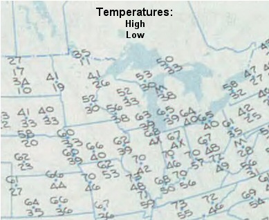 |
| 500 mb (about 18,000 ft) upper air chart at 6 AM, December 1, 1970. Click for larger view. | Surface weather chart at 6 AM, December 1, 1970. Click for larger view. | High/low temperature chart for December 1, 1970. Click for larger view. |
What made this event even more unusual was the time of the day the tornadoes occurred and the strength of the tornadoes. While most tornadoes occur during the afternoon and evening hours, the tornadoes on December 1, 1970 occurred between 7:00 AM and 10:45 AM. Three of the four tornadoes were classified as "strong." The strongest was an F3 tornado (on the then-used Fujita scale from 0-5); two others were rated F2.
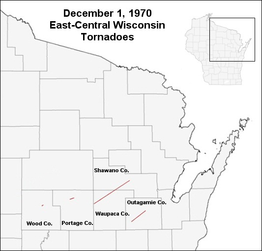
The first of the four twisters touched down north of Stevens Point in Portage County around 7:00 AM and was on the ground for nearly three miles before dissipating. Another severe storm spawned the second tornado of the day 12 miles southeast of Marshfield. The tornado was on the ground for about two miles and was rated F2. The third tornado formed around 9:45 AM four miles northwest of Iola in Waupaca County. The tornado moved northeast for 28 miles into Shawano County in Pella. A women and her three small children escaped injury when their mobile home was lifted up by the tornado and "exploded" with debris scattered over a field. This tornado was rated F2.
The fourth and strongest tornado, an F3, formed at 10:15 AM near Medina in Outagamie County. The twister moved northeast at 50 mph and destroyed twenty barns and five houses. The tornado resulted in over a half million (1970) dollars in damage.
|
|
| Approximate location of tornadoes on December 1, 1970. Click for larger view |
This event is the latest in the year tornadoes have been reported in the area since accurate tornado record-keeping began in 1950.