Green Bay, WI
Weather Forecast Office
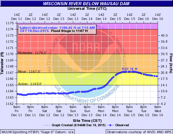
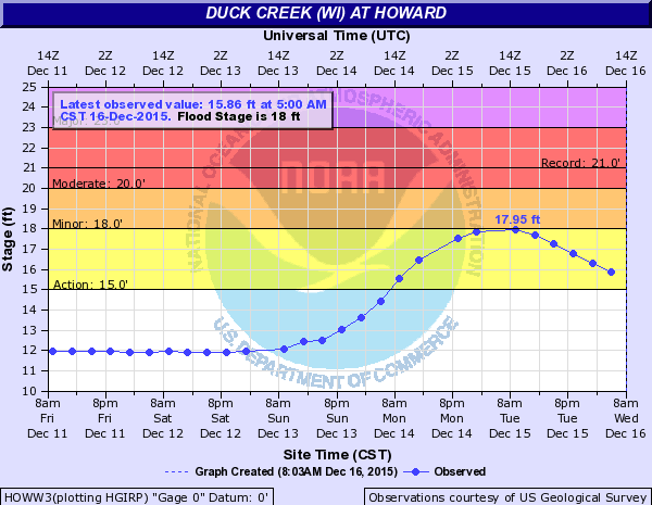
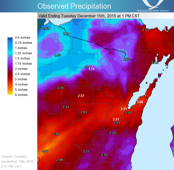
Two days of heavy rain caused local flooding across central and east-central Wisconsin on December 14. The rain came in two waves, with thunderstorms early in the morning of December 13, and a steady rain later on the 13th into the 14th. Rivers and streams rose in response to the heavy rain, with minor flooding reported near a few rivers, including the Wisconsin River and Duck Creek.
 |
|
||
| Two-day rainfall across northeast and central Wisconsin, December 13-14. Click image for larger view. | River stage observations for the Wisconsin River and Duck Creek. Click image for larger view. |
Green Bay December rainfall records were set during the event:
| Record | Amount | Comment |
| Heaviest 2-Day Total | 3.51" | Previous record 2.50" in 1891 |
| 2nd Heaviest 1-Day Total | 1.91" (12/14/2015) | Current record 1.94" on 12/14/1891 |
| 3rd Heaviest 1-Day Total | 1.60" (12/13/2015) | |
| 3rd Wettest December | 3.93" (as of 12/15/2015) | Current record 4.20" in 1893 |
In addition to the rainfall records, the river stage at Duck Creek near Howard/Hobart on the west side of Green Bay reached 18 feet, which is the highest December stage recorded (records back to 1990). Several homes in Green Bay reported water in basements and a few water-covered roads were temporarily closed.
US Dept of Commerce
National Oceanic and Atmospheric Administration
National Weather Service
Green Bay, WI
2485 South Point Road
Green Bay, WI 54313-5522
920-494-2363
Comments? Questions? Please Contact Us.