Green Bay, WI
Weather Forecast Office
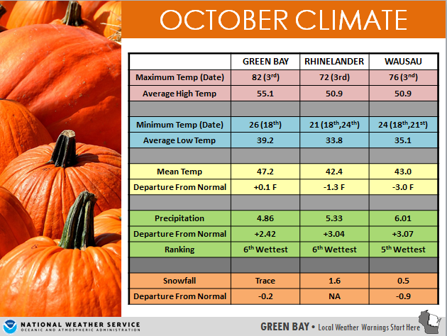
October 2018 will go down in the record books cooler and wetter than normal for most. At Green Bay, the temperature averaged a tenth of a degree above normal. For locations north and west of Green Bay, temperatures averaged 1 to 3 degrees below normal where Rhinelander was 1.3 F below normal and Wausau 3.0 F below normal. It was a very wet October across the region. Wausau recorded the 5th wettest October on record, while Green Bay and Rhinelander recorded the 6th wettest October on record.
Additional information can be found on the Midwest Climate Watch from the Midwest Climate Center at: https://mrcc.illinois.edu/cliwatch/watch.htm
US Dept of Commerce
National Oceanic and Atmospheric Administration
National Weather Service
Green Bay, WI
2485 South Point Road
Green Bay, WI 54313-5522
920-494-2363
Comments? Questions? Please Contact Us.

