Green Bay, WI
Weather Forecast Office
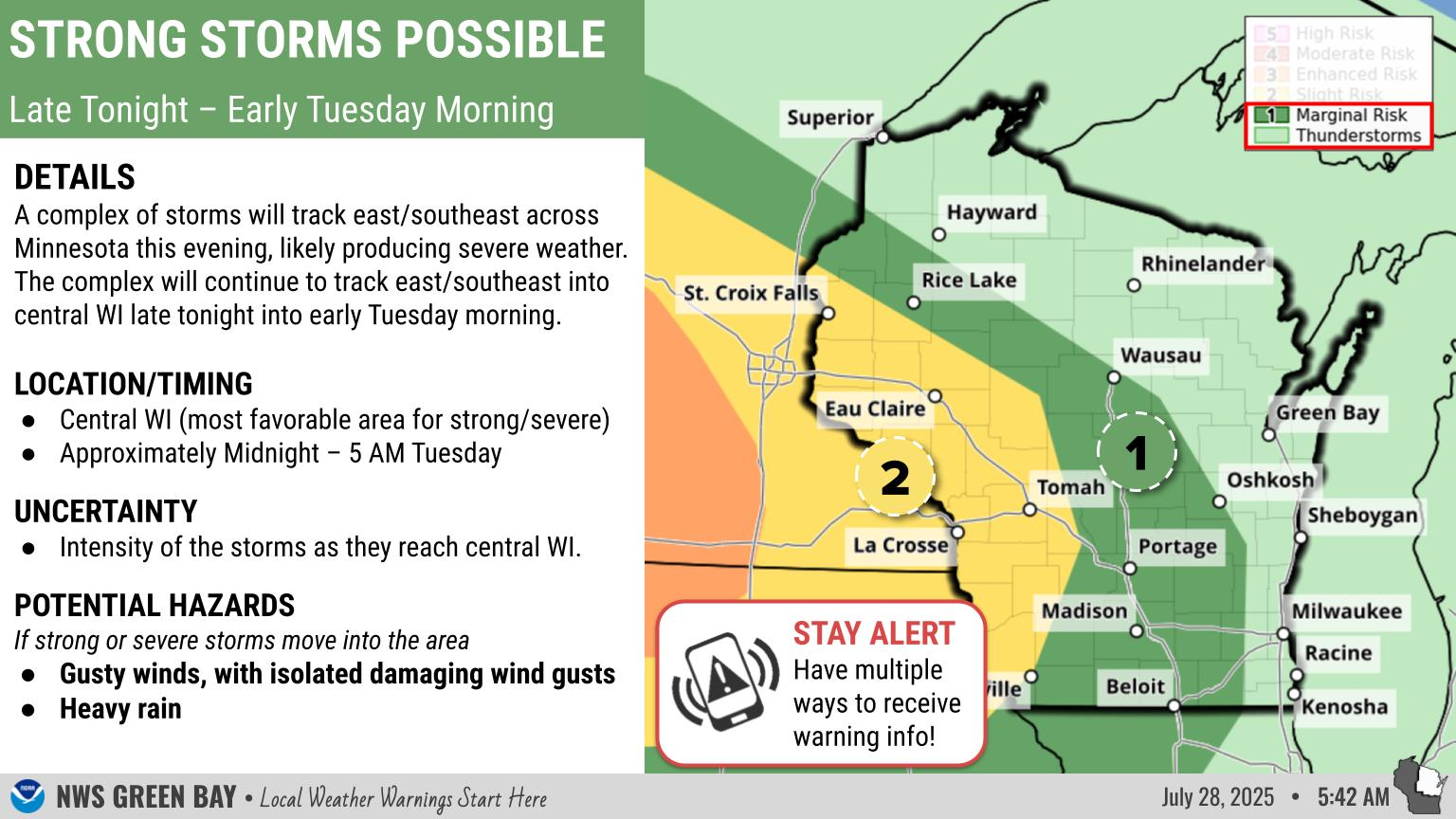
What to Expect: A fast moving storm system will bring a round of snow to the area Sunday. The heaviest snow is expected to fall across central and east-central Wisconsin.
Roads are likely to become snow covered and slippery Sunday morning, with the snow probably hampering travel through Sunday evening. Monitor road conditions by visiting the Wisconsin DOT site: http://511wi.gov
Actions: Remember to slow down, keep extra distance between vehicles, and allow extra time to reach your destination. Be sure and check back with this page as it will be undated when the forecast changes and as the snow moves through the area.
Current Watches, Warnings, and Advisories Across the Region

Highlights of Upcoming Weather
Current Official Snowfall Forecast

Current Radar

Recent Snowfall Reports
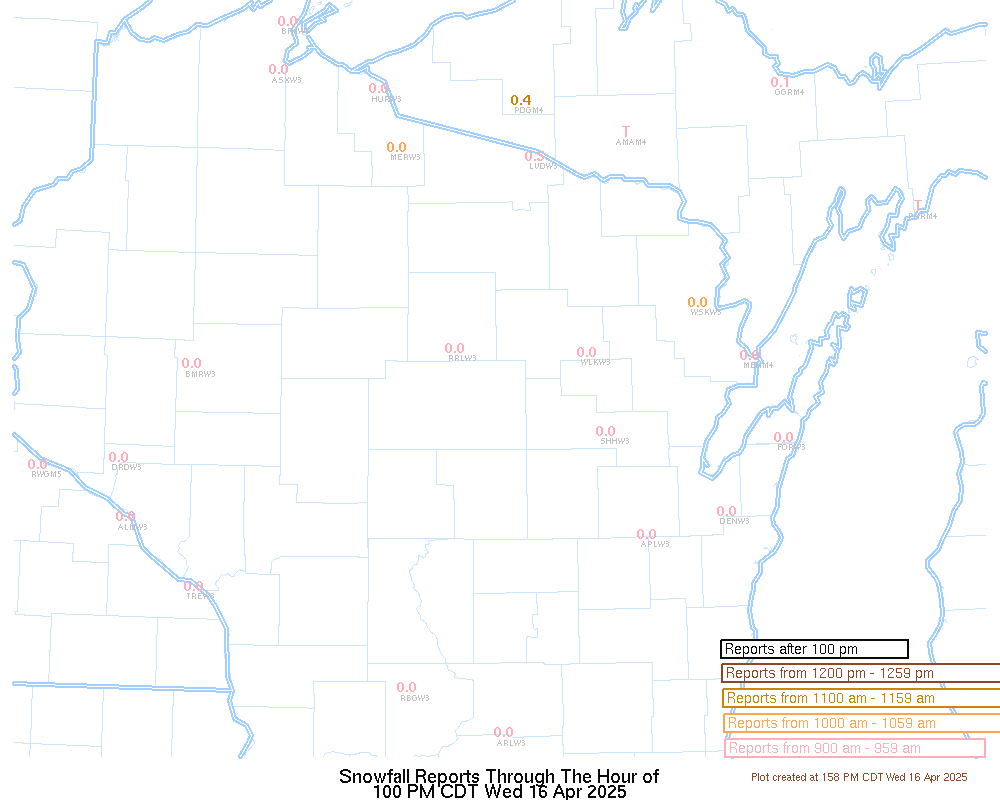
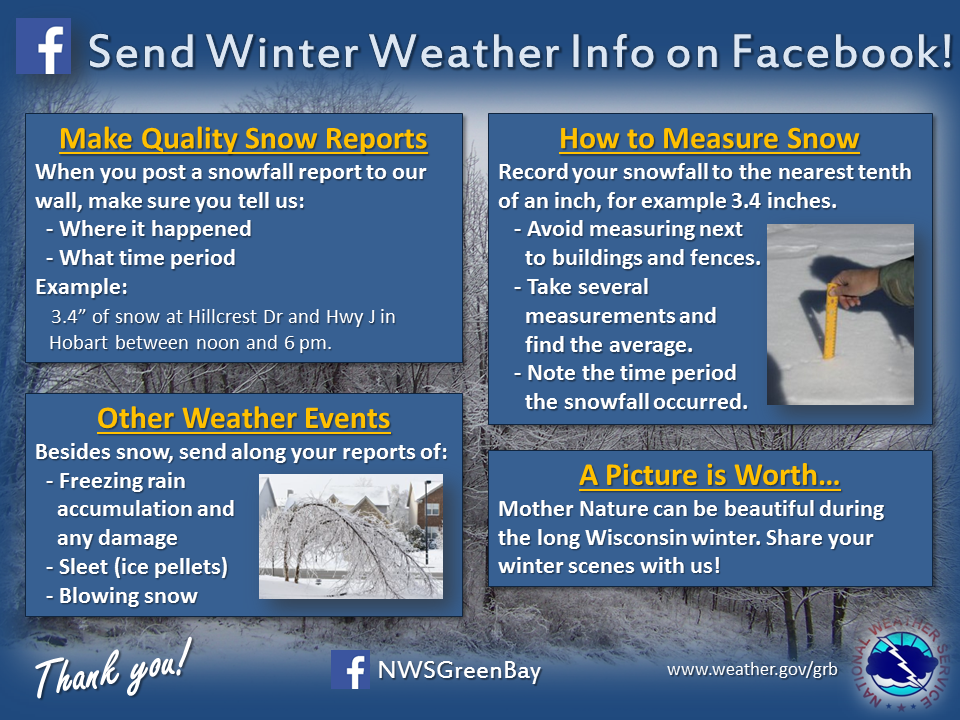
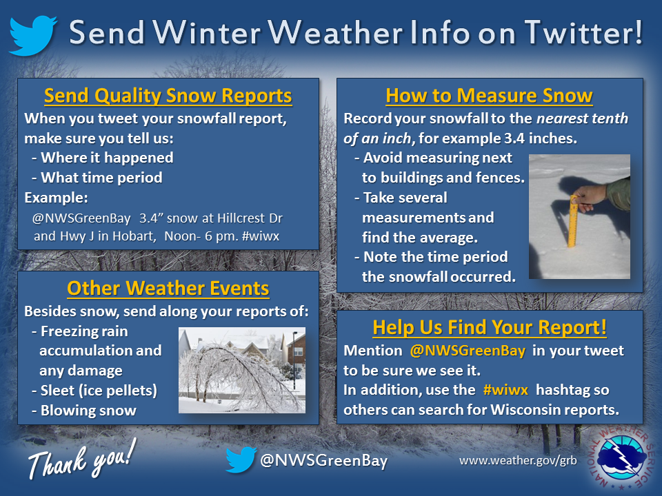
We Appreciate Your Snowfall Reports!
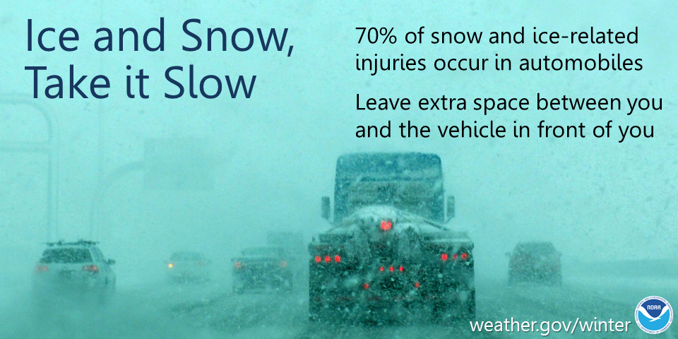
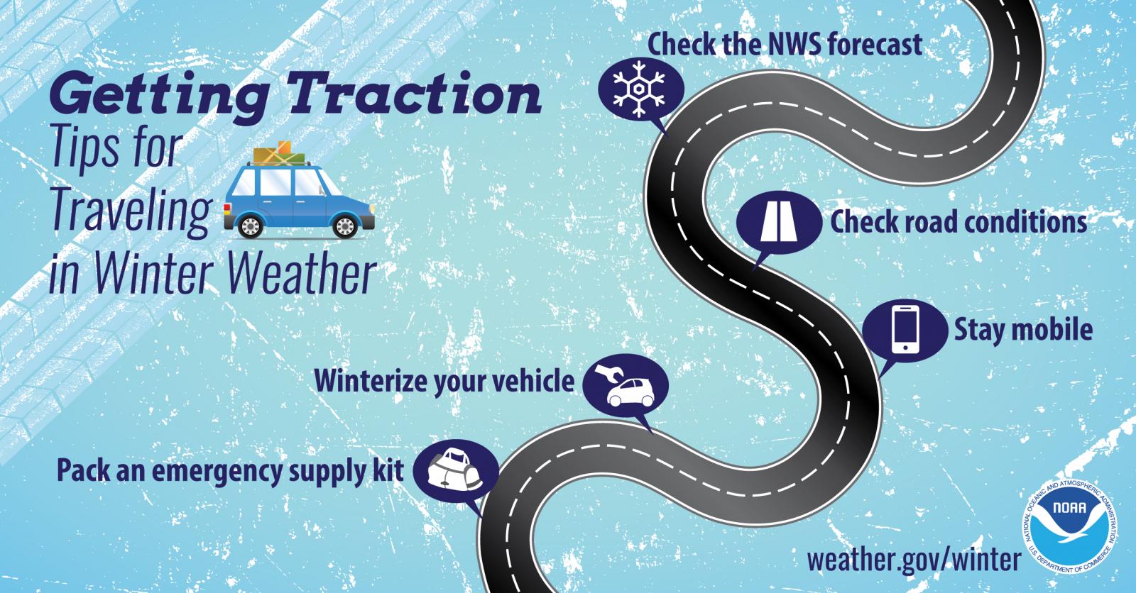
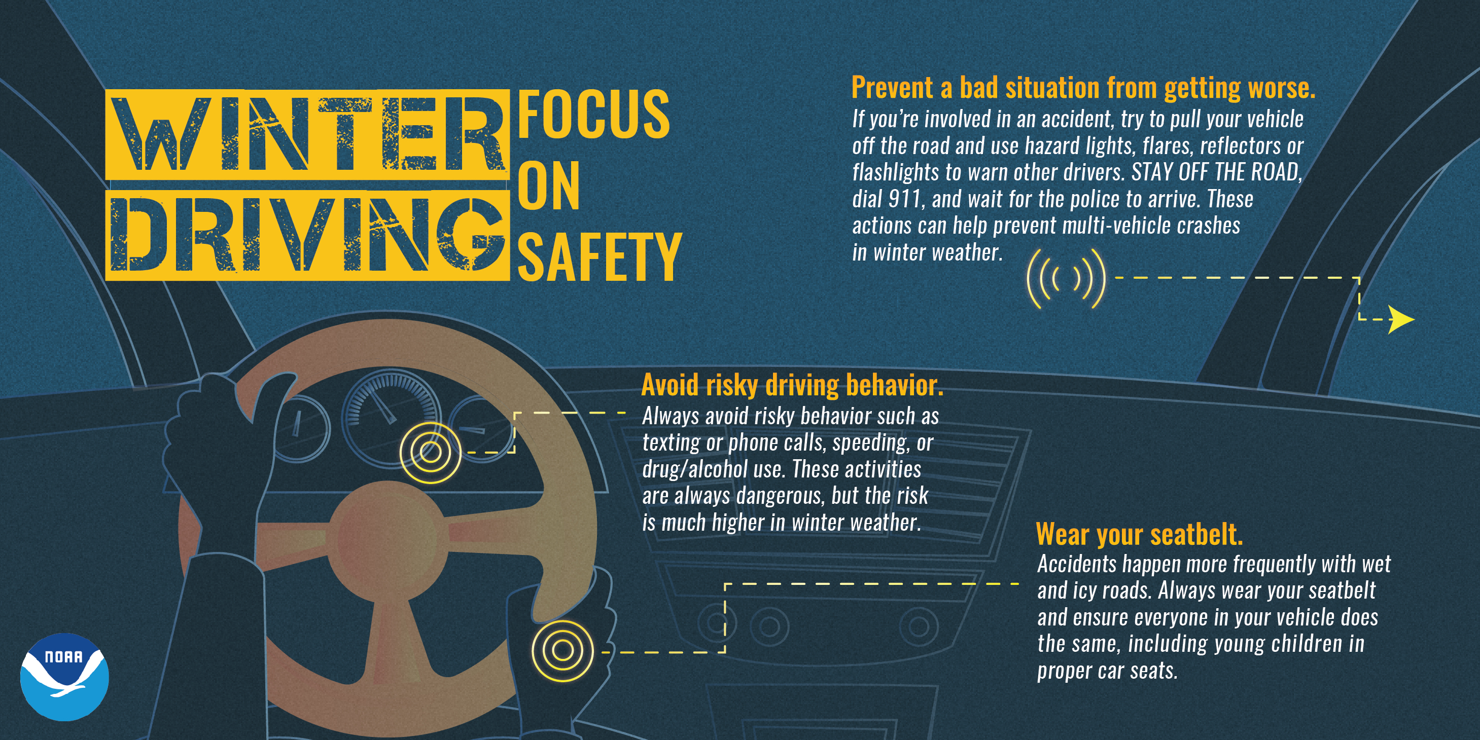
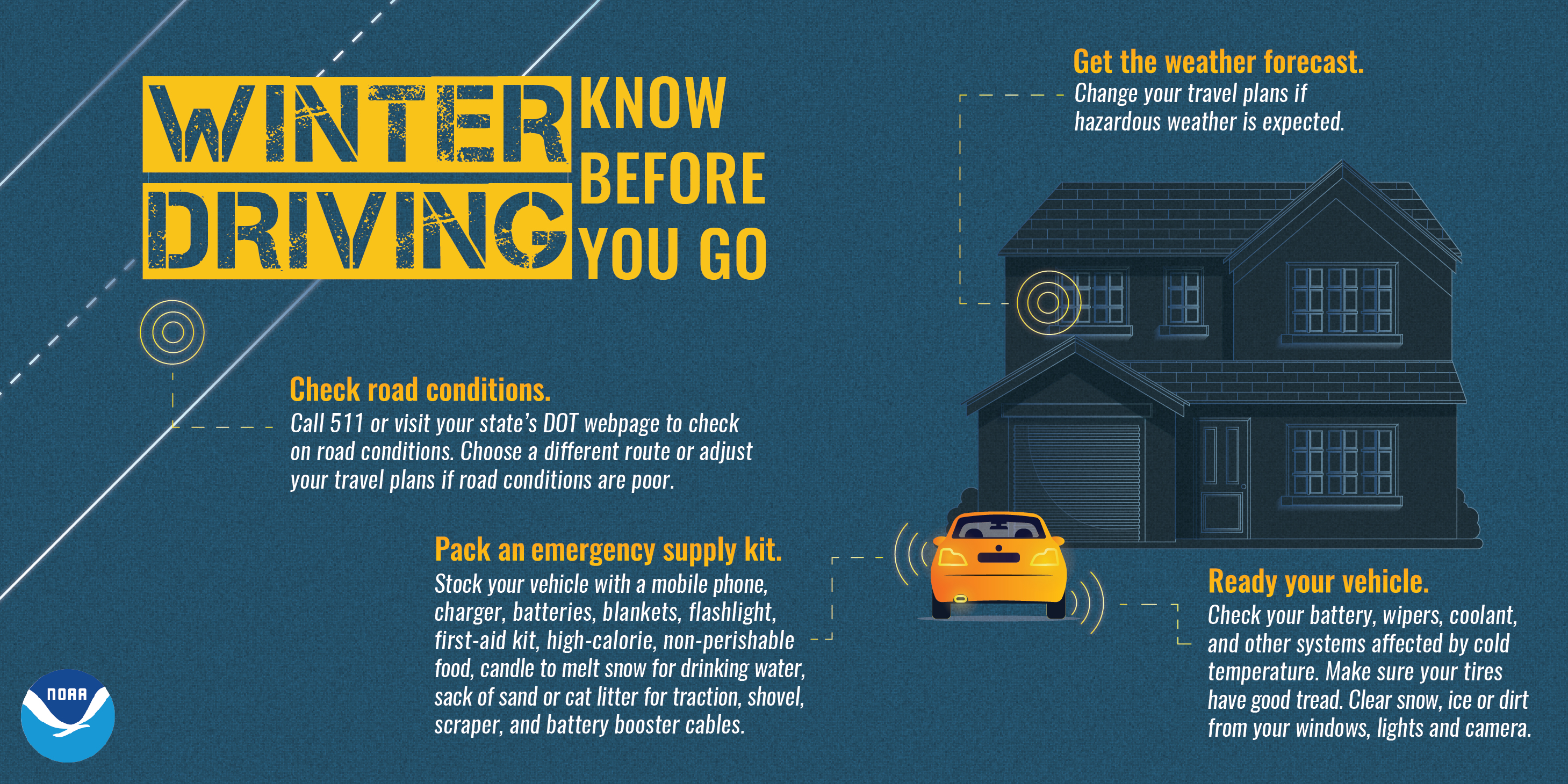
Safety Information
.jpg)
 Media use of NWS Web News Stories is encouraged!
US Dept of Commerce
National Oceanic and Atmospheric Administration
National Weather Service
Green Bay, WI
2485 South Point Road
Green Bay, WI 54313-5522
920-494-2363
Comments? Questions? Please Contact Us.

