Green Bay, WI
Weather Forecast Office
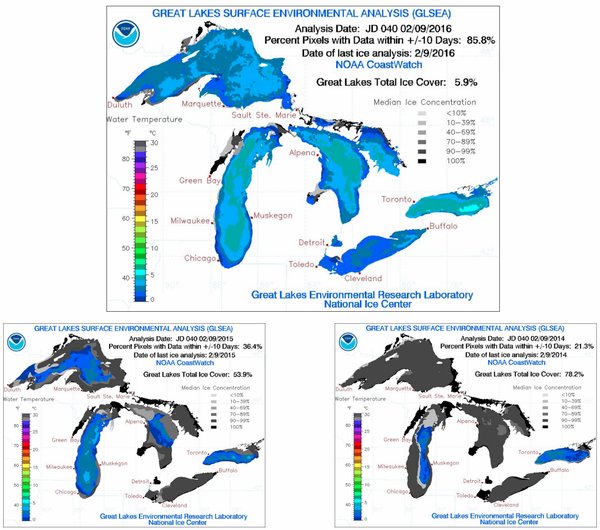
Ice coverage on the Great Lakes as of 2/9/2016 is only 6%. The lack of ice is partly due to the fact there was a strong El Niño all winter long which led to above normal temperatures, with a record warmest December in Green Bay, Wausau, and Rhinelander. Ice coverage is down dramatically compared to 2015 when there was just over 50% coverage and 78% in 2014. (see graphic below) In fact, ice coverage on Lake Michigan peaked at 94% in March 2014. This shows just how much ice coverage can vary year to year. The big difference we see in the weather is an increase in lake effect clouds/snow down wind of the Great Lakes. As long as the lakes stay free of ice, expected continued bouts of lake effect snow and clouds with each period of cold weather.
US Dept of Commerce
National Oceanic and Atmospheric Administration
National Weather Service
Green Bay, WI
2485 South Point Road
Green Bay, WI 54313-5522
920-494-2363
Comments? Questions? Please Contact Us.

