Abnormally dry to moderate drought conditions were noted across the area during the first half of June. Since then, there have been several periods of heavy rain across much of the area. Below the map are rainfall totals since June 20th from COOP observers and ASOS sites.
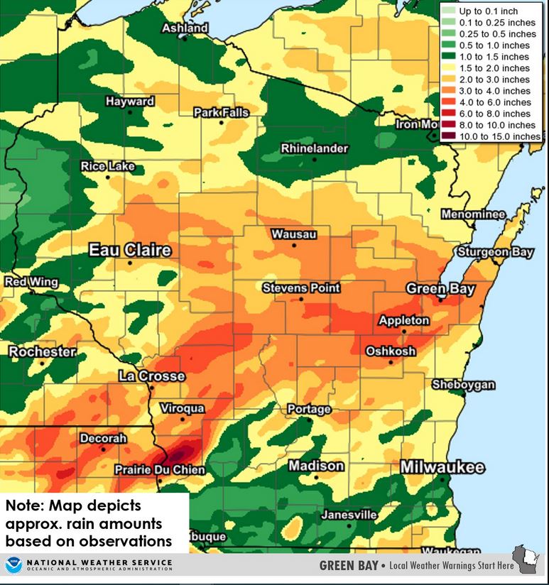
                    Rainfall                                   RAINFALL
Location            (INCHES)           LOCATION                (INCHES)
------------------------------------------------------------------------------
Stevens Point           5.05           Suring                    2.95
Wisc. Rapids COOP       5.05           Merrill                   2.89
Waupaca                 5.01           Eau Pleine Reservoir      2.75
New London              4.96           Florence                  2.73
Pulaski                 4.75           Forestville               2.59
Green Bay Botanical     4.59           Willow Reservoir          2.47
Shiocton                4.46           Washington Island         2.44
Clintonville            4.29           Antigo                    2.31
Green Bay NWS           4.05           Marshfield COOP           2.08
Appleton                4.03           White Lake                2.07
Wautoma                 4.01           Two Rivers                2.07
Green Bay East          3.97           Lac Vieux Desert          1.97
Green Bay ASOS          3.91           Summit Lake               1.95
Wisc. Rapids ASOS       3.84           Brillion                  1.90
Wausau                  3.71           Peshtigo                  1.86
Shawano                 3.55           Manitowoc                 1.49
Wausau                  3.52           Crivitz High Falls        1.45
Oshkosh COOP            3.26
Waupaca                 3.18
Stratford               3.08

