
Frontal boundary and wave of low pressure will keep an active weather pattern from the Great Lakes region through the southern Plains the next couple of days. Isolated instances of severe thunderstorms and flash flooding are possible. Meanwhile, as summer comes to a close, above normal temperatures continue for central and eastern U.S. - especially for most of Puerto Rico with excessive heat. Read More >
Green Bay, WI
Weather Forecast Office
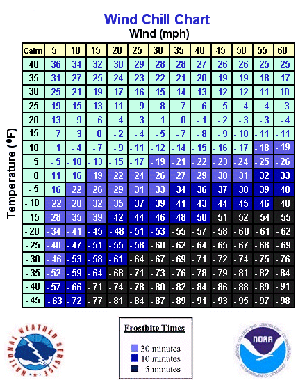
Gusty northwest winds combined with a fresh surge of bitterly cold air will overspread the area tonight. Wind chill indices of 20 below to 30 below zero are expected by late tonight. Wind chills this low indicate that frostbite to exposed skin can occur in as little as 20 to 30 minutes. If you are planning to be outdoors at any point, be sure to dress appropriately. Multiple layers of light clothing provide better insulation against the cold than a single heavy layer.
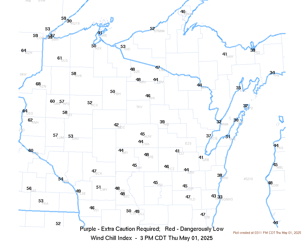
| Current Watches, Warnings & Advisories - Click for larger view | Latest Wind Chill Values - Click for larger view |
 |
 |
 |
Click here for a
Here are some additional links to help monitor the winter weather: |
Here are some additional links to help monitor the weather:
US Dept of Commerce
National Oceanic and Atmospheric Administration
National Weather Service
Green Bay, WI
2485 South Point Road
Green Bay, WI 54313-5522
920-494-2363
Comments? Questions? Please Contact Us.

