Overview
|
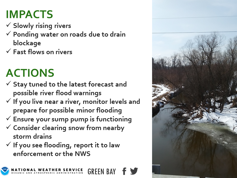
River levels c recede
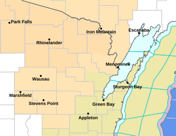
River levels and high flows across the Wolf and Fox river basins will remain steady or slowly recede this week. Boaters should continue to use caution when venturing on area rivers. Persons living near rivers and streams should monitor the latest river forecasts and hydrologic statements. See the image to the right for current river flood warning locations. Please click on the tabs below for more information. Click on any image for a larger view. For additional river forecasts, stages, impacts, crests, and other information, please visit our AHPS Website. |
|
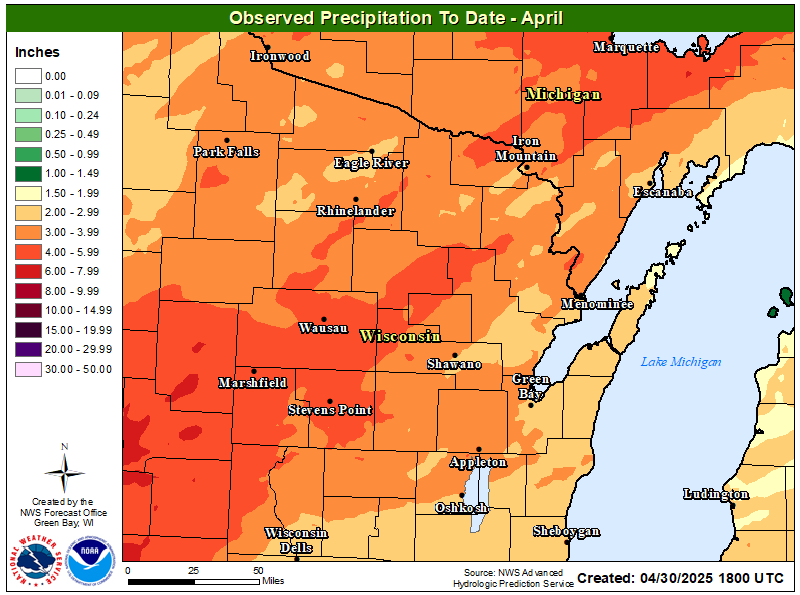
Precipitation
|
|
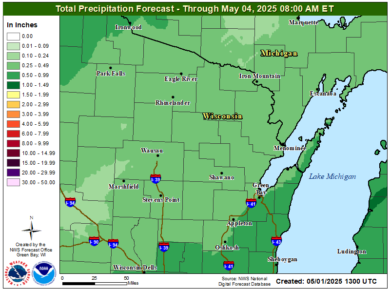 3-Day Precipitation Forecast 3-Day Precipitation Forecast |
|
 WPC Day 1-3 QPF Forecast WPC Day 1-3 QPF Forecast |
 WPC Day 1-7 QPF Forecast WPC Day 1-7 QPF Forecast |
|
| Additional WPC Forecasts | ||
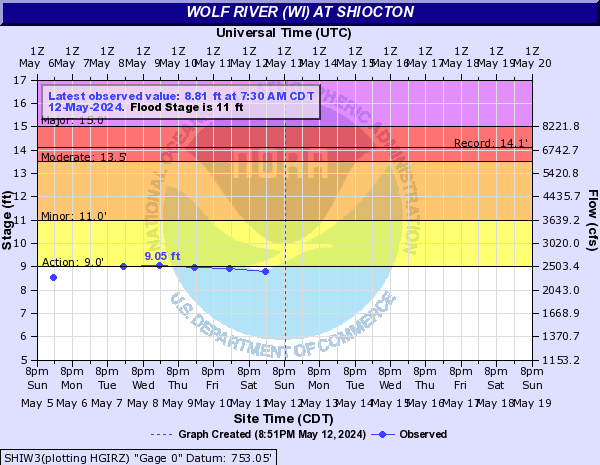
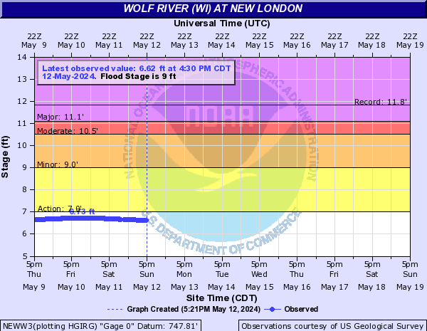
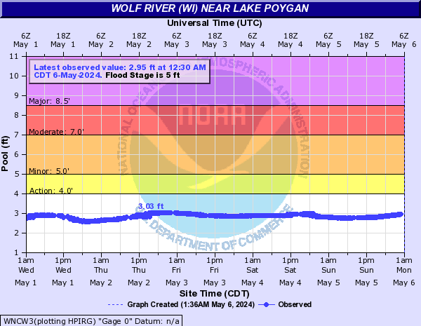
Wolf / Embarrass Rivers
Click on "more info" for information on the river location, flooding impacts, historic crests, and other information.
|
|
|
|
|
|
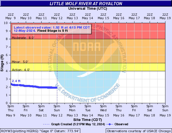 Wolf River @ Royalton (more info) Wolf River @ Royalton (more info) |
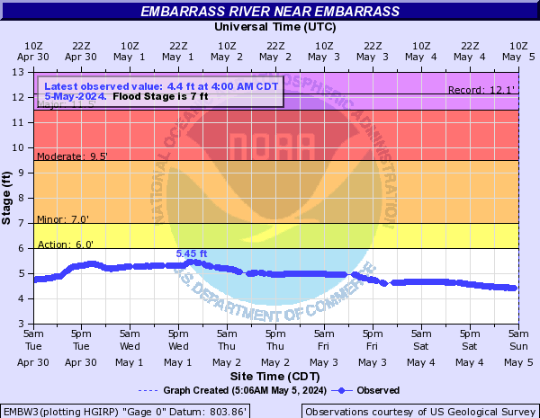 Embarrass River @ Embarrass (more info) Embarrass River @ Embarrass (more info) |
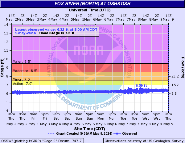
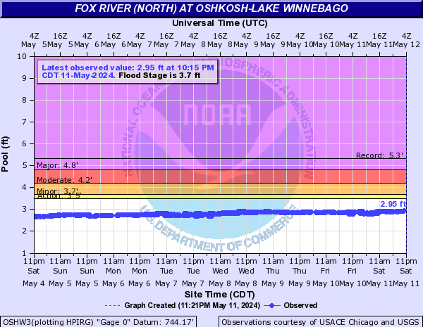
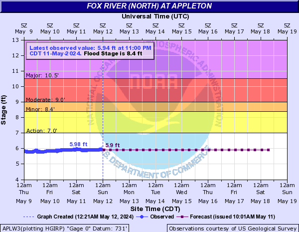
Fox River
Click on "more info" for information on the river location, flooding impacts, historic crests, and other information.
|
|
|
|
|
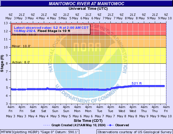
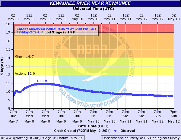
Manitowoc River / Kewaunee River
Click on "more info" for information on the river location, flooding impacts, historic crests, and other information.
|
|
|
Wisconsin / Yellow Rivers
Click on "more info" for information on the river location, flooding impacts, historic crests, and other information.
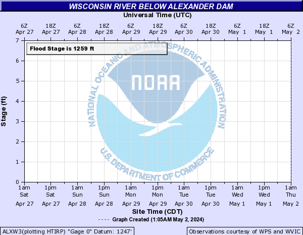 Wisconsin River below Alexander Dam (more info) Wisconsin River below Alexander Dam (more info) |
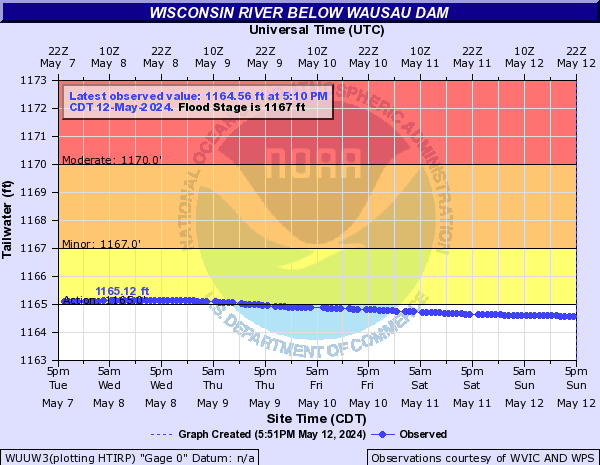 Wisconsin River below Wausau Dam (more info) Wisconsin River below Wausau Dam (more info) |
|
|
 Wisconsin River below Stevens Point Dam (more info) Wisconsin River below Stevens Point Dam (more info) |
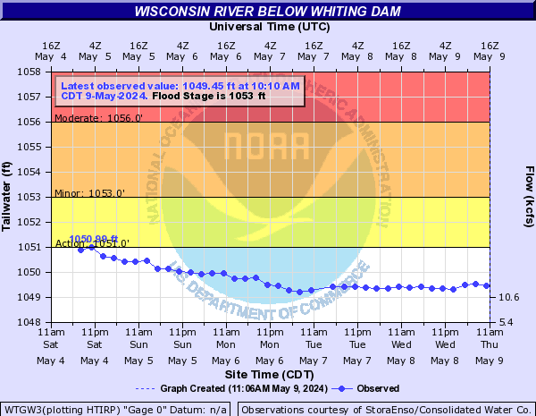 Wisconsin River below Whiting Dam (more info) Wisconsin River below Whiting Dam (more info) |
 Wisconsin River below Whiting Dam (more info) Wisconsin River below Whiting Dam (more info) |
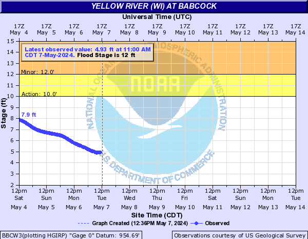 Yellow River @ Babcock (more info) Yellow River @ Babcock (more info) |
 |
Media use of NWS Web News Stories is encouraged! Please acknowledge the NWS as the source of any news information accessed from this site. |
|