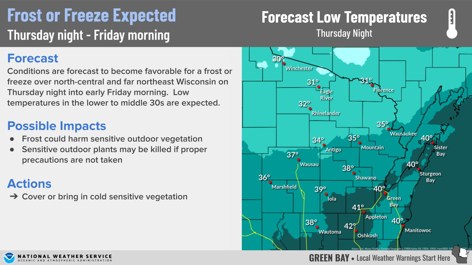
Prolonged Period of Cold Weather
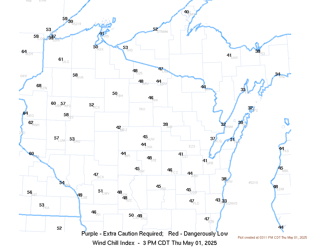
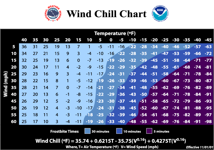
| The weather pattern over the next several days will allow for multiple surges of cold air and little variation in temperatures from day to day. Afternoon highs will generally be in the single digits and teens, with overnight lows falling below zero, especially away from Lake Michigan. Saturday will be the only day where highs are closer to normal. (See detailed temperature forecasts in the tab on the right.) Wind will also make temperatures feel much colder, with wind chills of 15 to 30 below zero possible, especially during the nights and mornings. Wind Chill Advisories will be needed at times during this cold stretch of weather.
Current Advisories and Warnings |
|
Temperature / Wind Chill
 |
 |
 |
|
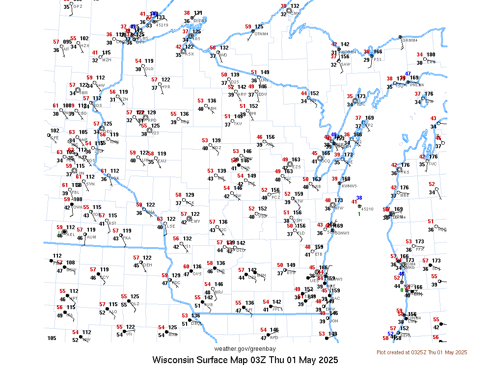
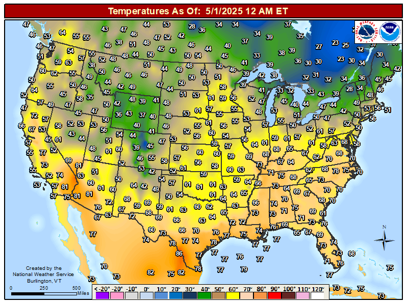
| Current Surface Map | Current Wind Chills | Current Temps Across The U.S. | |
 |
 |
 |
|
| High Temperature Forecast Day 1 | High Temperature Forecast Day 2 | High Temperature Forecast Day 3 | |
 |
 |
 |
|
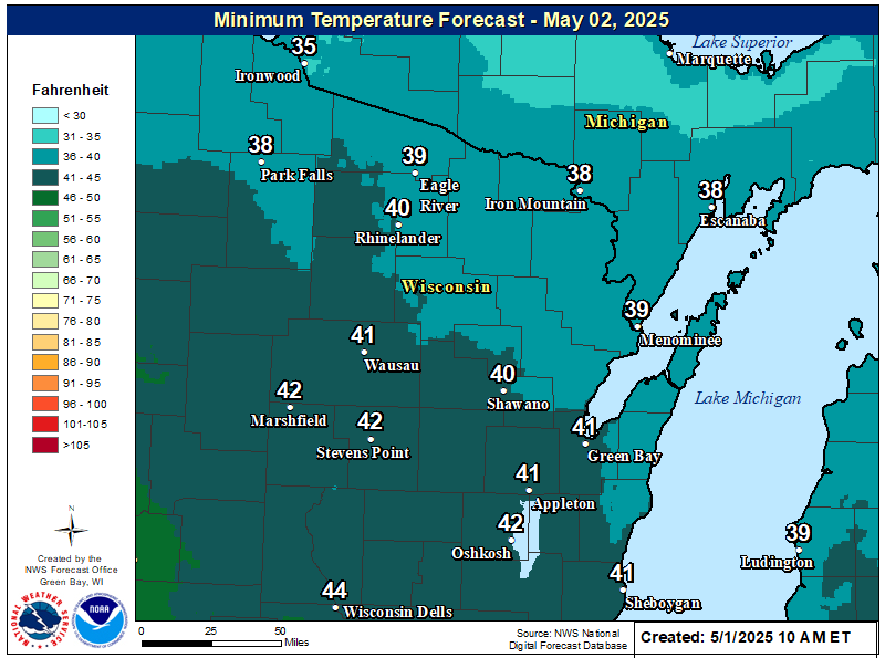
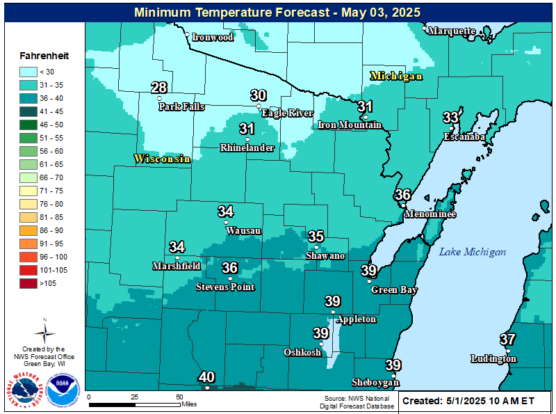
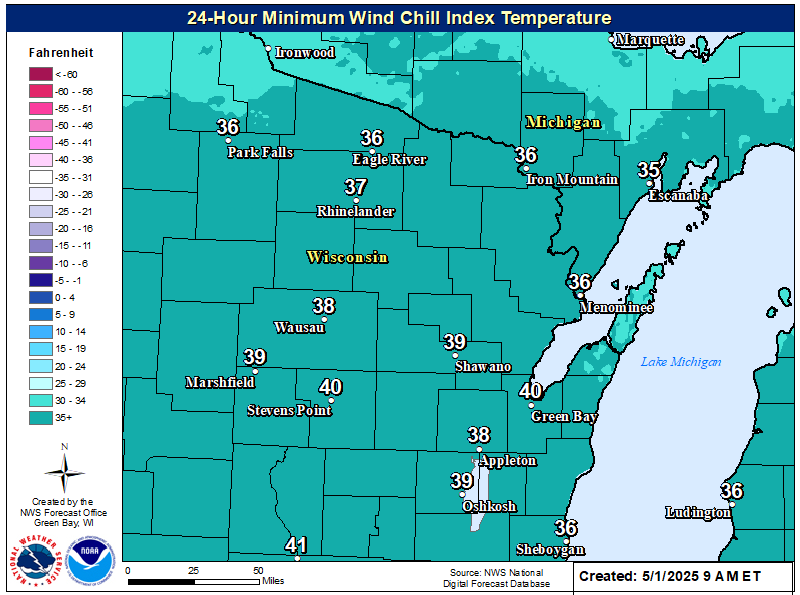
| Low Temperature Forecast Day 1 | Low Temperature Forecast Day 2 | 24-Hour Coldest Wind Chill Forecast |
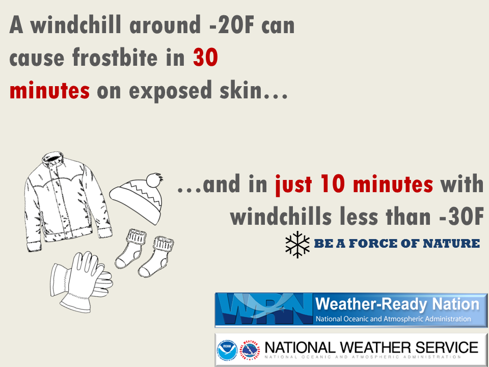
Wind Chill Index Chart
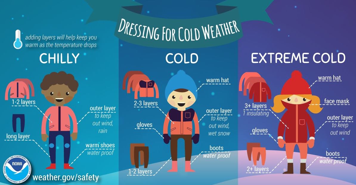
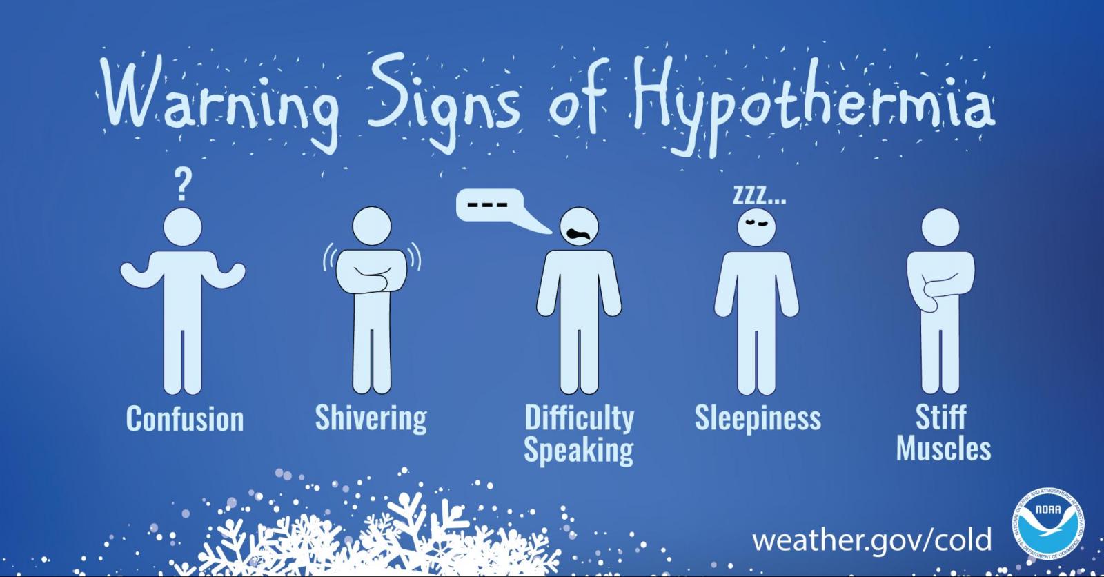
Cold Weather Safety Information
| Cold Weather | ||
|
|
|
|
| Wind Chills Facts | Dressing For Cold Weather | Hypothermia Inf |
|
|
|
.png) |
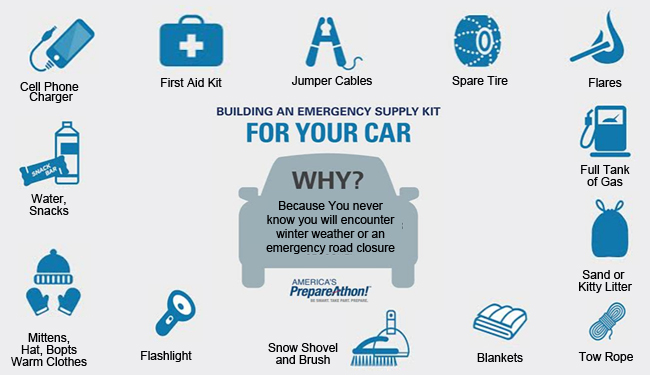
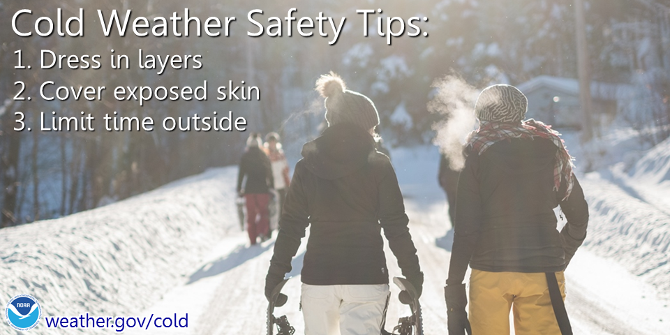
| Supply Kit for Your Car | Cold Weather Safety Tips | Safety Tips for Your Pets |
 |
Media use of NWS Web News Stories is encouraged! Please acknowledge the NWS as the source of any news information accessed from this site. |
|