Green Bay, WI
Weather Forecast Office
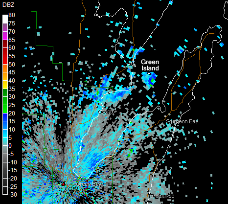
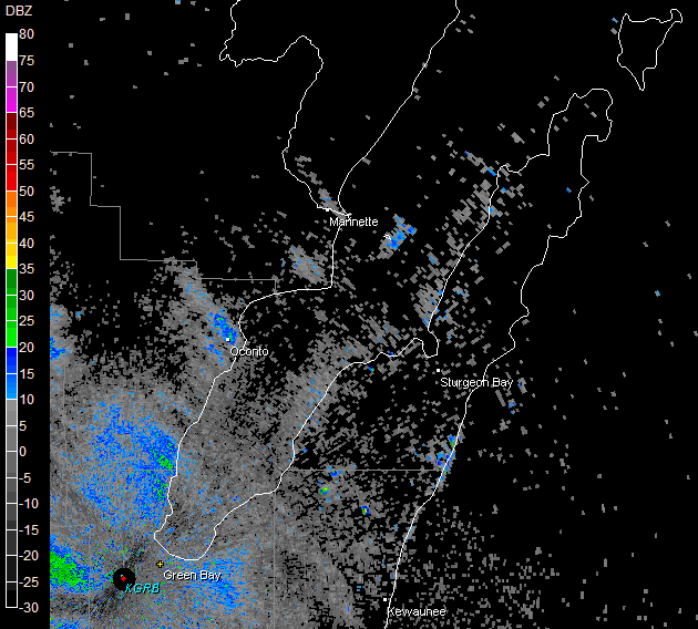
Leading up to fall migration, a number of bird species are known to gather at large communal roosting sites, which are often detected by NWS Doppler radar. The unique doughnut pattern, known as a "roost ring," is the result of birds departing their roosting site in all directions, roughly in equal densities. As they travel further from their roosting site and reach higher altitudes, they are detected by radar until they either rise above or drop below the radar beam. Some species typically return to the same roosting sites in the evening, which are usually situated near bodies of water. As a result, the roost rings are often observed in the same locations on radar over the course of several mornings.
Here are two examples showing roost rings as birds begin to forage for food near sunrise from Green Island in Green Bay:
| Below is an eight-image animation of radar reflectivity from the NWS Green Bay Doppler radar on August 10, 2006. The first radar picture is taken at 5:25 AM; the last one about 6:15 AM. | This roost ring occurred on August 11, 2010. The first radar picture is taken at 5:31 AM; the last one at 6:14 AM. Besides the roost ring, rain can also be seen moving into the area from the west. | |
 |
 |
US Dept of Commerce
National Oceanic and Atmospheric Administration
National Weather Service
Green Bay, WI
2485 South Point Road
Green Bay, WI 54313-5522
920-494-2363
Comments? Questions? Please Contact Us.

