Dangerous heat will expand from the Gulf Coast into the Southern Plains and Desert Southwest through week's end. Additional extreme heat impacting the Pacific Northwest will shift to the northern Plains by the weekend. Tropical Storm Bertha is expected to continue to impact portions of the northwestern Gulf Coast from south central Louisiana to the upper Texas coast today. Read More >
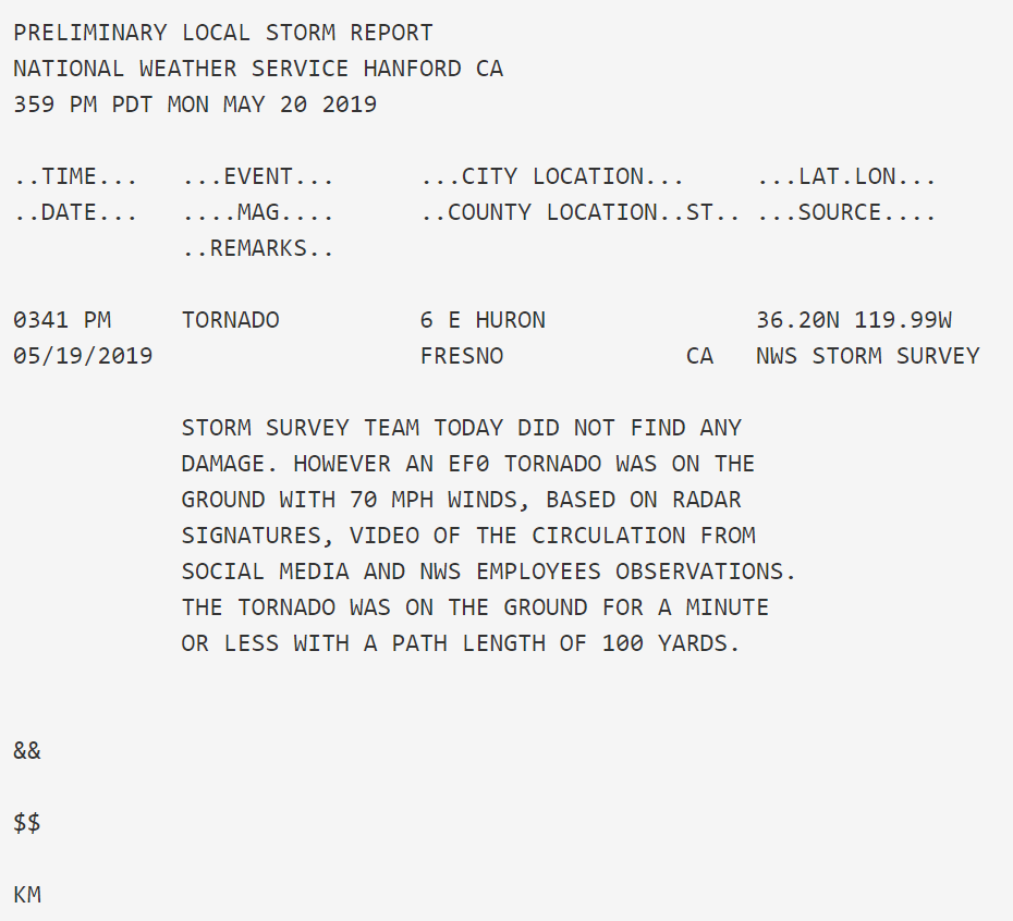
After thorough analysis of radar data, storm surveys and consultation with local residents, a tornado was confirmed east of Huron in Fresno county.
This was the sixth confirmed tornado in NWS Hanford's area this season, 5 EF0s and one EF1 in Clovis.
Below are pictures of the storm, and radar data during its brief touchdown. This cell also produced significant accumulating small hail on roads in Stratford, which led to a traffic accident. Hail damaged nearby crops and agriculture.

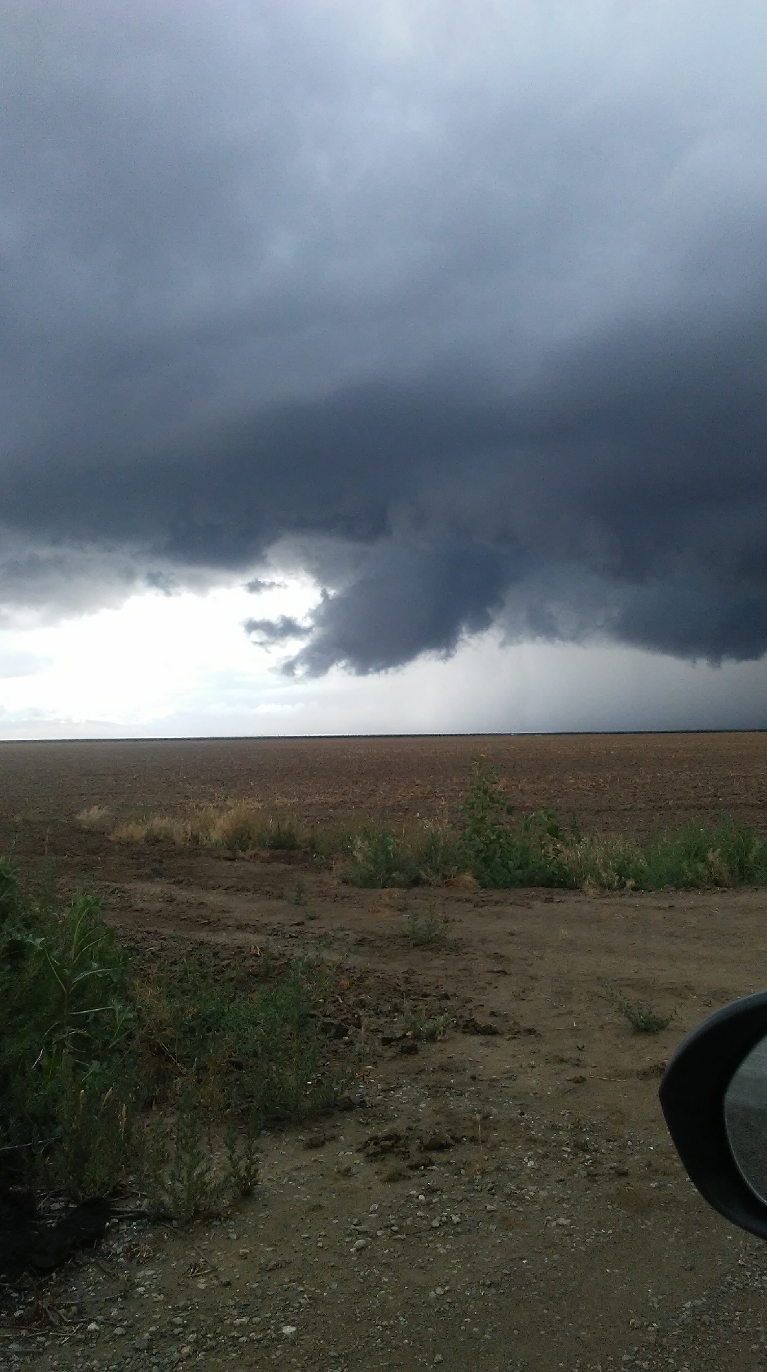
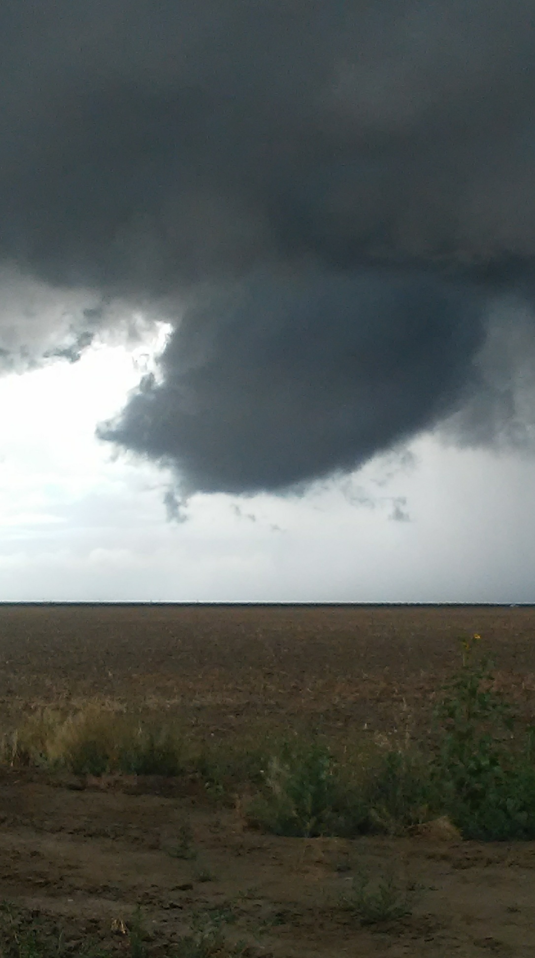

These photos above were taken by meteorologist Andy Bollenbacher between 3:39p and 3:45pm May 19.
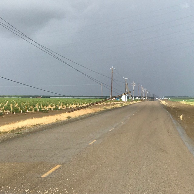
Senior Forecaster Jeff Barlow took this photo of a downed power line pole after conducting a survey shortly after the event. This was likely caused by winds in the Rear flank downdraft portion of the storm, just to the west of the brief tornado touchdown.
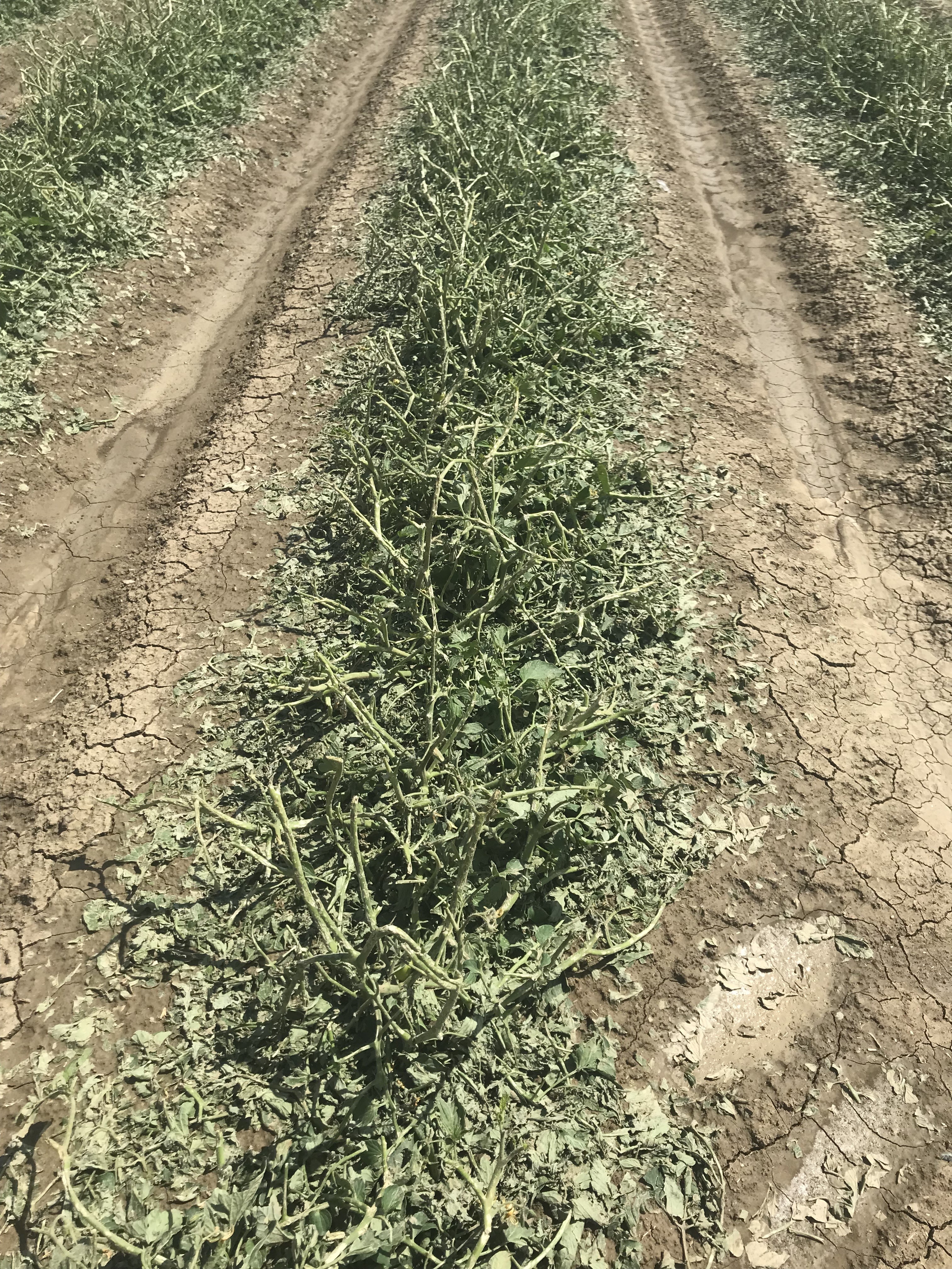
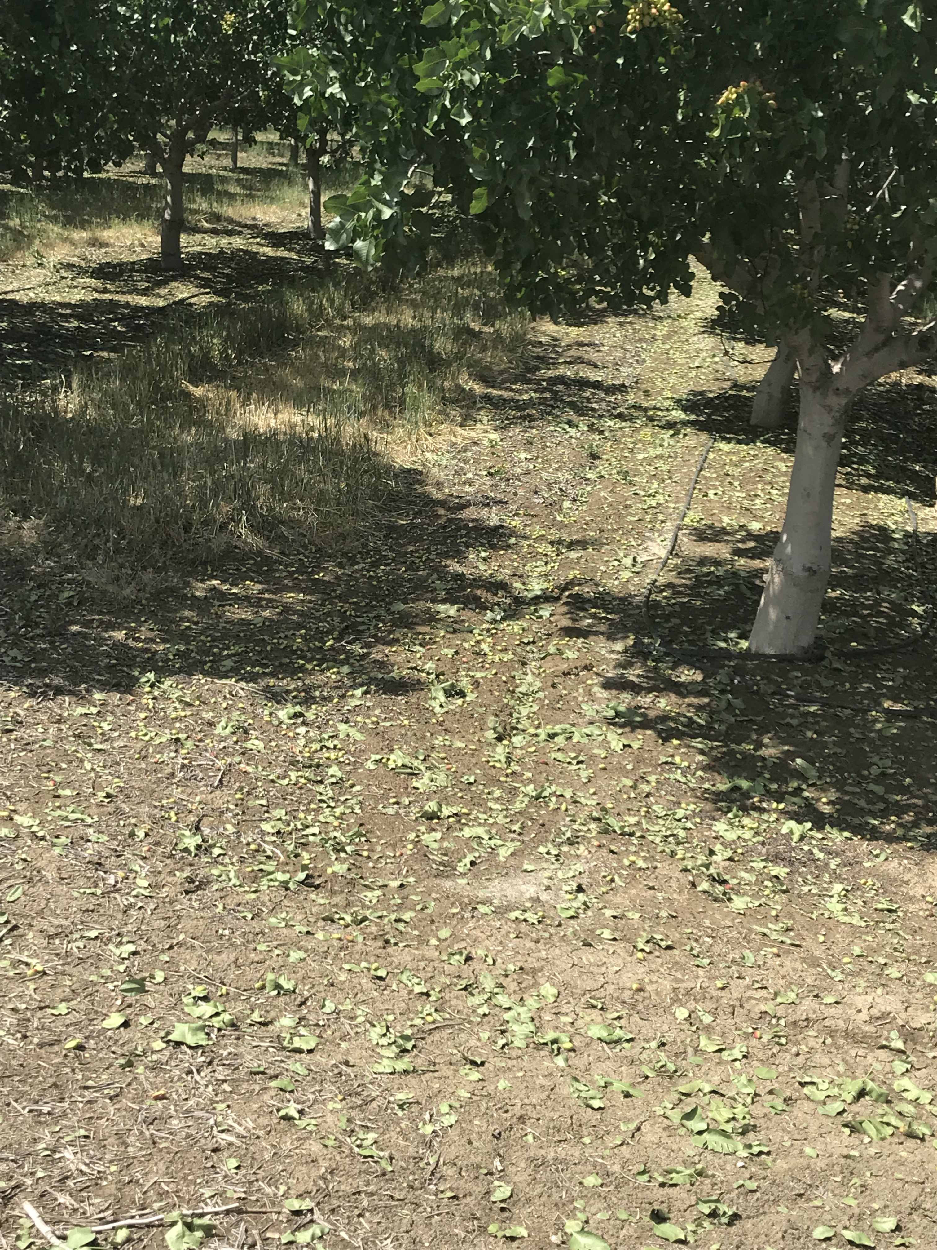
Forecaster Jim Andersen and Meteorologist-In-Charge Kevin Lynott took these photos of crop damage after a second storm survey May 20, and spoke with some folks who were closest to the storm.
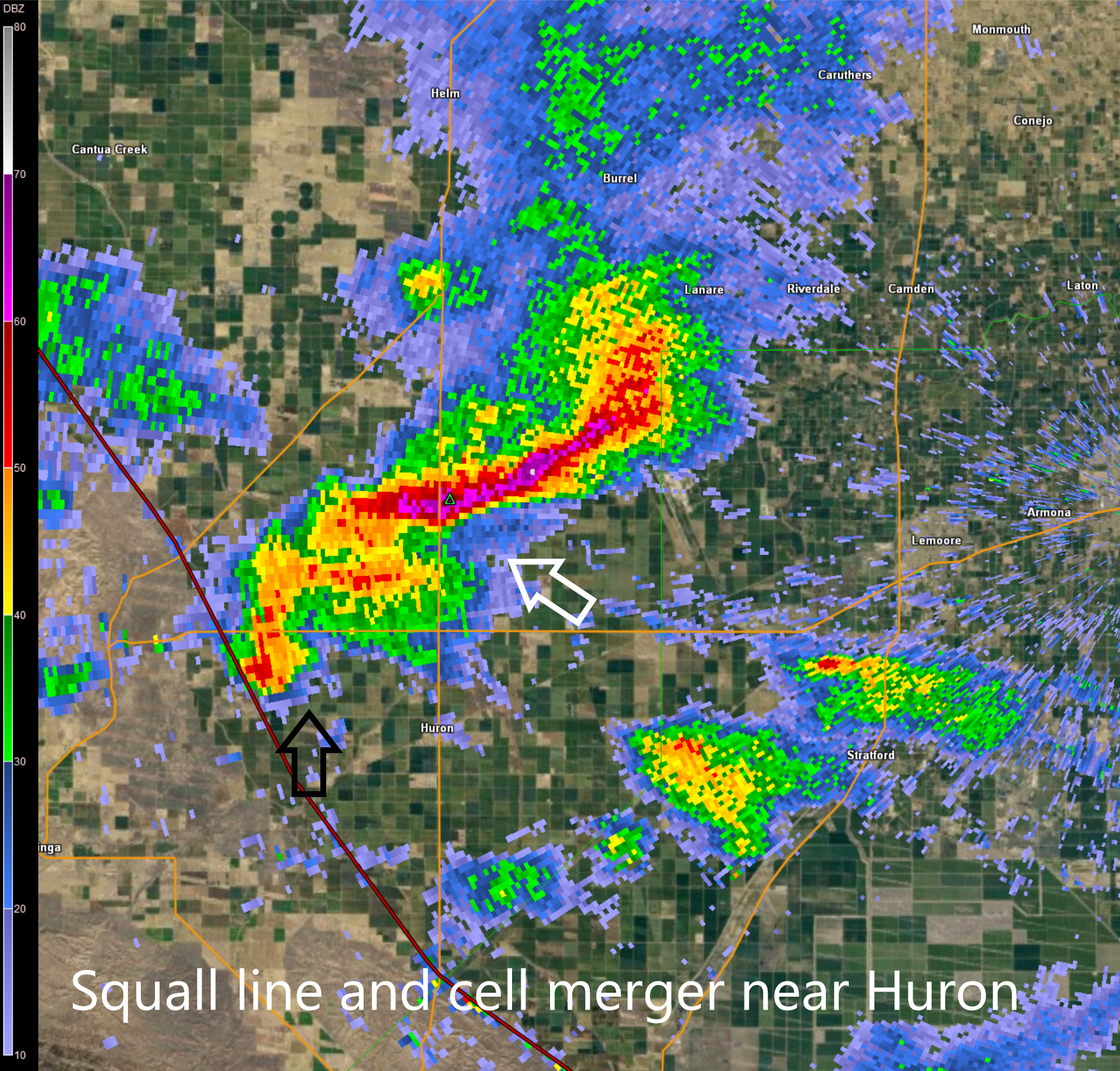
The evolution of this storm was quite unusual. First it moved east, crossing I-5 and the west central boundary of Fresno county. As it strengthened, it began moving southeast, which was different than any of the other showers and thunderstorms in the area, which were moving to the east. This is referred to as a "right mover". The movement became even more deviant as the southwest portion, of the line of storms, merged with another strong cell north of Huron and west of Lemoore. At this point, the signs of rotation began showing up in radar data.
The NWS Hanford forecast staff did a great job tracking the entire life cycle of this storm beginning with a Special Weather Statement issued at 130 pm, issuing Significant Weather Statements that remarked the potential for funnel clouds, then upgrading to a Severe Thunderstorm Warning through 7pm.
This brief event review was written by Science and Operations Officer Kris Mattarochia, with pictures and suggestions from Meteorologist-In-Charge Kevin Lynott, Forecaster Jimmy Andersen, Andy Bollenbacher and Senior Meteorologist Jeff Barlow. Thanks to all, especially the entire Sunday NWS Hanford staff for their hard work!
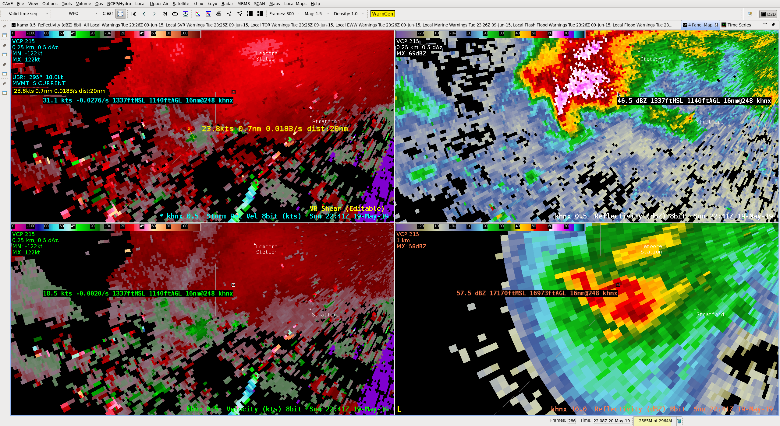
Finally, here's an image showing when the storm exhibited its best low level rotation, upward motion and wind shear (change in winds both in speed and direction with height) to produce the tornado. Although it may seem small and obscure, the shear value in the upper left picture (0.0183/s) measured by our radar is higher than what we usually observe in the Central Valley.