| A cold front has swept through the area bringing in Arctic air that will stay in our area through Friday morning. Some dangerously cold wind chills are expected overnight through Thursday morning. A Wind Chill Advisory has been issued for areas along and north of I-74.
How Cold and When
- Wind chills will range from around 10-15 below zero along and north of I-74, to near zero south of I-70.
- The lowest wind chills are expected from midnight tonight through about 10 am Thursday.
Potential Impacts
- People exposed to extreme cold are susceptible to frostbite in a matter of minutes. Areas most prone to frostbite are uncovered skin and the extremities, such as hands and feet. Dress in layers if you will be outside for an extended period. Try to cover every part of your body: ears, nose, toes and fingers, etc. Mittens are better than gloves. Keep your skin dry.
- Drink plenty of fluids since hydration increases the blood's volume, which helps prevent frostbite. Avoid caffeine, alcohol and cigarette. Caffeine constricts blood vessels, preventing warming of your extremities. Alcohol reduces shivering, which helps keep you warm. Please don't leave your pets outside for any length of time while it is this cold. Below are indicators of frostbite
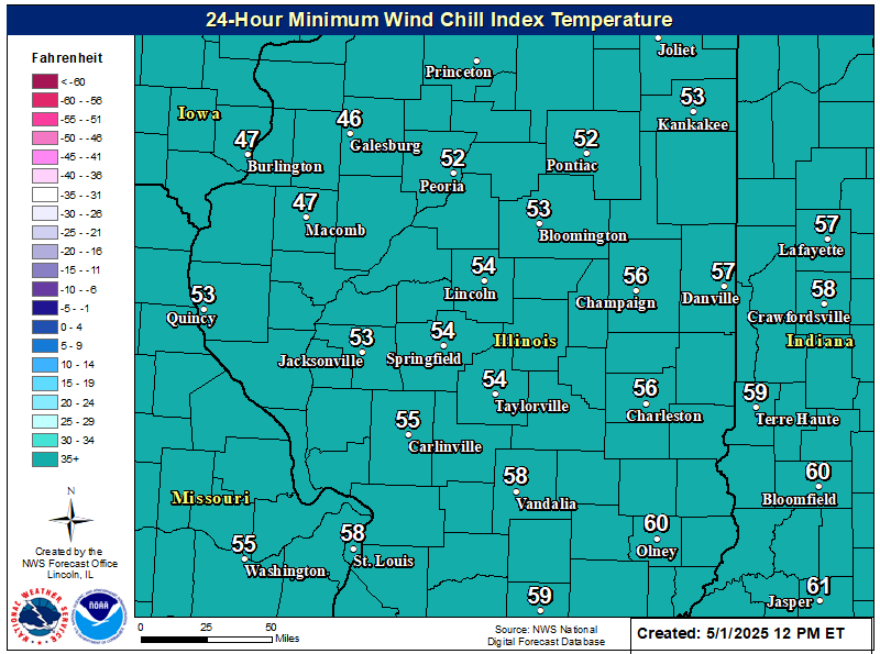
Lowest wind chills next 24 hours
|
|
|
Hazardous Weather Outlook

Weather Story
|

