Central Illinois
Weather Forecast Office
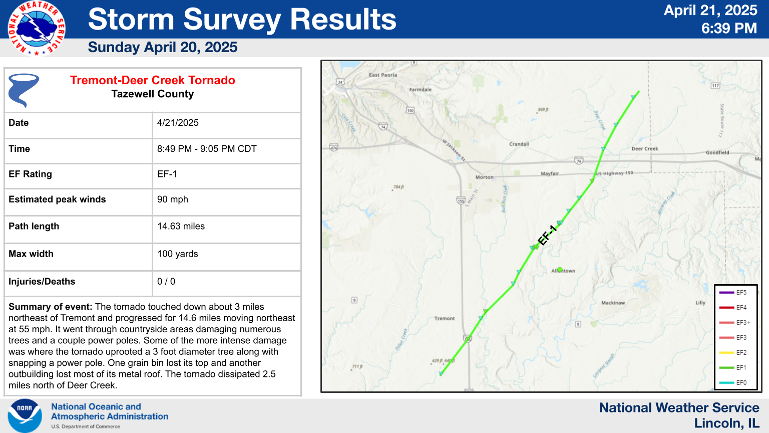
An EF-1 tornado was confirmed in Tazewell County from Sunday evening's severe storms. You can view more information and photos of the damage here.
US Dept of Commerce
National Oceanic and Atmospheric Administration
National Weather Service
Central Illinois
1362 State Route 10
Lincoln, IL 62656
217-732-7321 (forecast recording) or 217-732-3089
Comments? Questions? Please Contact Us.

