Overview
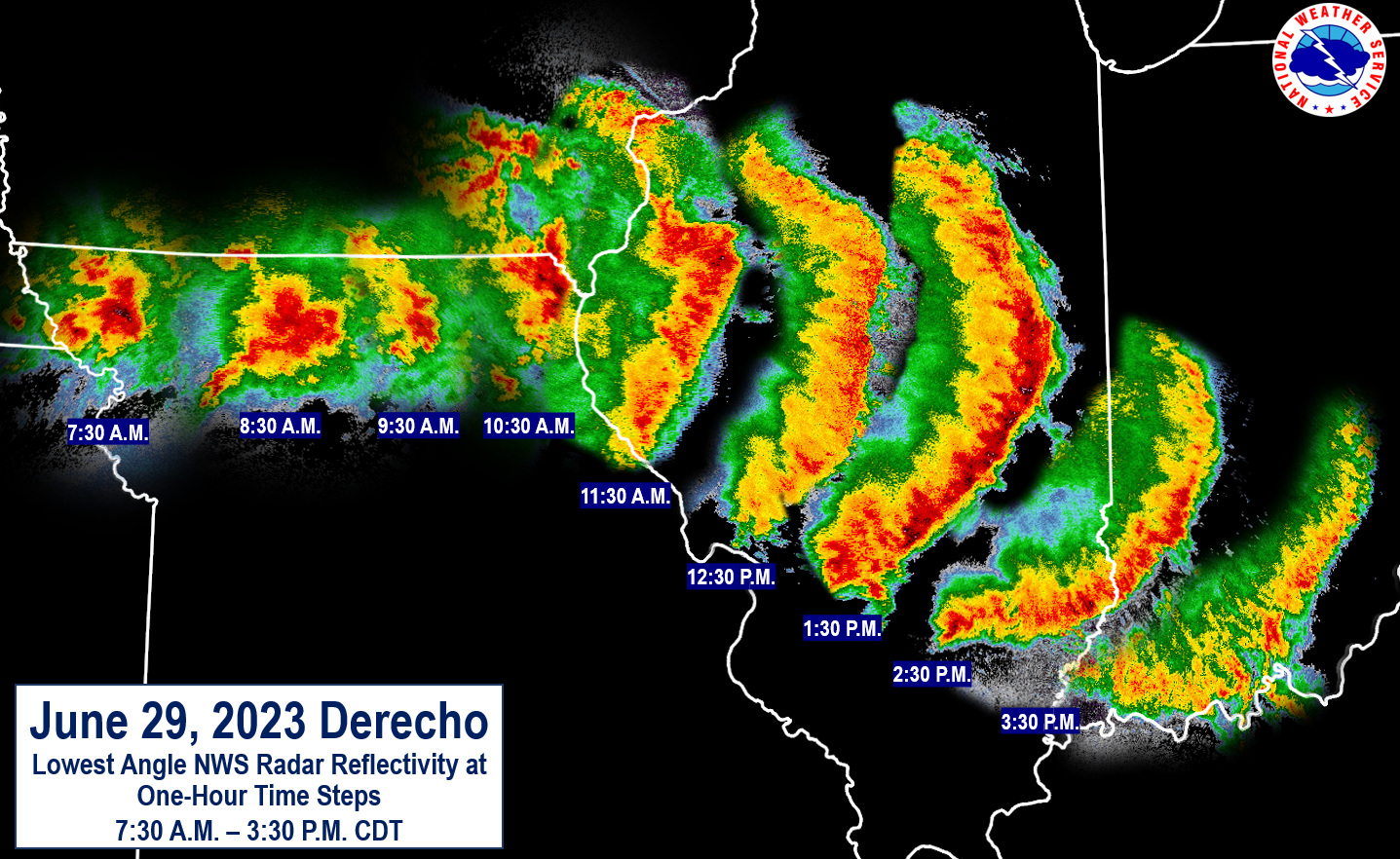
(Image created by Matt Friedlein, NWS Davenport Science and Operations Officer)
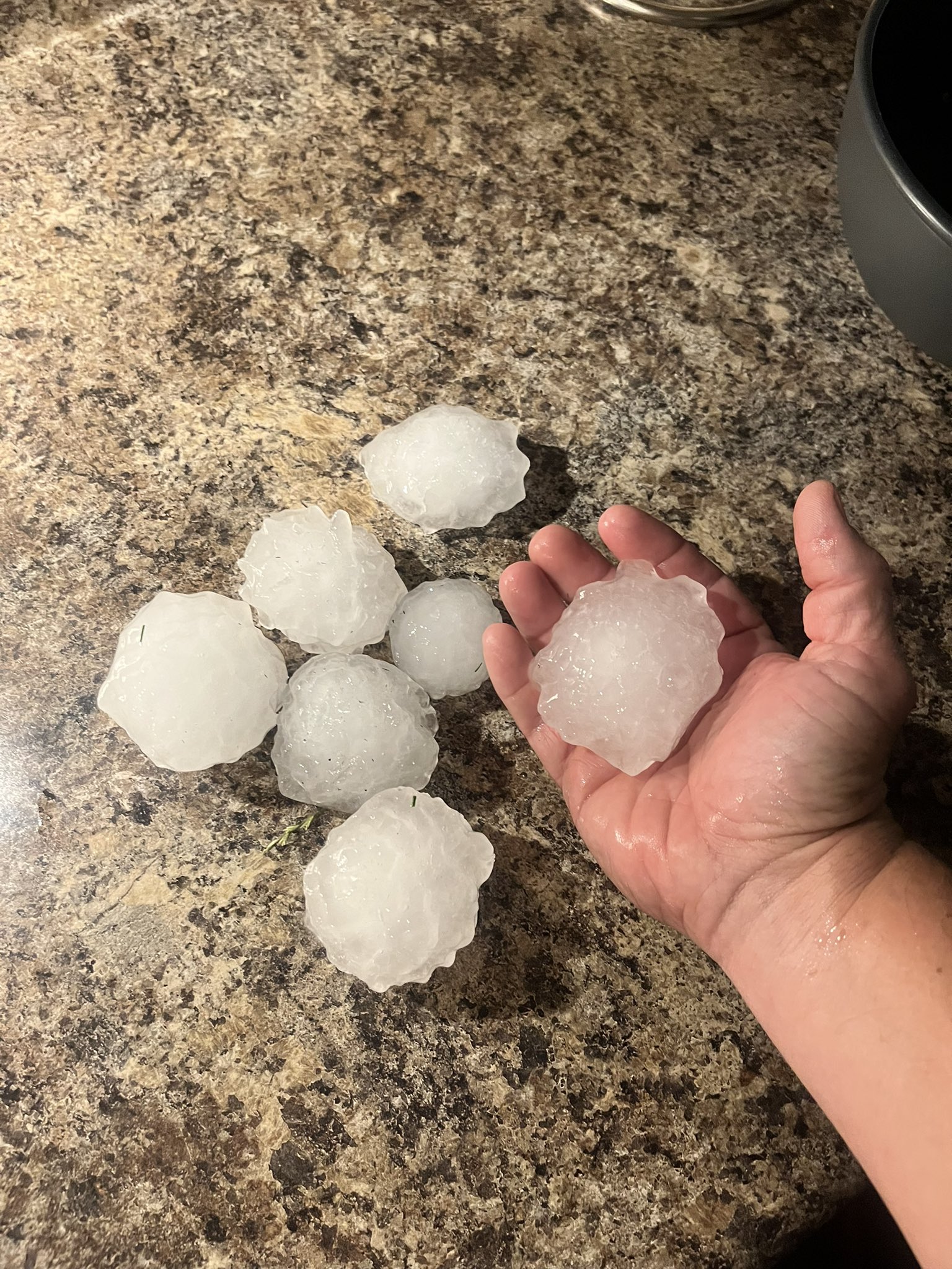
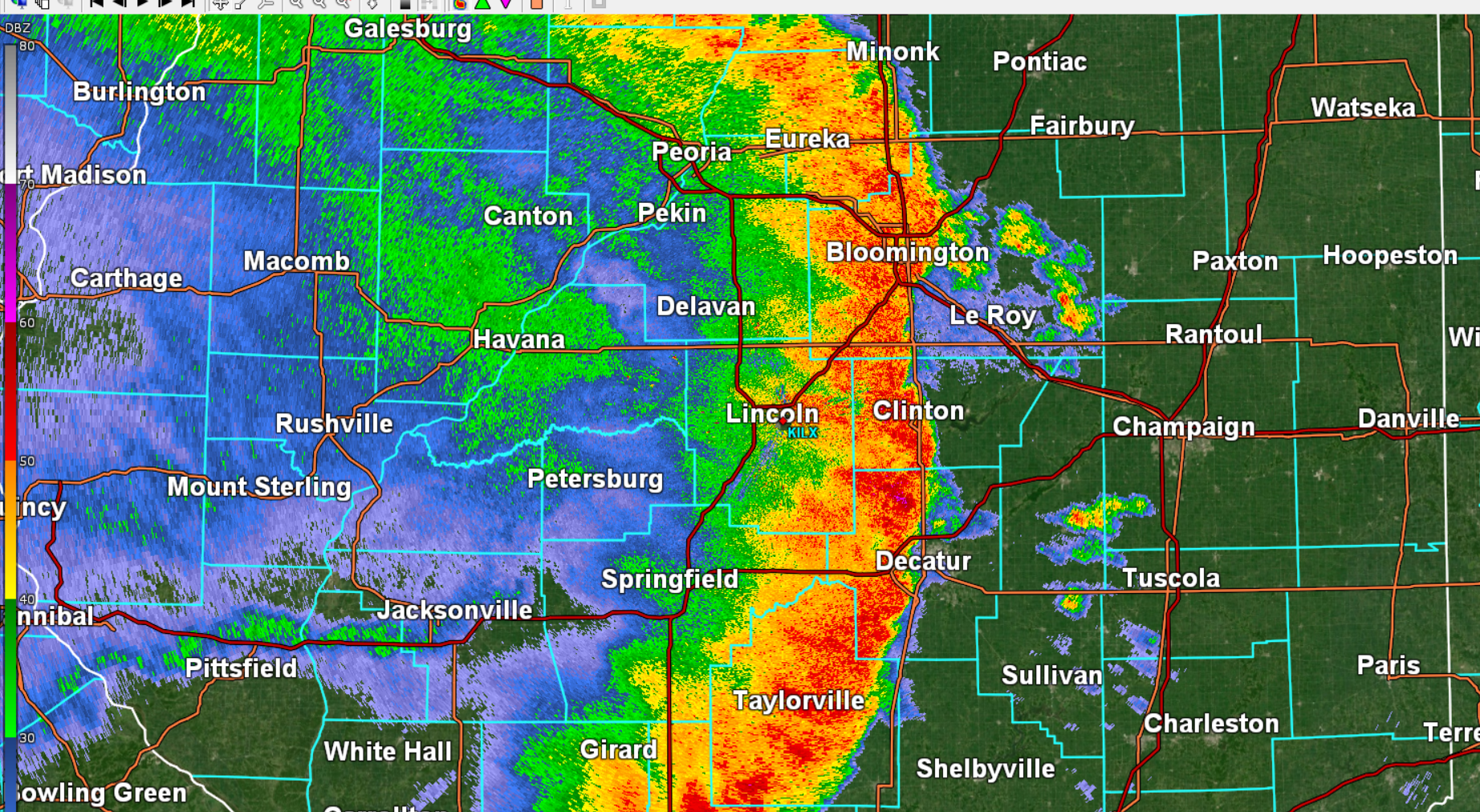
Several rounds of severe storms moved through central and southeast Illinois on Thursday, June 29, 2023. The first round began before sunrise and continued into the mid morning hours, with supercell thunderstorms that produced very large hail and heavy rainfall from Peoria into parts of eastern Illinois, including 3.25" hail in Tuscola.
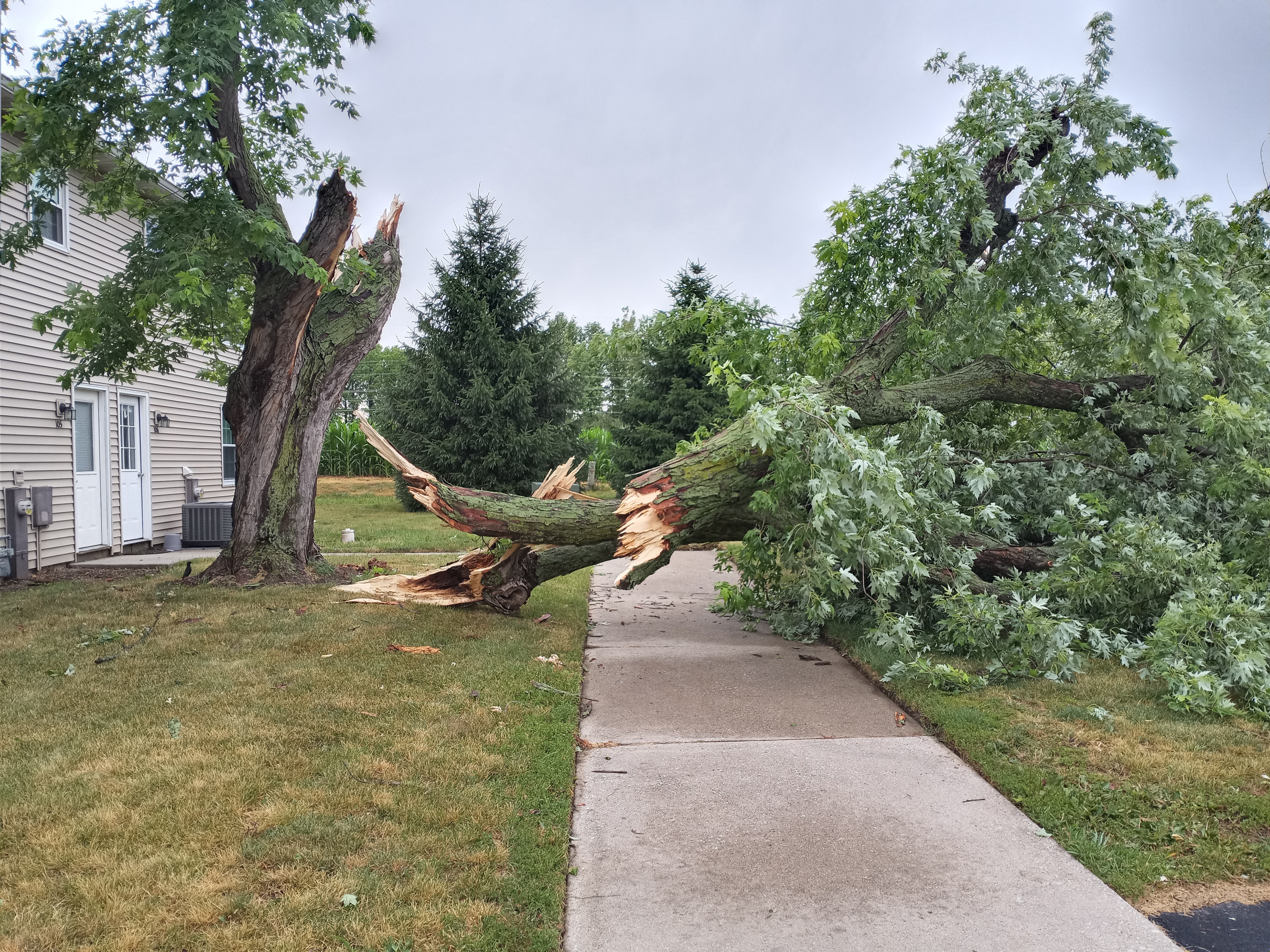
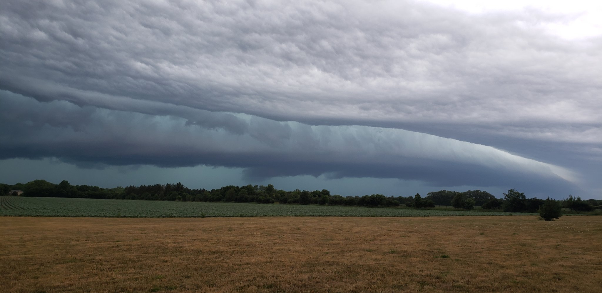
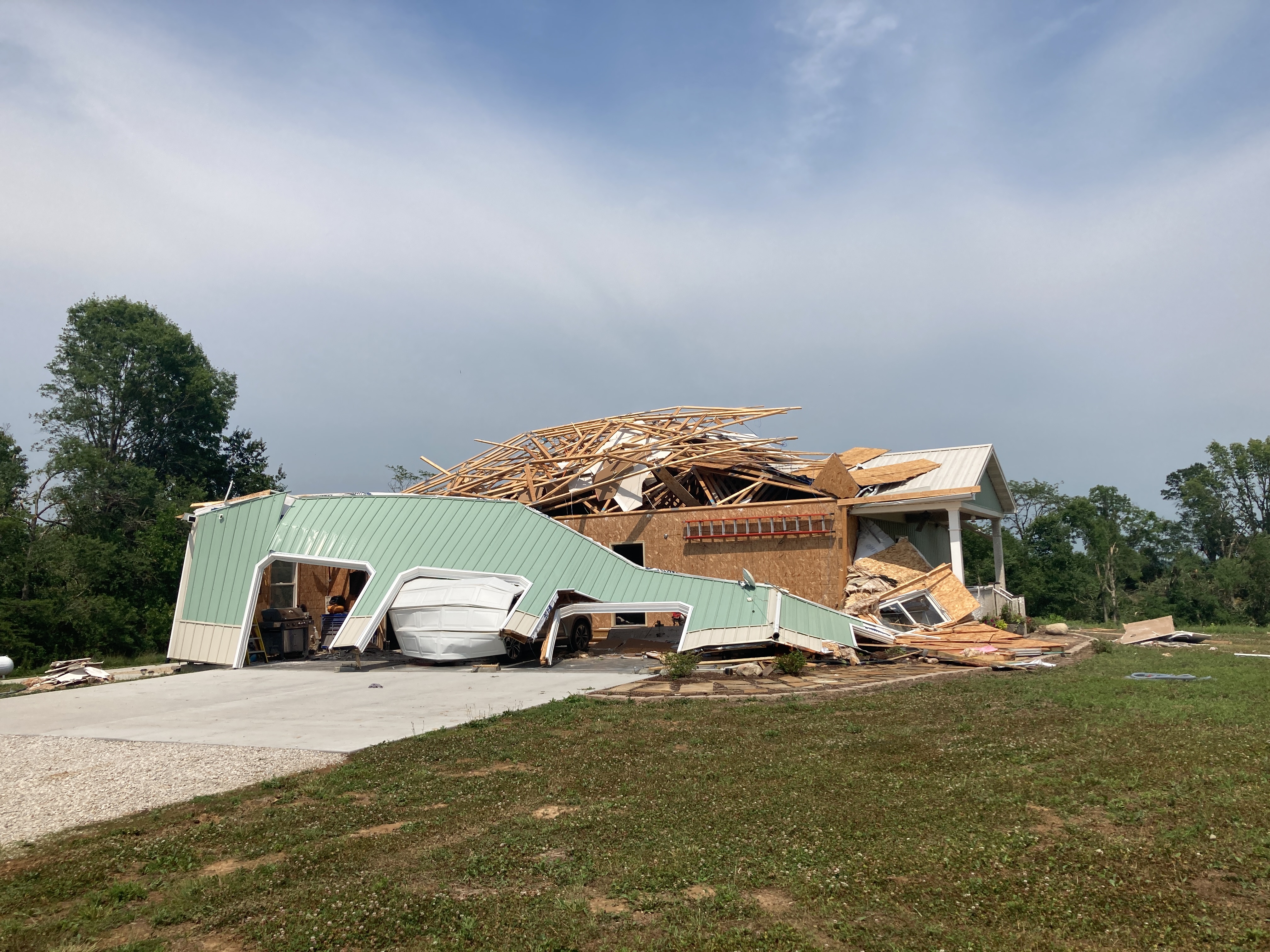
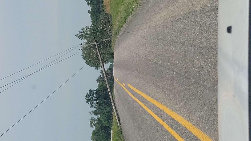
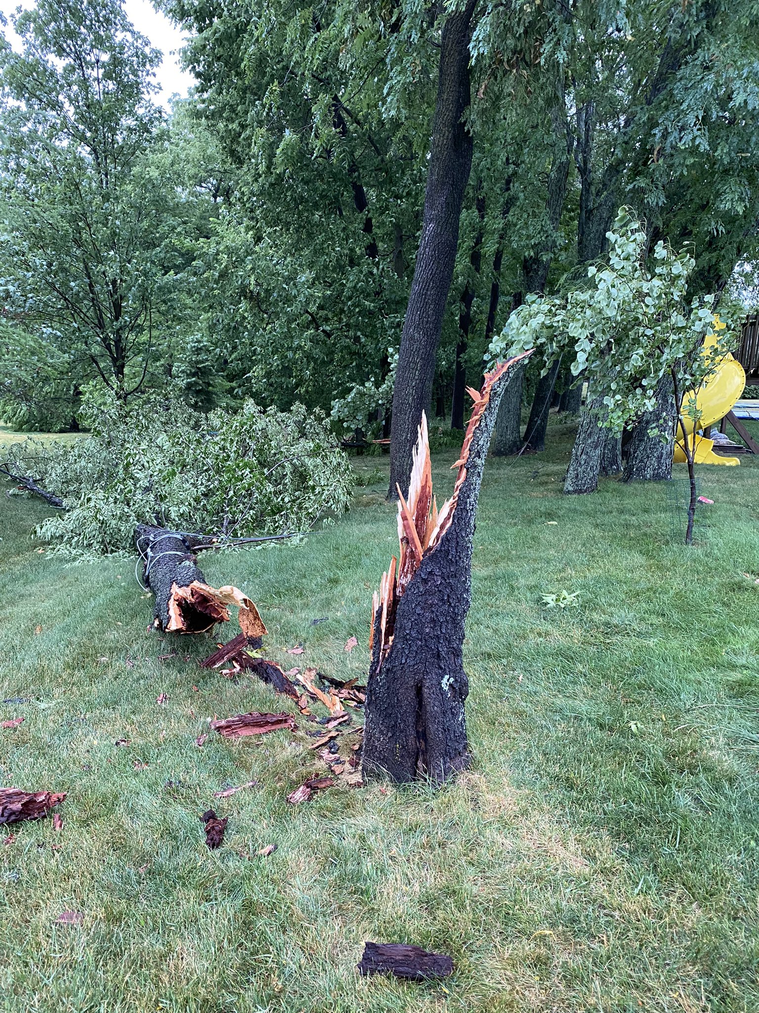
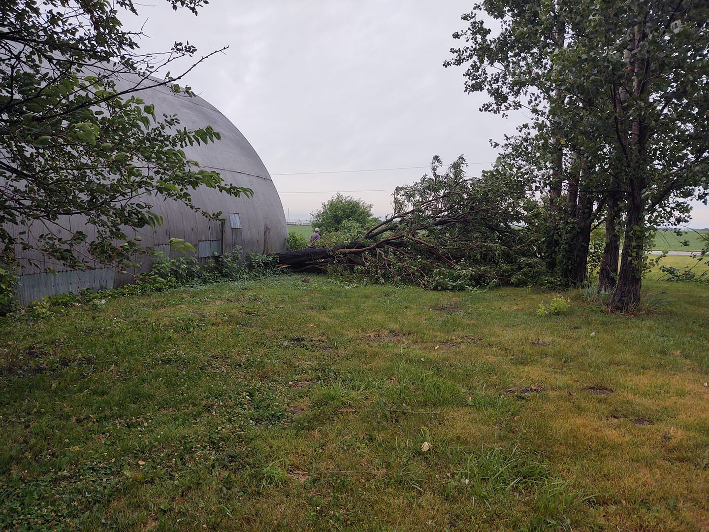
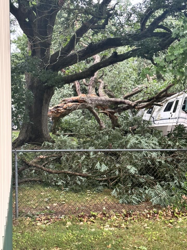
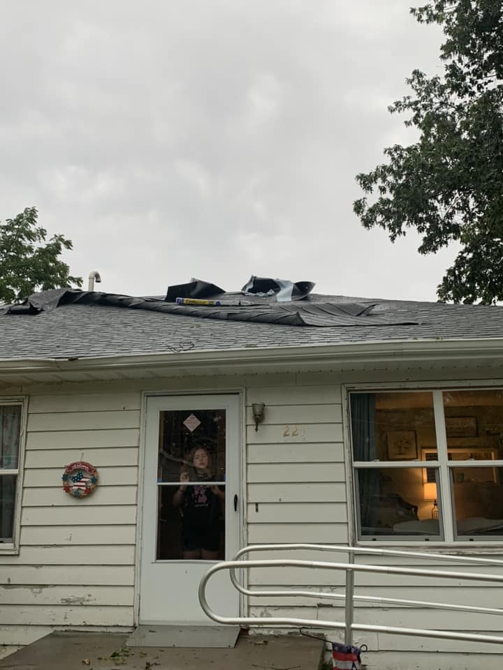
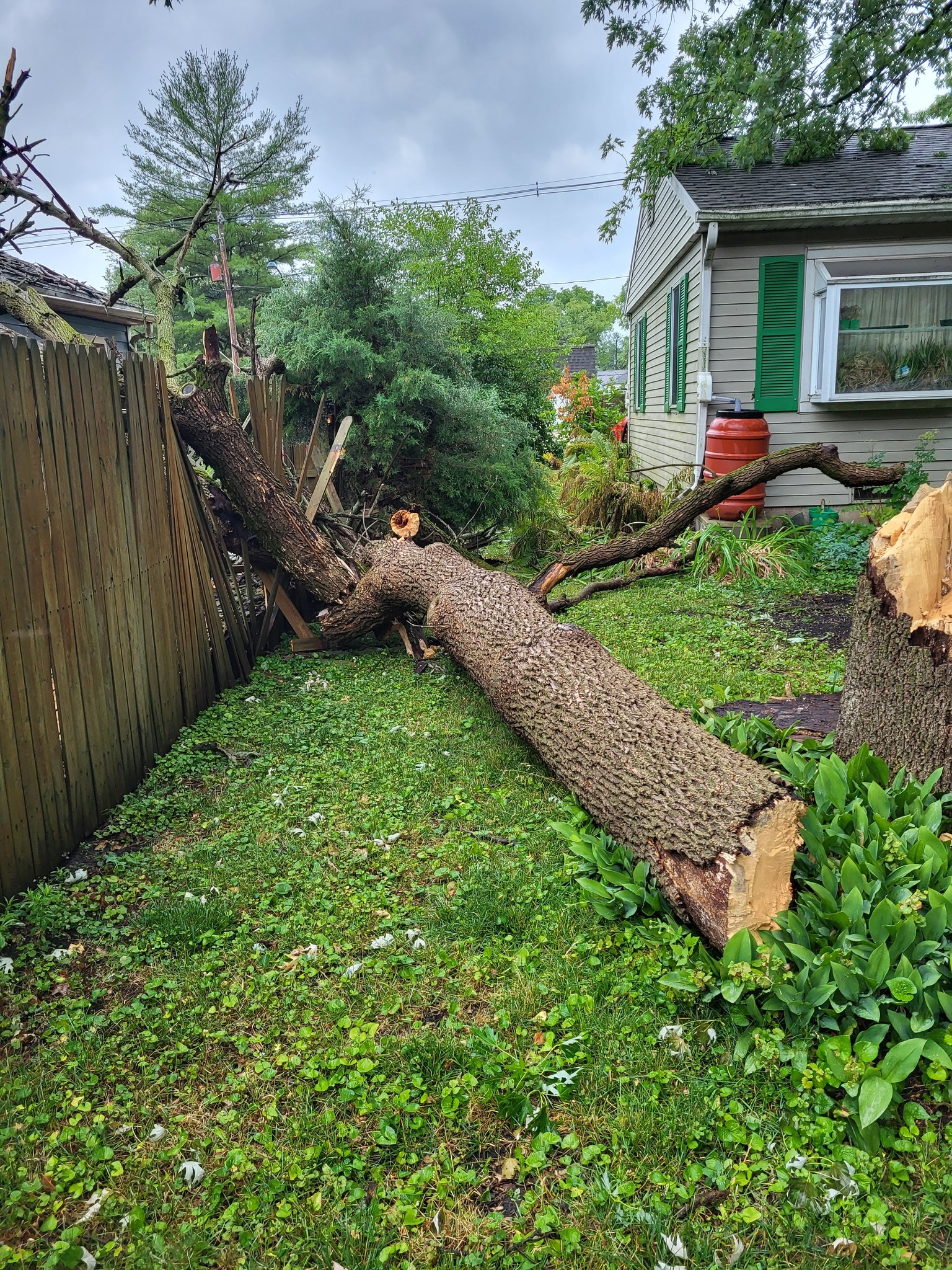
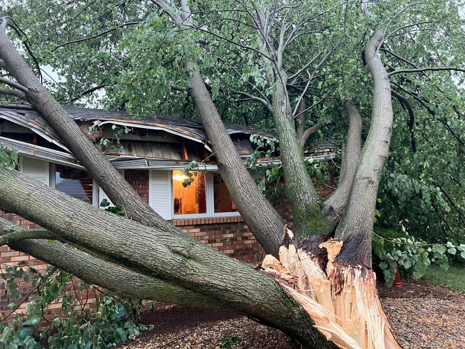
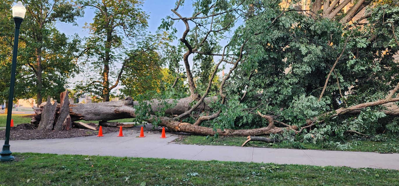
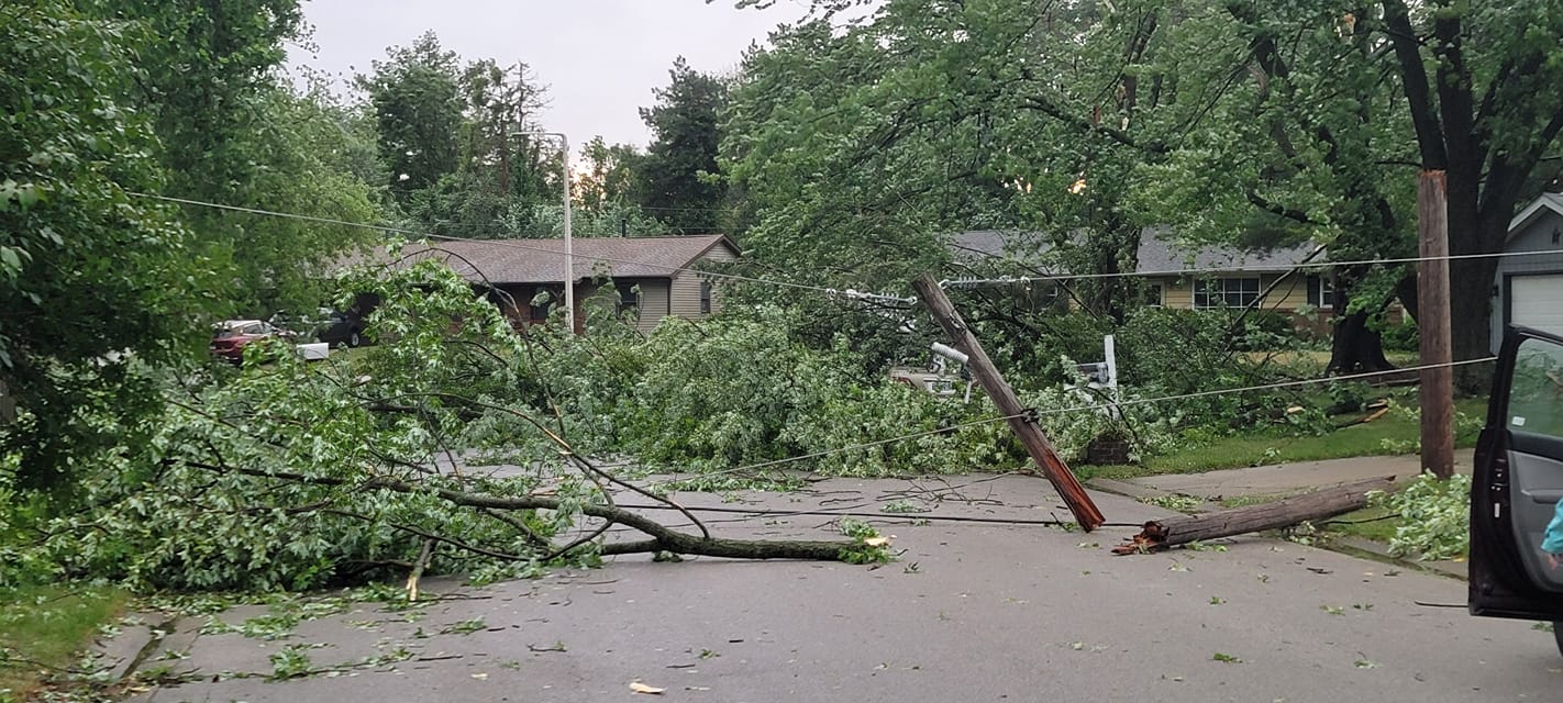
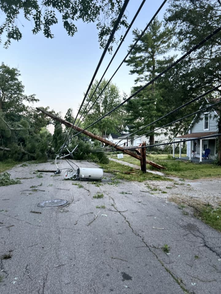
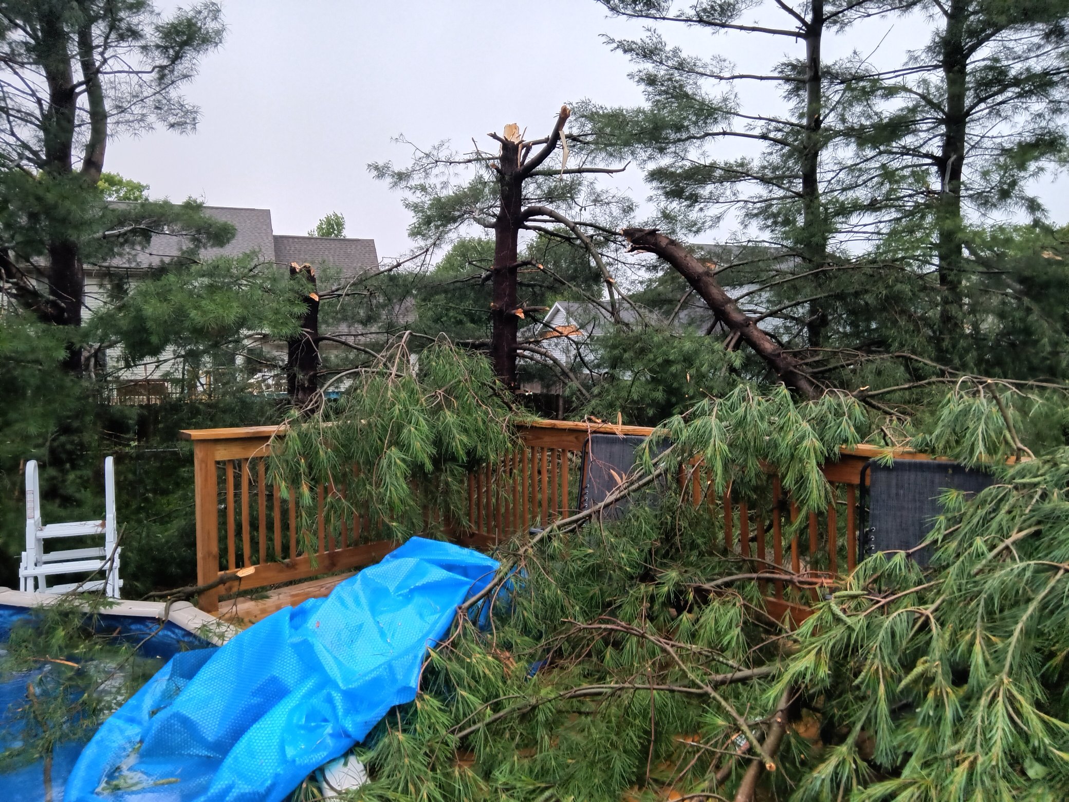
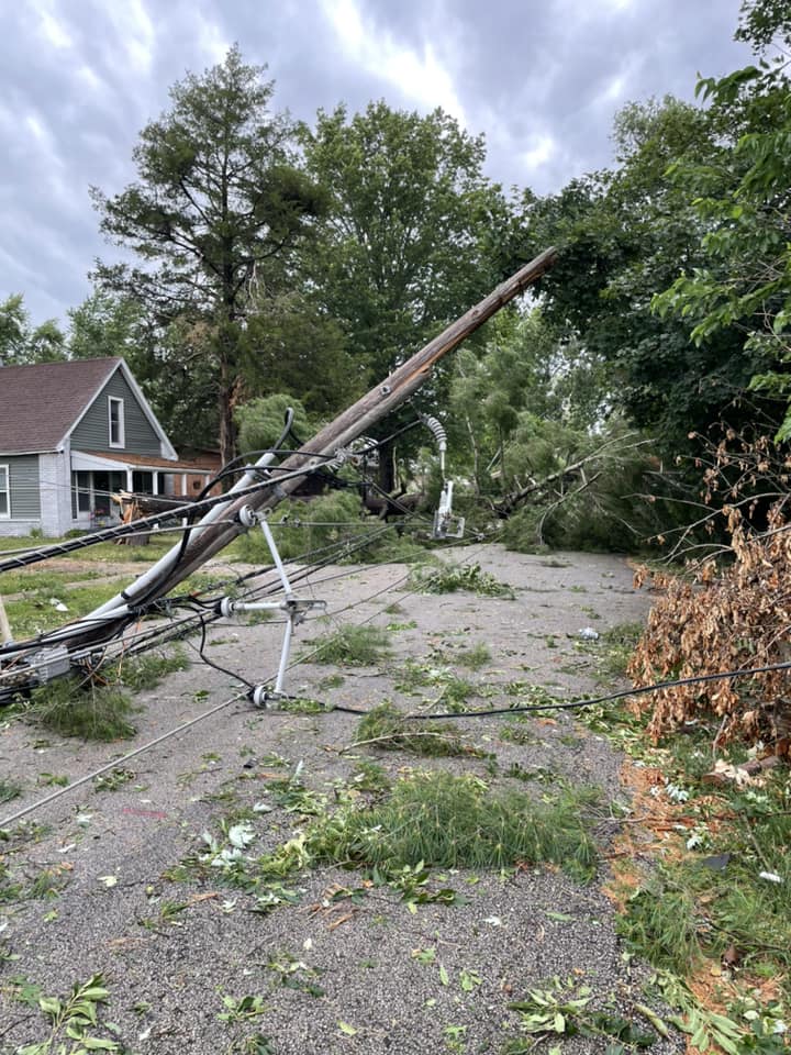
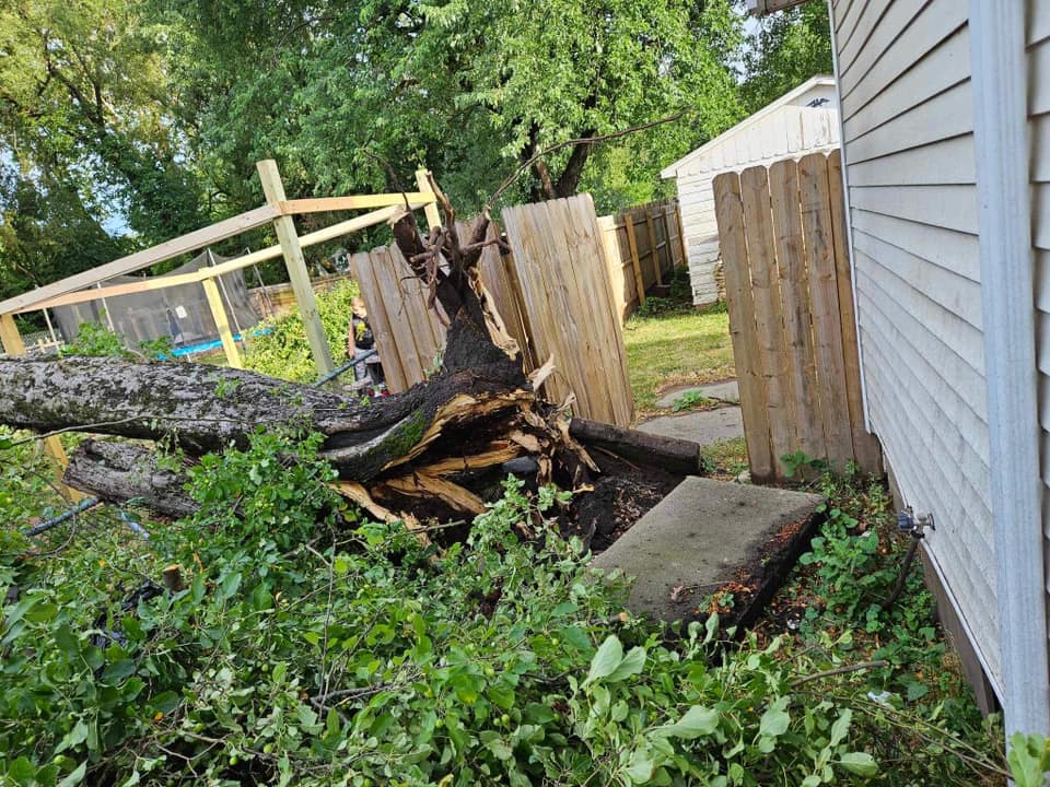
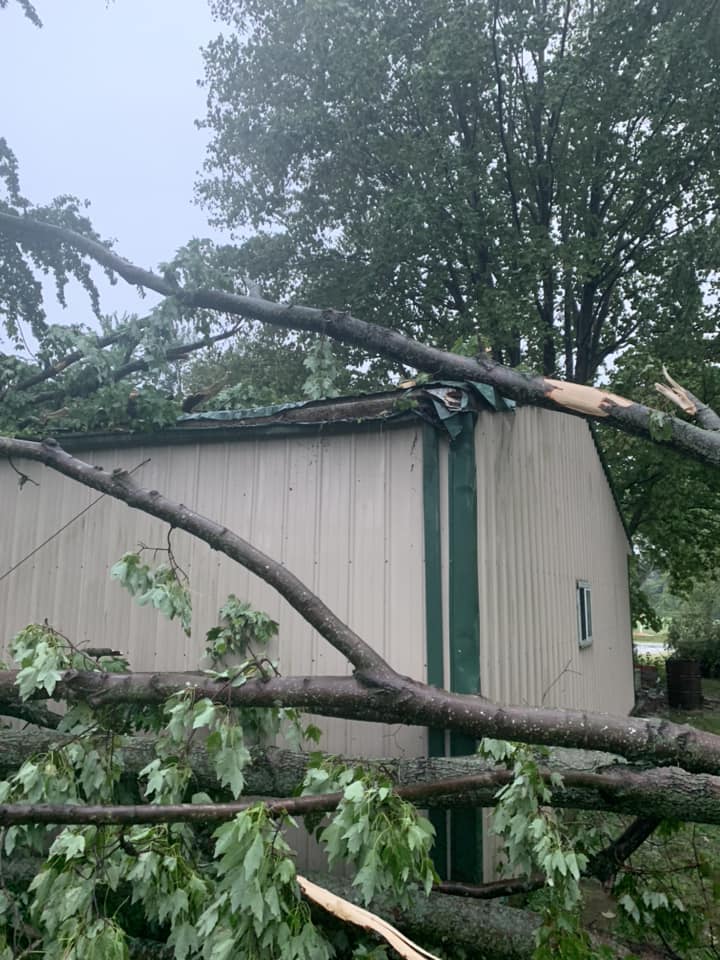
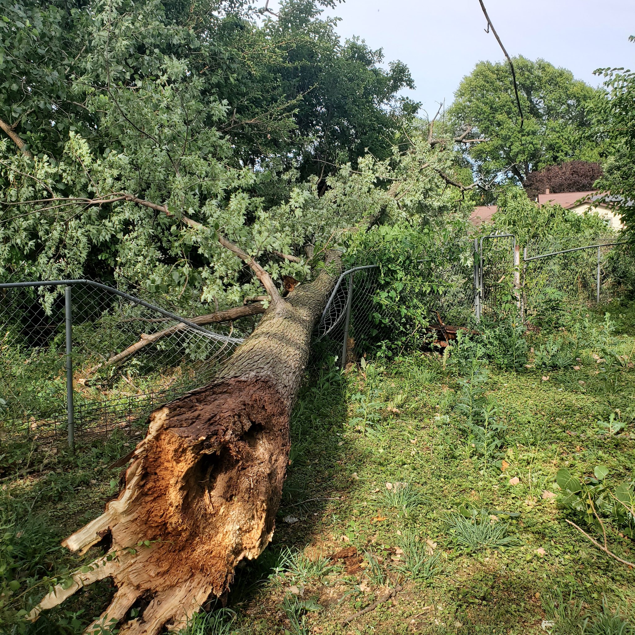
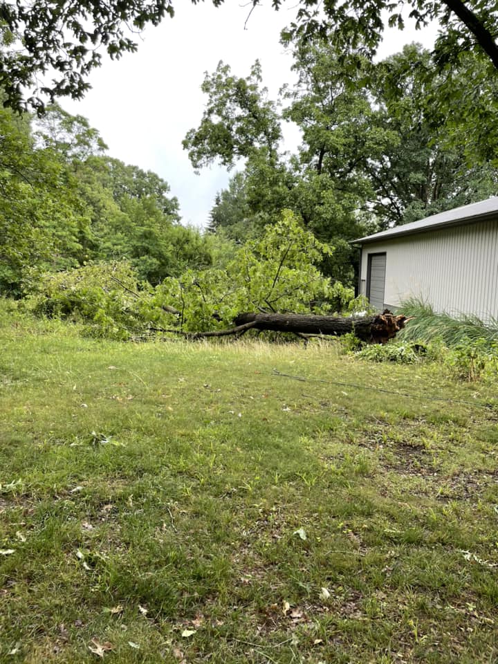
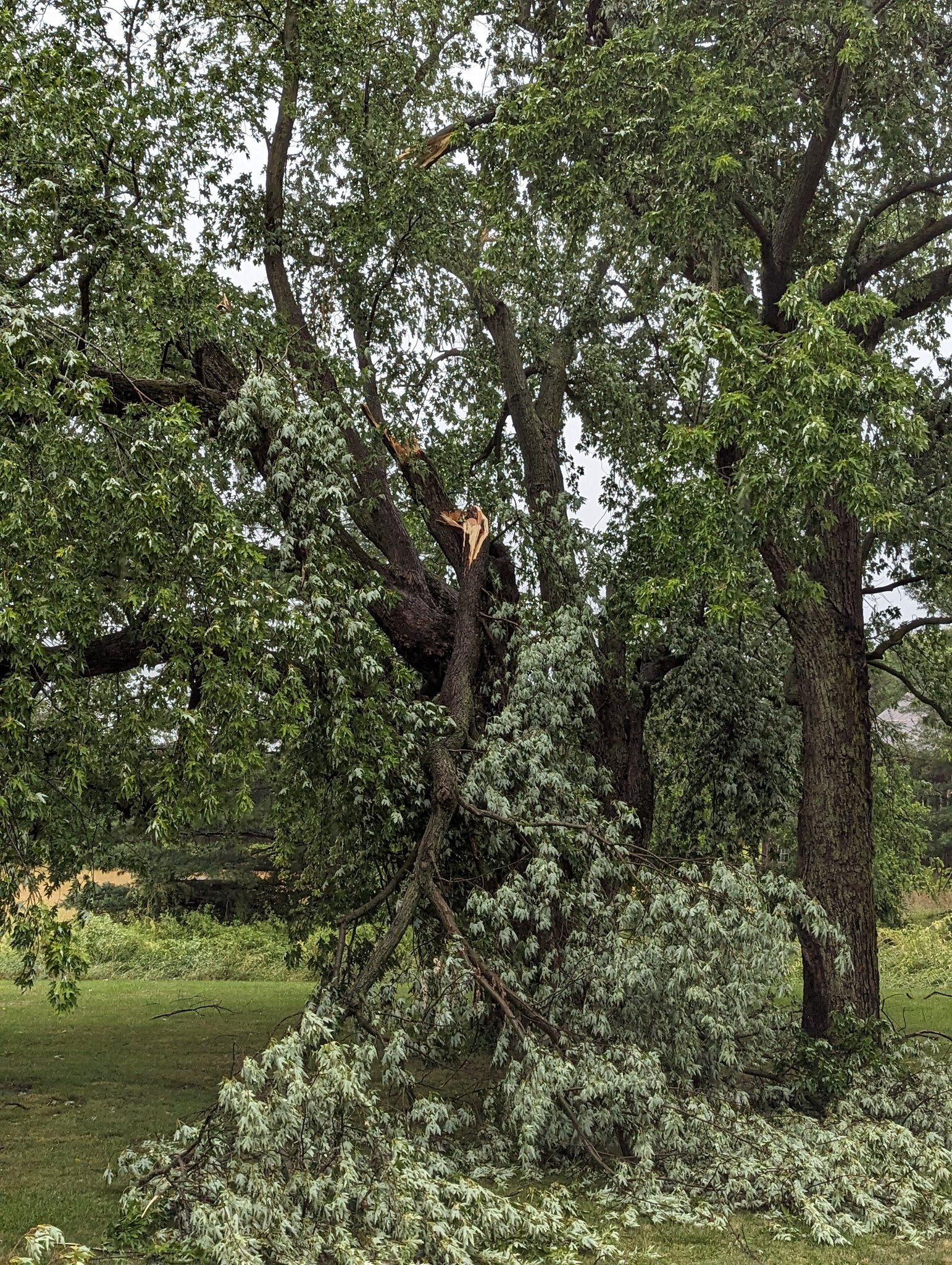
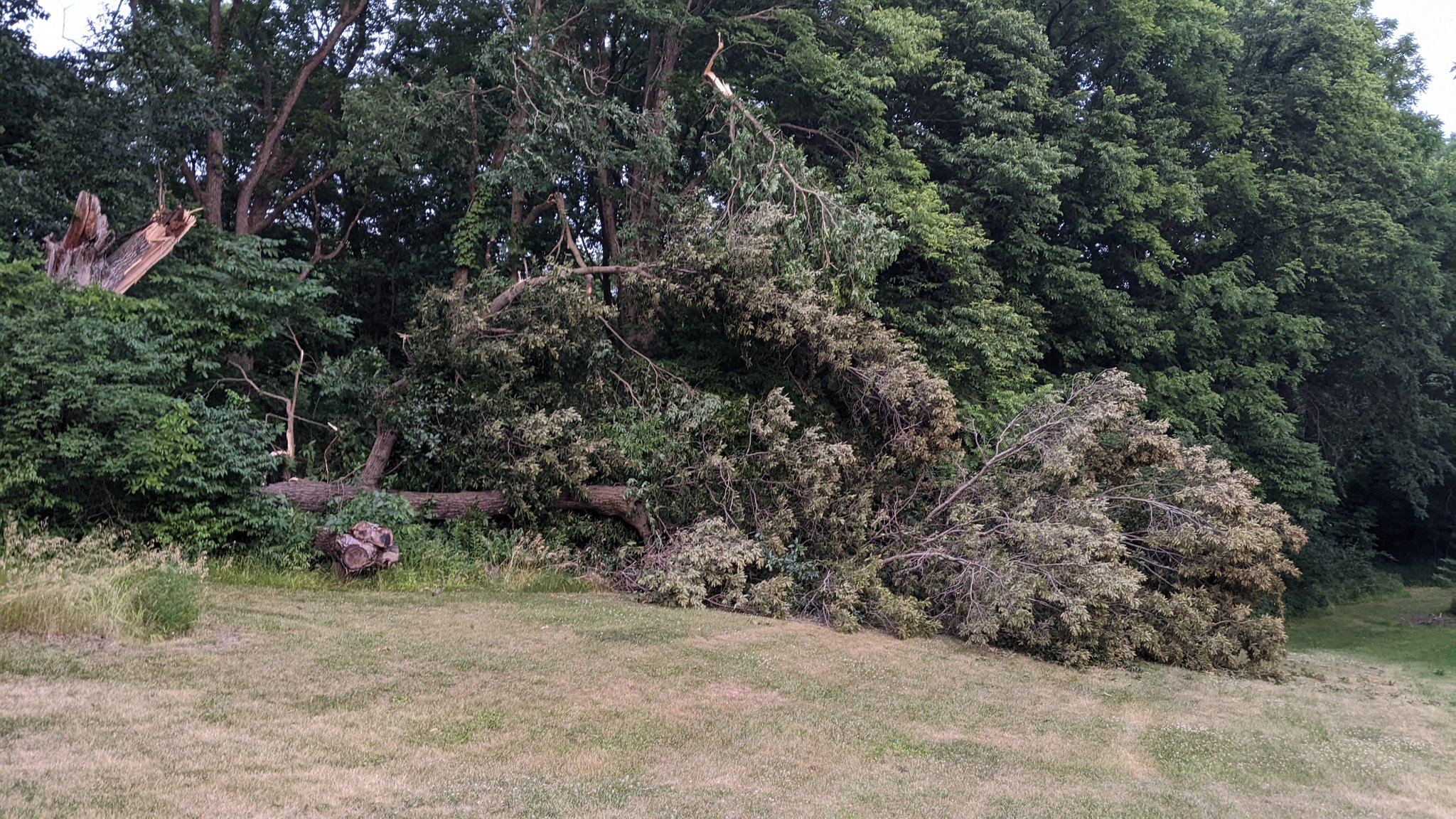
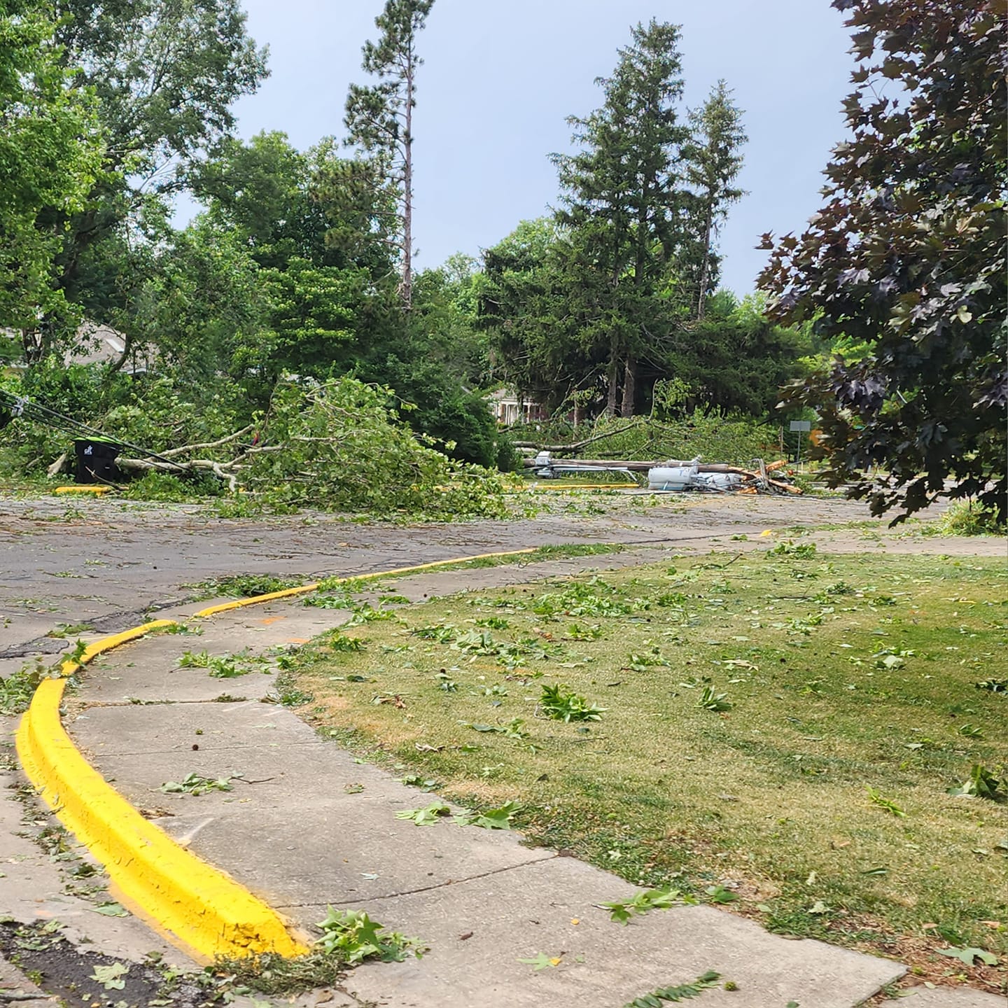
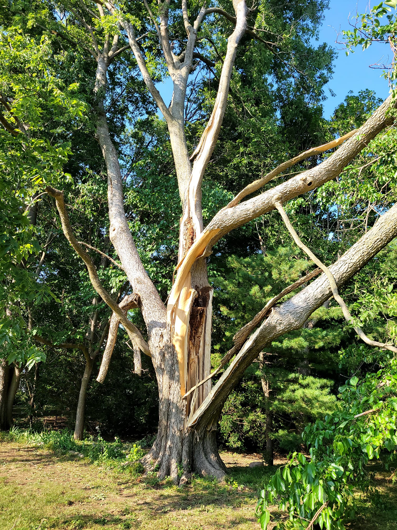
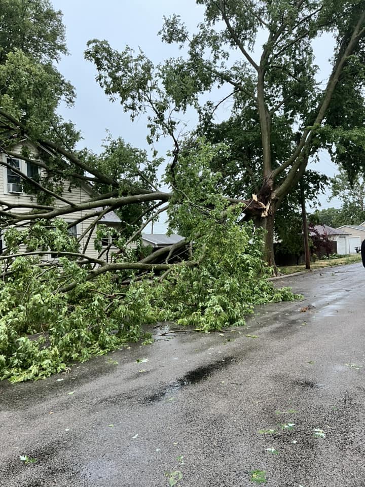
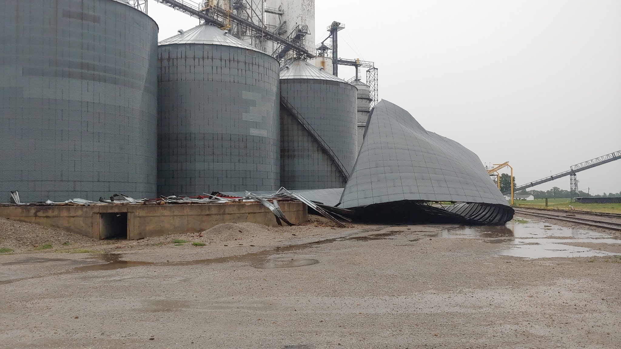
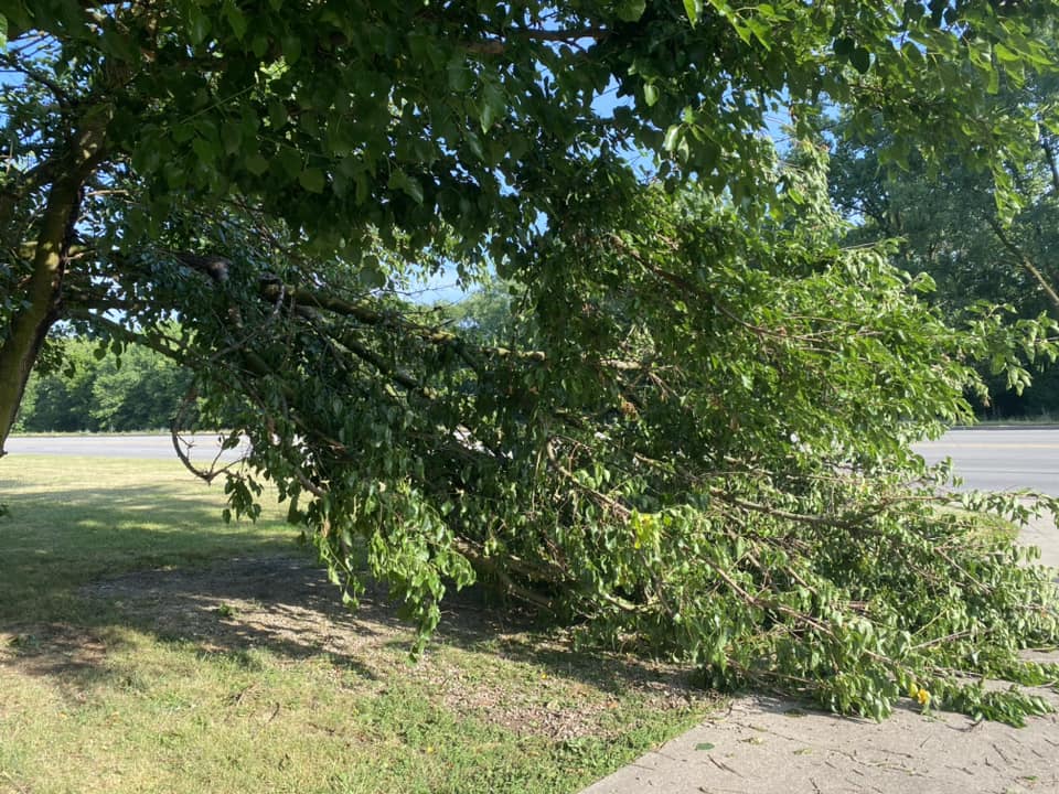
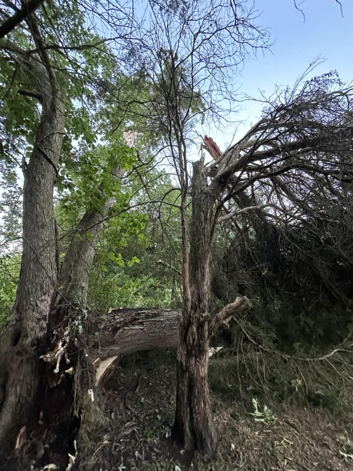
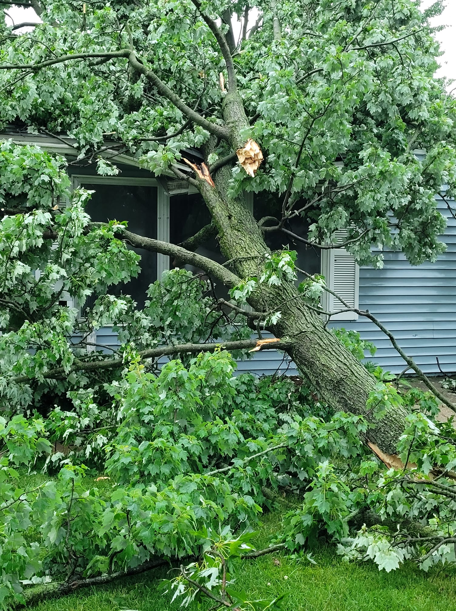
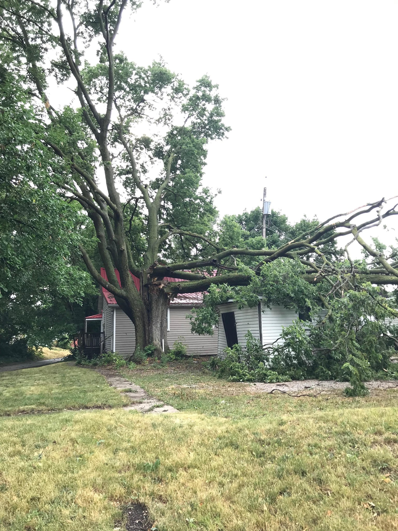
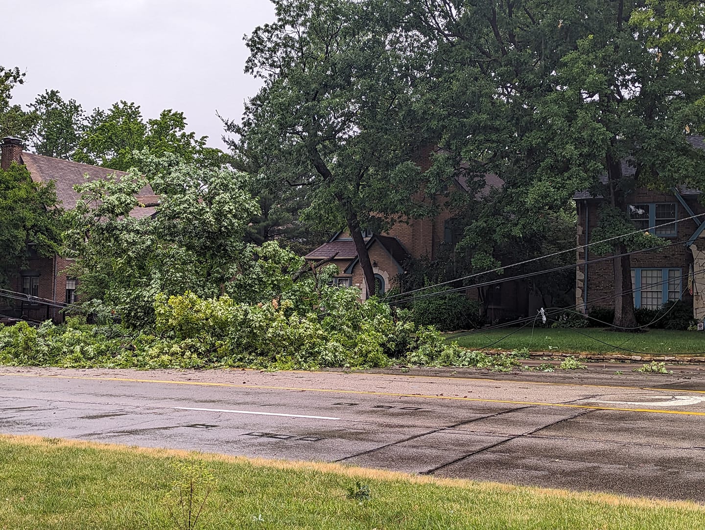
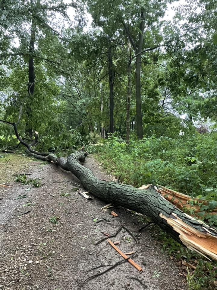
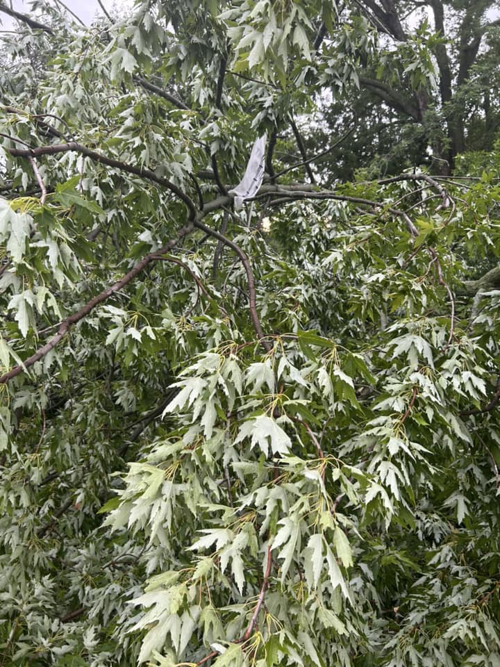
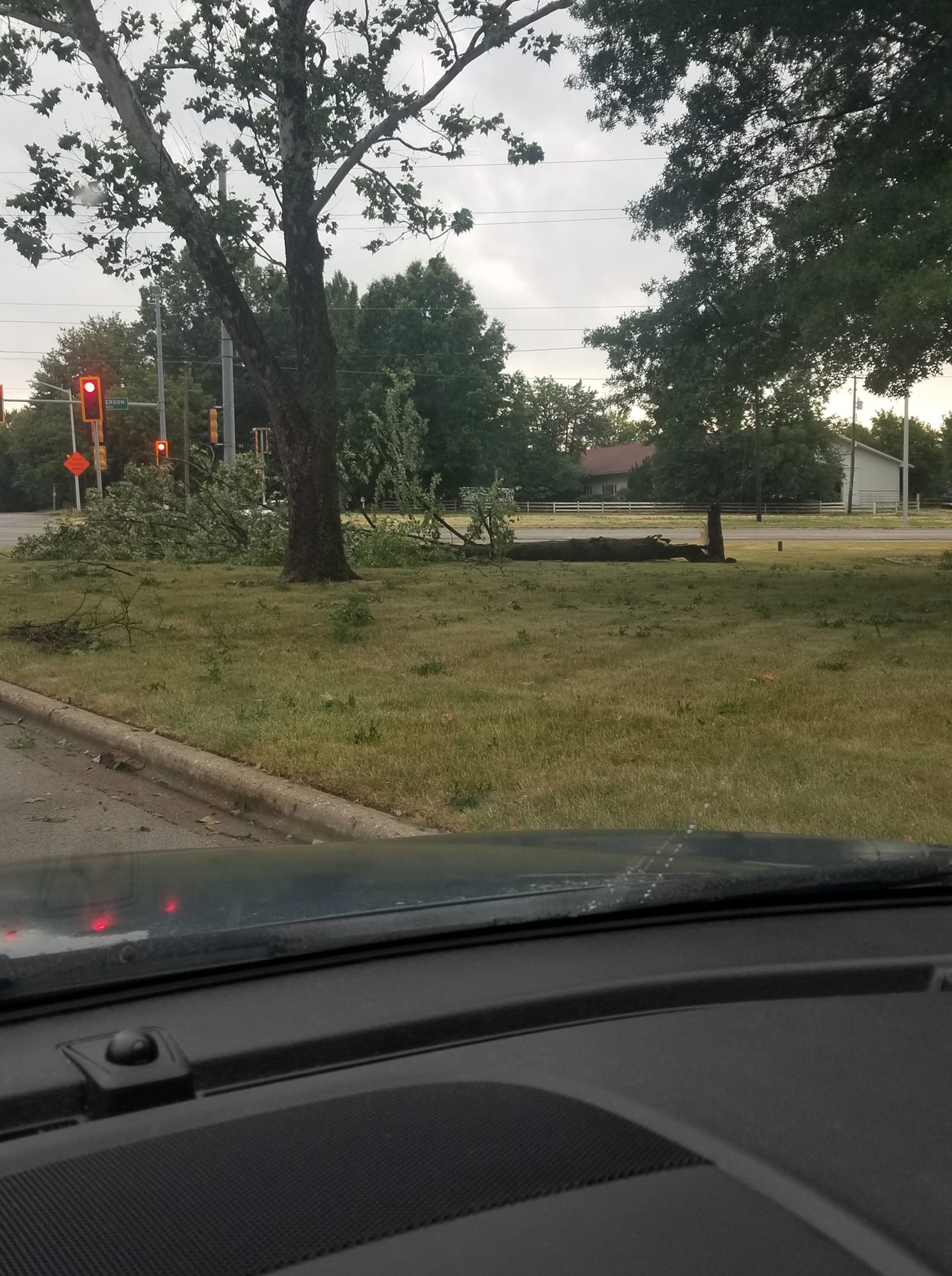
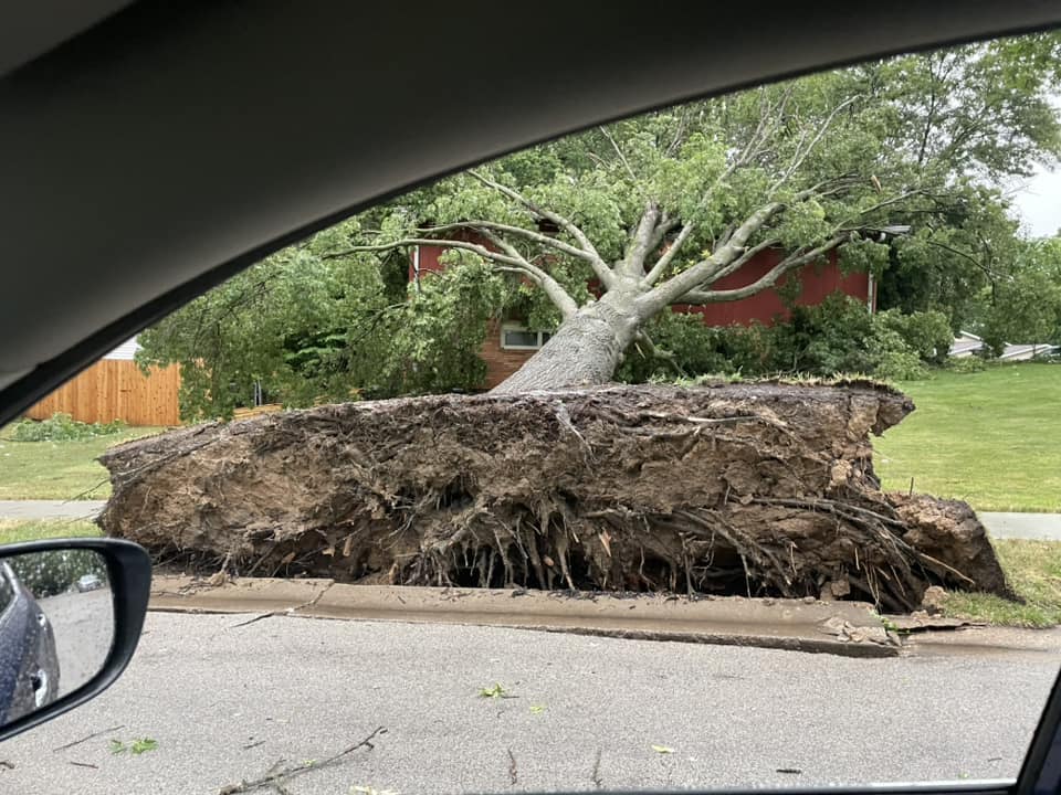
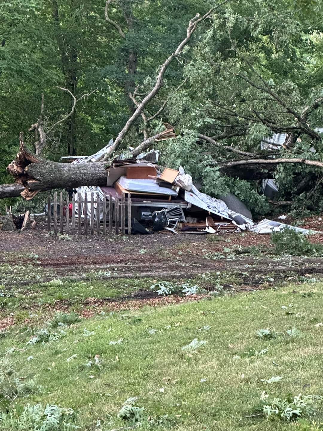
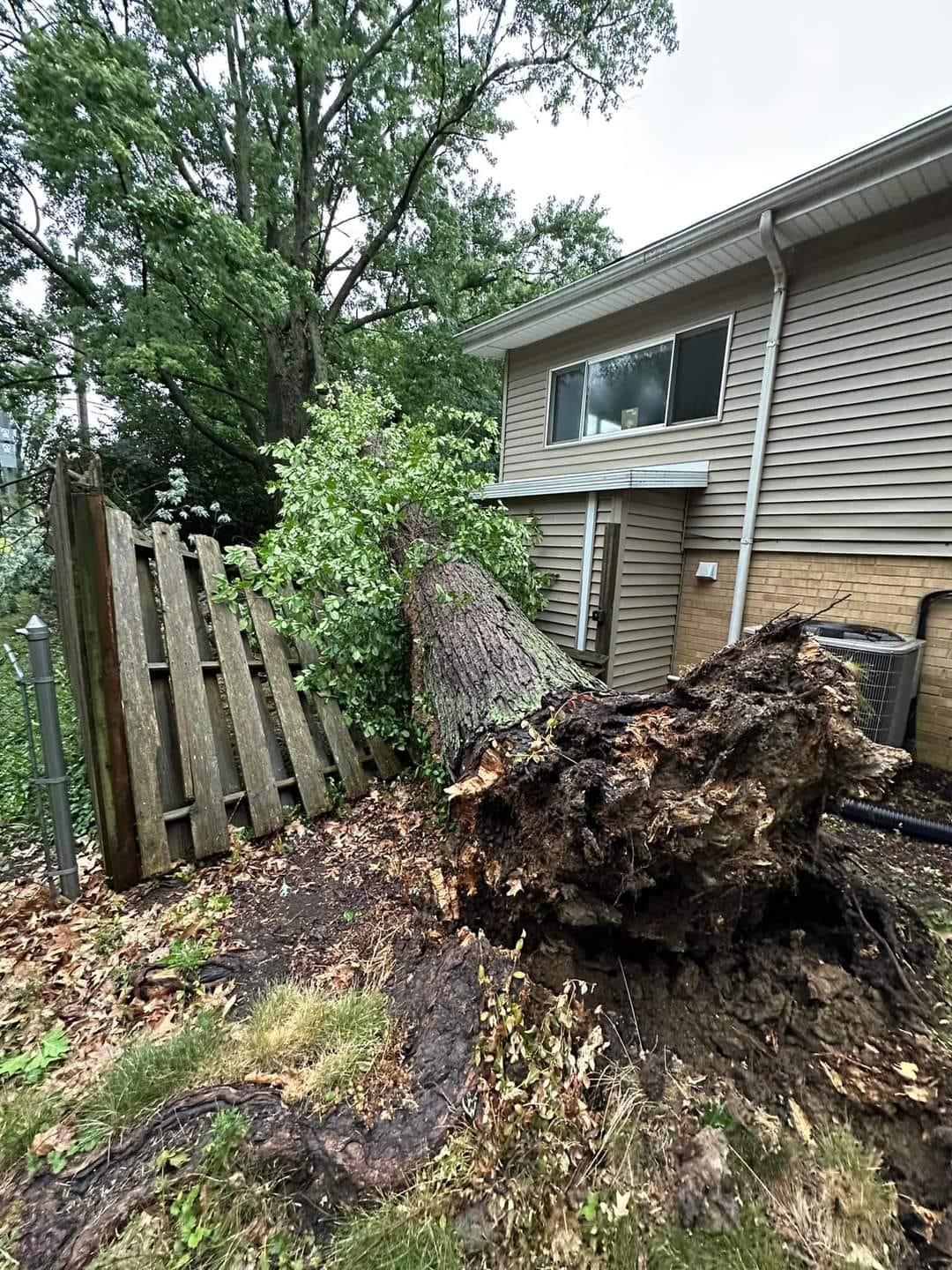
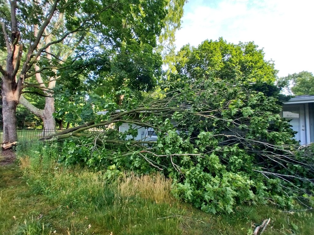
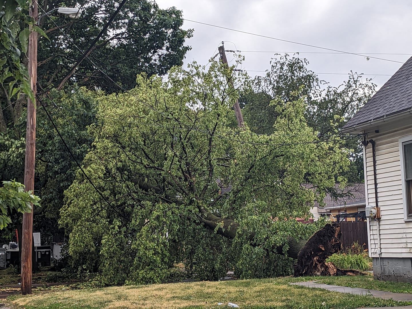
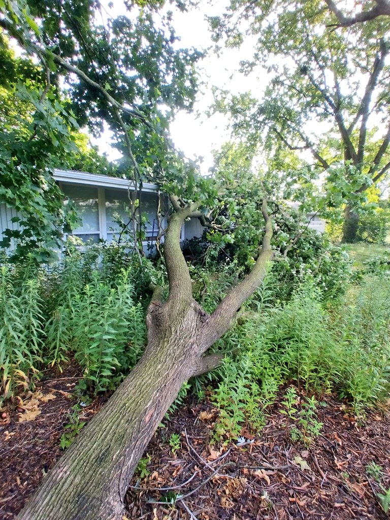
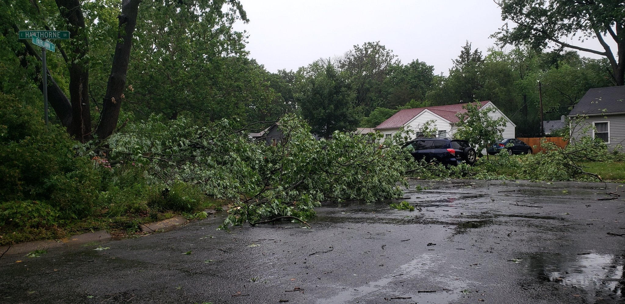
By later that morning, a large bow echo/derecho that initiated from overnight storms over the central Plains entered west-central Illinois, spreading east-southeast through the entire forecast area by the late afternoon hours. Widespread, significant straight-line wind damage was reported areawide as well as a few tornadoes. Some surface observing equipment in central and southeast IL recorded wind gusts of 70 mph or greater with our highest gust being 101 mph from a personal weather station that took a direct hit from the Taylorville, IL tornado. This resulted in a substantial amount of tree damage, crop damage, and extensive power outages across a good portion of the forecast area. The derecho continued to track southeast of here into southern Indiana and points beyond, producing more wind damage.
The third and final round was more localized and occurred south of I-70 during the early evening hours when a few supercell thunderstorms produced large hail up to 2" in parts of Clay and Richland counties.

What is a derecho? A derecho is a widespread, long-lived wind storm that is associated with a band of rapidly moving showers or thunderstorms variously known as bow echoes, squall lines, or quasi-linear convective systems. By definition, if the wind damage swath extends more than 400 miles in length and 60 miles in width, includes wind gusts of at least 58 mph (50 kt) or greater along most of its length, along with several well-separated 75 mph (65 kt) or greater gusts, then the event is classified a derecho.
Tornadoes:
|
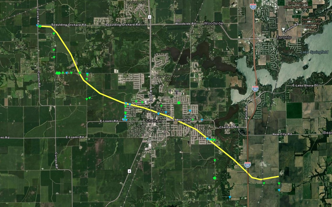
Curran/Chatham Tornado
|
||||||||||||||||
|
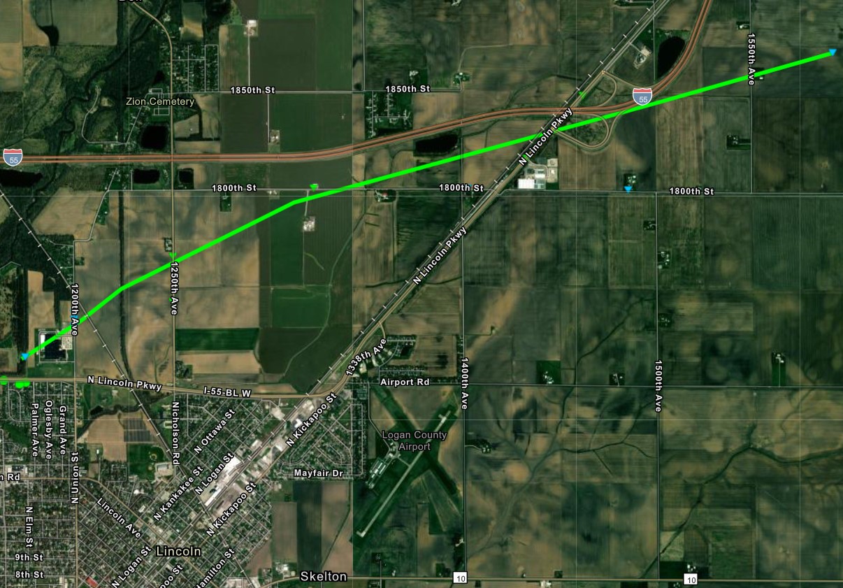
Lincoln Tornado
|
||||||||||||||||
|
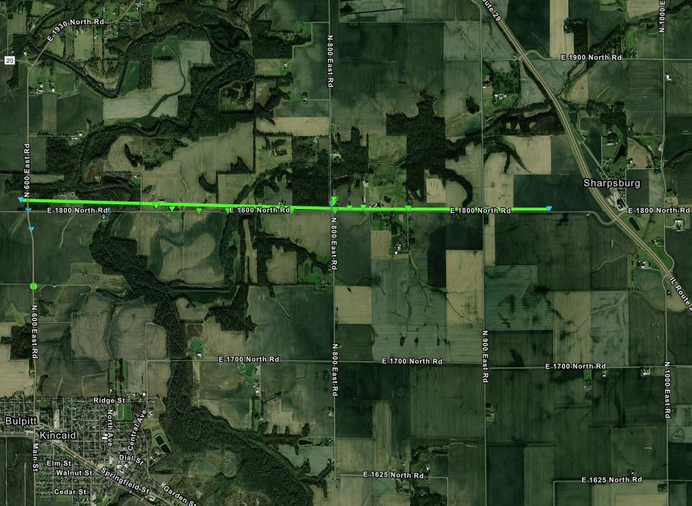
Sharpsburg Tornado
|
||||||||||||||||
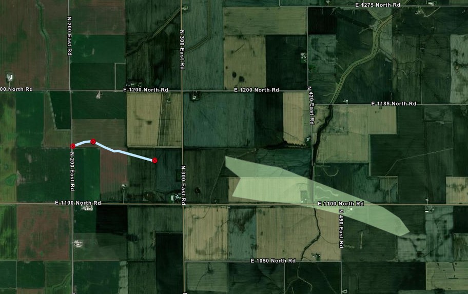
|
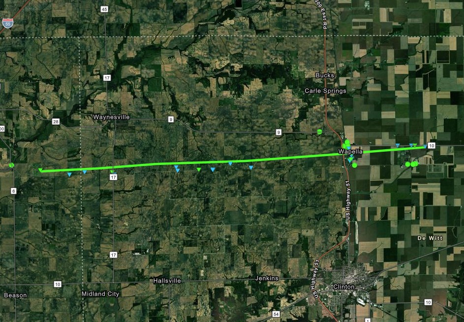
Waynesville/Wapella Tornado
|
||||||||||||||||
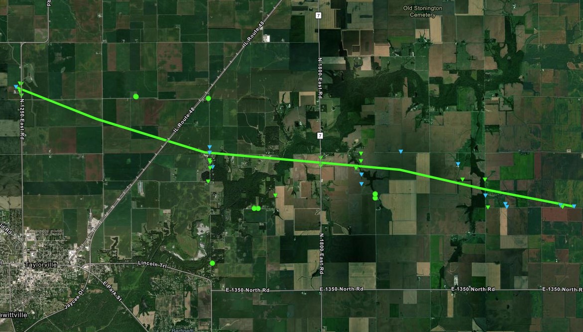
|
Taylorville Tornado
|
||||||||||||||||
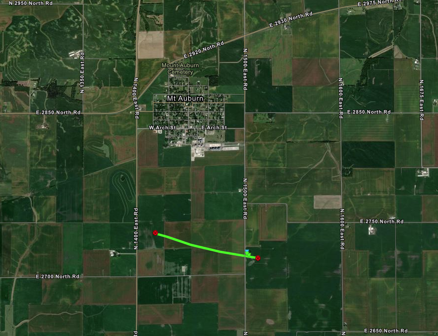
|
Mt. Auburn Tornado
|
||||||||||||||||
|
Palmer Tornado
|
||||||||||||||||
The Enhanced Fujita (EF) Scale classifies tornadoes into the following categories:
| EF0 Weak 65-85 mph |
EF1 Moderate 86-110 mph |
EF2 Significant 111-135 mph |
EF3 Severe 136-165 mph |
EF4 Extreme 166-200 mph |
EF5 Catastrophic 200+ mph |
 |
|||||
Satellite

Satellite image over central Illinois from 12:58 pm CDT. Click image for animation (GOES-16 1-minute scans) from 9 am to 2 pm. More information available from CIMMS at the University of Wisconsin.
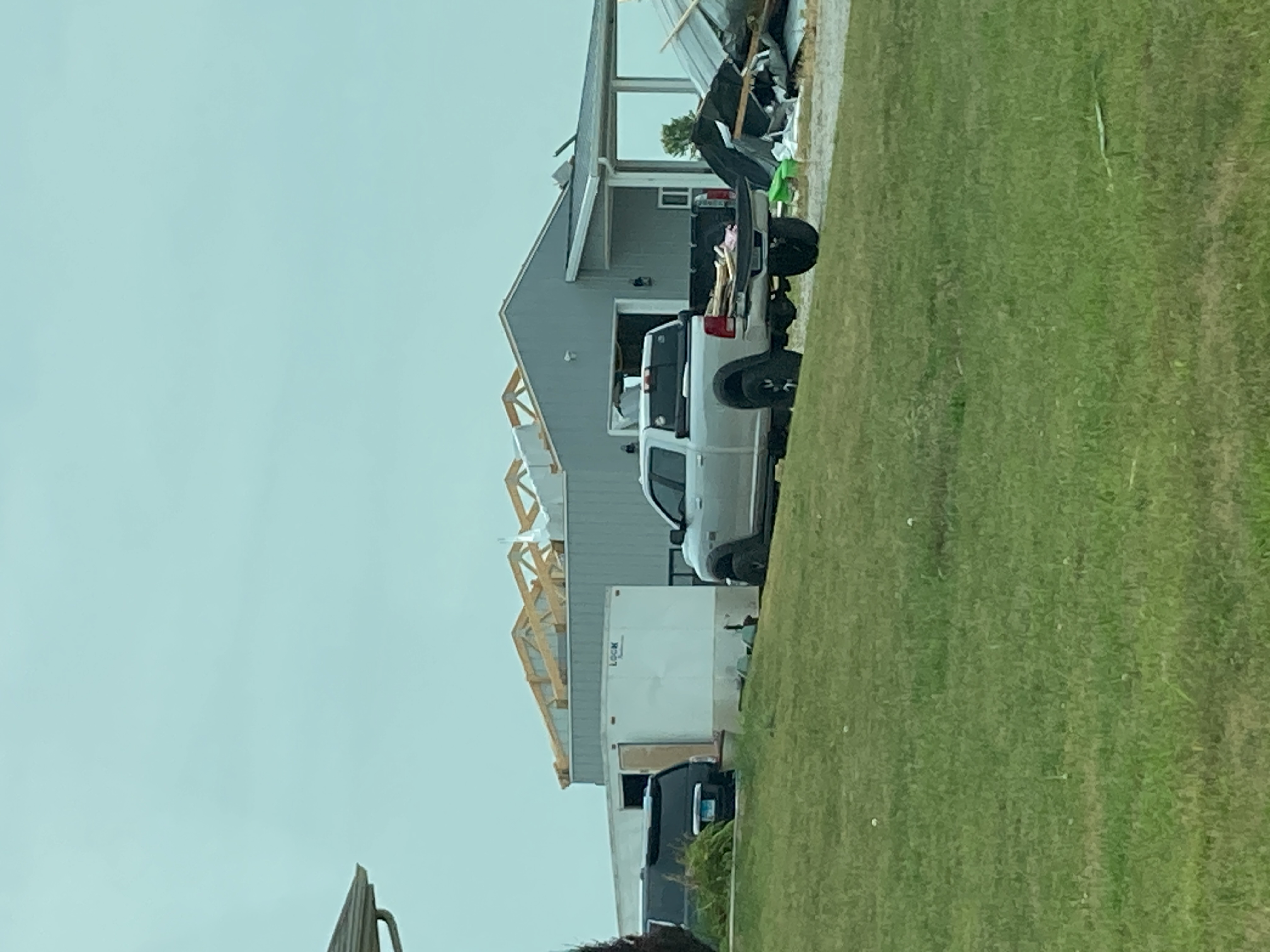
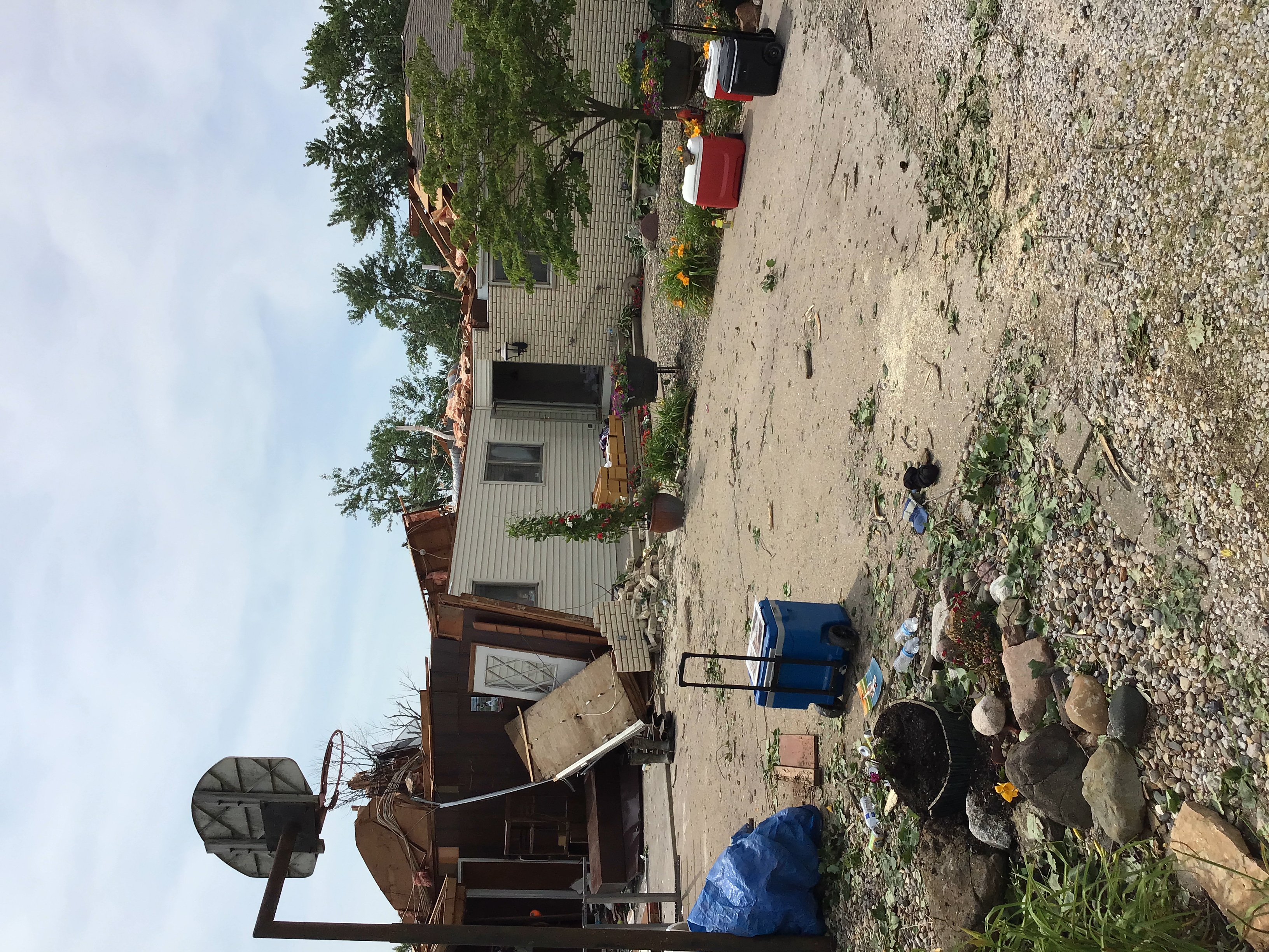
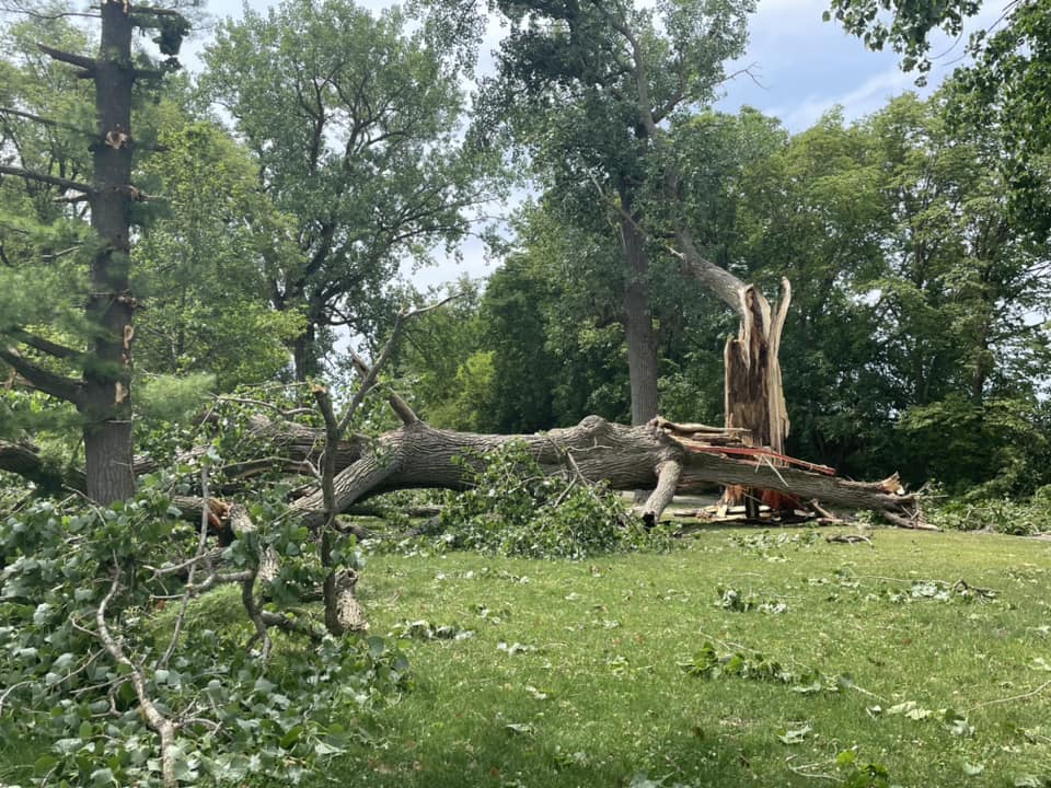
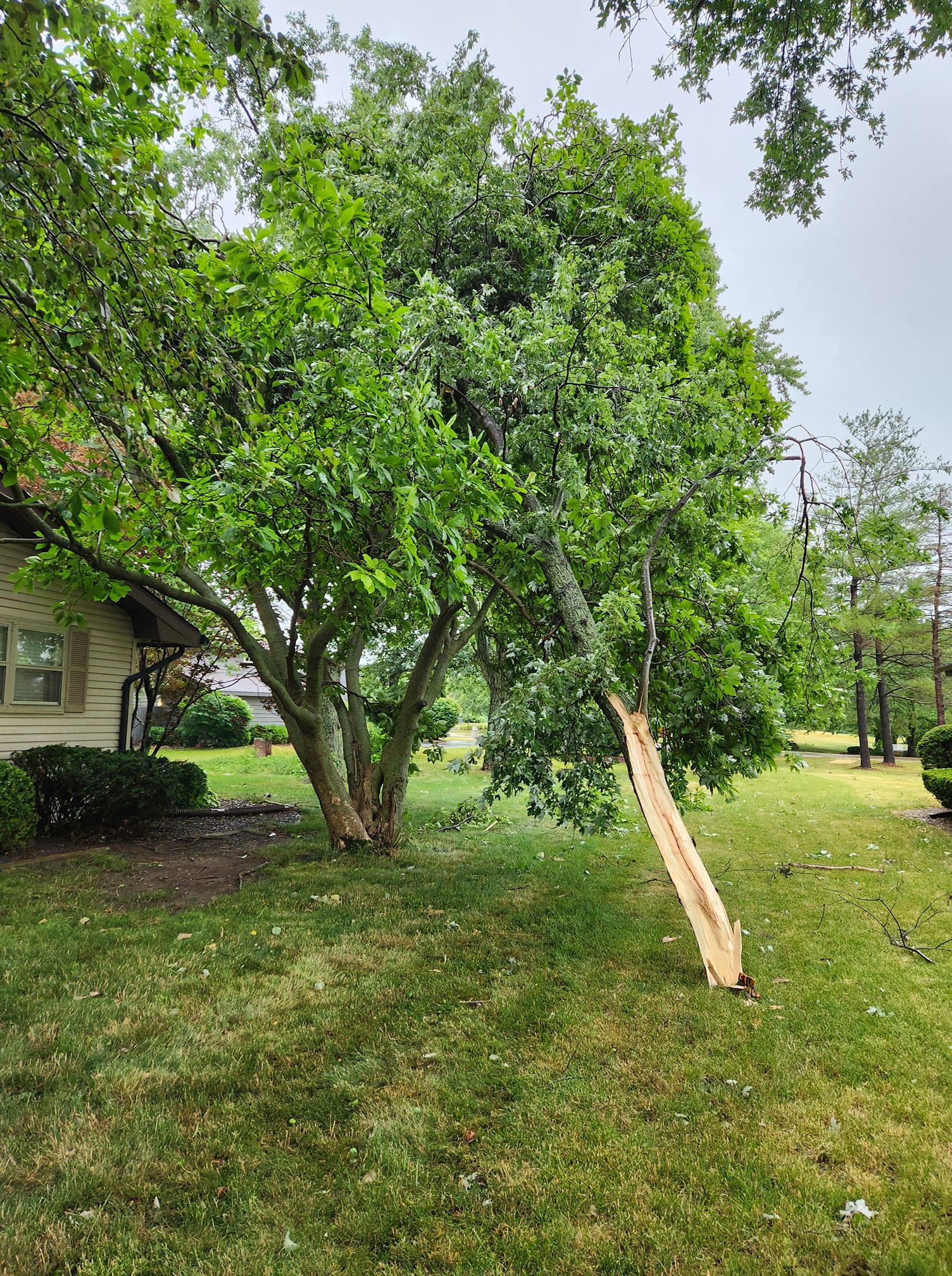
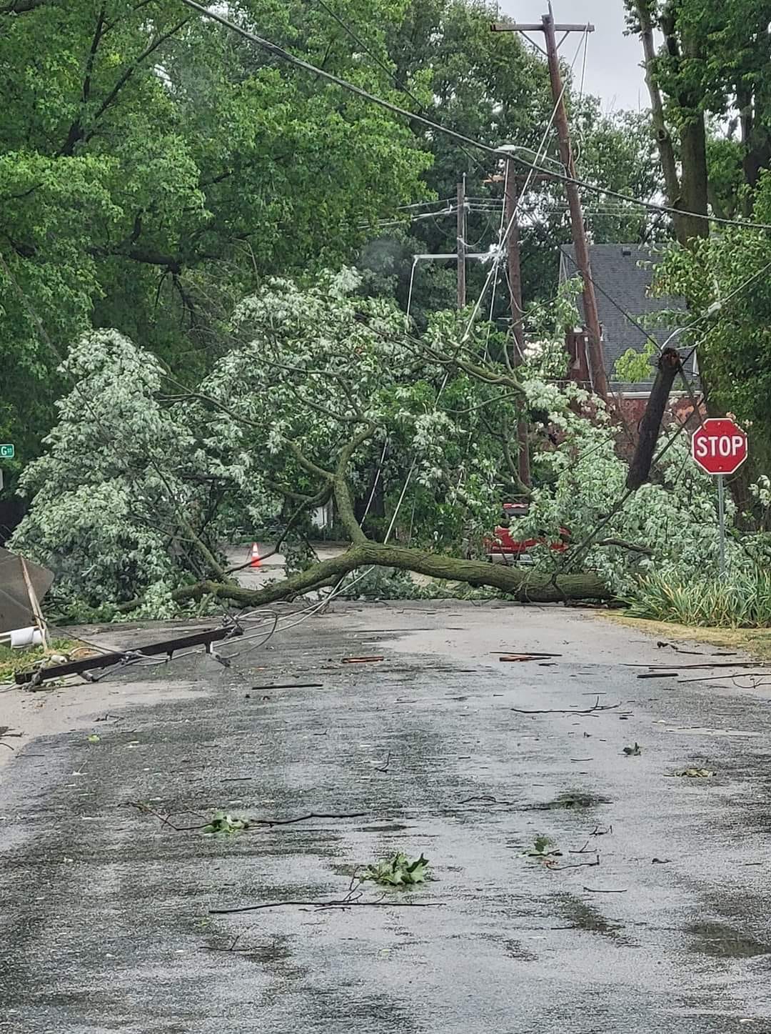
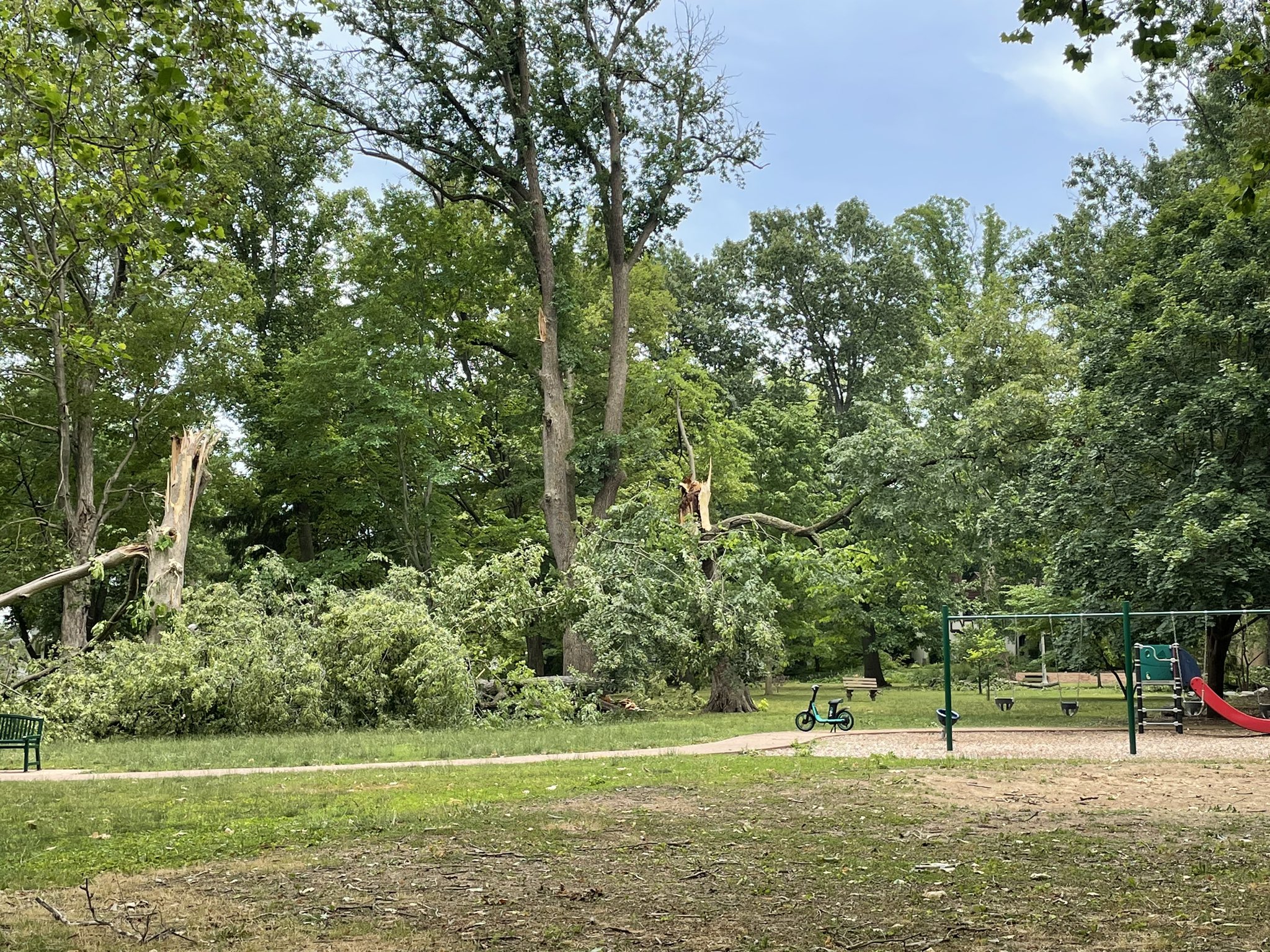
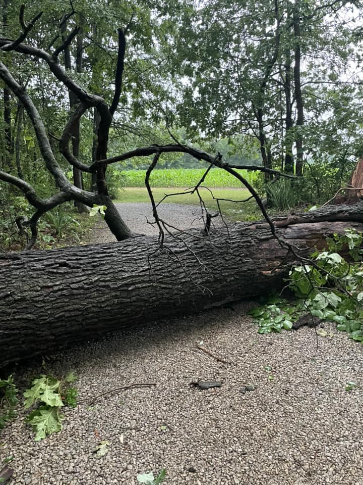
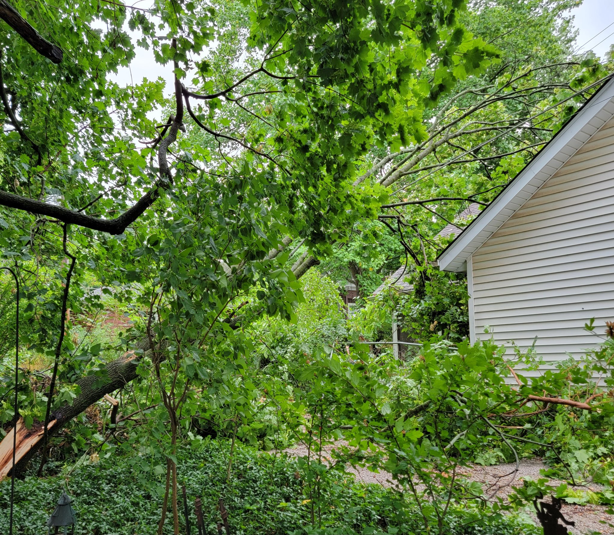
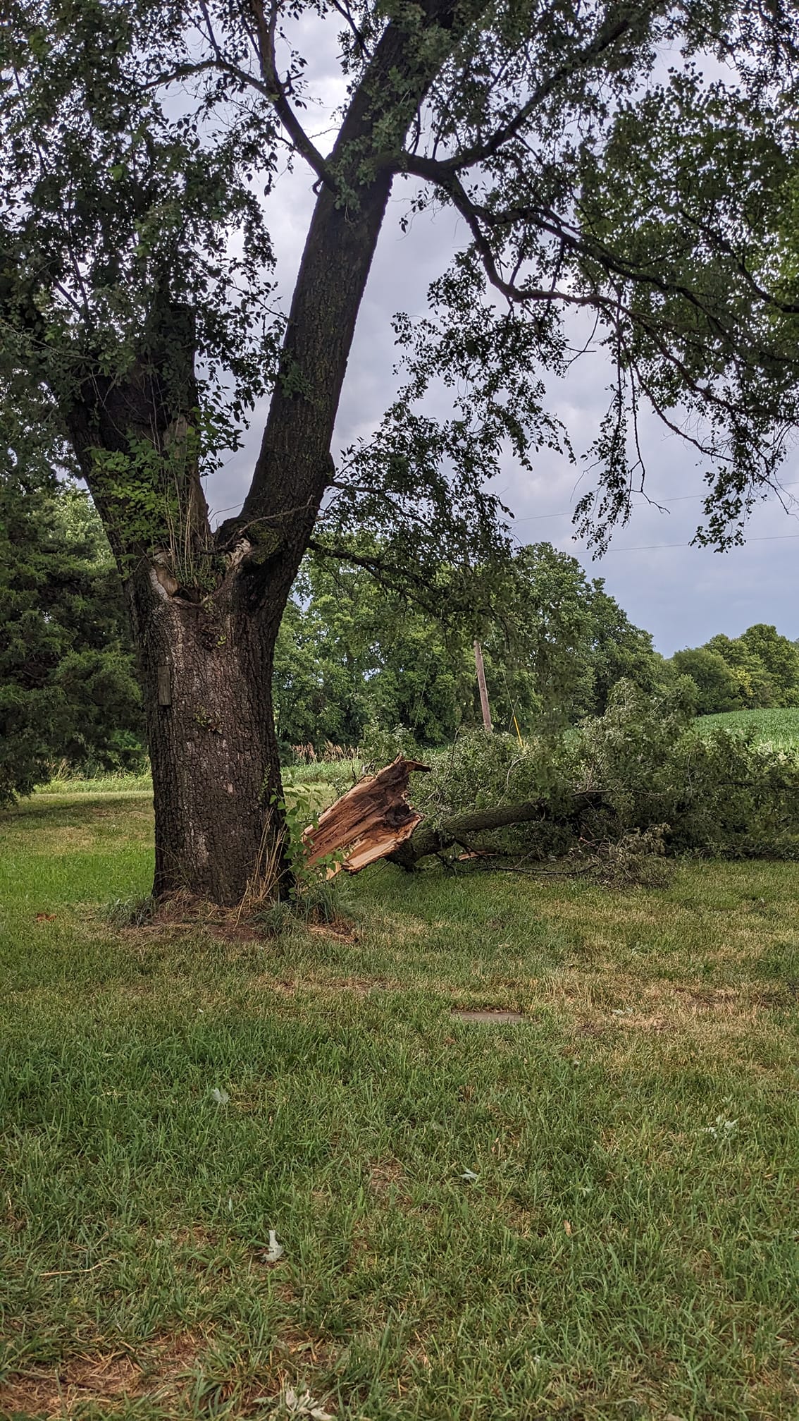
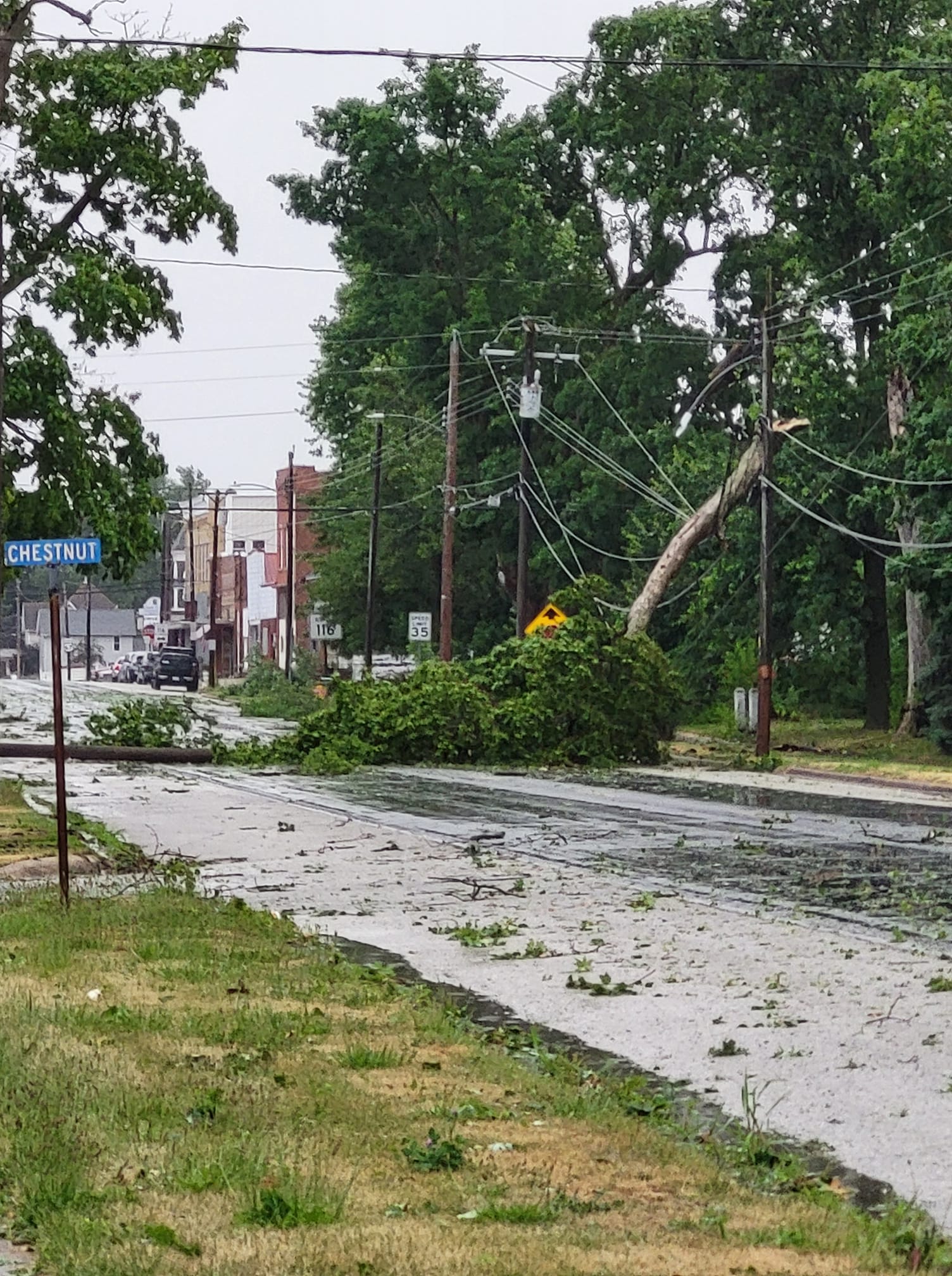
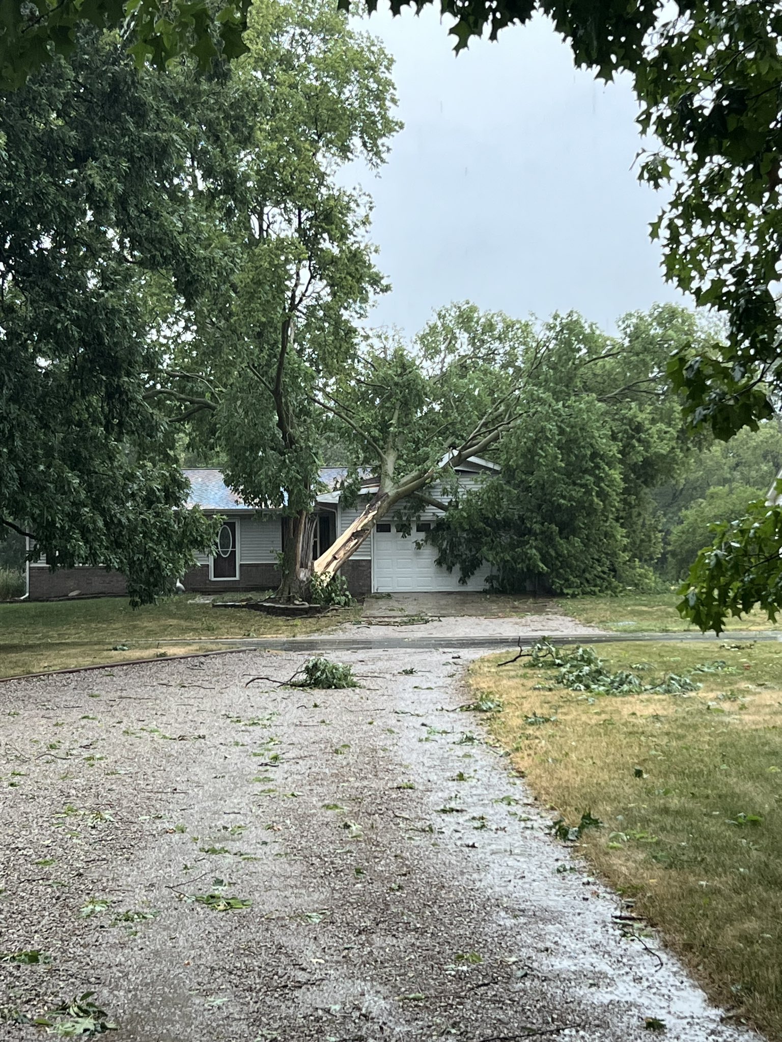
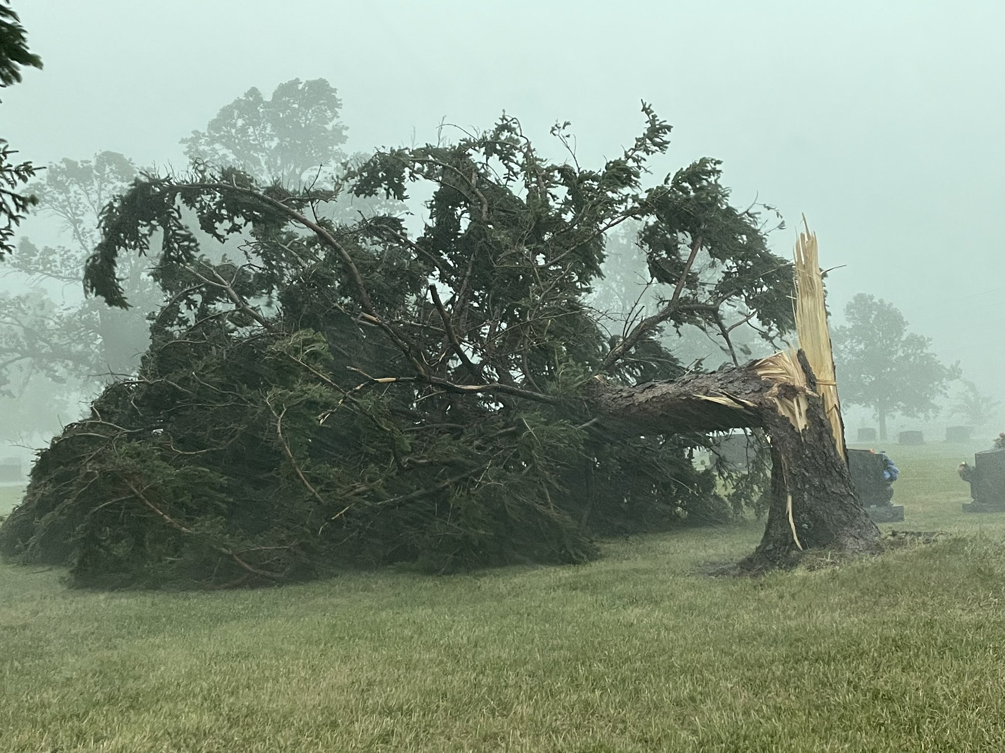
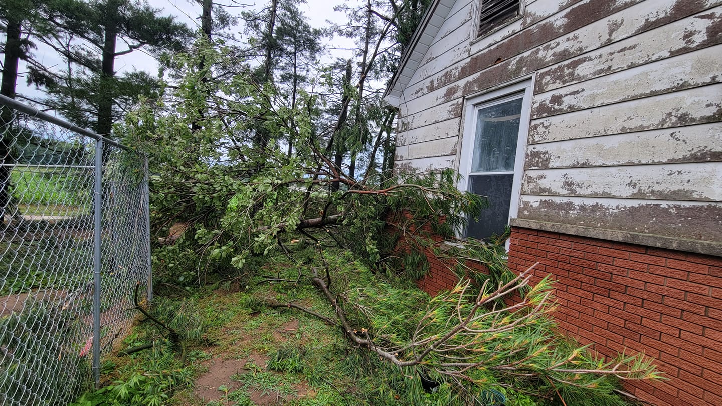
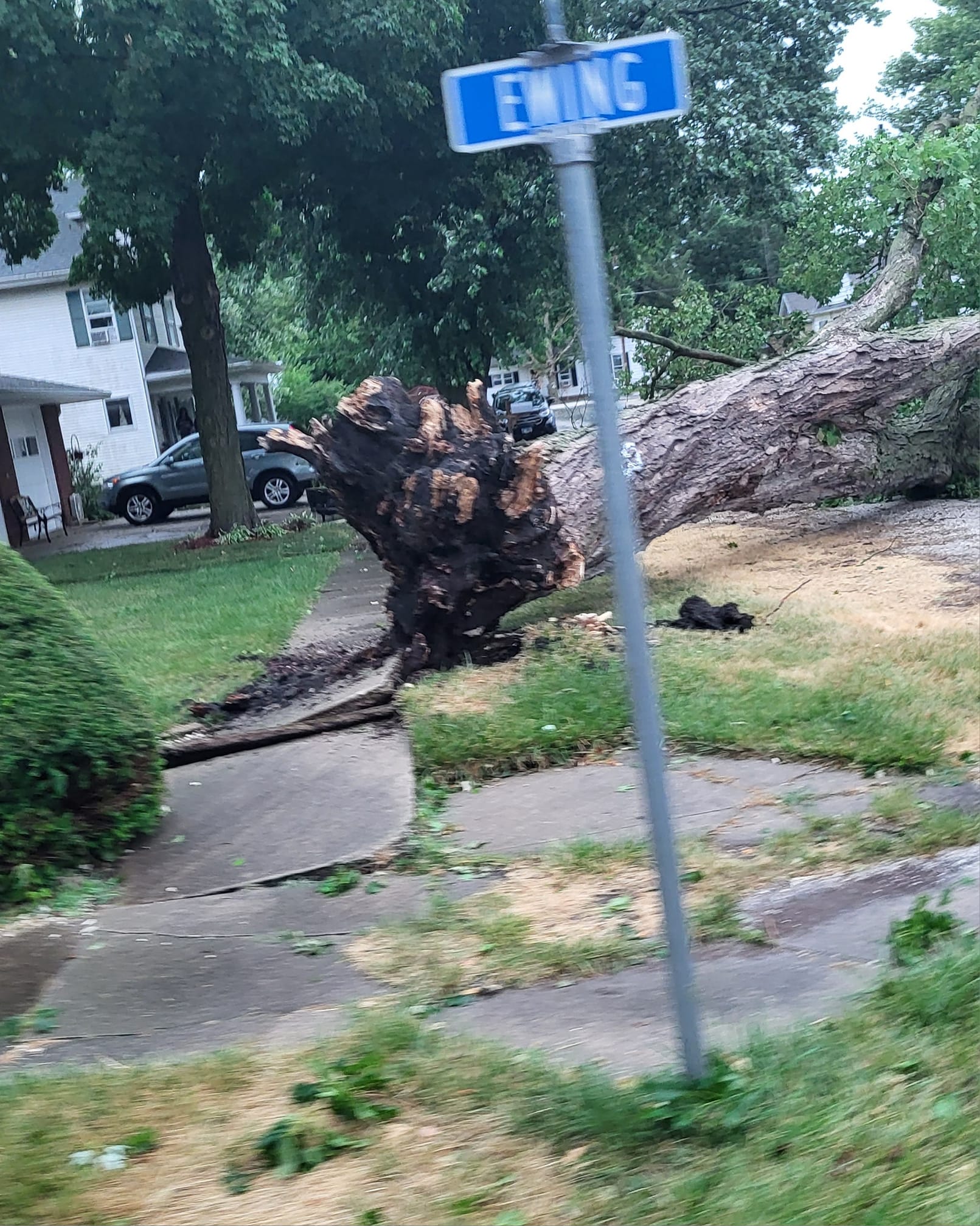
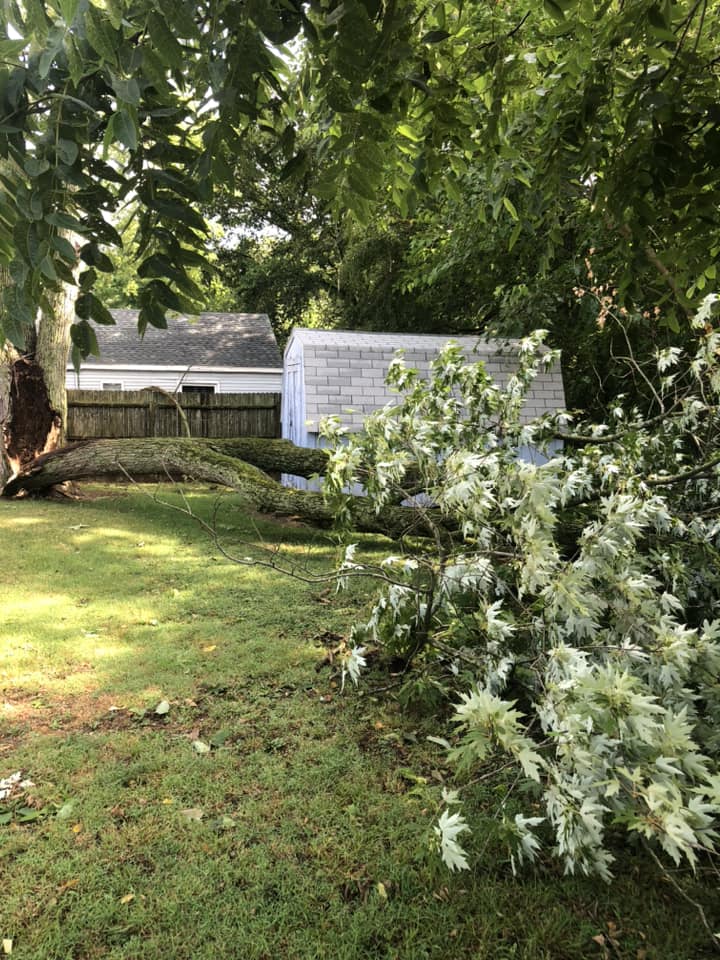
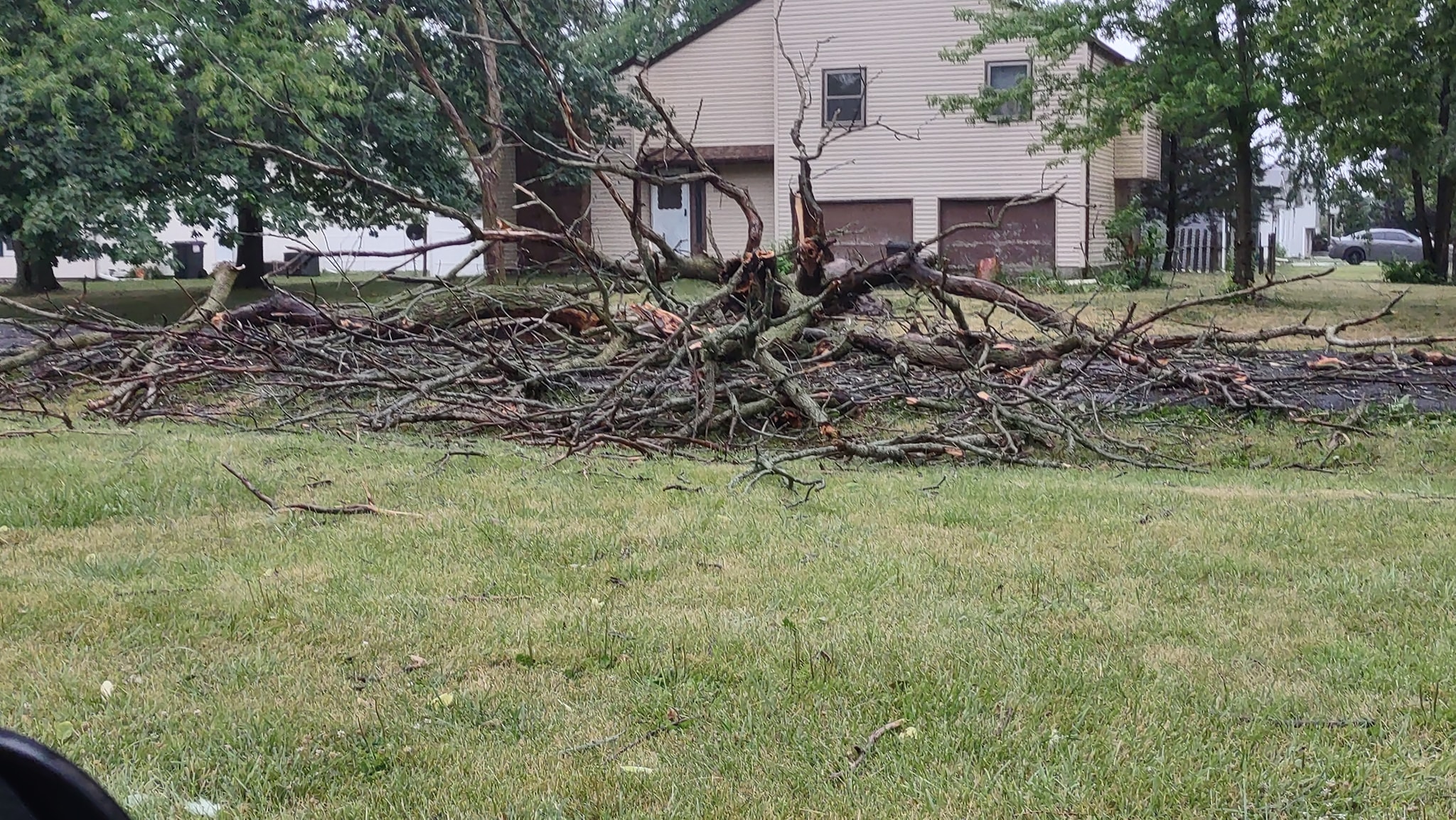
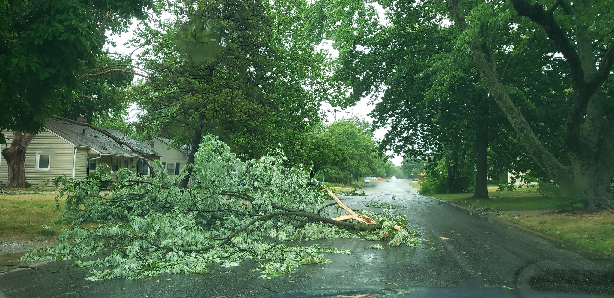
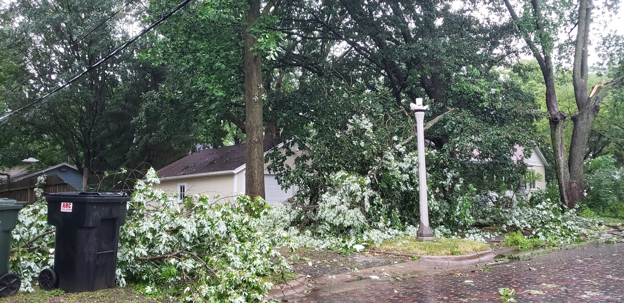
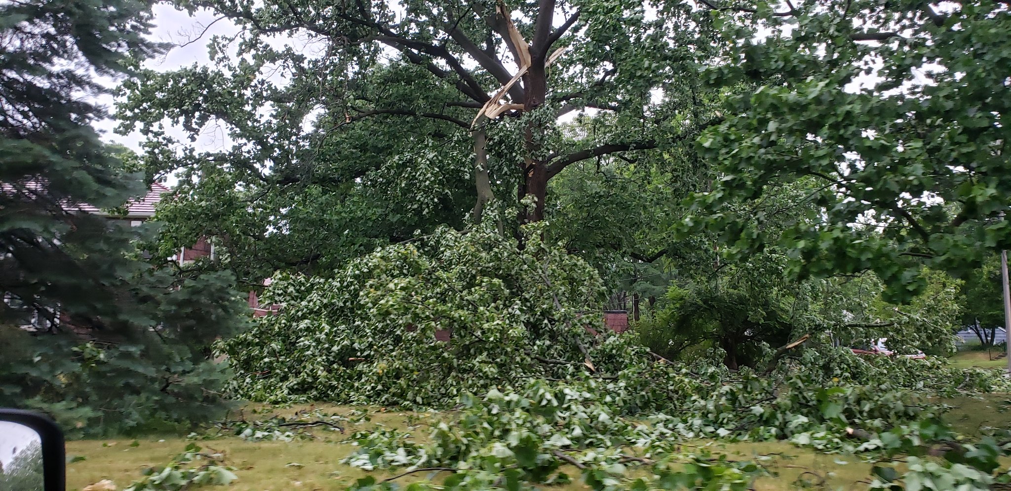
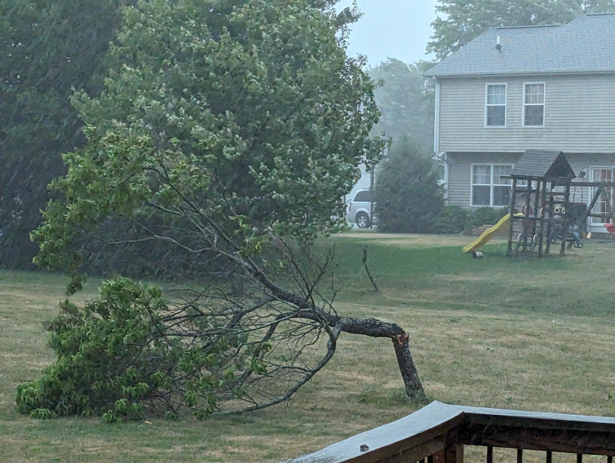
Photos & Video
 |
 |
 |
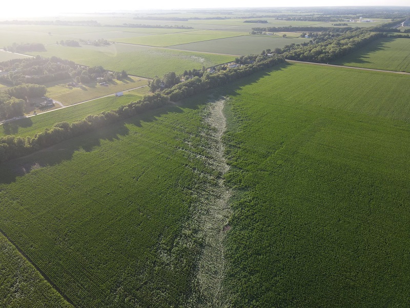 |
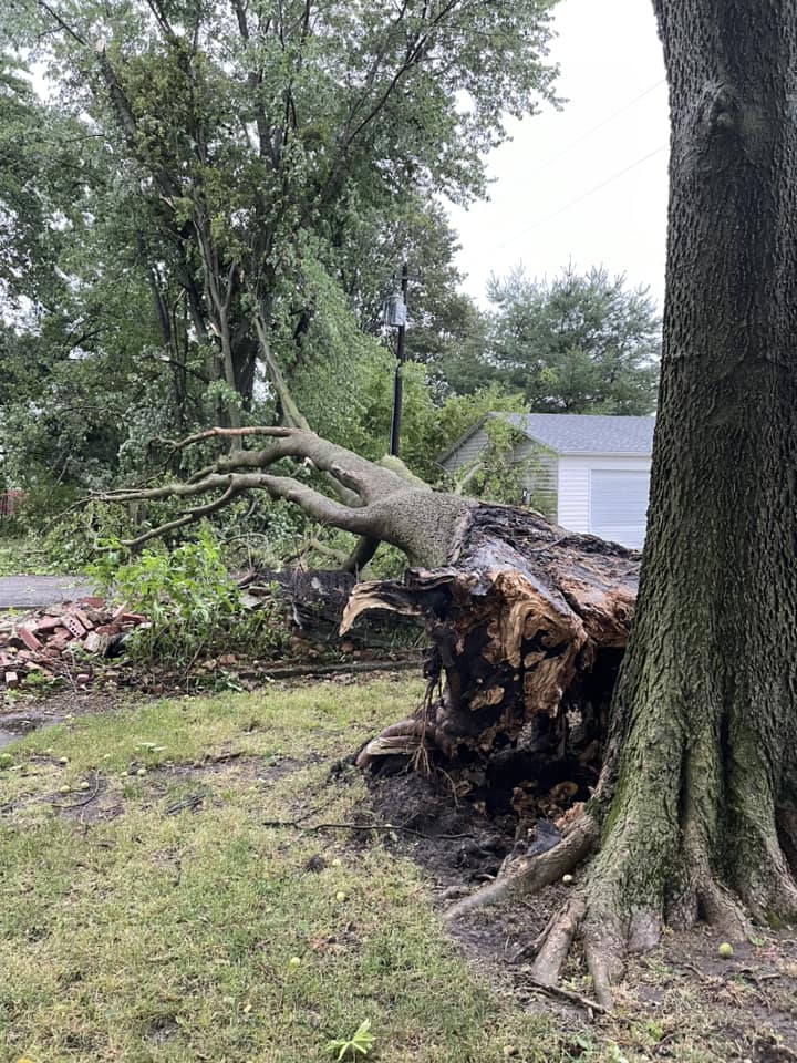
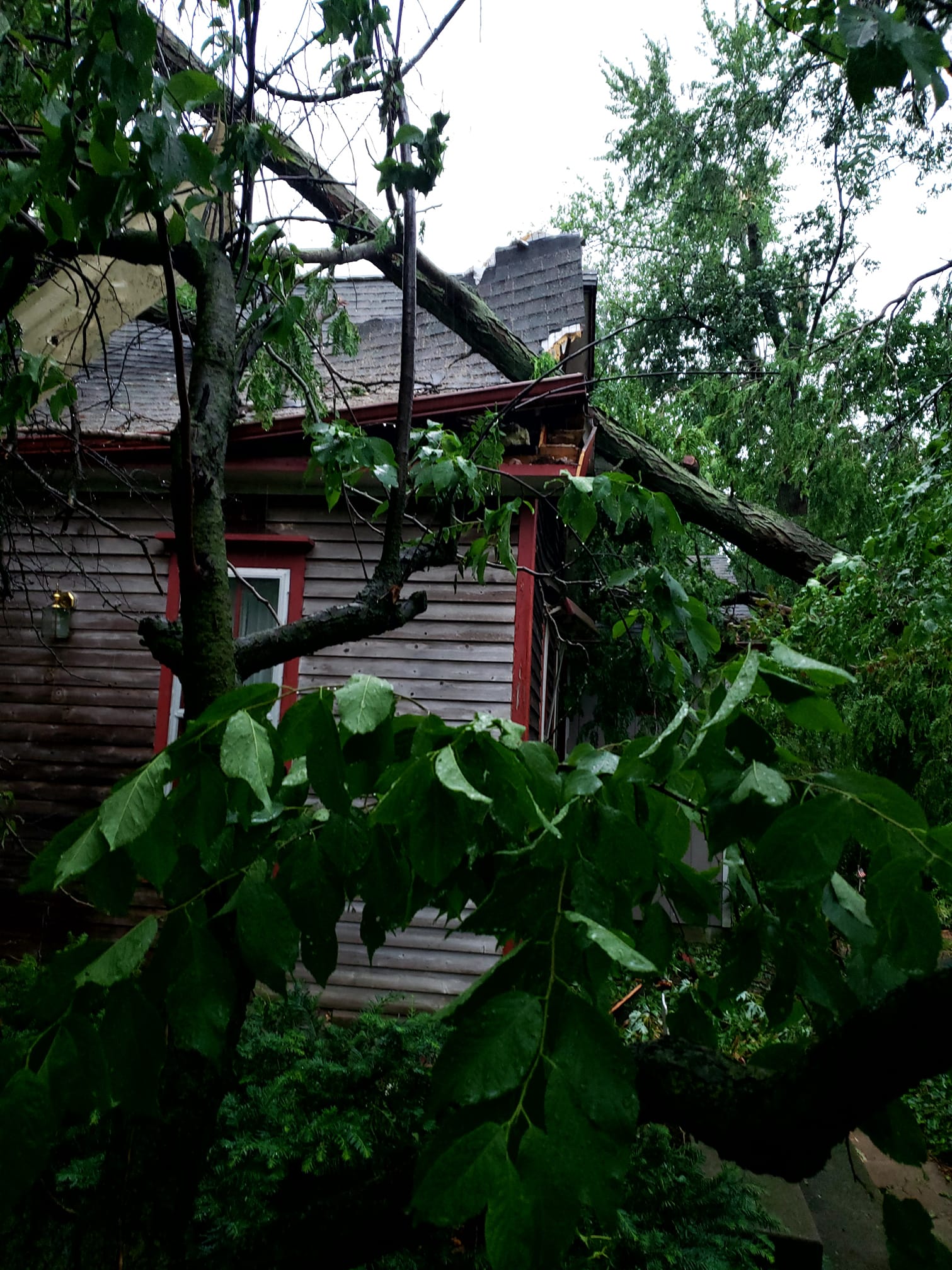
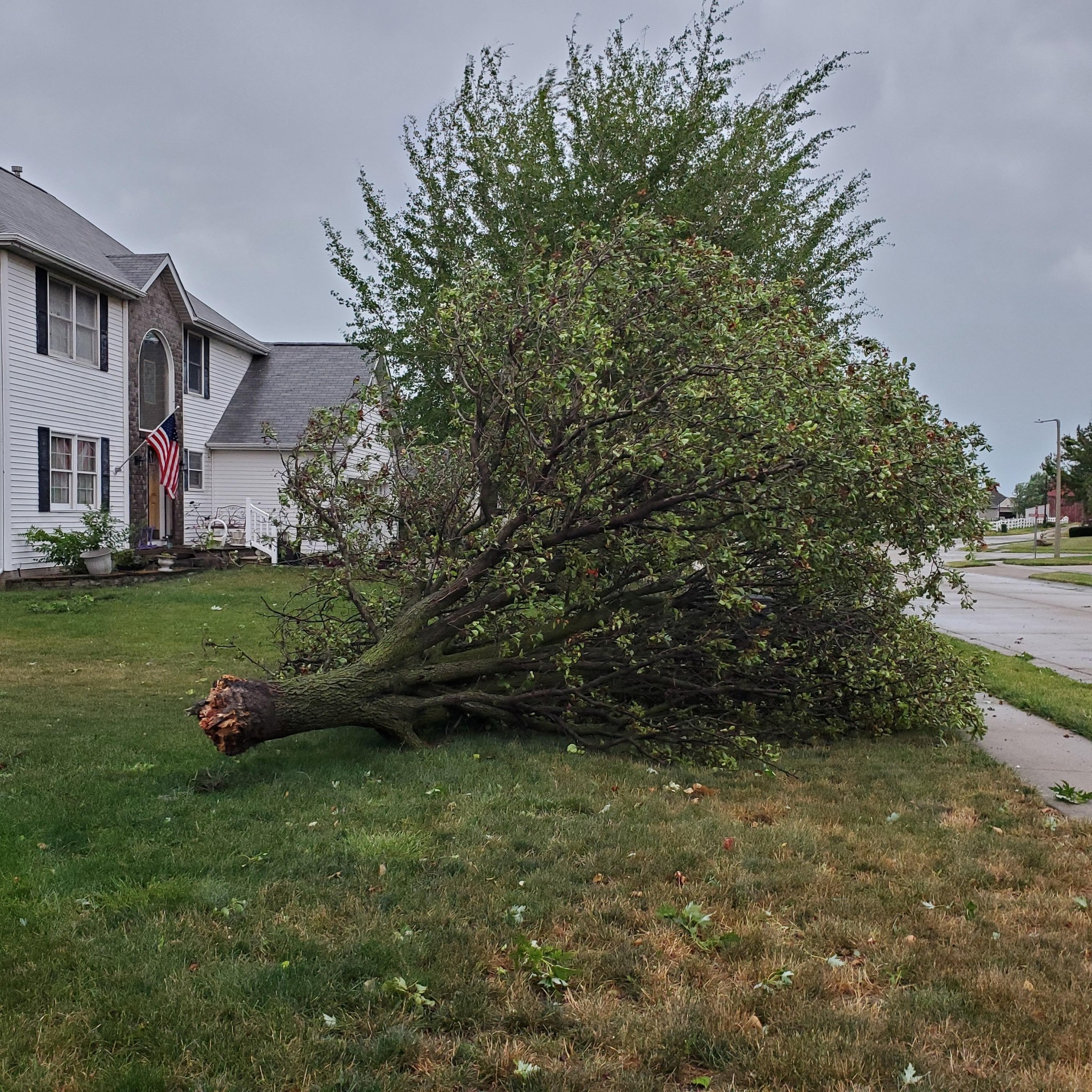
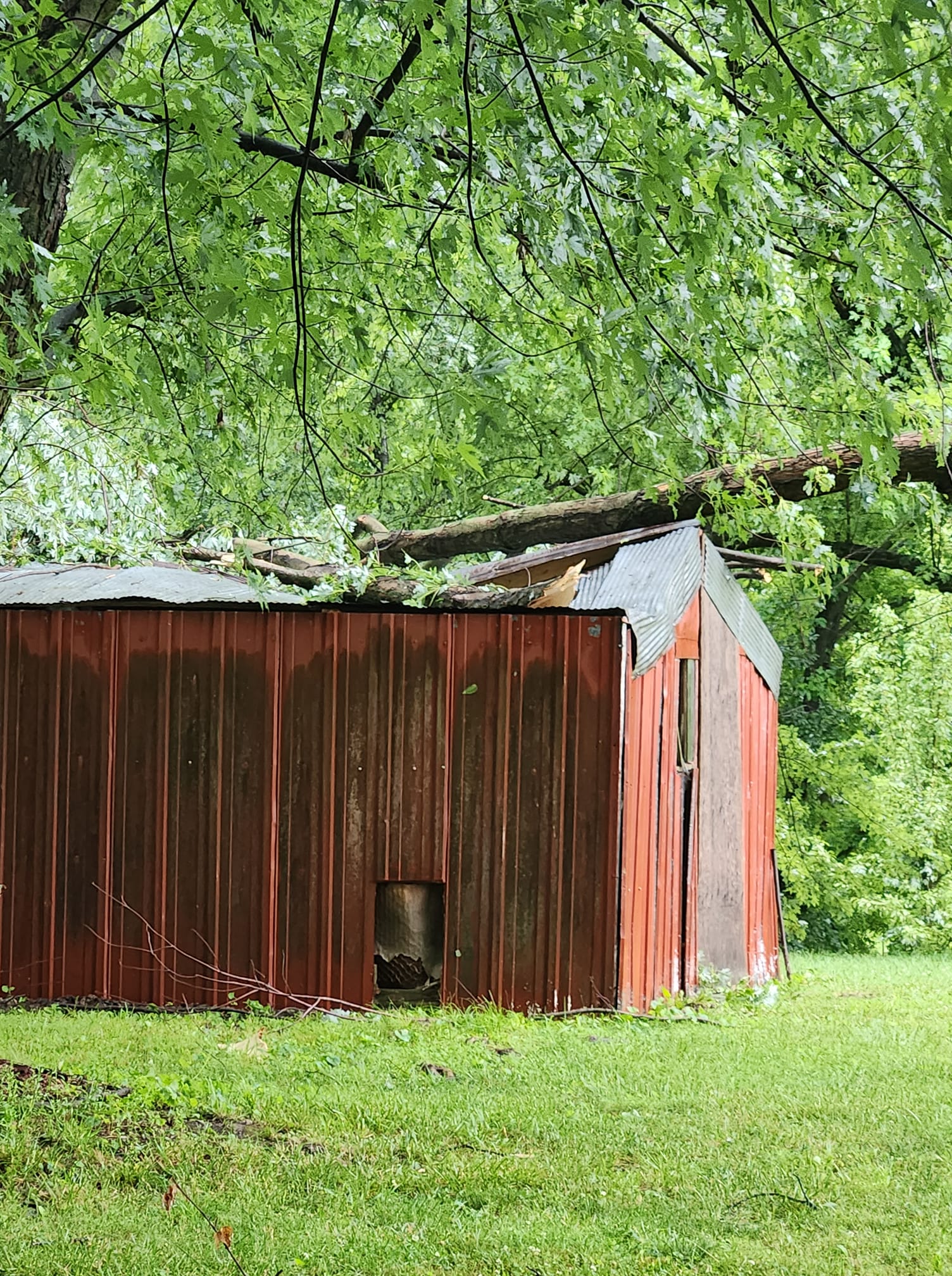
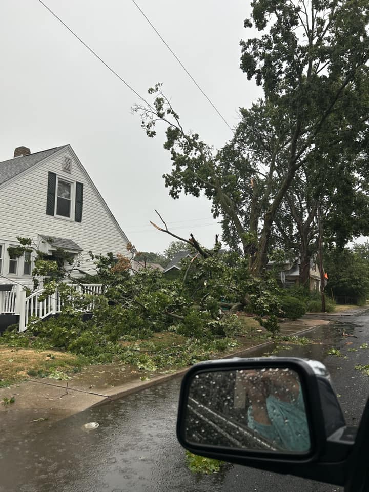
| Large tree down in Lincoln, IL (Photo by NWS Employee) | Large hail in Tuscola (Photo by Chris Fowler) | Shelf Cloud in Champaign-Urbana (Photo by Jeff Frame) | Tornado track in a corn field near Chatham, IL (Photo by Kyle Golden) |
 |
 |
 |
 |
| Structural damage cause by EF-2 tornado in Chatham, IL (NWS Survey) | EF-2 tornado damage south of Curran, IL (NWS Survey) | Taylorville tornado damage, resident's personal weather station measured 101 mph winds (NWS Survey) | Power lines blown down near Taylorville, IL (NWS Survey) |
 |
 |
 |
 |
| Two miles north of Mahomet (Photo by Ken Dallmier) | Tree damage in Armington (Photo by Janelle Broadfield) | Tree damage in Athens (Photo by Shannon Shofner) | Roof damage in Atwood (Photo by Shelia Anderson) |
 |
 |
 |
 |
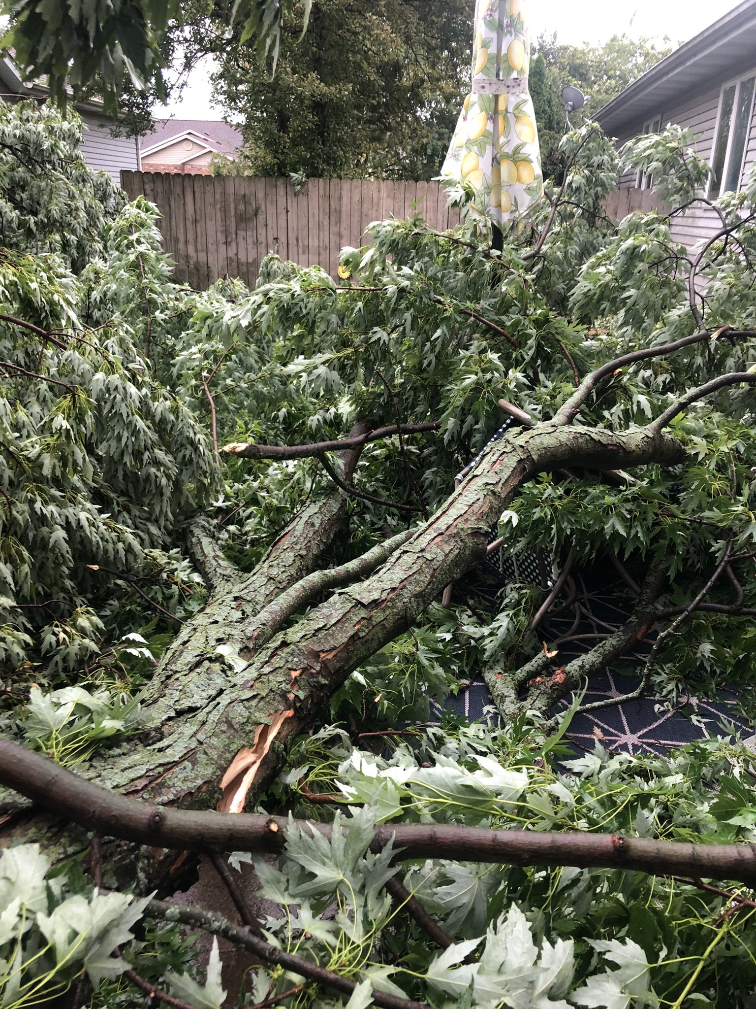
| Tree damage in Bement (Photo by Ryan Mulvaney) | Tree damage in Bloomington (Photo by Patrick Cortesi) | Tree and power line damage in Blue Mound (Photo by Chloe Moyer) | Tree damage in Carle Park in Urbana (Photo by Mark White) |
 |
 |
 |
 |
| Tree damage in Champaign (Photo by David McCall) | Tree damage in Champaign (Photo by Tiffany Davis) | Tree damage in Charleston on the EIU Campus (Photo by Carla Matthews) | Tree damage in Chatham (Photo by Aaron Whitcomb) |
 |
 |
 |
 |
| Power line damage in Chatham (Photo by Amy Dewes) | Tree damage in Chatham (Photo by Doug Martin) | Damage in Chatham (Photo by Heather Woods) | Damage in Decatur (Photo by Cassie Bentz) |
 |
 |
 |
 |
| Downed tree in Decatur (Photo by Julie Stalets) | Tree damage in Flat Rock (Photo by Jeff Hemrich) | Tree damage in Franklin (Photo by Scott Roodhouse) | Tree damage in Glasford (Photo by Kari Clark) |
 |
 |
 |
 |
| Tree damage in Heyworth (Photo by Chris Higgins) | Tree damage in Homer Lake Park (Photo by Tom Davis) | Tree damage in Jacksonville (Photo by Holly Edmiston) | Tree damage in Jacksonville (Photo by Keith Lawson) |
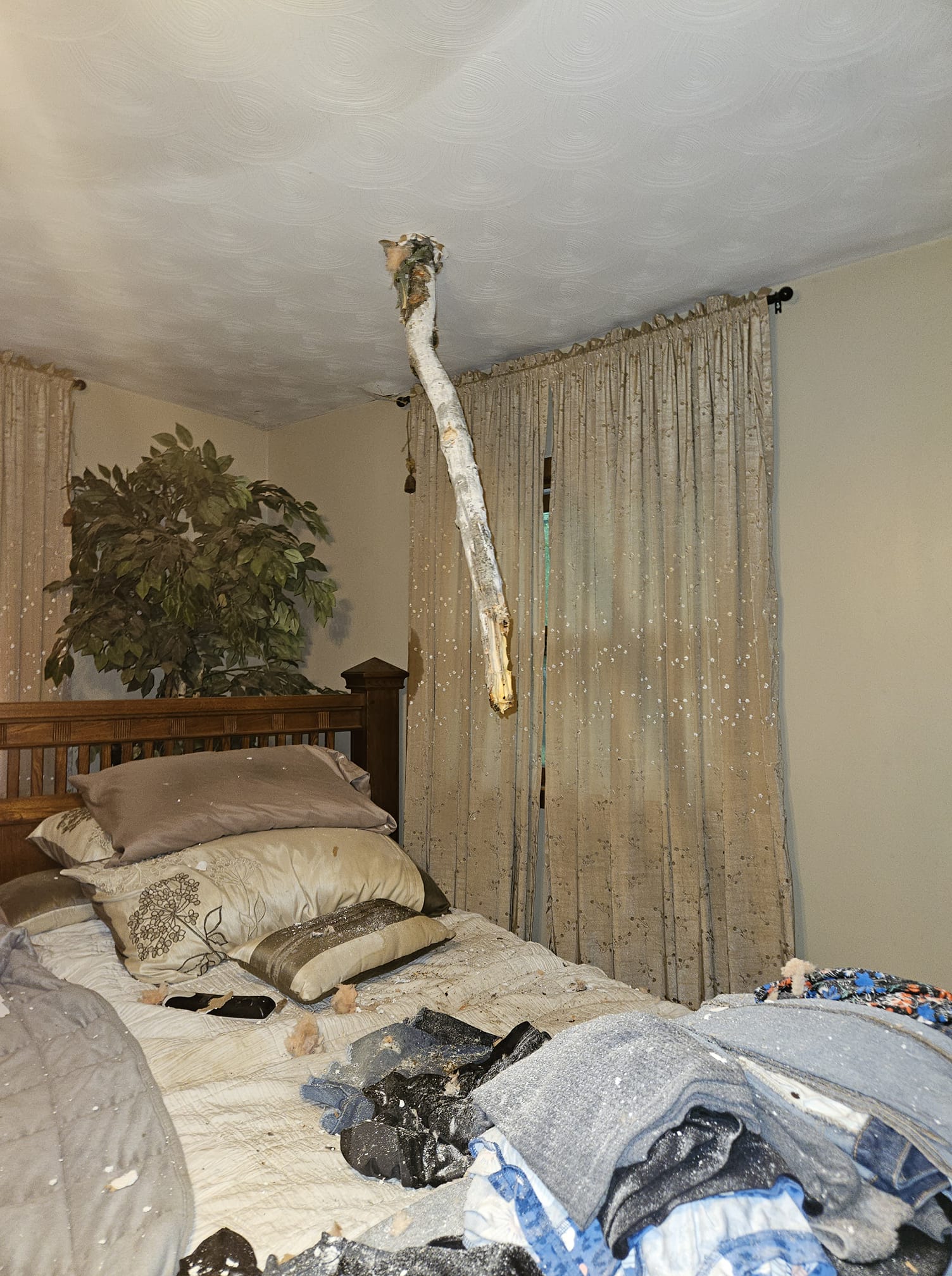
 |
 |
 |
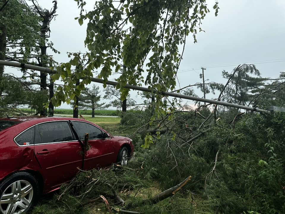 |
| Tree damage in Lincoln (Photo by Nicole Worth) | Tree damage in Martinsville (Photo by Tammy Huckaba) | Tree limb through roof in Monticello (Photo by Monica Williams) | Tree and car damage in Mount Auburn (Photo by Kelly Rice) |
 |
 |
 |
 |
| Tree damage in Normal (Photo by Gayla Betts) | Grain bin destroyed in Oakland (Photo by Matt Davis) | Tree damage in Decatur (Photo by Pam Hollis) | Tree damage in Pana (Photo by Doug Clark) |
 |
 |
 |
 |
| Tree damage in Paris (Photo by Derek Scott) | Tree damage in Pekin (Photo by Anna Quarello-Lee) | Tree damage in Peoria (Photo by Erica Louise) | Tree damage in Petersburg (Photo by Michelle Bloomquist) |
 |
 |
 |
 |
| Tree damage at the Rail Golf Course in Springfield (Photo by Jim Johnson) | Tree damage in Rochester (Photo by Jennifer Kilby) | Tree and power line damage in Roseville (Photo by Amber Pakosz) | Tree damage in Saint Joseph (Photo by Andrew Sigurdsson) |
 |
 |
 |
 |
| Tree damage southeast of Jacksonville (Photo by Winston Wells) | Tree damage southeast of Mattoon (Photo by Anthony Mantell) | Tree damage in Sidney (Photo by Mike Roy) | Tree damage on the south side of Chatham (Photo by Sean Beasley) |
 |
 |
 |
 |
| Tree damage on the south side of Springfield (Photo by Katlyn Graff) | Tree damage in southern Clark County (Photo by Lori Truelove) | Tree damage in Springfield (Photo by Nicole Miller) | Tree damage in Springfield (Photo by Schelli Kirby) |
 |
 |
 |
 |
| Tree damage in Springfield (Photo by Tammy Hovey) | Tree damage in Springfield (Photo by Nicole Miller) | Tree damage in St. Francisville (Photo by Heather Gray) | Tree damage in Tallula (Photo by Julie Woodvine) |
 |
 |
 |
 |
| Tree damage in Tilton (Photo by Debra Urban) | Tree damage in Tolono (Photo by Kastie Pavlik) | Tree Damage in Urbana (Photo by Cindy Chan) | Tree damage in Urbana (Photo by Kathleen Jones) |
 |
 |
 |
 |
| Tree damage in Urbana (Photo by Cindy Chan) | Tree damage in Urbana (Photo by Jeff Frame) | Tree damage in Urbana (Photo by Jeff Frame) | Tree damage in Urbana (Photo by Jeff Frame) |
 |
 |
 |
 |
| Tree damage in Urbana (Photo by Jeff Frame) | Tree damage in Washington (Photo by Bob Johann) | Tree damage in West Peoria (Photo by Brock Crothers) | Tree damage in West White Oaks in Springfield (Photo by Joan Sestak) |
Radar
Radar
 |
 |
 |
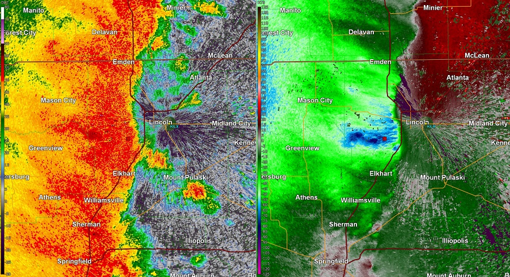 |
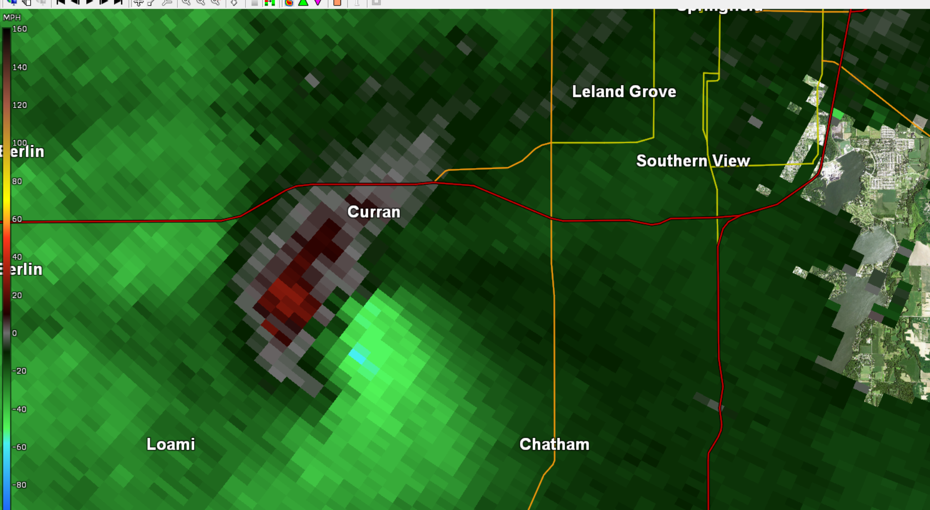
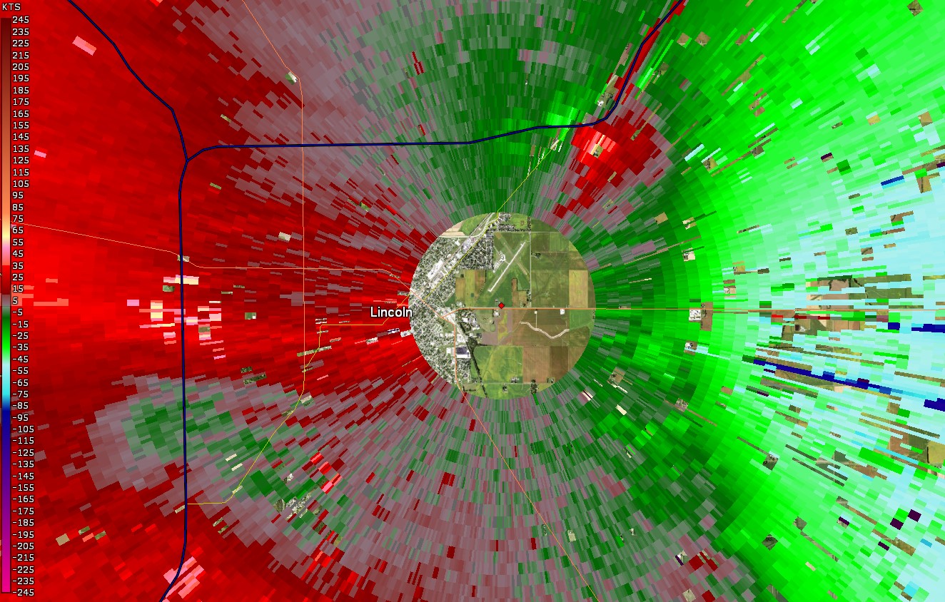
| KILX 0.5 deg Base Reflectivity at 12:45 pm. The Wapella, IL tornado is seen by the small nub just above the first "n" in the word Clinton. | KILX 0.5 deg Base Velocity at 12:12 pm as the tornado began south of Curran, IL. | KILX Storm Relative Motion image at 12:29 pm, when the Lincoln tornado was at I-55 exit 133, which took down numerous power lines/poles. The NWS office is located at the red dot in the center. | KILX 0.5 deg Base Reflectivity (left) & 0.5 deg Velocity (right) at 12:22 pm. The dark blue area just southwest of Lincoln, IL shows radar sampled wind speeds as high as 80-87 kts (90-100 mph) at 500 ft AGL. |
Storm Reports
Interactive mapping available from the Storm Prediction Center


Preliminary Local Storm Report...Summary
National Weather Service Lincoln IL
1149 PM CDT Thu Jun 29 2023

..TIME...   ...EVENT...      ...CITY LOCATION...     ...LAT.LON...
..DATE...   ....MAG....      ..COUNTY LOCATION..ST.. ...SOURCE....
            ..REMARKS..

1116 AM     Tstm Wnd Gst     Camden                  40.15N 90.77W
06/29/2023  E60 MPH          Schuyler           IL   Emergency Mngr


1120 AM     Tstm Wnd Dmg     Avon                    40.66N 90.44W
06/29/2023                   Fulton             IL   Emergency Mngr

            Numerous trees and power lines were blown
            down.

1135 AM     Tstm Wnd Gst     1 WSW Fairview          40.62N 90.19W
06/29/2023  E60 MPH          Fulton             IL   Emergency Mngr


1135 AM     Tstm Wnd Gst     2 W Cuba                40.49N 90.23W
06/29/2023  E60 MPH          Fulton             IL   Trained Spotter


1135 AM     Tstm Wnd Dmg     1 S Cuba                40.48N 90.19W
06/29/2023                   Fulton             IL   Trained Spotter

            6 inch diameter tree snapped. Time estimated
            by radar.

1135 AM     Tstm Wnd Dmg     Cuba                    40.49N 90.19W
06/29/2023                   Fulton             IL   Trained Spotter

            8 to 10 inch tree limbs down in Cuba. Time
            estimated by radar.

1136 AM     Tstm Wnd Dmg     1 E Cuba                40.49N 90.17W
06/29/2023                   Fulton             IL   Trained Spotter

            Large tree, approximately one foot in
            diameter, down on east side of Cuba.

1140 AM     Tstm Wnd Dmg     Canton                  40.56N 90.04W
06/29/2023                   Fulton             IL   Trained Spotter

            One foot diameter tree limb down, causing
            damage to patio furniture. Time estimated by
            radar.

1140 AM     Tstm Wnd Gst     Canton                  40.56N 90.04W
06/29/2023  E60 MPH          Fulton             IL   Trained Spotter


1140 AM     Tstm Wnd Dmg     Lewistown               40.40N 90.15W
06/29/2023                   Fulton             IL   Public

            Report from mPING: 1-inch tree limbs broken;
            Shingles blown off.

1143 AM     Tstm Wnd Dmg     1 N Saint Augustine     40.73N 90.41W
06/29/2023                   Knox               IL   Trained Spotter

            Small trees down at intersection of Highway
            41 and 116.

1143 AM     Tstm Wnd Dmg     Meredosia               39.83N 90.56W
06/29/2023                   Morgan             IL   Trained Spotter

            Several trees down across town with 2 ft
            diameter or greater. Roof damage to multiple
            homes.

1152 AM     Tstm Wnd Dmg     Jacksonville            39.73N 90.23W
06/29/2023                   Morgan             IL   Trained Spotter

            Tree down on a truck.

1152 AM     Tstm Wnd Dmg     1 NE Trivoli            40.70N 89.88W
06/29/2023                   Peoria             IL   Mesonet

            A large tree branch was blown down.

1154 AM     Tstm Wnd Dmg     3 NNW Woodson           39.67N 90.25W
06/29/2023                   Morgan             IL   Public

            Machine shed partially collapsed at the
            intersection of Old Airport Rd. and Sheehan
            Rd.

1154 AM     Tstm Wnd Gst     3 SSE Henderson         40.99N 90.33W
06/29/2023  M65 MPH          Knox               IL   Trained Spotter

            Wind gust measured on mobile anemometer
            between Galesburg and Wataga. Some corn
            stalks bent over.

1154 AM     Tstm Wnd Dmg     Jacksonville            39.73N 90.23W
06/29/2023                   Morgan             IL   Trained Spotter

            Several branches down.

1155 AM     Tstm Wnd Dmg     2 E South Jacksonville  39.71N 90.20W
06/29/2023                   Morgan             IL   Trained Spotter

            Large tree snapped about half way up trunk.

1202 PM     Tstm Wnd Dmg     2 ENE Southern View     39.77N 89.61W
06/29/2023                   Sangamon           IL   Trained Spotter

            SWOP member reported 8-10 power poles
            snapped along Dirksen Pkwy from thunderstorm
            winds.

1203 PM     Tstm Wnd Gst     Bellevue                40.69N 89.69W
06/29/2023  M62 MPH          Peoria             IL   Trained Spotter


1205 PM     Tstm Wnd Dmg     2 WNW Peoria            40.73N 89.63W
06/29/2023                   Peoria             IL   CO-OP Observer

            A tree was blown down across the street from
            Holy Family School.

1205 PM     Tstm Wnd Dmg     3 ENE Pleasant Plains   39.89N 89.87W
06/29/2023                   Sangamon           IL   Public

            5 to 8 inch tree limbs snapped near
            Salisbury, and one tree uprooted.

1205 PM     Tstm Wnd Dmg     1 ESE Pekin             40.57N 89.63W
06/29/2023                   Tazewell           IL   Emergency Mngr

            A large tree and several tree branches were
            blown down in Pekin Park.

1205 PM     Tstm Wnd Gst     East Peoria             40.66N 89.58W
06/29/2023  E60 MPH          Tazewell           IL   Emergency Mngr

            Reported at Fondulac Park.

1205 PM     Tstm Wnd Gst     3 SW Groveland          40.57N 89.58W
06/29/2023  E60 MPH          Tazewell           IL   Emergency Mngr


1207 PM     Tstm Wnd Dmg     4 SSW Alta              40.76N 89.67W
06/29/2023                   Peoria             IL   NWS Employee

            Large tree blown over, approximately 18
            inches in diameter. Time estimated by radar.

1207 PM     Tstm Wnd Dmg     4 SSW Alta              40.77N 89.66W
06/29/2023                   Peoria             IL   NWS Employee

            Large branch down, approximately five inches
            in diameter.

1210 PM     Tstm Wnd Gst     4 W Washington          40.70N 89.48W
06/29/2023  E60 MPH          Tazewell           IL   Emergency Mngr


1212 PM     Tstm Wnd Gst     Tremont                 40.53N 89.49W
06/29/2023  M55 MPH          Tazewell           IL   Emergency Mngr


1214 PM     Tstm Wnd Gst     3 SSW Morton            40.57N 89.48W
06/29/2023  E60 MPH          Tazewell           IL   Emergency Mngr


1215 PM     Tstm Wnd Dmg     2 S Jerome              39.74N 89.68W
06/29/2023                   Sangamon           IL   Public

            One foot diameter tree snapped in half, just
            north of I-72.

1215 PM     Tstm Wnd Dmg     2 S Curran              39.72N 89.77W
06/29/2023                   Sangamon           IL   Public

            A home was heavily damaged on Curran Road
            south of County Road 5 1/2 South. Possibly
            caused by a tornado.

1215 PM     Tstm Wnd Dmg     Washington              40.70N 89.41W
06/29/2023                   Tazewell           IL   Emergency Mngr

            A large tree branch was blown down.

1215 PM     Tstm Wnd Dmg     1 NW Chatham            39.68N 89.71W
06/29/2023                   Sangamon           IL   Trained Spotter

            Large tree down blocking subdivision road.

1215 PM     Tstm Wnd Dmg     Edwards                 40.75N 89.74W
06/29/2023                   Peoria             IL   Public

            Report from mPING: 3-inch tree limbs broken.
            Time estimated by radar.

1215 PM     Tstm Wnd Gst     1 SSW Morton            40.60N 89.47W
06/29/2023  E60 MPH          Tazewell           IL   Trained Spotter


1215 PM     Tstm Wnd Dmg     2 ESE Alta              40.81N 89.61W
06/29/2023                   Peoria             IL   Public

            Five inch diameter tree branch snapped. Time
            estimated by radar.

1215 PM     Tstm Wnd Dmg     2 ENE Southern View     39.76N 89.61W
06/29/2023                   Sangamon           IL   Trained Spotter

            At least 15 power poles down. Time estimated
            by radar.

1215 PM     Tstm Wnd Dmg     Peoria Heights          40.74N 89.57W
06/29/2023                   Peoria             IL   Public

            Six to eight inch diameter branch blown off
            of healthy tree, blocking Crestwood Drive.

1215 PM     Tstm Wnd Dmg     1 SSE Peoria Heights    40.73N 89.57W
06/29/2023                   Peoria             IL   Public

            Tree down on a car and power lines. Time
            estimated by radar.

1215 PM     Tstm Wnd Dmg     Curran                  39.74N 89.77W
06/29/2023                   Sangamon           IL   Public

            Major structural damage with significant
            roof loss. Possibly caused by a tornado.

1217 PM     Tstm Wnd Gst     Capital Airport         39.84N 89.68W
06/29/2023  M61 MPH          Sangamon           IL   ASOS


1218 PM     Tstm Wnd Dmg     1 NW Chatham            39.68N 89.71W
06/29/2023                   Sangamon           IL   Public

            Report from mPING: Trees uprooted or
            snapped. Possibly caused by a tornado.

1219 PM     Tstm Wnd Dmg     2 SE Southern View      39.74N 89.63W
06/29/2023                   Sangamon           IL   Trained Spotter

            Two trees were blown over.

1220 PM     Tstm Wnd Dmg     Rochester               39.75N 89.53W
06/29/2023                   Sangamon           IL   Public

            Several large tree branches down. Time
            estimated from radar.

1220 PM     Tstm Wnd Dmg     Springfield             39.80N 89.65W
06/29/2023                   Sangamon           IL   Public

            Trash dumpster downtown blown into a window,
            causing it to shatter.

1220 PM     Tstm Wnd Dmg     Springfield             39.80N 89.65W
06/29/2023                   Sangamon           IL   Public

            Large tree blown down onto a chain link
            fence, destroying the fence. Time estimated
            by radar.

1220 PM     Tstm Wnd Dmg     1 WNW Chatham           39.68N 89.72W
06/29/2023                   Sangamon           IL   Trained Spotter

            Camper rolled into a house, with shingles
            blown off the house. Possibly caused by a
            tornado.

1220 PM     Tstm Wnd Dmg     2 ESE Chatham           39.67N 89.67W
06/29/2023                   Sangamon           IL   Cocorahs

            Several large trees down. Several houses
            with shingle damage. Possibly caused by a
            tornado. Time estimated by radar.

1220 PM     Tstm Wnd Dmg     1 SW Springfield        39.80N 89.66W
06/29/2023                   Sangamon           IL   Trained Spotter

            Large tree limbs down at intersection of
            Spring and Edwards in Springfield.

1220 PM     Tstm Wnd Dmg     Chatham                 39.67N 89.71W
06/29/2023                   Sangamon           IL   Trained Spotter

            Trees uprooted and power lines down.
            Possibly caused by a tornado.

1220 PM     Tstm Wnd Dmg     Chatham                 39.67N 89.71W
06/29/2023                   Sangamon           IL   Trained Spotter

            Substantial roof damage (approximately 50
            percent of roofing lost). Possibly caused by
            a tornado.

1224 PM     Tstm Wnd Dmg     1 N Spaulding           39.88N 89.54W
06/29/2023                   Sangamon           IL   Public

            Report from mPING: 3-inch tree limbs broken.
            Time estimated by radar.

1225 PM     Tstm Wnd Dmg     Dawson                  39.86N 89.46W
06/29/2023                   Sangamon           IL   Trained Spotter

            Extensive tree damage in Dawson with
            numerous roads blocked by debris. Time
            estimated by radar.

1226 PM     Tstm Wnd Dmg     4 W Danvers             40.53N 89.25W
06/29/2023                   McLean             IL   Public

            Corn crops laying over.

1227 PM     Tstm Wnd Gst     1 NNW Lincoln           40.16N 89.37W
06/29/2023  E60 MPH          Logan              IL   Cocorahs


1227 PM     Tstm Wnd Dmg     2 NNW Lincoln           40.17N 89.38W
06/29/2023                   Logan              IL   NWS Employee

            Two foot diameter tree blown down. Shingles
            blown off apartment complex. Possibly caused
            by tornado. Time estimated by radar.

1229 PM     Tstm Wnd Dmg     Danvers                 40.53N 89.18W
06/29/2023                   McLean             IL   Public

            Numerous tree branches down.

1230 PM     Tstm Wnd Dmg     4 WNW Beason            40.17N 89.25W
06/29/2023                   Logan              IL   NWS Employee

            Large tree branches down.

1230 PM     Tstm Wnd Dmg     Carlock                 40.58N 89.13W
06/29/2023                   McLean             IL   Mesonet

            A large tree was blown down.

1230 PM     Tstm Wnd Dmg     Lincoln                 40.15N 89.36W
06/29/2023                   Logan              IL   Emergency Mngr

            Many power lines down in Lincoln.

1230 PM     Tstm Wnd Dmg     2 S NWS Lincoln         40.12N 89.34W
06/29/2023                   Logan              IL   Emergency Mngr

            Many power lines down along Route 121.

1230 PM     Tstm Wnd Dmg     Mount Pulaski           40.02N 89.28W
06/29/2023                   Logan              IL   Emergency Mngr

            Roof blown off of outbuilding.

1230 PM     Tstm Wnd Dmg     1 WNW Lincoln           40.15N 89.38W
06/29/2023                   Logan              IL   Emergency Mngr

            Tree fell onto residence causing significant
            damage.

1230 PM     Tstm Wnd Dmg     2 NE Logan County Airpo 40.19N 89.31W
06/29/2023                   Logan              IL   NWS Employee

            7 to 8 power poles were blown down at I-55
            Exit 133 just north of Lincoln. Power lines
            were draped across the bridge that goes over
            Route 66.

1230 PM     Tstm Wnd Dmg     2 S Armington           40.31N 89.31W
06/29/2023                   Logan              IL   Public

            Grain bins were damaged along US-136.

1230 PM     Tstm Wnd Dmg     1 E Logan County Airpor 40.16N 89.33W
06/29/2023                   Logan              IL   NWS Employee

            Large tree broken along 1400th Ave, and
            several tree branches down along Airport Rd.

1231 PM     Tstm Wnd Dmg     3 SE Armington          40.31N 89.27W
06/29/2023                   Logan              IL   NWS Storm Survey

            Large tree branches and one tree trunk
            broken on 1600th Ave. just north of US-136.
1233 PM     Tstm Wnd Dmg     Chestnut                40.05N 89.18W
06/29/2023                   Logan              IL   Fire Dept/Rescue

            70 year old tree snapped in half and crashed
            into the roof of a modular home.
1234 PM     Tstm Wnd Dmg     1 SE Mount Auburn       39.75N 89.24W
06/29/2023                   Christian          IL   Public

            Delayed SMS report with pictures from public
            line out of Blue Mound, IL. Images of
            outbuilding demolished, damage to window of
            a home, likely totaled vehicle, and multiple
            fallen trees/limbs.
1234 PM     Tstm Wnd Dmg     1 WNW Beason            40.15N 89.20W
06/29/2023                   Logan              IL   NWS Employee

            Tree limbs down.

1235 PM     Tstm Wnd Dmg     2 NE Logan County Airpo 40.19N 89.32W
06/29/2023                   Logan              IL   Emergency Mngr

            Power lines down on I-55 near mile marker
            133, prompting some road closures.
1235 PM     Tstm Wnd Dmg     4 NNW McLean            40.36N 89.21W
06/29/2023                   McLean             IL   NWS Storm Survey

            Large tree branches down.
1235 PM Tstm Wnd Dmg 2 N Taylorville 39.58N 89.30W
06/29/2023 Christian IL Emergency Mngr
Emergency manager reports trees through
houses across northeastern third of
Christian County. 2 barns were also
destroyed.
1235 PM Tstm Wnd Dmg 2 ENE Beason 40.15N 89.16W
06/29/2023 Logan IL NWS Employee
Large tree limbs down along highway 10 just
west of Midland City.
1236 PM Tstm Wnd Dmg Hallsville 40.15N 89.09W
06/29/2023 De Witt IL NWS Employee
A few large tree branches were blown down.
1238 PM Tstm Wnd Dmg 1 NW Taylorville 39.56N 89.31W
06/29/2023 Christian IL Public
Large branches down, gutters and shingles
blown off.
1238 PM Tstm Wnd Dmg 2 S Waynesville 40.21N 89.13W
06/29/2023 De Witt IL NWS Employee
A shed was destroyed and several trees were
damaged at the intersection of Thorps Road
and North 100 East Road.
1238 PM Tstm Wnd Dmg Shirley 40.41N 89.06W
06/29/2023 McLean IL NWS Employee
Shingle damage and small limbs down.
1240 PM Tstm Wnd Dmg 1 NW Taylorville 39.56N 89.31W
06/29/2023 Christian IL Public
Report from mPING: 3-inch tree limbs broken;
Power poles broken.
1240 PM Tstm Wnd Dmg Mclean 40.32N 89.17W
06/29/2023 McLean IL Emergency Mngr
Power lines down.
1240 PM Tstm Wnd Dmg McLean 40.31N 89.17W
06/29/2023 McLean IL NWS Employee
Large tree broken along US-136.
1240 PM Tstm Wnd Dmg 2 ESE Mclean 40.30N 89.13W
06/29/2023 McLean IL NWS Employee
Areas of corn flattened.
1240 PM Tstm Wnd Dmg Waynesville 40.24N 89.13W
06/29/2023 De Witt IL NWS Employee
Several tree limbs down in town.
1241 PM Tstm Wnd Dmg 2 W Clinton 40.15N 89.00W
06/29/2023 De Witt IL NWS Employee
Highway 10 was closed west of Clinton due to
downed trees and power lines.
1241 PM Tstm Wnd Dmg 1 WNW Normal 40.51N 88.99W
06/29/2023 McLean IL Public
NWS employee reports several large tree
branches down throughout Normal.
1241 PM Tstm Wnd Dmg 3 N Waynesville 40.28N 89.13W
06/29/2023 McLean IL NWS Employee
Tree limbs down.
1244 PM Tstm Wnd Dmg Clinton 40.15N 88.97W
06/29/2023 De Witt IL NWS Employee
A tree was blown over onto a house on Van
Buren Street.
1245 PM Tstm Wnd Dmg Forsyth 39.92N 88.96W
06/29/2023 Macon IL Public
Report from mPING: 3-inch tree limbs broken.
1245 PM Tstm Wnd Dmg Clinton 40.16N 88.96W
06/29/2023 De Witt IL NWS Employee
Numerous trees and power lines were blown
down.
1245 PM Tstm Wnd Dmg Boody 39.76N 89.05W
06/29/2023 Macon IL NWS Employee
Several tree branches were blown down.
1245 PM Tstm Wnd Dmg Blue Mound 39.70N 89.12W
06/29/2023 Macon IL Emergency Mngr
Multiple trees down.
1245 PM Tstm Wnd Dmg Warrensburg 39.93N 89.06W
06/29/2023 Macon IL Trained Spotter
Multiple trees down.
1245 PM Tstm Wnd Dmg 1 NW Harristown 39.85N 89.09W
06/29/2023 Macon IL Mesonet
A tree and several tree branches were blown
down.
1246 PM Tstm Wnd Dmg Wapella 40.22N 88.96W
06/29/2023 De Witt IL NWS Employee
Numerous trees and tree branches were blown
down.
1250 PM Tstm Wnd Dmg Decatur 39.84N 88.95W
06/29/2023 Macon IL Trained Spotter
Three inch diameter branch snapped. Time
estimated by radar.
1250 PM Tstm Wnd Dmg 3 NNE Decatur 39.88N 88.93W
06/29/2023 Macon IL Public
Report from mPING: 3-inch tree limbs broken.
1250 PM Tstm Wnd Gst Heyworth 40.31N 88.98W
06/29/2023 M60 MPH McLean IL Emergency Mngr
1250 PM Tstm Wnd Dmg Heyworth 40.31N 88.98W
06/29/2023 McLean IL Emergency Mngr
Trees down.
1250 PM Tstm Wnd Dmg 3 SW Decatur 39.82N 88.98W
06/29/2023 Macon IL Emergency Mngr
Downed tree took out power lines near
Enterprise School.
1250 PM Tstm Wnd Dmg 2 SSW Toluca 40.98N 89.14W
06/29/2023 Marshall IL Trained Spotter
Power pole leaning.
1250 PM Tstm Wnd Dmg Forsyth 39.92N 88.96W
06/29/2023 Macon IL Public
Large tree branch down on corner of Lucile
Ave and Highway 51.
1250 PM Tstm Wnd Dmg Macon 39.71N 89.00W
06/29/2023 Macon IL Emergency Mngr
Multiple trees down.
1250 PM Tstm Wnd Dmg 1 W Decatur 39.84N 88.98W
06/29/2023 Macon IL Public
Four inch diameter tree limb down off of
healthy tree, west of Millikin University.
Time estimated by radar.
1252 PM Tstm Wnd Dmg 1 SSE Mount Zion 39.77N 88.86W
06/29/2023 Macon IL Public
Report from mPING: 3-inch tree limbs broken.
1254 PM Tstm Wnd Gst Decatur Airport 39.83N 88.86W
06/29/2023 M75 MPH Macon IL ASOS
1255 PM Tstm Wnd Dmg Pana 39.39N 89.08W
06/29/2023 Christian IL Trained Spotter
Several large tree branches down.
1255 PM Tstm Wnd Dmg 3 ESE Harristown 39.82N 89.03W
06/29/2023 Macon IL Public
Several tree limbs blown down. Time
estimated by radar.
1255 PM Tstm Wnd Dmg 1 N Pana 39.40N 89.08W
06/29/2023 Christian IL Public
Report from mPING: 3-inch tree limbs broken.
1255 PM Tstm Wnd Dmg 3 ENE Decatur 39.86N 88.91W
06/29/2023 Macon IL Public
Report from mPING: Trees uprooted or
snapped.
1255 PM Flood 1 S Bloomington 40.46N 88.99W
06/29/2023 McLean IL Public
Report from mPING: River/Creek overflowing;
Cropland/Yard/Basement Flooding.
1258 PM Tstm Wnd Dmg Le Roy 40.35N 88.77W
06/29/2023 McLean IL Public
Report from mPING: 3-inch tree limbs broken.
1258 PM Tstm Wnd Gst Le Roy 40.35N 88.76W
06/29/2023 E60 MPH McLean IL Emergency Mngr
0100 PM Tstm Wnd Dmg 4 WSW Hammond 39.77N 88.65W
06/29/2023 Moultrie IL Public
Report from mPING: 3-inch tree limbs broken.
0100 PM Flash Flood 1 NW Taylorville 39.56N 89.31W
06/29/2023 Christian IL Public
Report from mPING: Street/road flooding.
0100 PM Tstm Wnd Dmg Dalton City 39.71N 88.80W
06/29/2023 Moultrie IL Public
Multiple trees down on top of homes.
0100 PM Tstm Wnd Dmg 4 E Cisco 40.00N 88.65W
06/29/2023 Piatt IL Public
Trees were blown down, blocking all
entrances to the 4-H Memorial Camp.
0105 PM Tstm Wnd Dmg Monticello 40.03N 88.57W
06/29/2023 Piatt IL Public
Many large tree branches blown down from
healthy trees.
0105 PM Tstm Wnd Dmg Farmer City 40.24N 88.64W
06/29/2023 De Witt IL Trained Spotter
Trees blown down on homes, causing damage to
structures. Wind also blew shingles off
houses.
0105 PM Tstm Wnd Dmg Farmer City 40.24N 88.64W
06/29/2023 De Witt IL Trained Spotter
Widespread tree damage, with numerous trees
down on houses and garages.
0105 PM Tstm Wnd Dmg 1 E Farmer City 40.24N 88.63W
06/29/2023 De Witt IL Trained Spotter
Shingles damaged at hotel in Farmer City.
0108 PM Flash Flood 1 S Bloomington 40.46N 88.99W
06/29/2023 McLean IL Public
Report from mPING: Street/road flooding.
0112 PM Tstm Wnd Dmg 1 S Tolono 39.98N 88.26W
06/29/2023 Champaign IL Newspaper
Several power poles down on US-45,
cornfields flattened, large tree branches
down at East Side Park.
0114 PM Tstm Wnd Gst 1 NE Lake of the Woods 40.22N 88.36W
06/29/2023 M61 MPH Champaign IL Mesonet
0115 PM Tstm Wnd Dmg Tuscola 39.80N 88.28W
06/29/2023 Douglas IL Emergency Mngr
Widespread tree damage, with numerous trees
down on houses and cars.
0115 PM Tstm Wnd Dmg 2 N Mahomet 40.22N 88.41W
06/29/2023 Champaign IL Public
Large trees snapped near the base.
0115 PM Tstm Wnd Dmg 2 S Urbana 40.09N 88.21W
06/29/2023 Champaign IL Public
Large tree uprooted on Grange Dr.
0115 PM Tstm Wnd Dmg 2 SSE Arcola 39.66N 88.29W
06/29/2023 Douglas IL Broadcast Media
Several semis overturned on I-57.
0115 PM Tstm Wnd Dmg 3 NW Willard Airport 40.07N 88.30W
06/29/2023 Champaign IL Law Enforcement
Semi overturned on I-57 near the Curtis Rd.
exit.
0116 PM Tstm Wnd Dmg 1 N Camargo 39.81N 88.17W
06/29/2023 Douglas IL Public
Large tree branch broken off.
0116 PM Tstm Wnd Dmg Savoy 40.06N 88.25W
06/29/2023 Champaign IL Newspaper
Large tree snapped off on Tomaras Ave.
0116 PM Tstm Wnd Dmg Willard Airport 40.04N 88.27W
06/29/2023 Champaign IL Broadcast Media
Portion of the terminal roof was ripped off,
causing airport closure. Via WCIA-TV.
0116 PM Tstm Wnd Gst Willard Airport 40.04N 88.28W
06/29/2023 M79 MPH Champaign IL ASOS
0116 PM Tstm Wnd Gst 1 NE Lake of the Woods 40.22N 88.36W
06/29/2023 M82 MPH Champaign IL Mesonet
Mesonet station CW2101 Mahomet.
0117 PM Tstm Wnd Dmg Philo 40.00N 88.16W
06/29/2023 Champaign IL Public
Large trees snapped and corn flattened.
0120 PM Tstm Wnd Dmg Sidney 40.02N 88.07W
06/29/2023 Champaign IL Newspaper
Corrects previous tstm wnd dmg report from
Sidney. Power lines down and tree damage.
Grain storage facility collapsed.
0120 PM Tstm Wnd Dmg 1 W Urbana 40.11N 88.21W
06/29/2023 Champaign IL Public
Report from mPING: 3-inch tree limbs broken.
0120 PM Tstm Wnd Dmg 1 WSW Champaign 40.11N 88.28W
06/29/2023 Champaign IL Public
Several tree limbs down, some blocking
roadways. Light pole also blown down on west
John St.
0120 PM Tstm Wnd Dmg 1 W Urbana 40.11N 88.23W
06/29/2023 Champaign IL Public
Large trees down in Campustown.
0122 PM Tstm Wnd Dmg 1 NE Urbana 40.12N 88.19W
06/29/2023 Champaign IL Public
Large tree limb down.
0124 PM Tstm Wnd Dmg 3 N Neoga 39.36N 88.45W
06/29/2023 Cumberland IL Trained Spotter
Spotter reported numerous trees and limbs
down with winds increasing and visibility
near 0.
0125 PM Tstm Wnd Dmg Neoga 39.32N 88.45W
06/29/2023 Cumberland IL Trained Spotter
Extensive tree damage across Neoga, with
some trees down on houses and residents
trapped inside.
0125 PM Tstm Wnd Dmg 1 NE Urbana 40.12N 88.19W
06/29/2023 Champaign IL Public
Severe damage to trees.
0125 PM Tstm Wnd Dmg Urbana 40.11N 88.21W
06/29/2023 Champaign IL Public
Report from mPING: 3-inch tree limbs broken.
0125 PM Tstm Wnd Dmg 1 WNW Savoy 40.08N 88.28W
06/29/2023 Champaign IL Public
Power lines down on south Mattis Avenue.
Time estimated by radar.
0125 PM Tstm Wnd Dmg Ogden 40.11N 87.96W
06/29/2023 Champaign IL CO-OP Observer
A tree was blown down.
0130 PM Tstm Wnd Dmg Saint Joseph 40.11N 88.05W
06/29/2023 Champaign IL Public
Corrects previous tstm wnd dmg report from
Saint Joseph Power poles down, large tree
split at the base, and tree limbs broken.
0130 PM Tstm Wnd Gst 2 NW Sidney 40.04N 88.10W
06/29/2023 M75 MPH Champaign IL Trained Spotter
0130 PM Tstm Wnd Dmg 2 NW Sidney 40.04N 88.10W
06/29/2023 Champaign IL Trained Spotter
Crops damaged.
0130 PM Tstm Wnd Dmg Neoga 39.32N 88.45W
06/29/2023 Cumberland IL Public
Multiple large trees 1 to 2 foot in diameter
snapped.
0130 PM Tstm Wnd Dmg 2 NW Homer 40.07N 87.99W
06/29/2023 Champaign IL Cocorahs
Numerous trees down near Homer Lake.
0130 PM Tstm Wnd Dmg Allerton 39.91N 87.94W
06/29/2023 Vermilion IL Public
Extensive tree damage reported.
0130 PM Hail Ogden 40.11N 87.96W
06/29/2023 M0.75 inch Champaign IL CO-OP Observer
0132 PM Tstm Wnd Gst 2 SE Lerna 39.40N 88.27W
06/29/2023 E80 MPH Coles IL Public
Spotter estimates 80 mph wind gusts with
large tree down in front lawn.
0132 PM Tstm Wnd Dmg Brocton 39.72N 87.93W
06/29/2023 Edgar IL Mesonet
Trees down. SWOP report.
0133 PM Tstm Wnd Gst 3 SSW Royal 40.16N 87.99W
06/29/2023 M65 MPH Champaign IL Mesonet
Mesonet station UP806 3 SW Royal.
0135 PM Tstm Wnd Dmg Paris 39.61N 87.70W
06/29/2023 Edgar IL Broadcast Media
Damage to county courthouse. Relayed via
WTHI-TV.
0135 PM Tstm Wnd Dmg Penfield 40.30N 87.95W
06/29/2023 Champaign IL Emergency Mngr
Trees and power lines down.
0135 PM Tstm Wnd Dmg Sidell 39.91N 87.82W
06/29/2023 Vermilion IL Emergency Mngr
Trees and power lines down.
0135 PM Tstm Wnd Dmg Fairmount 40.05N 87.83W
06/29/2023 Vermilion IL Emergency Mngr
Trees and power lines down.
0135 PM Tstm Wnd Dmg Oakwood 40.11N 87.78W
06/29/2023 Vermilion IL Public
Report from mPING: Trees uprooted or
snapped.
0135 PM Tstm Wnd Dmg 1 W Charleston 39.48N 88.19W
06/29/2023 Coles IL Public
Report from mPING: 3-inch tree limbs broken.
0135 PM Tstm Wnd Dmg 4 SSW Charleston 39.43N 88.21W
06/29/2023 Coles IL Public
Delayed Report. Several large trees 2 ft in
diameter snapped and uprooted near Bent Tree
Golf Course along Lincoln Highway Rd.
0137 PM Tstm Wnd Dmg Chrisman 39.80N 87.68W
06/29/2023 Edgar IL Public
Trees down, two of which are on houses.
Phone and cable lines down.
0140 PM Tstm Wnd Dmg 2 SE Oakwood 40.09N 87.75W
06/29/2023 Vermilion IL Emergency Mngr
Multiple trees down on buildings, some
people trapped.
0145 PM Tstm Wnd Dmg 1 SSW Danville 40.12N 87.64W
06/29/2023 Vermilion IL Law Enforcement
Memorial Bridge (IL Route 1) blocked by
downed trees.
0145 PM Tstm Wnd Dmg Georgetown 39.98N 87.64W
06/29/2023 Vermilion IL Emergency Mngr
Trees down on homes.
0145 PM Tstm Wnd Dmg Tilton 40.10N 87.64W
06/29/2023 Vermilion IL Emergency Mngr
Trees down on homes.
0145 PM Tstm Wnd Dmg 1 N Georgetown 40.00N 87.64W
06/29/2023 Vermilion IL Emergency Mngr
Trees down blocking roads.
0147 PM Tstm Wnd Gst 3 NE Henning 40.33N 87.66W
06/29/2023 M70 MPH Vermilion IL Trained Spotter
0148 PM Tstm Wnd Dmg Danville 40.14N 87.63W
06/29/2023 Vermilion IL Trained Spotter
Several trees were blown down, including one
that fell onto a house.
0148 PM Tstm Wnd Dmg Paris 39.62N 87.69W
06/29/2023 Edgar IL Trained Spotter
Power lines down.
0150 PM Tstm Wnd Dmg 3 SSE Vermilion Regiona 40.16N 87.58W
06/29/2023 Vermilion IL Emergency Mngr
Intersection of Michigan and Winter blocked
by downed trees.
0150 PM Tstm Wnd Dmg 2 W Vermilion Regional 40.20N 87.63W
06/29/2023 Vermilion IL Law Enforcement
Tree fell on vehicle, no injuries.
0150 PM Tstm Wnd Dmg 1 WNW Danville 40.14N 87.64W
06/29/2023 Vermilion IL Public
Large tree snapped onto power poles.
0150 PM Tstm Wnd Dmg 2 W Rossville 40.38N 87.70W
06/29/2023 Vermilion IL Emergency Mngr
Tree down on vehicle, trapping two people.
0157 PM Tstm Wnd Dmg 1 W Louisville 38.77N 88.52W
06/29/2023 Clay IL Trained Spotter
Power lines down.
0202 PM Tstm Wnd Dmg Robinson 39.01N 87.74W
06/29/2023 Crawford IL Mesonet
Numerous tree branches were blown down and
one home had shingles torn off the roof.
0215 PM Tstm Wnd Dmg Parkersburg 38.59N 88.06W
06/29/2023 Richland IL Public
Power line down. Time estimated from radar.
0218 PM Tstm Wnd Dmg 1 SW Bridgeport 38.70N 87.77W
06/29/2023 Lawrence IL Mesonet
A tree and power lines were blown down.
0221 PM Tstm Wnd Gst Lawrenceville Airport 38.76N 87.60W
06/29/2023 M70 MPH Lawrence IL ASOS
0225 PM Tstm Wnd Dmg 2 SW Bridgeport 38.69N 87.78W
06/29/2023 Lawrence IL Public
Report from mPING: Trees uprooted or
snapped.
0230 PM Rain 2 E Bloomington 40.48N 88.96W
06/29/2023 M1.85 inch McLean IL Trained Spotter
Fell over two hours.
0650 PM Hail 3 SW Noble 38.67N 88.26W
06/29/2023 E1.75 inch Richland IL Public
0654 PM Hail 5 SSE Noble 38.63N 88.19W
06/29/2023 E2.00 inch Richland IL Public
0655 PM Rain Olney Noble Airport 38.72N 88.17W
06/29/2023 M2.43 inch Richland IL AWOS
6-hour total.
0813 PM Hail Sumner 38.72N 87.86W
06/29/2023 E1.00 inch Lawrence IL Public
Report from mPING: Quarter (1.00 in.).
&&
$$
Rainfall Reports

..TIME...   ...EVENT...      ...CITY LOCATION...     ...LAT.LON...
..DATE...   ....MAG....      ..COUNTY LOCATION..ST.. ...SOURCE....
            ..REMARKS..

0600 AM     Rain             2 S Olney               38.70N 88.08W
06/30/2023  M3.18 inch       Richland           IL   CO-OP Observer

            24 hour total.

0655 PM     Rain             Olney Noble Airport     38.72N 88.17W
06/29/2023  M2.43 inch       Richland           IL   AWOS

            6-hour total.

0600 AM     Rain             1 SSW Marshall          39.38N 87.70W
06/30/2023  M2.41 inch       Clark              IL   Cocorahs

            24 hour total.

0500 AM     Rain             2 NW Shirley            40.46N 89.07W
06/30/2023  M2.29 inch       McLean             IL   NWS Employee

            24 hour total.

0720 AM     Rain             3 W Robinson            39.01N 87.80W
06/30/2023  M2.10 inch       Crawford           IL   Mesonet

            24 hour total. SWOP report.

0600 AM     Rain             2 NNW Central Illinois  40.50N 88.93W
06/30/2023  M2.00 inch       McLean             IL   NWS Employee

            24 hour total.

0700 AM     Rain             2 WNW Danvers           40.54N 89.21W
06/30/2023  M2.00 inch       McLean             IL   Cocorahs

            24 hour total.

0700 AM     Rain             1 SSE Normal            40.50N 88.98W
06/30/2023  M1.94 inch       McLean             IL   Cocorahs

            24 hour total.

0425 PM     Rain             3 S Alta                40.77N 89.64W
06/29/2023  M1.91 inch       Peoria             IL   Public

            Fell between 11:30 am and 3:30 pm.

0600 AM     Rain             1 NNW Bloomington       40.50N 89.00W
06/30/2023  M1.90 inch       McLean             IL   CO-OP Observer

            24 hour total.

0700 AM     Rain             Marshall                39.39N 87.69W
06/30/2023  M1.89 inch       Clark              IL   Cocorahs

            24 hour total.

0615 PM     Rain             2 N Downs               40.42N 88.87W
06/29/2023  M1.80 inch       McLean             IL   Public

            36-hour total.

0800 AM     Rain             2 NE Olney              38.75N 88.07W
06/30/2023  M1.74 inch       Richland           IL   Cocorahs

            24 hour total.

0730 AM     Rain             1 SSE Morrisonville     39.41N 89.45W
06/30/2023  M1.73 inch       Christian          IL   Cocorahs

            24 hour total.

0800 AM     Rain             Carlock                 40.58N 89.13W
06/30/2023  M1.72 inch       McLean             IL   Cocorahs

            24 hour total.

0700 AM     Rain             4 W Tremont             40.53N 89.56W
06/30/2023  M1.69 inch       Tazewell           IL   Cocorahs

            24 hour total.

0600 AM     Rain             3 SW Bloomington        40.45N 89.03W
06/30/2023  M1.56 inch       McLean             IL   Cocorahs

            24 hour total.

0815 AM     Rain             3 WNW Peoria Heights    40.75N 89.62W
06/30/2023  M1.53 inch       Peoria             IL   CO-OP Observer

            24 hour total.

0630 AM     Rain             Lovington               39.71N 88.63W
06/30/2023  M1.53 inch       Moultrie           IL   CO-OP Observer

            24 hour total.

0700 AM     Rain             3 WSW Mackinaw          40.52N 89.42W
06/30/2023  M1.50 inch       Tazewell           IL   Cocorahs

            24 hour total.

0600 AM     Rain             3 NW Peoria             40.77N 89.67W
06/30/2023  M1.50 inch       Peoria             IL   Cocorahs

            24 hour total.

0630 AM     Rain             Avon                    40.66N 90.44W
06/30/2023  M1.50 inch       Fulton             IL   CO-OP Observer

            24 hour total.

0700 AM     Rain             3 SE Taylorville        39.53N 89.25W
06/30/2023  M1.50 inch       Christian          IL   Cocorahs

            24 hour total.

0630 AM     Rain             1 SSW Bloomington       40.47N 89.00W
06/30/2023  M1.48 inch       McLean             IL   Cocorahs

            24 hour total.

0700 AM     Rain             2 N Petersburg          40.04N 89.85W
06/30/2023  M1.47 inch       Menard             IL   Cocorahs

            24 hour total.

0800 AM     Rain             2 SW Bloomington        40.46N 89.02W
06/30/2023  M1.47 inch       McLean             IL   Cocorahs

            24 hour total.

0700 AM     Rain             Normal                  40.50N 88.99W
06/30/2023  M1.45 inch       McLean             IL   Cocorahs

            24 hour total.

0700 AM     Rain             Normal                  40.51N 88.98W
06/30/2023  M1.45 inch       McLean             IL   Cocorahs

            24 hour total.

0600 AM     Rain             2 S Central Illinois Ai 40.45N 88.91W
06/30/2023  M1.44 inch       McLean             IL   Cocorahs

            24 hour total.

0600 AM     Rain             4 ESE Altona            41.09N 90.09W
06/30/2023  M1.44 inch       Knox               IL   Cocorahs

            24 hour total.

0620 AM     Rain             2 N Springfield         39.83N 89.65W
06/30/2023  M1.40 inch       Sangamon           IL   Cocorahs

            24 hour total.

0630 AM     Rain             2 SSE Clay City         38.66N 88.33W
06/30/2023  M1.38 inch       Clay               IL   CO-OP Observer


0700 AM     Rain             4 W Eureka              40.72N 89.35W
06/30/2023  M1.35 inch       Tazewell           IL   Cocorahs

            24 hour total.

0700 AM     Rain             Normal                  40.51N 88.98W
06/30/2023  M1.34 inch       McLean             IL   Cocorahs

            24 hour total.

0700 AM     Rain             1 SSW Morton            40.60N 89.47W
06/30/2023  M1.32 inch       Tazewell           IL   CO-OP Observer

            24 hour total.

0800 AM     Rain             4 NNW Hopedale          40.47N 89.45W
06/30/2023  M1.32 inch       Tazewell           IL   NWS Employee

            24 hour total.

0700 AM     Rain             1 NW Pana               39.40N 89.09W
06/30/2023  M1.31 inch       Christian          IL   Cocorahs

            24 hour total.

0630 AM     Rain             Yates City              40.78N 90.01W
06/30/2023  M1.30 inch       Knox               IL   CO-OP Observer

            24 hour total.

0700 AM     Rain             1 W Galesburg           40.95N 90.39W
06/30/2023  M1.30 inch       Knox               IL   CO-OP Observer

            24 hour total.

0700 AM     Rain             1 SSW Morton            40.60N 89.47W
06/30/2023  M1.29 inch       Tazewell           IL   Cocorahs

            24 hour total.

0630 AM     Rain             Petersburg              40.01N 89.85W
06/30/2023  M1.27 inch       Menard             IL   Cocorahs

            24 hour total.

0700 AM     Rain             Jacksonville            39.73N 90.23W
06/30/2023  M1.26 inch       Morgan             IL   Cocorahs

            24 hour total.

0700 AM     Rain             4 NE Janesville         39.42N 88.19W
06/30/2023  M1.25 inch       Coles              IL   Cocorahs

            24 hour total.

0800 AM     Rain             2 NNW Washington        40.73N 89.42W
06/30/2023  M1.24 inch       Tazewell           IL   Cocorahs

            24 hour total.

0700 AM     Rain             3 S Dunlap              40.82N 89.68W
06/30/2023  M1.23 inch       Peoria             IL   Cocorahs

            24 hour total.

0700 AM     Rain             1 NNE Flora             38.68N 88.48W
06/30/2023  M1.23 inch       Clay               IL   CO-OP Observer

            24 hour total.

0700 AM     Rain             3 W Edinburg            39.66N 89.45W
06/30/2023  M1.23 inch       Christian          IL   Cocorahs

            24 hour total.

0800 AM     Rain             1 E Heyworth            40.31N 88.97W
06/30/2023  M1.22 inch       McLean             IL   Cocorahs

            24 hour total.

0800 AM     Rain             2 WSW Lawrenceville     38.72N 87.72W
06/30/2023  M1.22 inch       Lawrence           IL   CO-OP Observer

            24 hour total.

0700 AM     Rain             2 NE Washington         40.72N 89.38W
06/30/2023  M1.21 inch       Tazewell           IL   Cocorahs

            24 hour total.

0600 AM     Rain             6 SSE Clay City         38.61N 88.31W
06/30/2023  M1.21 inch       Clay               IL   CO-OP Observer

            24 hour total.

0700 AM     Rain             1 SSE Lexington         40.63N 88.77W
06/30/2023  M1.19 inch       McLean             IL   Cocorahs

            24 hour total.

0700 AM     Rain             5 NNW El Paso           40.81N 89.05W
06/30/2023  M1.17 inch       Woodford           IL   Cocorahs

            24 hour total.

0725 AM     Rain             3 WSW Mackinaw          40.52N 89.42W
06/30/2023  M1.17 inch       Tazewell           IL   CO-OP Observer

            24 hour total.

0630 AM     Rain             1 WSW Tuscola           39.79N 88.29W
06/30/2023  M1.17 inch       Douglas            IL   CO-OP Observer

            24 hour total.

0630 AM     Rain             1 WSW Neoga             39.32N 88.46W
06/30/2023  M1.16 inch       Cumberland         IL   CO-OP Observer

            24 hour total.

0800 AM     Rain             5 SE Bloomington        40.43N 88.93W
06/30/2023  M1.15 inch       McLean             IL   Cocorahs

            24 hour total.

0630 AM     Rain             Hutsonville             39.11N 87.66W
06/30/2023  M1.14 inch       Crawford           IL   CO-OP Observer

            24 hour total.

0700 AM     Rain             Hutsonville             39.11N 87.66W
06/30/2023  M1.14 inch       Crawford           IL   Cocorahs

            24 hour total.

0600 AM     Rain             Toulon                  41.09N 89.86W
06/30/2023  M1.12 inch       Stark              IL   Cocorahs

            24 hour total.

0715 AM     Rain             1 NW Buffalo            39.86N 89.42W
06/30/2023  M1.12 inch       Sangamon           IL   CO-OP Observer

            24 hour total.

0730 AM     Rain             1 ENE Monticello        40.03N 88.56W
06/30/2023  M1.11 inch       Piatt              IL   Cocorahs

            24 hour total.

0700 AM     Rain             1 WNW Normal            40.51N 89.00W
06/30/2023  M1.10 inch       McLean             IL   Cocorahs

            24 hour total.

0645 AM     Rain             1 SW Henry              41.10N 89.37W
06/30/2023  M1.10 inch       Marshall           IL   Cocorahs

            24 hour total.

0700 AM     Rain             1 NNE Urbana            40.12N 88.20W
06/30/2023  M1.09 inch       Champaign          IL   Cocorahs

            24 hour total.

0600 AM     Rain             1 NNE Champaign         40.13N 88.26W
06/30/2023  M1.08 inch       Champaign          IL   Cocorahs

            24 hour total.

0700 AM     Rain             4 N Cerro Gordo         39.95N 88.72W
06/30/2023  M1.06 inch       Piatt              IL   Cocorahs

            24 hour total.

0700 AM     Rain             1 E Casey               39.30N 87.97W
06/30/2023  M1.06 inch       Clark              IL   CO-OP Observer

            24 hour total.

0520 AM     Rain             4 NW Danville           40.18N 87.68W
06/30/2023  M1.05 inch       Vermilion          IL   Cocorahs

            24 hour total.

0655 AM     Rain             4 WSW Hammond           39.77N 88.65W
06/30/2023  M1.04 inch       Moultrie           IL   Cocorahs

            24 hour total.

0700 AM     Rain             Urbana                  40.11N 88.21W
06/30/2023  M1.04 inch       Champaign          IL   Cocorahs

            24 hour total.

0645 AM     Rain             Mahomet                 40.19N 88.40W
06/30/2023  M1.03 inch       Champaign          IL   Cocorahs

            24 hour total.

0700 AM     Rain             Lewistown               40.40N 90.16W
06/30/2023  M1.01 inch       Fulton             IL   Cocorahs

            24 hour total.

0730 AM     Rain             2 SW Decatur            39.82N 88.98W
06/30/2023  M1.00 inch       Macon              IL   Cocorahs

            24 hour total.

0900 AM     Rain             3 SSE Clinton           40.11N 88.94W
06/30/2023  M1.00 inch       De Witt            IL   Cocorahs

            24 hour total.

&&

$$
Additional Information
The Forecast
 |
 |
 |
 |
| Observed sounding from Lincoln NWS 6 am CDT |
Observed sounding from Lincoln NWS 11 am CDT |
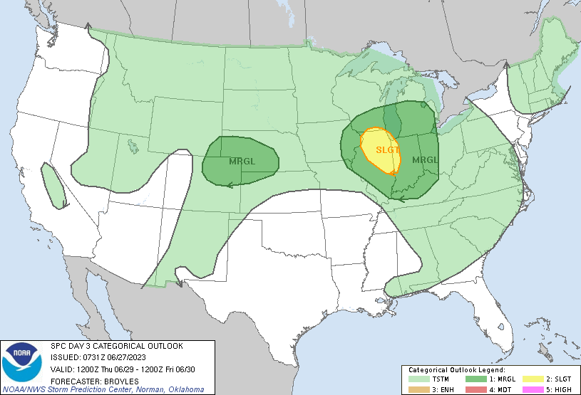
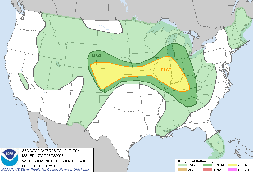
SPC Day 3 Categorical Outlook | SPC Day 2 Categorical Outlook |
 |
 |
 |
 |
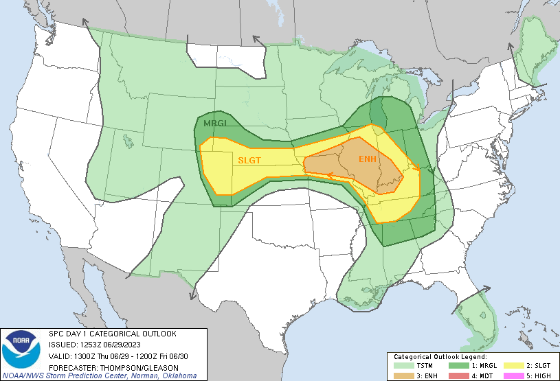
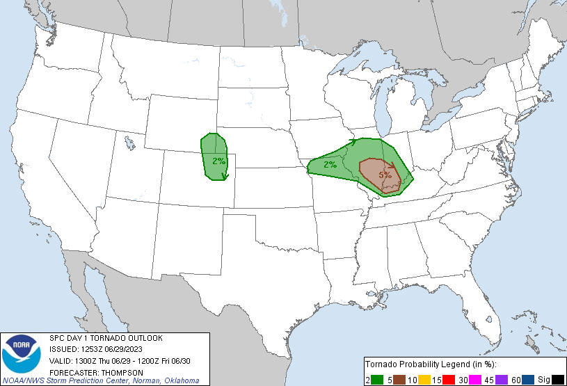
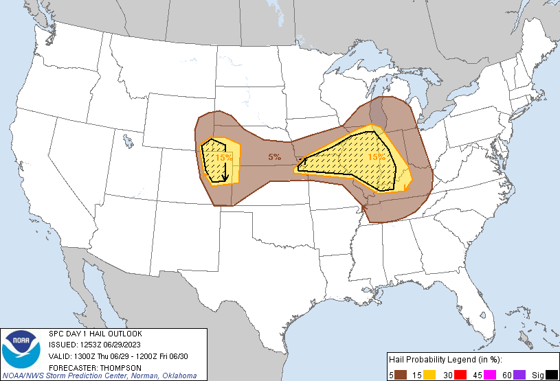
| SPC Day 1 Categorical Outlook | SPC Day 1 Tornado Outlook | SPC Day 1 Hail Outlook | SPC Day 1 Wind Outlook |
Warning Statistics
| Parameter | Value |
| Total number of warnings issued by the Lincoln NWS | 42 |
| Percentage of warnings verified with severe weather reports | 64.3% |
| False alarm rate (i.e.: warning issued but nothing reported; value ranges from 0 to 1) |
0.36 |
| Probability of detection (number of warned storm reports vs. total of warned and unwarned reports; max=1) |
0.97 |
Summaries from other NWS Offices
 |
Media use of NWS Web News Stories is encouraged! Please acknowledge the NWS as the source of any news information accessed from this site. |
|